Chinook
-
Posts
9,432 -
Joined
-
Last visited
About Chinook

-
two TDSs in a small area
-
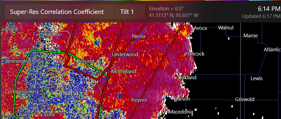
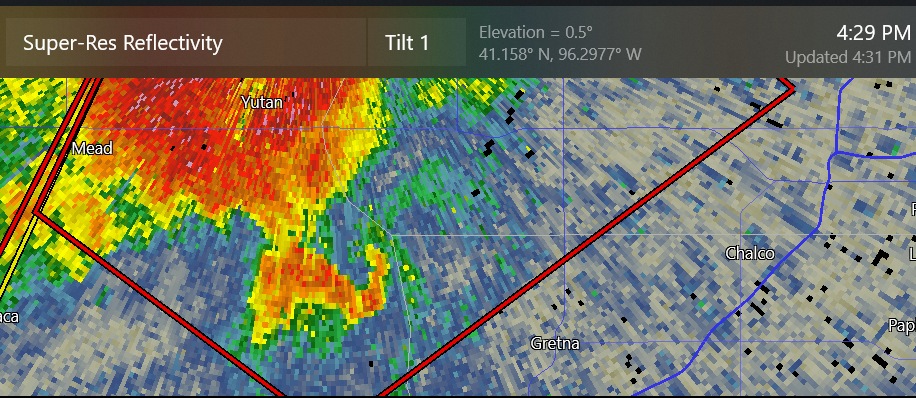
tornado damage in Omaha. Radar has a TDS over the Mississippi River. possible damage at the airport (Eppley)
-
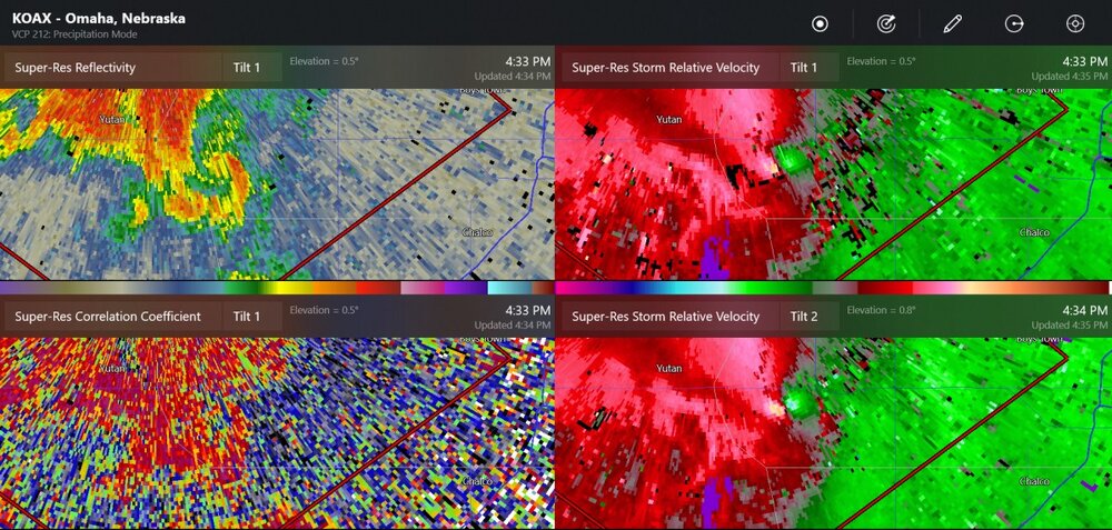
Incredible radar image of the damaging tornado from about a half hour ago. The OAX radar storm-relative velocity showed 132mph wind at one point

-
the large tornado has tracked 30 miles
-
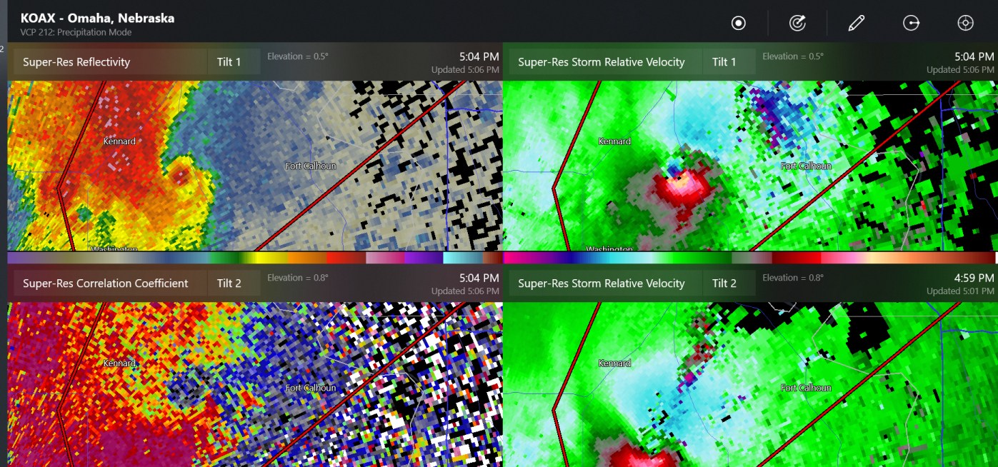
now the velocity sees it
-
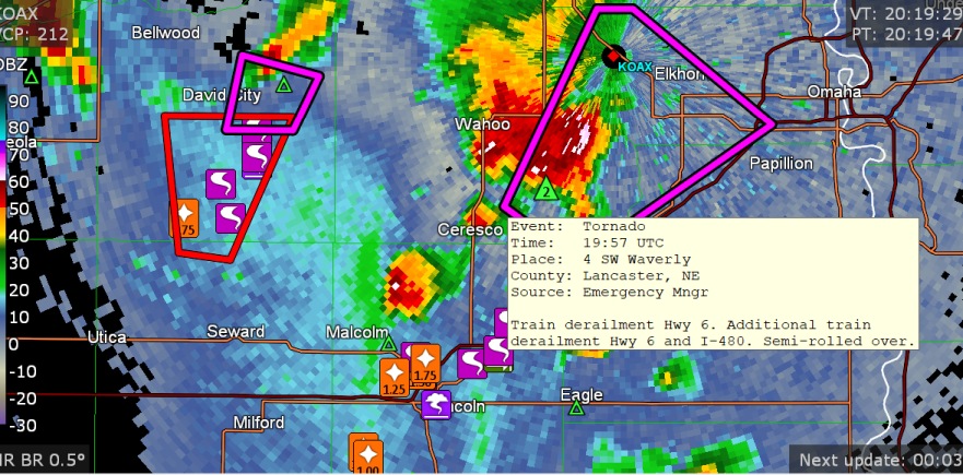
chasers are seeing a tornado, and look at this hook (west of Gretna, which is a large suburb of Omaha)
-
some buildings damaged at Waverly
-
this storm chaser saw rapid rotation
-
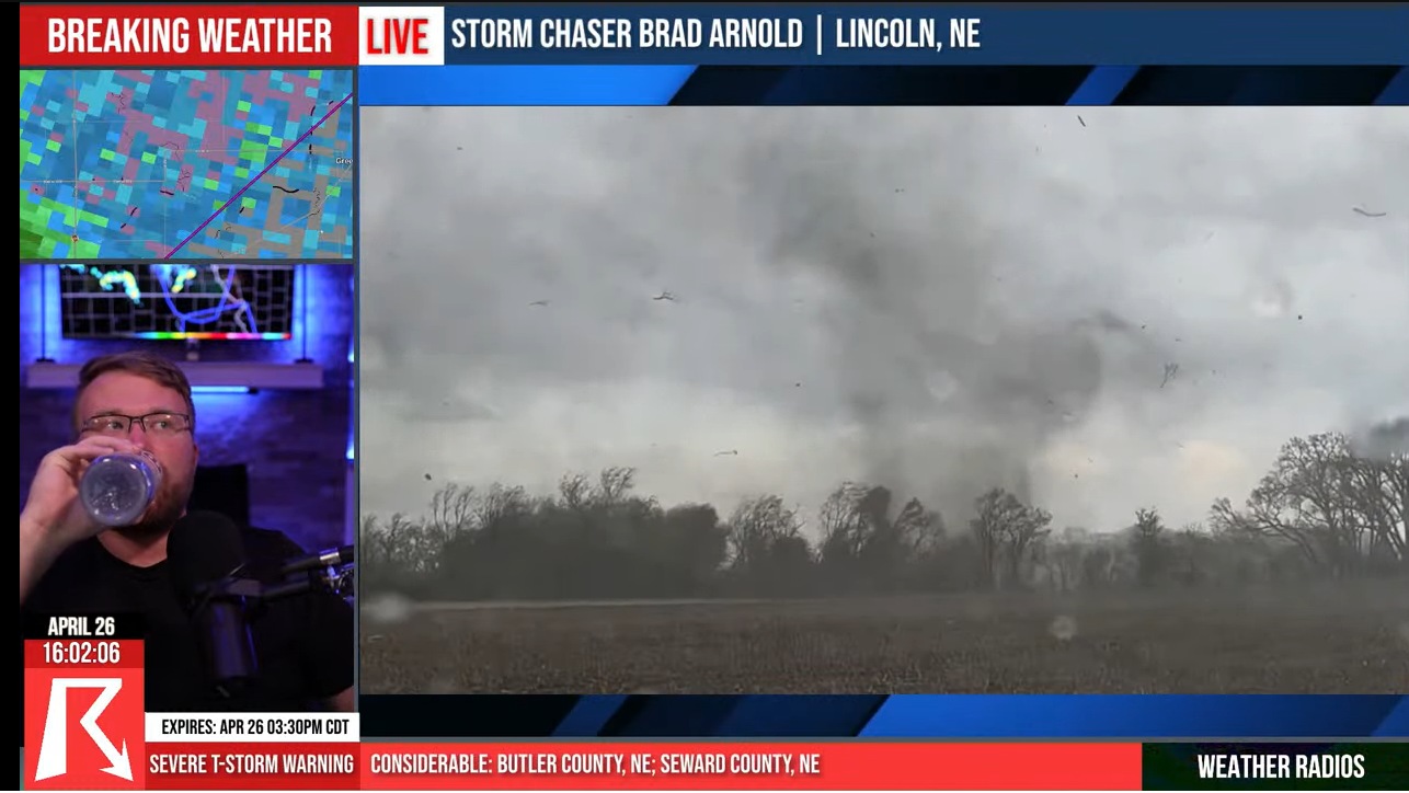
tornado is about 5 miles outside of Lincoln, seen by 3 storm chasers shown by Ryan Hall
-
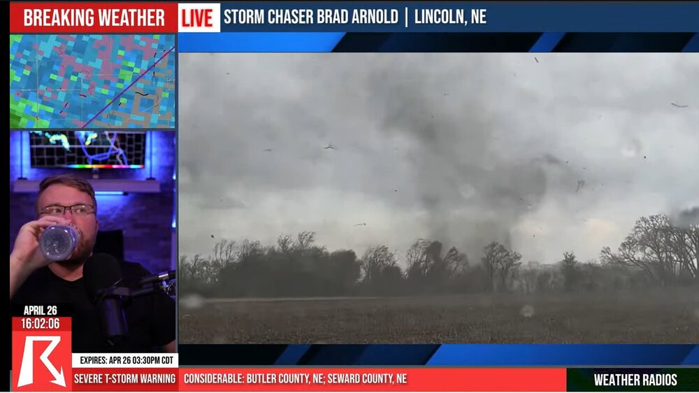
Chasers just saw a tornado at Lincoln
-
possible tornado and very dangerous situation at Lincoln Nebraska
-
We'll probably start a severe weather thread for the Thu/Fri time period.
-
There's a supercell on the Mexican foothills this evening with higher CAPE values. It's always interesting to see isolated cells with the S Texas radars if they are kind of close. For this cell, it's distant.
-
5"-6" of rain this month for central Indiana- central Ohio
-
lake-effect stability