
Connecticut Snowfall Totals: Feb. 5, 2016

Entry posted by Quincy ·
2,823 views

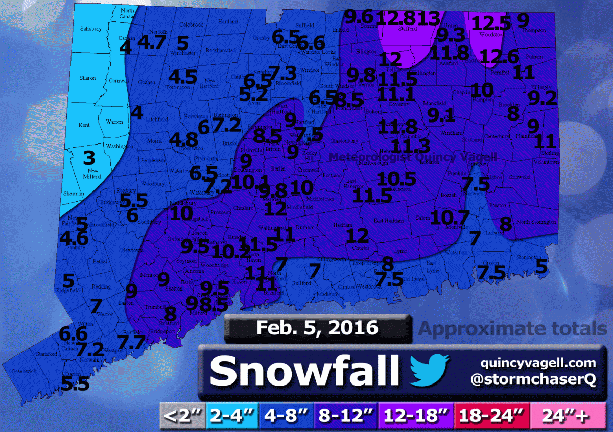
Here is a snowfall map using reports from various sources. Many of the reports came from this forum and the National Weather Service. Only social media reports that passed through quality control were considered. All reports gathered were carefully considered and compared before being included.
Spotty light rain impacted portions of Connecticut on February 4th as a frontal boundary slowly advanced east through the area. As the front became nearly stationary near the coast, a wave of low pressure developed over eastern North Carolina early on the 5th. As low pressure organized, colder air filtered in and precipitation changed to snow across Connecticut.
The storm system moved swiftly to the northeast, but there were several hours of moderate to heavy snow across parts of southern and eastern New England, as well as Long Island. The heaviest snow in Connecticut was observed from New Haven County, northeastward into interior periods of eastern Connecticut. Some of the hill towns in northeastern Connecticut reported just over a foot of snow. Snow came to an end between late morning and the afternoon hours on the 5th.
0 Comments
Recommended Comments
There are no comments to display.
Create an account or sign in to comment
You need to be a member in order to leave a comment
Create an account
Sign up for a new account in our community. It's easy!
Register a new accountSign in
Already have an account? Sign in here.
Sign In Now