

Logan11
-
Posts
7,229 -
Joined
-
Last visited
Content Type
Profiles
Blogs
Forums
American Weather
Media Demo
Store
Gallery
Posts posted by Logan11
-
-
7 minutes ago, dryslot said:
6.5", Really never got into any heavy stationary bands here.
Powder here. 7.5".
-
Congrats on the good sized totals over there. 7.5" here. Light snow lingering a bit yet here.
Ohh FWIW this BB isn't letting people use emojis today. Just found that odd.....
-
 1
1
-
-
7.3 inches up here. Still a gentle light snow falling but the end is near.
-
13 minutes ago, ForestHillWx said:
I used to drive out to Thatcher State Park to study/hike the Indian ladder trail when I was up at SUNY/ALS. I miss it up there, but can’t get my wife to agree to head north.
That's cool. I'm about 8 miles northwest of Thatcher. The LP extends past Thatcher to the Mohawk now but admittedly a good chunk of it still follows roads in places on this northern extension. I went to SUNYA also but later 80 to early 90s.
-
 1
1
-
-
6 minutes ago, NorthShoreWx said:
Light to moderate snow here and temp is down to 32. The street is beginning to cave.
It's not out of the question we end up with an inch here, but we had two or more inches of snow twice last winter so no records for futility are on the table.
I guess futility continues for the Central Park Zoo or wherever they take measurements now. It makes a good headline.
-
9 minutes ago, wdrag said:
Since I have no emoji's...thanks... these are what we like to enjoy. Gotta have some fun. Thagts a heckuva long driveway!!! Sticks I suspect, just like up here near the Appalachian Trail.
Yeah Helderberg Mountains (really hills) west of Albany, a northeast extension of the Catskills geologically speaking. I'm just off the 'Long Path' .. hiking trail. That goes from the GW Bridge northward to here amd crosses the App Trail around Schunemunk or thereabouts.
-
1
-
-
7 minutes ago, wdrag said:
Tomorrow I'll probably update the headline to maybe add a tag??? and certainly make it clear that OBS for this next event just fall right into this thread.
I'm probably gassed out for the day... and won't post much more til tomorrow morning.
Thanks for the great posts. I only slept about three hours and then had to shovel out the plowed in end of the driveway. Plow guy is coming when its done to do the remaining 500 feet. Maybe an afternoon nap. LOL
-
15 minutes ago, IrishRob17 said:
Good to see you posting here, hope all is well. 33/31 with light snow, wha5 appears to be a heavier band just to my west.
Oh I'm fine.. Of course I am 57 now and not the 27 that I was when I started on the predecessor wx chat and boards. LOL Glad to see you guys again! And that you did so well with this storm.
I'm 160 miles north of the city now so I don't post in here too much. Remember years ago I was in Saugerties.
-
2
-
-
3 hours ago, snywx said:
You can see where the band set up last night..
10-15" in the band
Need to extend that a little north now. The Kingston area had a good foot. Then it tails off so by the time you're into Greene County it's 6 or 7 inches. But we remain in steady snow, moderate at times. 6" at my place in Albany County. 28F.
A rather meager 16" of snow for the season to date. Last year we started slow also but then got pounded by three big wet snowstorms in February/March and closed with 96 inches.
-
4
-
-
Just saw a report of 7 inches out of Pine Plains at the northern end of Dutchess County so the band had lost some of it's oomph in the ensuing 30 miles from POU north northeast to Pine Plains.
-
1 minute ago, wdrag said:
Not sure why I can't add reactions---thank you for your comment. I do appreciate these.
Yeah I tried to add emojis to my comment and it wouldn't let me. Go figure....
-
7 minutes ago, wdrag said:
Wantage NJ (this part 12.6"): with freezing drizzle in progress at 28F and the settling has a SD of 11.
OBS and discussion-OBS for second storm will continue here. We still have 12 hours to go (4P) before its all dome out of our area.
Nice to see you posting on here! I used to read your great discussions out of BOX in the 90's.
I think you may have come into our old Usenet #weather Channel a few times. Todd Gross started that in '94.
-
3
-
-
16 minutes ago, LibertyBell said:
Nice, there could be an 18" report somewhere out of NW NJ by the time the storm ends. Basically from NE PA through NW NJ to the Hudson Valley got 12-18" with 3-4 inches per hour rates for 2-3 hours!
I'm not sure how far up the Hudson Valley that serious stuff made it. A foot was reported near Poughkeepsie. It didn't make it to the northern Catskills over to Albany. The band weakened on approach. 3.5" here but the light to moderate snow continues. 23 degrees.
-
1
-
-
25 minutes ago, wxeyeNH said:
34.3F Flipping to snow as it looks to be coming to an end. Good call in that. Highest wind gust during storm was 11mph but expected that. Highest temp 40.2F. 50% of ground is still covered with snow except on my south open field which is less
A bit of light snow yet here but 4.5" is probably it. More like something in early spring with the big elevational component. 6.5" at 1500'+ and some 8"+ amounts over 2000 ft. Must be virtually nothing on the Mohawk-Upper Hudson Valley floor.
We had several heavy wet snowstorms here in late February and March which pushed us to 96" for last winter. I'm ready for some dry snow.
-
3
-
-
11 minutes ago, powderfreak said:
Looks like 2-3” of heavy paste and trees bending way over again here in town.
3,000ft about 6”.
About 4" here now.
-
Snow flakes are nice now despite being 31.5. 2 inches.
-
1
-
-
Flipped to all snow out here now. 32F.
-
2
-
-
22 minutes ago, Bostonseminole said:
just got back from errands.. EURO bumped south, waiting for EPS .. SREF's should be out soon
The 6z/18z it bumps ALB to rte 2 back into a good snowstorm. 0Z and 12Z it pushes it back south. That's been the pattern.
-
1 minute ago, Chrisrotary12 said:
I think it also has to do with the societal impact of a 12" snowstorm these days. 12" of snow is meh when it comes to disrupting travel and life really beyond the timeframe of when it is actually snowing.
A moderate non historic storm during Christmas season is still a big plus. It doesn't always have to be epic.
-
22 minutes ago, 40/70 Benchmark said:
NAM is problematic for se MA

Somehow I don't think I'm not getting that 20.1" that the NAM shows. Maybe shift the decimal one to the left.
")
-
3 minutes ago, Bostonseminole said:
NAM is first up to bat folks.. hopefully we don't trend away from a solid hit.
It's got to come off the cliff some at least. The last run had heavy snow to Lake Placid. Though with the NAM sometimes it will stick to it's guns and then fold in spectacular fashion over the final runs before the event.
-
2 minutes ago, JC-CT said:
My Compaq Presario is...still running the calculations
I still have my PC Jr. that my Dad git a discount on since he was an IBM employee in 1985. I haven't booted it up in a least 5 years though. It's retro- need the DOS floppy disk etc.
-
2
-
-
1 minute ago, 40/70 Benchmark said:
I think I had you near the s end of the 6-12".
Did you guys get the big Dec 2nd snowstorm last year? The one where I got 27".
Last winter was a one trick poney and a ton of nickel and dimes here...ending with 78".
-
1 minute ago, HoarfrostHubb said:
I'm thinking 5-8" in my hood, 6-9" a bit to my east...
The more OTS solutions (GFS hanging on) look like classic W to E sheer drop offs in accums. Shades of Jan. 1996. But others are now showing more poleward trajectory at least with longitude.
-
1
-

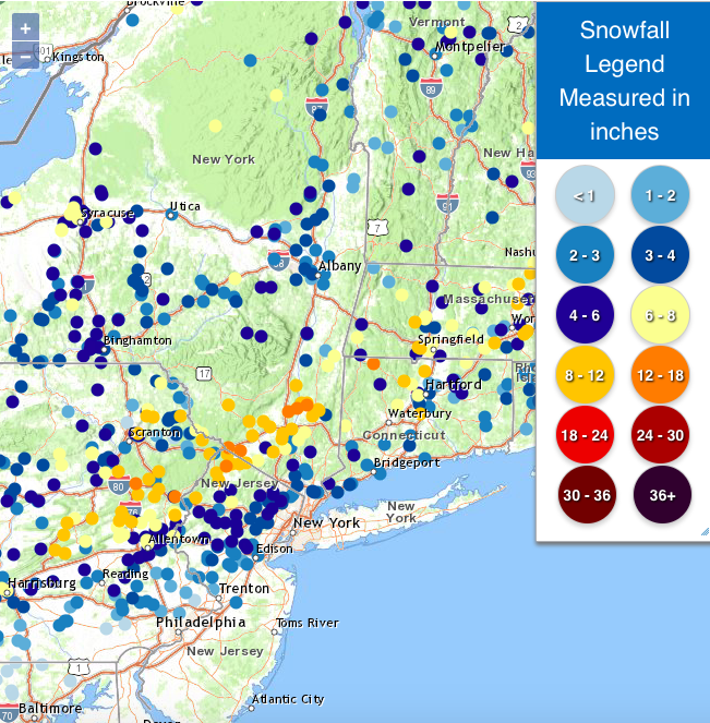
January 6-7, 2024 Winter Storm Obs Thread
in New England
Posted
That's awesome Ray. Congrats!