

TSSN+
-
Posts
1,563 -
Joined
-
Last visited
Content Type
Profiles
Blogs
Forums
American Weather
Media Demo
Store
Gallery
Posts posted by TSSN+
-
-
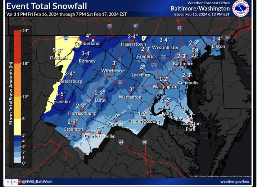
Almost 2” in Westminster
-
 1
1
-
-
We could be looking at a 50 degree night or rain. I’ll take my couple inches of snow and be happy.
-
1
-
 1
1
-
-
-
How to lose a storm in 6hrs lol
-
1
-
 2
2
-
 1
1
-
-
1 minute ago, psuhoffman said:
My temp is 36 but the dew point is only 17 so I’m not too concerned
Seeing how it was 44 and raining and then dropped to 33 and I got 2” the other day ya not concerned sitting at 37 here.
-
1
-
-
It’s wild that it’s still mostly sunny out and in like 8hrs will be dumping snow.
-
1
-
-
I’ve had 2 warnings this year and only got 3.5” and 3” out of both so maybe this time the adv will get me more lol
-
1
-
-
5 minutes ago, Bob Chill said:
Certainly has a clipper vibe from amounts, speed, northern stream but the origin is Seattle. Lol. Alberta Clipper, Manitoba Mauler, and now.... hold on to your seats... the Seattle Slammer!
Seattle slammers are the best lol
-
1
-
-
9 minutes ago, CAPE said:
Yeah not a clipper. Nice timing with the upper level features. The region is gonna be under the left exit region of the jet streak with PVA as the shortwave approaches. With cold air in place, perfect for a quick shot of moderate to heavy snow.
NWS considers it a clipper.
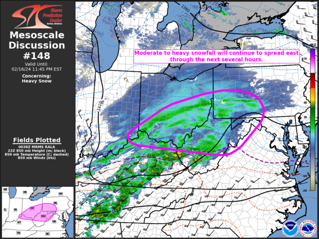
SHORT TERM /6 PM THIS EVENING THROUGH SUNDAY NIGHT/... A fast moving clipper system is forecast to track across southern Virginia tonight into Saturday morning. Cold air aloft will be in place for much of the area, although the thermal gradient will be very close to central Virginia and southern Maryland. Surface temperatures may be a few degrees above freezing at onset and may fail to drop much below freezing closer to the waters/urban areas and from Charlottesville to southern Maryland. However, the snow rates and overnight time frame will result in some accumulation across much of the area, with the main question mark being south of I-64. Onset time will be between 7 PM and midnight from west to east. Strong frontogentical forcing and the cyclonic side of a 200 kt jet aloft will result in very strong lift and good dendrite growth. This will lead to banding potential with 1-2 inch per hour rates. The location of the heavier bands remains in question, however the overall QPF maximum lies squarely across our forecast area. Travel will likely quickly deteriorate due to the snow rates. The main limiting factor is the very fast movement of the system, with most areas only seeing 3 or 4 hours of heavier snow rates. Snow will quickly depart to the east around or just after sunrise, except for some light lingering upslope snow which could last into the afternoon.
-
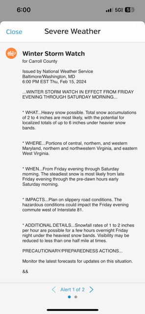
Why’s there another sws even in the watch area? lol
-
10 minutes ago, Terpeast said:
They’ll probably replace it with a new headline. Not sure why they hoisted a special weather statement in the first place, especially seeing that they hoisted a WSW soon after
I think they said adv will go out about 24hrs out so would assum between 10pm and midnight
-
14 minutes ago, T. August said:
Didn’t see it posted… LWX slashed totals
Not sure that makes sense. Issue watches then lower totals lol
-
4 minutes ago, anotherman said:
Meanwhile, just over the border in York County…..nothing and a local forecast for 1-2.
From your mouth the the weather gods, you got a watch.
-
-
-
9 minutes ago, WinterWxLuvr said:
Viagra
Winter storm Viagra, coming in hard and fast.
-
3
-
-
Just now, WinterWxLuvr said:
And Winter Storm Watches just to the west
Those been there
-
1
-
-
NWS has issued… a special weather statement… lol
-
1
-
7
-
-
1 minute ago, NorthArlington101 said:
10:1

Kuchera
Oh heck ya
-
1
-
-
1 minute ago, IronTy said:
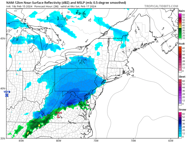
How is the NAM so god awfully slow? You'd think the frames were 4k resolution at this rate.
Here’s why

-
1
-
10
-
-
1 minute ago, stormtracker said:
I should know something in about 2 and a half days when the NAM will get to 60 hours.
May well as wait till after the storm is over. lol
-
5 minutes ago, psuhoffman said:


-
5
-
-
4 minutes ago, blizzardmeiser said:
What about Euro?
Doesn’t win till 1250 and won’t be in range will about 115
-
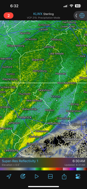
The typical Carroll county bs radar hole forming.
-
1
-

The Weekend Rule? Saturday 2/17 - The Icon Storm
in Mid Atlantic
Posted
Looks like maybe 4” out there here in Westminster. It looks fluffy out.