
NepaJames8602
-
Posts
361 -
Joined
-
Last visited
Content Type
Profiles
Blogs
Forums
American Weather
Media Demo
Store
Gallery
Posts posted by NepaJames8602
-
-
Some nice squall action out here in the Poconos this evening. Had several white out squalls blow through, one right after the other. Havent measured, but atleast a good 2" to even 3" it looks depending on the surface.
-
 3
3
-
-
Well it certainly feels like the dead of winter here in the Poconos. I woke up to 8 degrees. It's Hard to believe 50s and rain this weekend lol. Bye bye snow :(.
-
1
-
-
A chilly 7 degrees here in my part of the Poconos currently. Also, I picked up about 2" total from yesterday's squalls. Very wintry feel tonight, that's for sure.
-
2
-
-
Ended up with just shy of 3" here in the Poconos, and a crisp 20 degrees. Was surprised to wake up to that as well. That elevation I now have, really helped with accumulations.
-
Wont call it a bust for my area, more so a disappointment. Heaviest snowfall stayed a good 30 to 40 miles north of me. I ended up with 6". Dissapointing when you're forecasted for 9 to 15" though. Areas just to my north cleaned up with a solid 12", especially near my job. All in all, a decent even regardless. I'm looking forward to the next one in my new area:).
-
God awful out there here in the Poconos above 2k. Temp hovering around 20 degrees with freezing rain/sleet past three hours.
-
Winter Storm Warning
URGENT - WINTER WEATHER MESSAGE...UPDATED
National Weather Service Binghamton NY
349 PM EST Sat Nov 30 2019

NYZ018-044-056-062-PAZ039-040-044-048-072-011100-
/O.UPG.KBGM.WS.A.0010.191201T1200Z-191203T0000Z/
/O.EXB.KBGM.WS.W.0011.191201T1200Z-191203T0000Z/
Onondaga-Cortland-Broome-Sullivan-Susquehanna-Northern Wayne-
Lackawanna-Pike-Southern Wayne-
Including the cities of Syracuse, Cortland, Binghamton,
Monticello, Hallstead, Montrose, Damascus, Equinunk, Scranton,
Milford, and Honesdale
349 PM EST Sat Nov 30 2019

...WINTER STORM WARNING IN EFFECT FROM 7 AM SUNDAY TO 7 PM EST
MONDAY...

* WHAT...Heavy snow and mixed precipitation expected. Total snow
  accumulations of 9 to 15 inches and ice accumulations of around
  one tenth of an inch.

* WHERE...In Pennsylvania, Susquehanna, Northern Wayne,
  Lackawanna, Pike and Southern Wayne counties. In New York,
  Onondaga, Cortland, Broome and Sullivan counties.

* WHEN...A mixture of snow, sleet and freezing rain will
  overspread the area Sunday morning, and continue through the
  daytime hours. The wintry mix then changes to all snow after
  midnight Sunday night, and could be heavy at times through the
  day Monday.

* IMPACTS...Travel could be very difficult to impossible. The
  hazardous conditions could impact the Monday morning and evening
  commutes.

* ADDITIONAL DETAILS...The heaviest period of snow is expected to
  occur later Sunday night into Monday. Snowfall rates up to 2
  inches per hour are expected at times. Temperatures hover in the
  mid 20s to lower 30s through the event.
-
1
-
-
Winter Storm Watch
URGENT - WINTER WEATHER MESSAGE
National Weather Service Binghamton NY
314 PM EST Fri Nov 29 2019

NYZ045-056-057-062-PAZ039-040-048-072-301100-
/O.NEW.KBGM.WS.A.0010.191201T1200Z-191203T0000Z/
Chenango-Broome-Delaware-Sullivan-Susquehanna-Northern Wayne-Pike-
Southern Wayne-
Including the cities of Norwich, Binghamton, Delhi, Walton,
Monticello, Hallstead, Montrose, Damascus, Equinunk, Milford,
and Honesdale
314 PM EST Fri Nov 29 2019

...WINTER STORM WATCH IN EFFECT FROM SUNDAY MORNING THROUGH
MONDAY EVENING...

* WHAT...Heavy mixed precipitation possible. Total snow
  accumulations of 8 to 14 inches and ice accumulations of around
  one tenth of an inch possible.

* WHERE...In Pennsylvania, Susquehanna, Northern Wayne, Pike and
  Southern Wayne counties. In New York, Chenango, Broome,
  Delaware and Sullivan counties.

* WHEN...From Sunday morning through Monday evening.

* IMPACTS...Travel could be very difficult to impossible. The
  hazardous conditions could impact the morning or evening
  commute.

* ADDITIONAL DETAILS...A period of snow and sleet will move
  through the area Sunday morning, before mixing with freezing
  rain in the afternoon and evening hours. Another period of
  steady, or even heavy snow is forecast for Sunday night into
  Monday. Snowfall rates could reach 2 inches per hour at times,
  especially Sunday night and Monday. Temperatures will be in the
  mid 20s to lower 30s through the event.
-
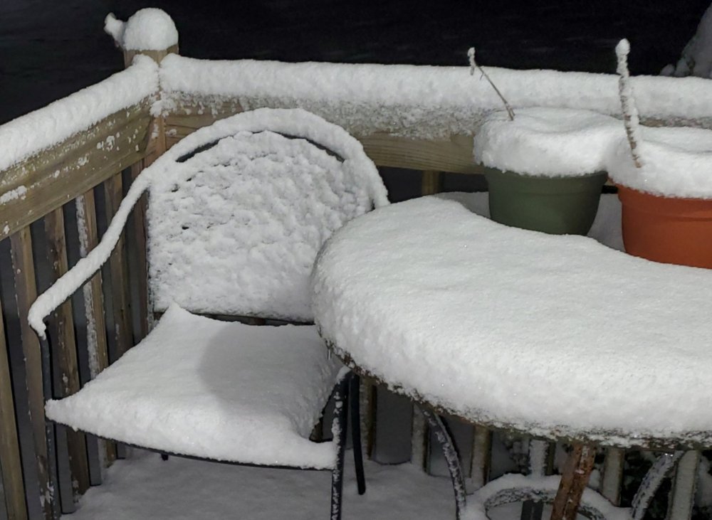
Nice coating of snow this evening here on the Pocono Plateau.
I haven't posted much lately, as I'm just settling into my new place. I just moved to the north western Pocono Plateau, in Newfoundland, Pa, Wayne county. My house sits at 2,070 feet. It's going to be an interesting winter for sure.
-
3
-
-
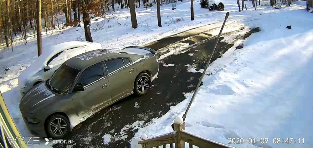
Rain has changed over to snow here in the Poconos at 1600' feet. Temp of 34 degrees as of 530pm.
-
4
-
-
Down to -6 at 9pm here in Mt. Cobb Pa.
-
1
-
-
I recently moved to Mt. Cobb Pa, 1600' elevation on the Wayne/Lackawanna county border. I have received 5.0", 28 degrees with moderate snow still falling. Eyeing the radar, maybe another hour or two left. Hopefully I'll reach that 6" mark. Binghamton NWS did a great job forecasting this one out here.
-
5.0" here with moderate snow in Mt. Cobb Pa, 1600' elevation.
-
 1
1
-
-
Winter storm watch for 6 to 10 here in the Poconos.

URGENT - WINTER WEATHER MESSAGE
National Weather Service Binghamton NY
305 PM EST Sun Jan 27 2019

NYZ036-045-046-057-062-PAZ040-048-072-282015-
/O.NEW.KBGM.WS.A.0003.190129T1200Z-190130T1200Z/
Madison-Chenango-Otsego-Delaware-Sullivan-Northern Wayne-Pike-
Southern Wayne-
Including the cities of Hamilton, Oneida, Norwich, Oneonta,
Delhi, Walton, Monticello, Damascus, Equinunk, Milford,
and Honesdale
305 PM EST Sun Jan 27 2019

...WINTER STORM WATCH IN EFFECT FROM TUESDAY MORNING THROUGH
WEDNESDAY MORNING...

* WHAT...Heavy snow possible. Total snow accumulations of 6 to 10
  inches possible.

* WHERE...In Pennsylvania, Northern Wayne, Pike and Southern
  Wayne counties. In New York, Madison, Chenango, Otsego,
  Delaware and Sullivan counties.

* WHEN... Snow is expected to develop Tuesday morning and continue
  through Tuesday night. Snow may be moderate to heavy at times.

* ADDITIONAL DETAILS...Travel could be very difficult. The
  hazardous conditions could impact the morning or evening
  commute.
-
Winter storm watch for 6-10 here in the Poconos for Tuesday. Should be interesting.
URGENT - WINTER WEATHER MESSAGE
National Weather Service Binghamton NY
305 PM EST Sun Jan 27 2019

NYZ036-045-046-057-062-PAZ040-048-072-282015-
/O.NEW.KBGM.WS.A.0003.190129T1200Z-190130T1200Z/
Madison-Chenango-Otsego-Delaware-Sullivan-Northern Wayne-Pike-
Southern Wayne-
Including the cities of Hamilton, Oneida, Norwich, Oneonta,
Delhi, Walton, Monticello, Damascus, Equinunk, Milford,
and Honesdale
305 PM EST Sun Jan 27 2019

...WINTER STORM WATCH IN EFFECT FROM TUESDAY MORNING THROUGH
WEDNESDAY MORNING...

* WHAT...Heavy snow possible. Total snow accumulations of 6 to 10
  inches possible.

* WHERE...In Pennsylvania, Northern Wayne, Pike and Southern
  Wayne counties. In New York, Madison, Chenango, Otsego,
  Delaware and Sullivan counties.

* WHEN... Snow is expected to develop Tuesday morning and continue
  through Tuesday night. Snow may be moderate to heavy at times.

* ADDITIONAL DETAILS...Travel could be very difficult. The
  hazardous conditions could impact the morning or evening
  commute.
-
Blizzard Warning
URGENT - WINTER WEATHER MESSAGE
National Weather Service Binghamton NY
1242 PM EST Fri Mar 2 2018

NYZ046-057-062-PAZ040-048-072-030600-
/O.UPG.KBGM.WS.W.0004.000000T0000Z-180303T0600Z/
/O.NEW.KBGM.BZ.W.0001.180302T1742Z-180303T0600Z/
Otsego-Delaware-Sullivan-Northern Wayne-Pike-Southern Wayne-
Including the cities of Oneonta, Delhi, Walton, Monticello,
Damascus, Equinunk, Milford, and Honesdale
1242 PM EST Fri Mar 2 2018

...BLIZZARD WARNING IN EFFECT UNTIL 1 AM EST SATURDAY...

* WHAT...Blizzard conditions. Winds gusting as high as 50 mph will
  cause whiteout conditions in blowing snow. Significant drifting
  of the snow is likely. Additional snow accumulations of 10 to 14
  inches are expected, especially at higher elevations.

* WHERE...In Pennsylvania, Wayne, Pike Counties. In New York,
  Otsego, Delaware and Sullivan Counties.

* WHEN...Until 1 AM EST Saturday.

* ADDITIONAL DETAILS...Travel will be very dangerous to
  impossible. Tree damage and scattered power outages expected
  especially at higher elevations from weight of snow and gusty
  winds. Winds gusting as high as 40 to 50 mph will cause areas of
  blowing and drifting snow.
Parents back home in Poconos getting pounded.
-
Solid early season event here in the Poconos, measured just shy of 7" at 8pm. My area was under that stationary banding on the nw side the past several hours. Binghamton was calling for 1 to 3". First positive bust in years.
-
3
-


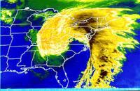
Wet snowstorm potential Jan 25-26, mainly high terrain northwest of NYC
in New York City Metro
Posted
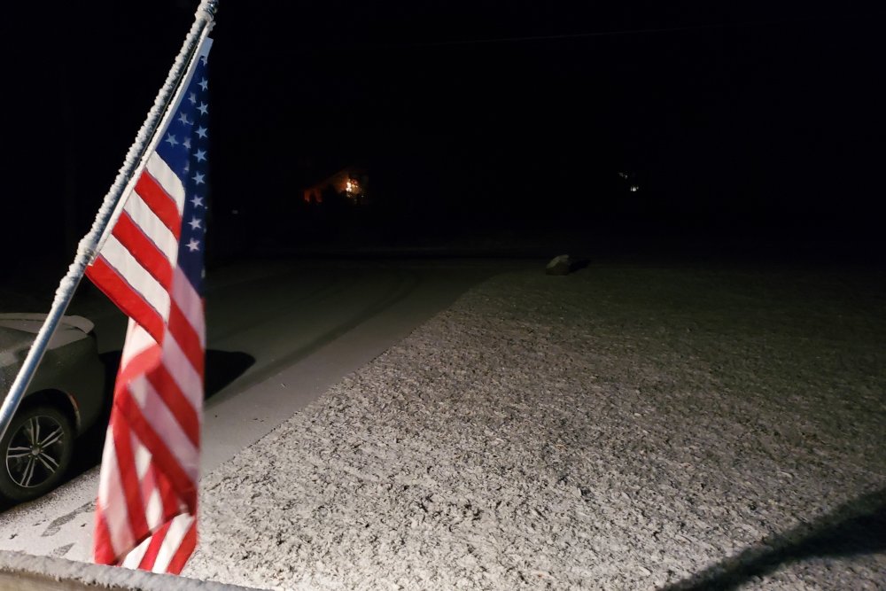
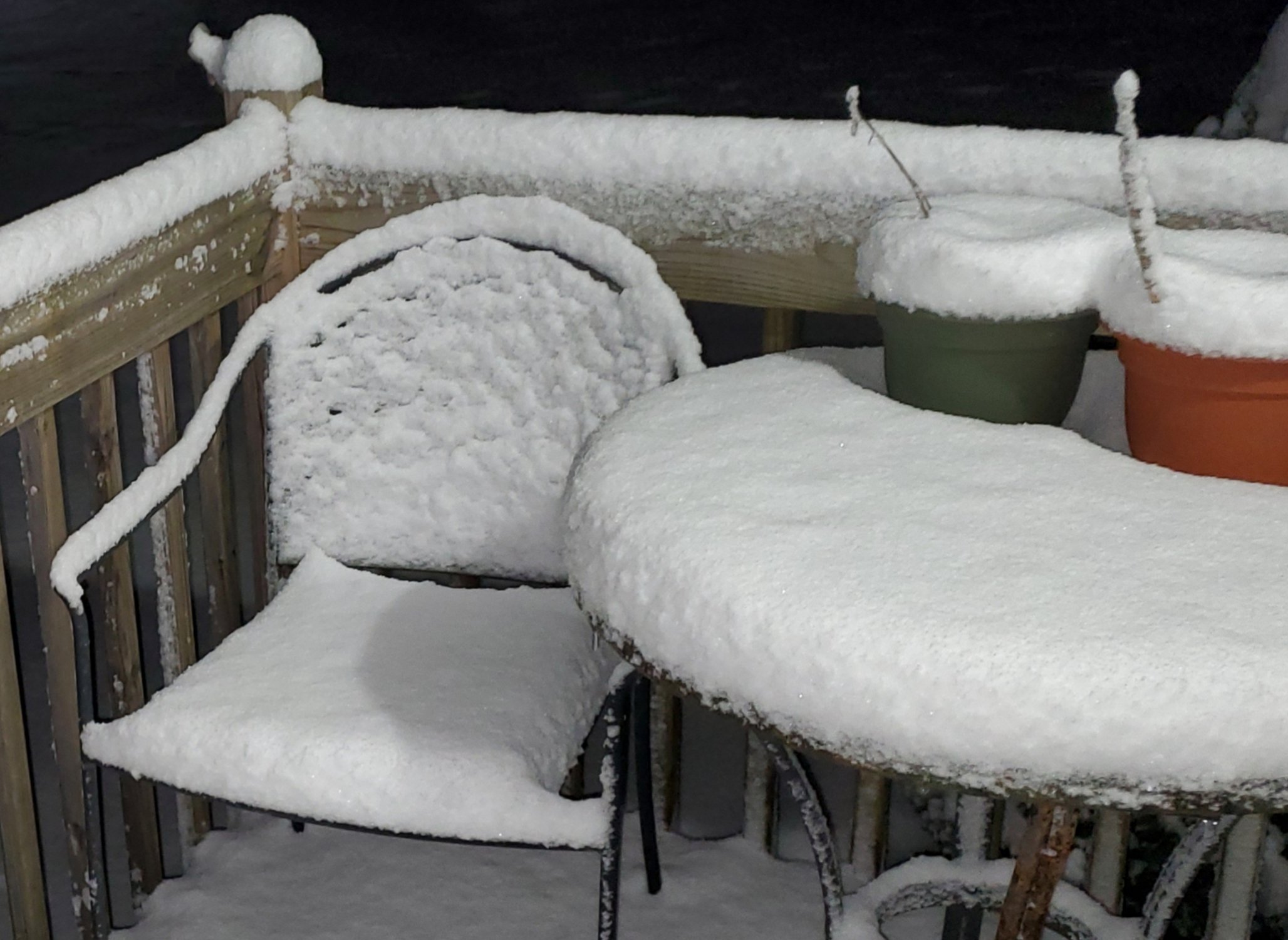
I'm not home, but rain has changed over to accumulating snow back home in the Poconos above 2,000 feet. This was a few moments ago from my outside camera. House elevation: 2,070'.