
MIstorm97
-
Posts
363 -
Joined
-
Last visited
Content Type
Profiles
Blogs
Forums
American Weather
Media Demo
Store
Gallery
Posts posted by MIstorm97
-
-
Hey my DAB got grinched away this is a serious tragedy
-
 1
1
-
 1
1
-
-
8 hours ago, RogueWaves said:
32F and light ZR on elevated surf's and trees in Canton/Plymouth area. Some SR maps were teasing me with 1-2" shown last night. WAA for the win (loss) bumping the boundary "just" north. UHI also not helping in this lame ass cold regime. Oh well, glad somebody in SEMI got a nice holiday present out of this.
That 0.5" of sleet and snow sure was a big holiday present
 Can pretty much toss the rest of the month too
-
 1
1
-
-
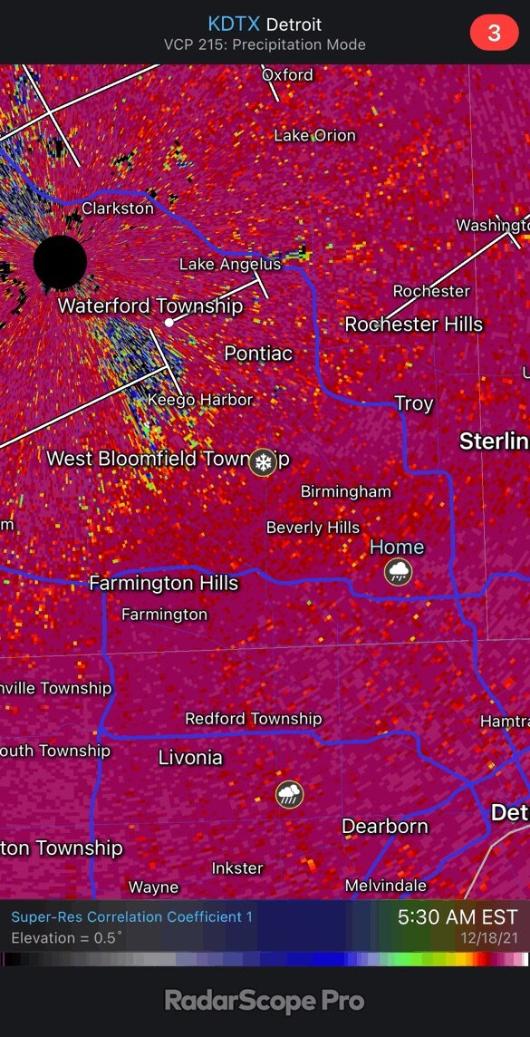
10 minutes ago, Stevo6899 said:
Bummer. I live at 16 and hayes and was a mix of snow and pingers. Just 5 miles north it was all snow. The dividing line always seems to end up in the same area. Easily an inch or 2 already with the band stalling overhead. Could be a interesting overachiever in central oakland/macomb.
Wouldn’t be surprised if some areas get 3-4” where the band sets up the best. Sucks that this is all sleet here. Going back to bed because this is a snoozefest
-
It’s a really tough scene out here ^
-
2
-
-
8 minutes ago, Stevo6899 said:
Pouring snow here in Shelby twp. Drive into work was very icy. Nice banding setting up along oakland/macomb.
I live about a mile north of 696 and it’s been moderate sleet this whole time. Constant pingers hitting the window as I type. Sad, but not surprised this happened. Despite modeled p-type maps showing all snow, skew-T plots told a different story. Was right on the border of it being sleet or snow, and any north trend or stronger WAA would mean sleet. Guess it means a top 5 least snowy December is still in play for DTW.
-
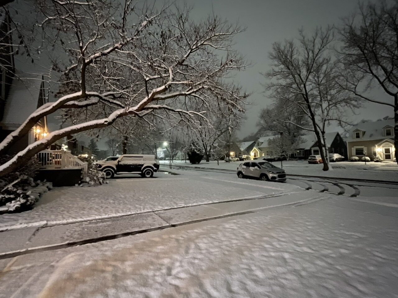
Starting off as pingers

-
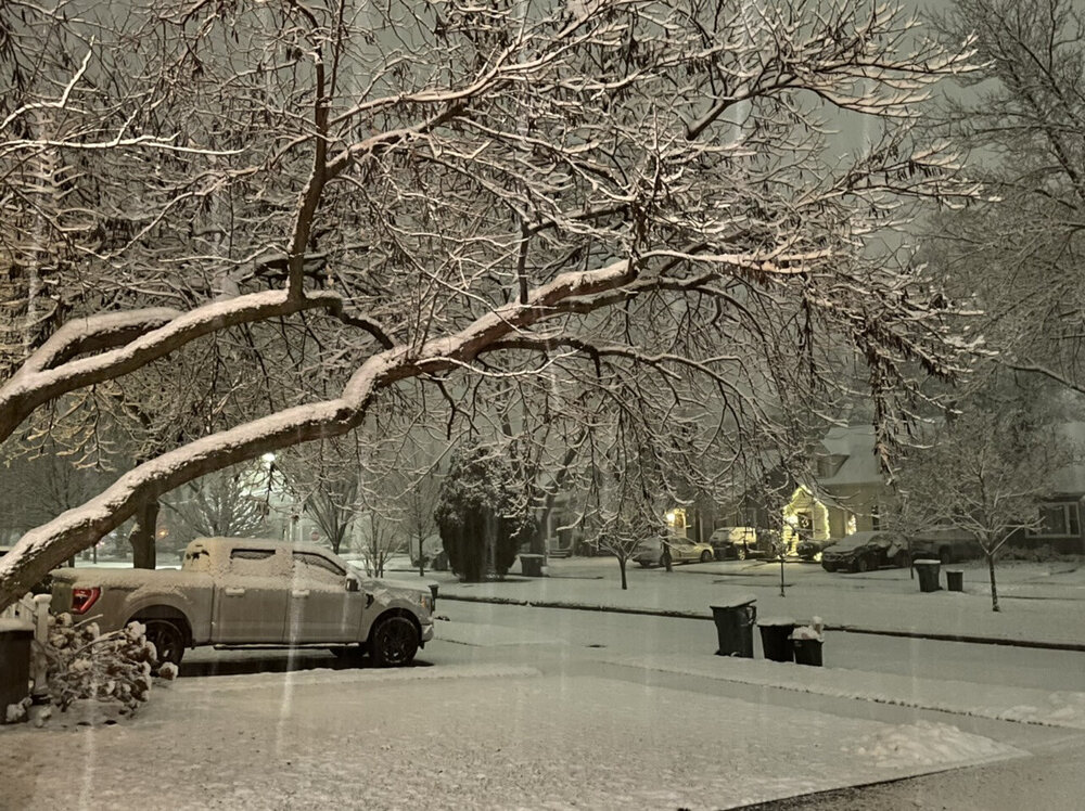
Picked up 2.2” from the clipper. It was a wet plaster snow for sure, but it was photogenic. Now sitting at 6.1” on the season.

-
4
-
-
Another solid thump. Still ripping so haven’t measured yet
-
3
-
-
6 hours ago, michsnowfreak said:
I can top that...I started shoveling then actually pulled out the snow blower. It was legit heart attack snow so I figured the snow blower would eat it up a lot easier than I could shovel it lol. Where's your girlfriend from?
She’s from SW Kansas haha so this is a big change. She’s finishing her studies up here and wants to remain in Michigan now.
WWA now issued for all of the Detroit area. At least 2-3” with rates up to an inch per hour. Liking the radar trends.
-
2
-
-
15 minutes ago, hlcater said:
Perpetual cool NW flow with absolutely zero precip to be seen.
December 2017 vibes.
I’m cool with that if the clippers keep hitting Michigan like they did in that month

-
1
-
-
15 hours ago, RogueWaves said:
That'd be great if it verifies. I'm just stoked to see snow plowed parking lots. Took until Jan 31st last winter for that to happen in Marshall. 2 weeks later winter was over. Three snows worth putting a blade on in 15 days. Last season in a nutshell for my locale.
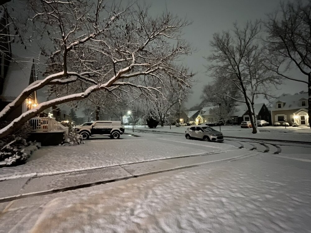
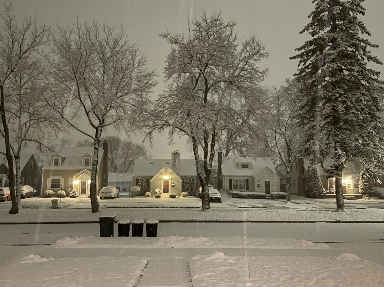
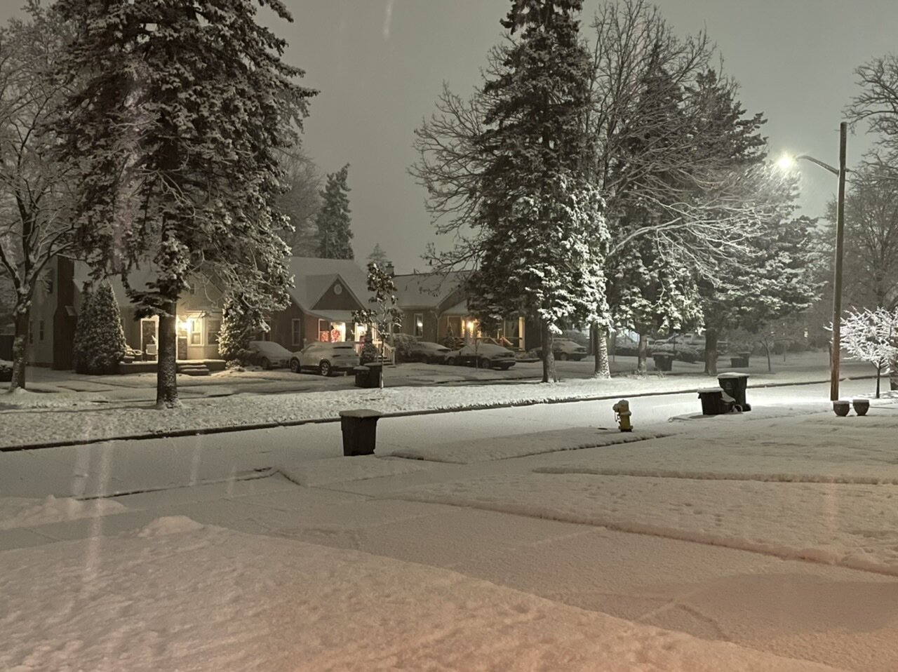
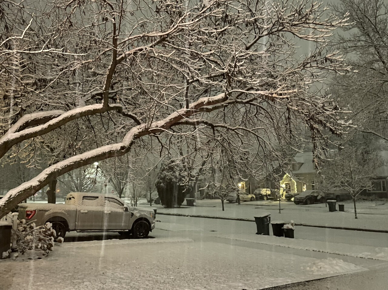
There were already plowed parking lots here with the snow a couple days ago. I broke out the shovel since we needed the driveway clear early yesterday. I’m just so happy to have decent snow again. All the trees have looked really beautiful caked in snow. It’s my gf’s first Michigan winter so she’s loving it
-
2
-
-
Got hit pretty good with that snow squall in the Royal Oak area. Had a few decent gusts out ahead of it, and then heavy snow in the squall. There was a decent squall earlier in the day too. Tomorrow night is looking decent as well with another quick couple inches in the P&C
-
1
-
-
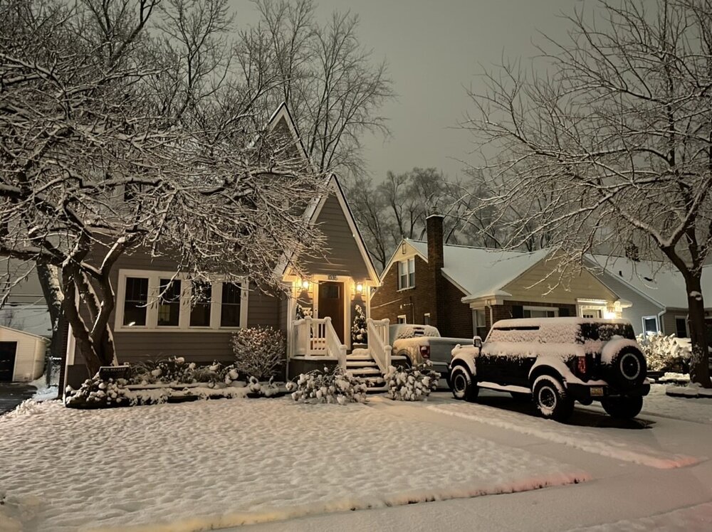
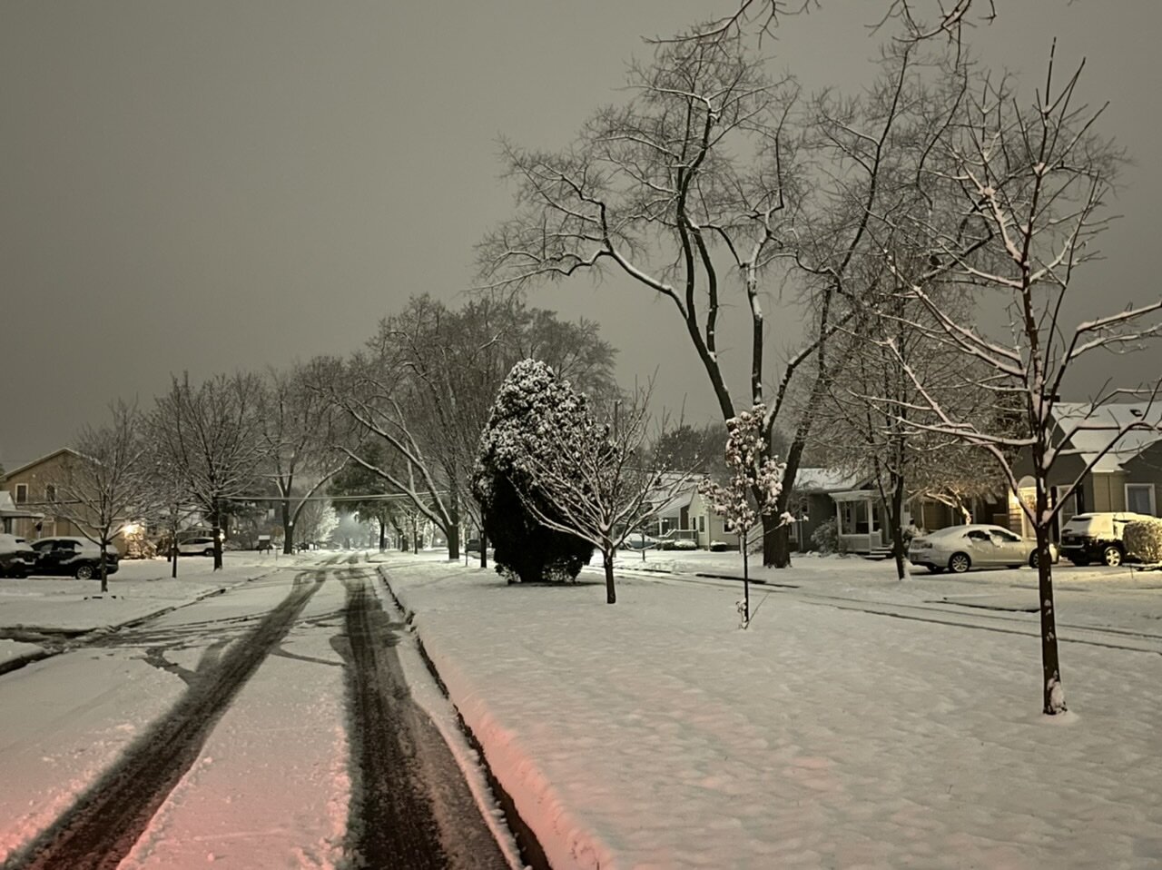
Finished with 3.1” in Berkley. Was at a concert so couldn’t do my usual documentation, but this was a good event. Snow is plastered to everything really well. Even got my first shovel of the season in.

-
7
-
-
First WWA of the year for 2-3”, with guidance pretty locked in for those amounts. Always excited for the first real accumulating event of the season
-
2
-
-
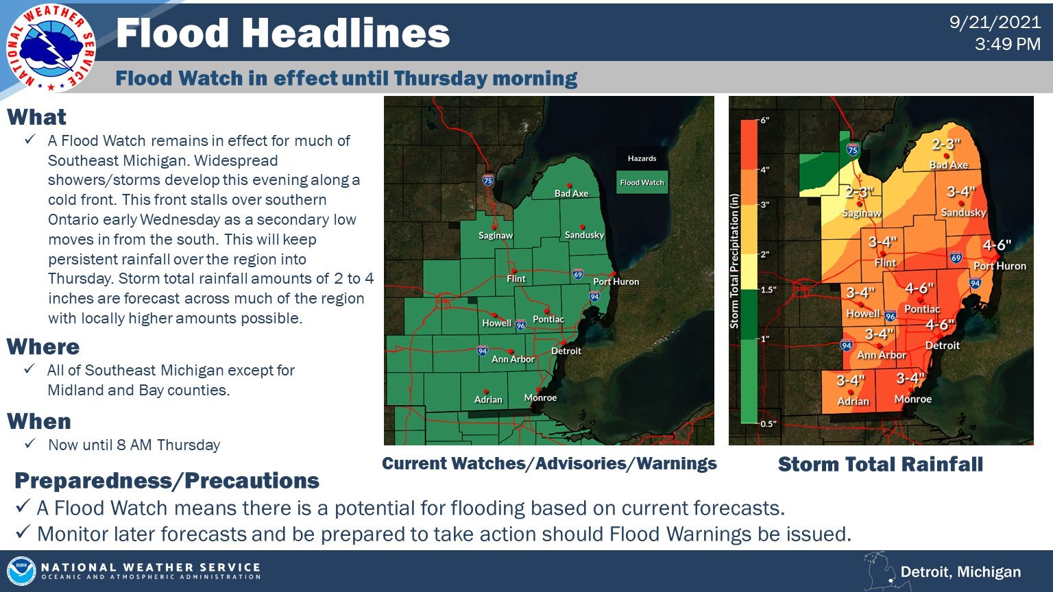
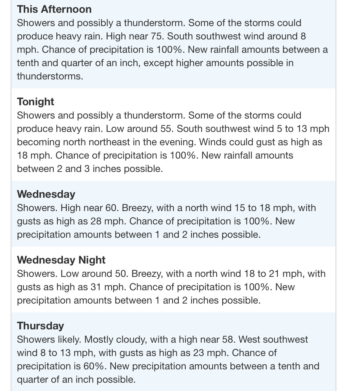
Don’t remember the last time I’ve seen rainfall amounts forecast this high here tbh


-
2
-
-
Super stoked for the 3-5” of rain after one of the wettest summers on record. Need to carry this hot hand into winter
-
1
-
-
3 hours ago, outflow said:
Did you notice the second tornado/waterspout that occurred to the nw of the main tornado? Around the time the above tornado was roping out, I looked to the north from m25 and could see a second funnel and thin condesation funnel about 3 miles nnw. The funnel went behind the treeline so I couldn't get a good look to see if/where it was on the ground at. I found a video online that appears to show the second tornado/spout I seen.
https://m.facebook.com/groups/147834125298027/permalink/4161742787240454/?anchor_composer=false
It looked like as the main tornado was occluding that a new tornado/tornadic waterspout formed. I couldn’t confirm anything due to trees blocking the ground but I thought I saw a new one form
-
4 minutes ago, MIstorm97 said:
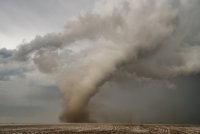
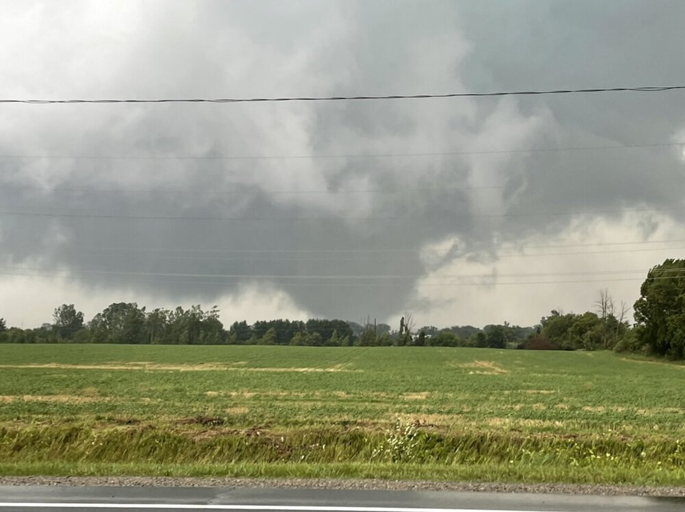
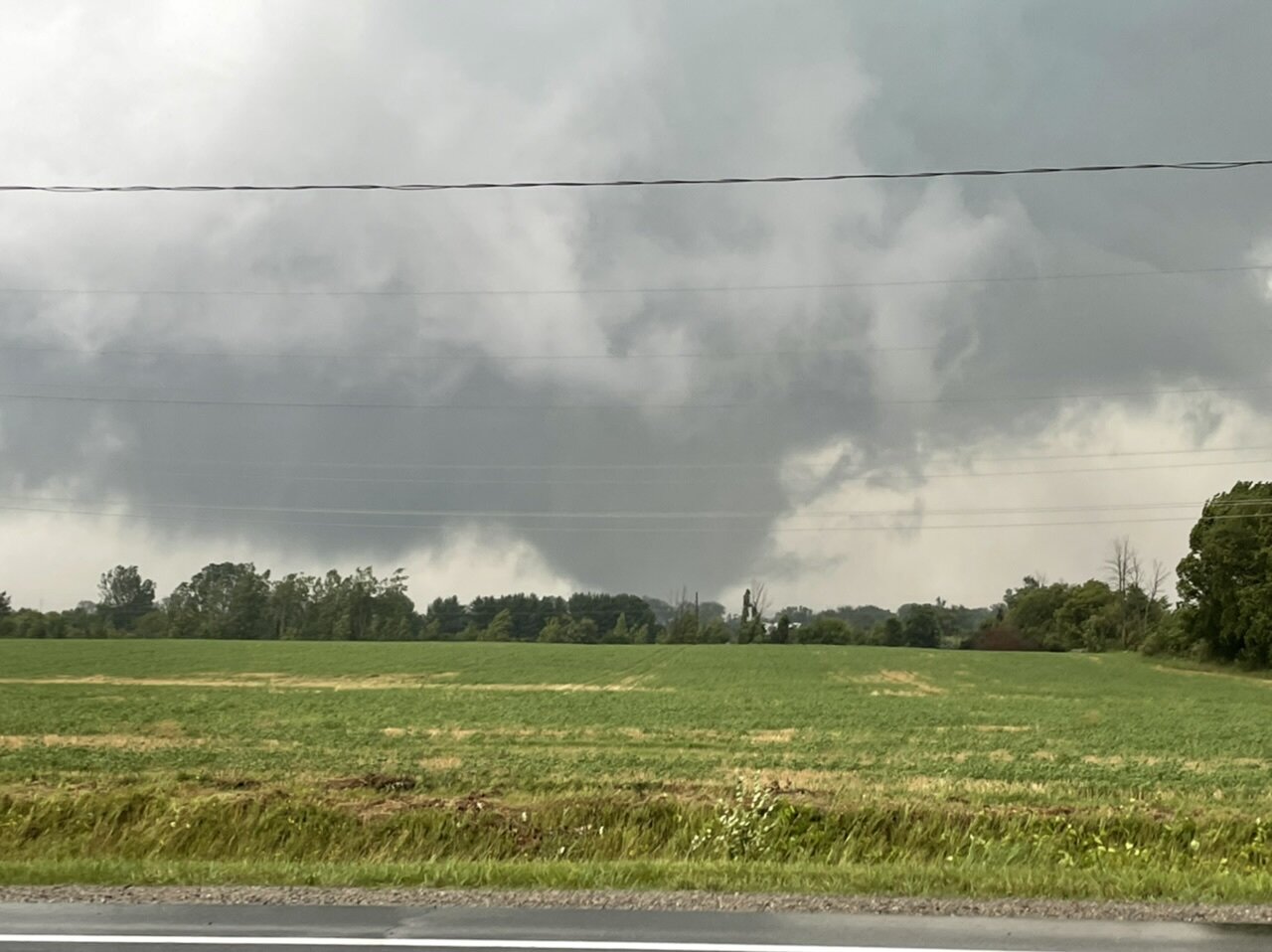
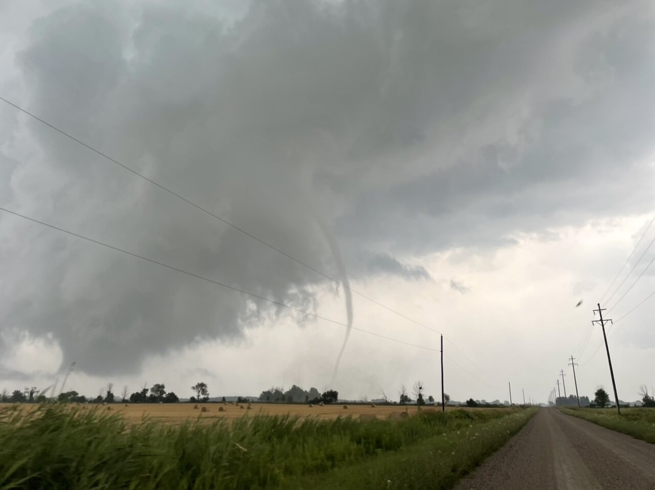
I also saw the Port Austin tornado yesterday. It was my first Michigan tornado I’ve seen in almost 4 years. Also had a large tornadic waterspout northwest of Port Austin before the storm came onshore. Environment just screamed “go here” in the Thumb to possibly see a tornado. Crossed the damage path of the EF2 from late June to see a rapidly rotating wall cloud just SE of Port Austin. A minute later the tornado developed. Pictures and video below. Will be editing pictures off my Sony a7RIV camera today.
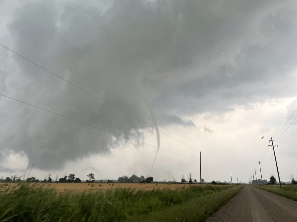
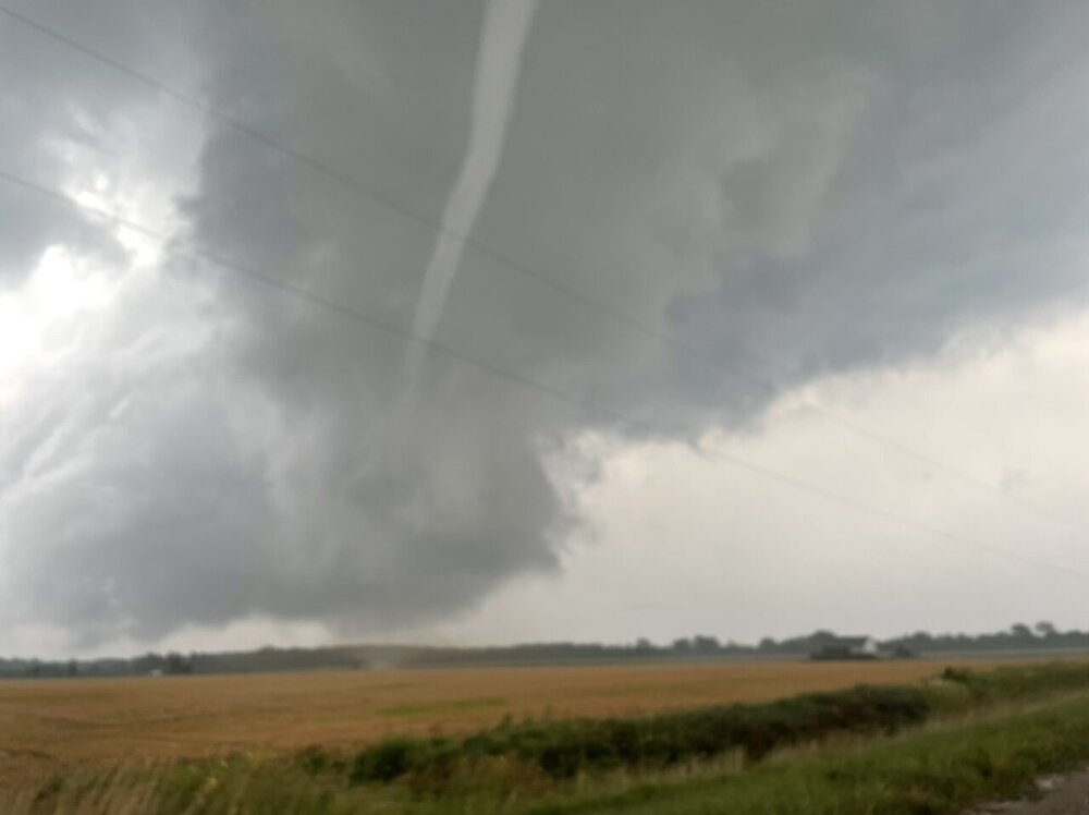
Also made multiple calls to DTX about this tornado event. First about the tornadic waterspout, then a couple about the Port Austin tornado. Knew there wouldn’t be any warnings just like last month without spotter confirmation, as the radar beams in the state once again were above the lower part of the storm.
-
I also saw the Port Austin tornado yesterday. It was my first Michigan tornado I’ve seen in almost 4 years. Also had a large tornadic waterspout northwest of Port Austin before the storm came onshore. Environment just screamed “go here” in the Thumb to possibly see a tornado. Crossed the damage path of the EF2 from late June to see a rapidly rotating wall cloud just SE of Port Austin. A minute later the tornado developed. Pictures and video below. Will be editing pictures off my Sony a7RIV camera today.
-
9
-
-
Measured 2.3” last night, with an additional 0.2” midday. Had some good quality dust and lighting at like 12-1pm yesterday. Still cranking out snow removal from the last storm so been busy. City government work is something else
-
1
-
-
DTW has had 12 February’s that officially had 20” or more. 7 have been since 2008. Look to add another February to that total tomorrow evening. February has been our month as of late.
-
4
-
-
I work in city government in the DPW for a good sized suburban Detroit city (Royal Oak). Had a snow emergency so was working 12 hours on/12 hours off for a couple days. Very exhausted and had no time to come on here. Got over 8” total from this storm. Earliest measurement ended up being underestimated, and lake enhanced snows also helped add to the totals. The blowing snow was super legit. While not a true blizzard, we were relatively close. Overall, this was a good storm and something needed this winter. Finally catching up on sleep after some crazy 3am start times.
-
6
-
-
Pretty underwhelming here...only 4” so far in this second round on top of 1.6” this morning.
-
Jelly of the LES. Love the intense events. Better be some pics and vids of pure rippage


New Years Winter Storm
in Lakes/Ohio Valley
Posted
Finished with 3.7” in Berkley, which isn’t too bad I guess. Pretty snore storm considering the long duration. Been busy the past several days but I’m okay with not tracking this storm much with how it turned out. Hoping a better storm can appear and verify.