

LSC97wxnut
-
Posts
771 -
Joined
-
Last visited
Content Type
Profiles
Blogs
Forums
American Weather
Media Demo
Store
Gallery
Posts posted by LSC97wxnut
-
-
A few flakes in Newtonville. 40.2*.
-
Late to the thread, but the brief squall that blew through here around 4:00 was pretty impressive.
Bummer the temps weren't close to normal around here or it would have been a really cool little windex.
-
 2
2
-
-
A few mangled flakes mixed in at 36* or so in Newtonville.
-
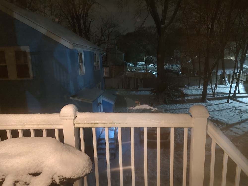
Still snowing lightly at 25.3*
Somewhere around 4" if I had to eyeball it? Didn't bring a ruler when out running around with the kiddo, but it wasn't more even before it compacted to what's in the photo.
-
2
-
-
Yep, CF through. 31.8*, 1/4 S and fog. Snow quickly coating all surfaces.
-
CF must be just about here. Fog has increased and temp has dropped to 32.5* in the last 45 minuets or so.
-
8 minutes ago, mreaves said:
Apparently not CBS. The game isn’t being shown here. Looks like we are getting Jacksonville/Tennessee.
FOX has the game today.
Pouring dendrites (1/3 S) and trying to accumulate on paved surfaces. Still around 34* though.
-
Rates trying to pick up again, still on the wrong side of the CF for accumulation.
Pretty to look at though
-
34.7* and light white rain.
-
Still around 1/2 S with decent dendrites, but Newtonville continues to be on the wrong side of the costal front at 34.2*.
-
1/2 S at 34.0* under the band in Newtonville.
Slushy 3/4" mostly on unpaved surfaces.
-
Oh well... up to 37.0* and all
 in Newtonville.
Hopefully it'll be snow tomorrow afternoon in Foxboro.
-
Kind of a mix in Newtonville. 36.7*
-
Watches up for outside 128 just as the NAM puts up a near-whiff.
-
-
A very light flurry n Needham currently.
-
1 hour ago, wishcast_hater said:
RE-LIVE the glory days of the weather channel:
https://battaglia.ddns.net/twc/#
Best using a computer, iPhone doesn’t play the music.
.That's so much fun! Awesome find!
I wonder if it played Mannheim Steamroller Christmas music in December?
-
 1
1
-
-
2 hours ago, Modfan2 said:
Power back late last evening; after being through TS storms here and Hurricanes in FL I chuckle at the those who wish to see a Hurricane here. A strong CAT 1 or higher would be devastating and most would be without power for 1 to two weeks or greater.
I wonder if part of the power restoration issue is, as many people mentioned here, this looked to be a normal wind event vs the high impact one it became?
As such, utilities didn't call in outside crews before hand to have them ready to go and are now playing catch-up?
-
 1
1
-
-
It was windier before the heavy rains came through.
Now that it's passed, just a light breeze and some showers.
Maybe we get clipped by that stuff in RI as the mesolow slides east of here.
-
Now we're in it. 1/4 R+ (Wish it was S+...)
-
Has become noticeably darker as the squall line approaches.
-
Light flicker with the most recent gust.
-
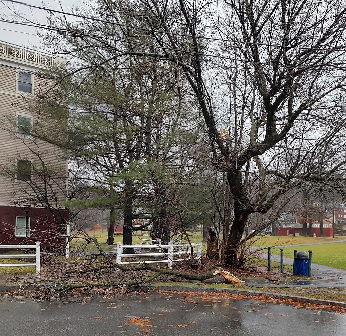
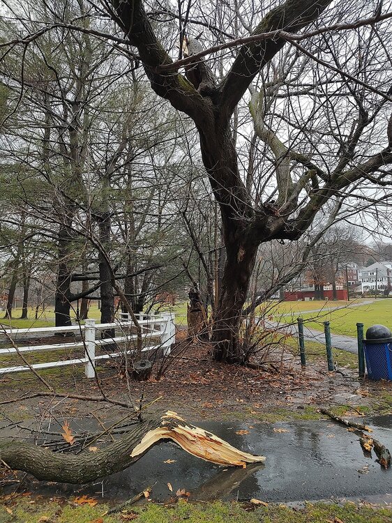
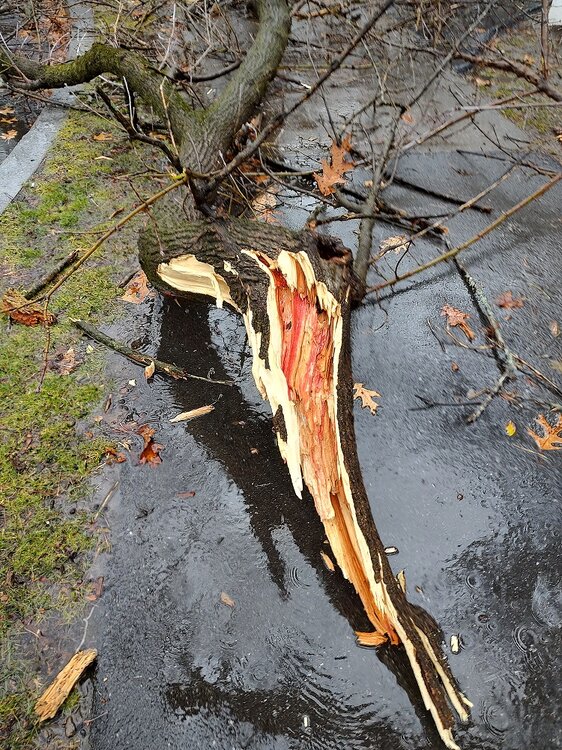
Well, maybe that tree wasn't as healthy as I thought? The red inside the limb can't be good?
-
Best gust of the storm blew a decent limb off a tree down the street here in Newtonville.
Can't get out there to see, but from here, it looked pretty healthy on the inside.
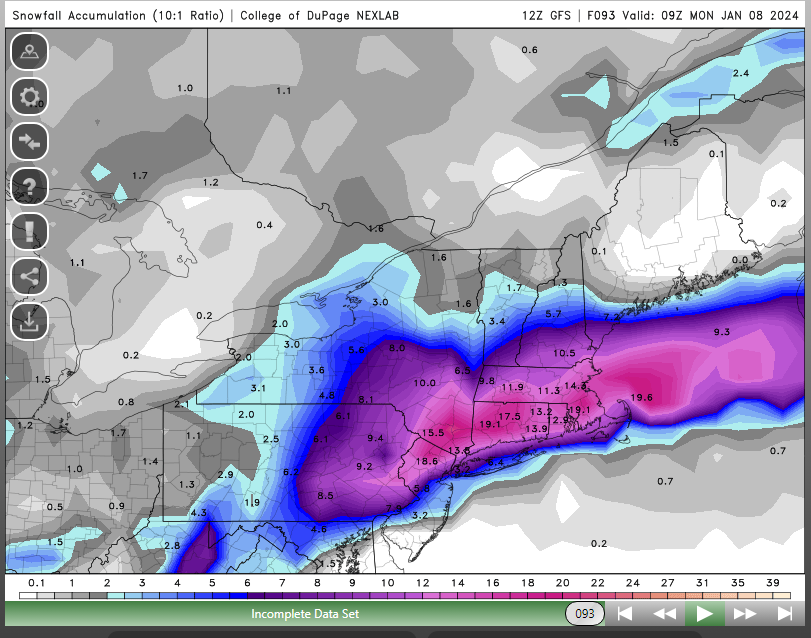
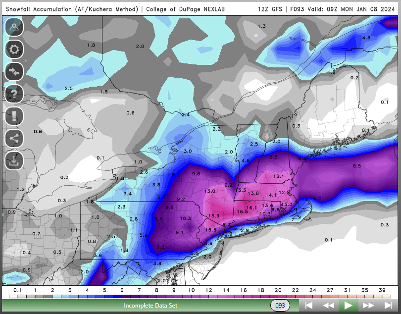


WINDEX threat 1/14
in New England
Posted
And just like that, it's stopped.