HIPPYVALLEY
-
Posts
32,932 -
Joined
-
Last visited
About HIPPYVALLEY

- Birthday 07/15/1968
-
 You are free to leave anytime you want, bruh’! I bet there’s a few on here that would even come help load up the moving van for you.
 -
Got down to 48°.
-
Saturday, July 18, 2026 Thunderstorm/Severe Weather Potential
HIPPYVALLEY replied to weatherwiz's topic in New England
Great moderate soaking rain for at least an hour here today. Yard is happy. -
I’m not used to this weather. The breeze is a little bit chilly. I don’t like oppressive heat, but I do like to be warm in the summer. I especially like warm evenings and tonight is not that.
-
Saturday, July 18, 2026 Thunderstorm/Severe Weather Potential
HIPPYVALLEY replied to weatherwiz's topic in New England
-
seems fine
-
Yeah, it’s been weird how dark it’s been for the past four hours.
-
It’s like 8 PM dark in downtown Greenfield right now. Crazy.
-
Peaked at 84° today in downtown Greenfield. It was definitely humid, but steady breeze all day.
-
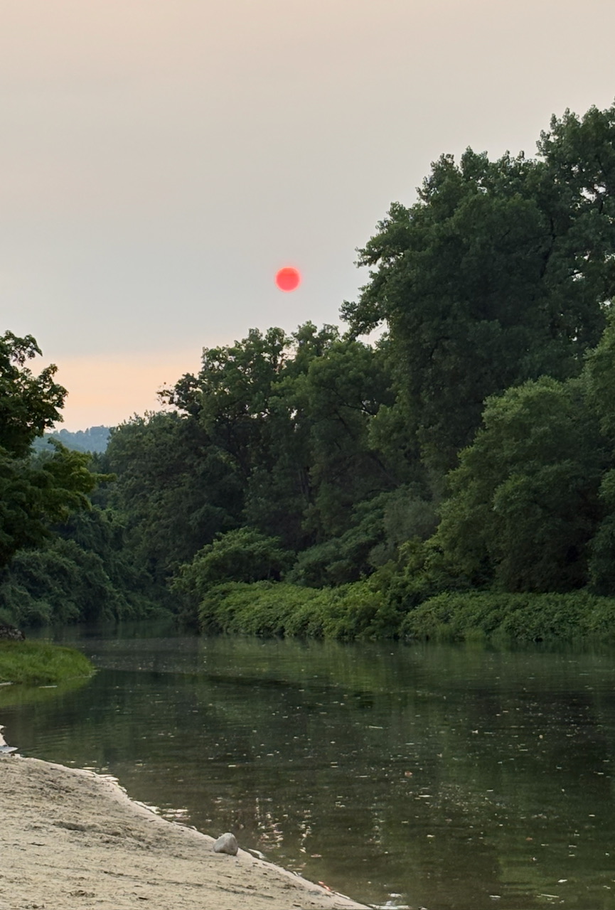
This isn’t the smoke I prefer to bathe myself in.
-
The sun is now completely obscured in the valley. I can taste the smoke in the air and the motion detector nightlight outside the brewery flicked on because it’s so dark right now. Killing a heat wave with smoke was not on my bingo card.
-
Greenfield actually got about .10” between the morning shower and the heavier afternoon shower. Very fortunate, good for the gardens and trees.
-
I believe that years ago, I read that a Carrington event would lead to the death of over half the populations of major cities within 6 weeks.
-
You have a better chance for a major ice storm than a major hurricane in SNE.