
SleetStormNJ
-
Posts
730 -
Joined
-
Last visited
Content Type
Profiles
Blogs
Forums
American Weather
Media Demo
Store
Gallery
Posts posted by SleetStormNJ
-
-
2 minutes ago, winterwx21 said:
Yeah you definitely want to post the Kuchera ratio maps instead, which Pivotal Weather has.
Union/Middlesex/Somerset is not getting 19 inches of snow, lol. 8-14 range I can definitely see with an 80/20 balance on snow/sleet accum.
-
 1
1
-
-
16 minutes ago, MJO812 said:
Fwiw GFS is all snow and a long duration
12+ for NYC with less towards the south coast but still a nice snowstorm.

That swath through NJ into metro is most definitely including a decent amount of sleet I think.
-
1
-
-
23 minutes ago, Dark Star said:
Not too bullish, haven't seen significant pressure falls along Hatteras yet. I would say 6-8" in central Union County NJ, unless the coastal low gets going FAST.
I'm not too far from you. Very interested to see how we fare. Sometimes we win and win big riding the line and other times we get sleetfest (hence my sig/name).
-
 1
1
-
-
4 minutes ago, jm1220 said:
That being said it's a step back on the NAM-more amped with the 700 low track for sure. Tracks from around Allentown through CT. Hopefully it's wrong. I'd think warm air aloft would come in stronger and risk a good chunk of the front end being sleet (for near the city and LI).
It seems to be a bit more extreme with the track/mid level warmth push than the other models. Worth watching for sure though.
-
12 minutes ago, SnowGoose69 said:
The 3km NAM has sleet to JFK and EWR at 23-00 but then miraculously holds it off and even pushes it south until 05Z. Not sure I believe a push like that gets held off
SG - How does the NAM usually do on thermals in these set ups? I recall it being hit or miss some events (some it nailed, others it came in too fast/warm).
-
3 minutes ago, jm1220 said:
RGEM apparently still quite warm/tucked in for 18z run today.
Toss........
-
 1
1
-
-
GFS doesn't bring the mid-level warming/dry slot.....
-
1 minute ago, jm1220 said:
We're really mostly concerned with the mid level lows not the surface low. If there's a strong 700mb low tracking through NE PA and the Hudson Valley, it won't matter much where the surface low is. It's a quick thump to a dryslot because dry/warm mid level air will be driven in from the south.
Yeah - it is something showing up a bit on all to one extreme or the other - that's why you're seeing a huge slug of sleet in the precip depictions even into parts of south-central/SE PA. Worth looking at tomorrow as the storm evolves and always a bit fun to track the handling of these lows.
-
NAM is really kind of on it's own with just how extreme it's pushing the slot and best dynamics NW. GFS is also kind of on it's own with it's confluence/shunt to the East.
EURO/UKMET blend seems like a wise evaluation at this juncture.
-
1
-
-
Too early to make those calls........LC is just guessing.
-
1
-
 1
1
-
-
16 minutes ago, weatherpruf said:
They expected rain sooner, and in some areas there was some brief drizzle but it switched back. RIght now is an all out sleet event. Sleetstorm must be in his glory.
Indeed. It is glorious.
-
1
-
-
I’m getting concerned we may be in for some serious icing into the afternoon and early evening until it warms up just enough for cold rain.
-
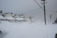
Heavy sleet where I am in Kenilworth/Cranford NJ area.
-
Big fan of sleet. Bigtime fan.
-
2
-

Major Nor'easter snow storm (possible top 20) Noon Wednesday-Noon Thursday Dec 16-17, 2020
in New York City Metro
Posted
Thanks! Just wanted to say you are a real asset and resource to this board. Appreciate your contributions and thought analysis too!
Keep us up to date on the model changes!