
ayuud11
-
Posts
2,004 -
Joined
Content Type
Profiles
Blogs
Forums
American Weather
Media Demo
Store
Gallery
Posts posted by ayuud11
-
-
Lake effect rain in fking early December, I’m done lol

-
46 minutes ago, WesterlyWx said:
Wow I was not expecting to see that when I woke up... where’s the lake effect???? Looks almost non existent and I have maybe 2 inches??? The NWS was right and we were all wrong. Guess that’s why they get paid the big bucks. Definitely will make me think again before criticizing them...
We got shafted HARD lol haha
-
10 minutes ago, Thinksnow18 said:
I was thinking well at least theres the cold blast next week with multiple chances for LES and general snow events...the last 3 runs of the GFS says you have no soup for you...damn snow Nazi...
Looking out just beyond the end of this period...there is increasing
agreement amongst the medium range models that much colder air will
then overspread our region for the middle and latter portions of
next week. If realized...this would result in temperatures falling
back to below normal levels...which in turn could lead to the
potential for significant lake snows downwind of the lakes dependent
upon how the background synoptic environment evolves across our
region. Stay tuned...
-
1 minute ago, Thinksnow18 said:
It appears to have set up further south than forecast...that band was forecasted for the Northtowns...oh well there's thursday night and next week starting Wednesday to look forward to.
Looks like it's getting lift from the front passing by.. btw i think we got a chance to see 4-8" here in the metro if everything works out. **** what BUF says lol!!
-
 1
1
-
-
-
Well look at this way whenever they don't issue any headlines we always over-achieve so let it be lol

-
12z HRDPS is showing some love for Northern counties, those transient bands are always tough to forecast on snowfall amounts..
-
 2
2
-
-
5 minutes ago, DeltaT13 said:
The only thing working for us right now is a very cold boundary layer which is changing everything to sleet. Minimal icing so far. 25 degrees in my backyard. If we change to rain, watch out. It will ice up stunningly fast.
Major icing going on in BUF right now and all the NWS has us for is WWA wtf lol? What are their criteria for ice storm warning?
-
Man ROC threading the needle with this one I’d be worried about a bust if I was them. CNY looks golden tho so early congrats!!
-
1
-
-
Man I hope some of y’all are not getting you’re hopes up so many things can go wrong with a storm like this at the last minute.
-
2
-
-
Fking sleet man

-
1 hour ago, wolfie09 said:
Last night 0z Canadian had a sw flow event at the end of it's run..
.thumb.png.12bc7d9a2fb920fff88bdaa59ea71dec.png)
Like BUFwx said without that Low retrograding out west it's hard to maintain a good SW flow, we could still get hit but it'll prolly be the usual SW winds shifting quickly as the low passes by..
-
Damm that LES potential after next week is fading by each run lol
-
1
-
-
20 minutes ago, BuffaloWeather said:
Vermont has been in the jackpot zone for the last few years, every event they seem to have the max totals.
Noticed that too perhaps some orographic lift in play??
-
43 minutes ago, BuffaloWeather said:
That last run is 40-50" across Metro Buffalo. It's all downhill from there.
Last major LES event we had in the city was back in 06 lol we’re certainly due... FYI Major as in 2ft+ lol not these 6-12” crap.
-
3
-
1
-
-
-
RGEM showing some love for WNY.

-
1
-
-
38 minutes ago, wolfie09 said:
Euro is still farther west..
.thumb.png.920ac730a9872a3ba8e853bc1c1e68cf.png)
.thumb.png.089fe45a62de324a1e1e0694fa5051c0.png)

-
For WNY folks that's the track you wanna see on the models this far out, i think we might be in for our first WSW event..
-
 1
1
-
-
19 minutes ago, Buffalo Bumble said:
Most wintry early November period incoming since the Little Ice Age...

Will this be the season we finally get that big LES event for the metro area??????????? we're certainly due!!
-
Man this shit funny dude, We’re getting best snowfall rates of the season atm. It has to be at least 3”/hr rates it’s just pouring..
-
3
-
-
South Buffalo must be getting crushed cuz it's easily 2"/hr rates on the northern fringe of that band..
-
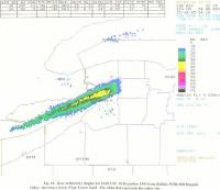
Man just look at that band off Erie, what a thing of beauty..
-
Adios LES band, let's see what the round 2 brings for tomorrow.
-
1
-

.png.1b628652bc70feed8baf99e2369cfd64.png)

.png.13c3118308ecbf15baa81f1fef772482.png)
.png.d39fa8ef3a1cf0e2254f5197c9d1d0d3.png)
Upstate/Eastern New York
in Upstate New York/Pennsylvania
Posted
Coming down pretty good in NT, looks like 2 inches of new snow since last night.