

Jump to content

Kevin Reilly

Members
  • Posts

    3,417
  • Joined

  • Last visited

Everything posted by Kevin Reilly

  1. There is a warm layer coming in off the Atlantic down your way in DC Baltimore area that warm air layer gets scoured away but barely up here in southern pa by PHL due to the storm hitting the breaks and moving off the coast east bound.
  2. Take away it’s beginning to look more like the other models at this time.
  3. December 23rd 2009 we got 23” here in Southeastern PA and the ocean water temperature at Atlantic City was 53. All about the proximity to the coast for the storm and that all important NE to NNE wind vector along the I-95 corridor happens all the time.
  4. Looking at this Eta is definitely on the eastern side of the track and strengthening. I got a friend in Cape Coral told him to batten down the hatches. Naples to Cape Coral Fort Myers up to Sarasota needs to pay very close attention. I would say Tropical Storm Warnings could be replaced by Hurricane warnings at 11 pm.
  5. The models have it a weak system that eases out to sea off the Carolina coast.
  6. At this point we look for signals but what is a bit troubling not only is the East Coast open to a hurricane strike a major ingredient to this scenario is a blocking high showing up in the Canadian Maritimes and its been there quite a few times now in the long range. I think we need to give it some credibility because up here in the northern latitudes there are definitely hints of changes to a fall like pattern with fairly large mid latitude storms just north of the Canadian border. Here is the system here crashing into extreme northeastern NC Virginia Beach 938-945 mb then to a position over Cheasepeak Bay at 964 mb then to the Eastern Great Lakes. Do I think its overdone maybe but we shall see.
  7. Yea here is your next threat September 12th take it with a grain of salt for now, but keep it in the back of your mind.
  8. These models are folding their arms and throwing them up in the air and saying there is no way 2 systems can be in the Gulf at the same time and tries seeing which one becomes the dominant feature. Depression 14 right now is getting awfully close to the northern coast of South America and Depression 13 is being sheared pretty good. I see no agreement on models and think the most likely outcome is rapid development right at landfall which in most cases happens in a moments notice without much warning. I’d be prepared in Florida and entire Gulf Coast.
  9. I am with you far from doom and gloom. I mean how much worse can this winter be in comparison to the winter of 2019-2020. We only had 2.3” the entire year here. Just like hurricane season every winter season is different. At the same time it’s rare to have an almost shut out on snow two years in a row.
  10. 95L. Has a vigorous mid level low but low level and mid level lows pretty far apart maybe it can get to the islands and pull an Isaias and relocate its centers. You can clearly see the mid level circulation tuck under the thunderstorms at sun down out there. https://tropicaltidbits.com/sat/satlooper.php?region=95L&product=vis
  11. Here’s a question to ponder. How does the Coronavirus affect climate change? The burning of fossil fuels has been dramatically cut since January till today. How will this affect short term weather patterns over the next year or two? Thoughts?
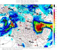
  12. There really hasn’t been a significant NAO block December to March really since 2009-2010? We scored big December 23rd 2009 and February 23rd or so 2010 off a negative NAO. Correct me if I’m wrong. Now of course NAO was negative on October 30th for Sandy 2012.
  13. Ahhh yes you struck a cord now I remember him you are so right he did!!!
  14. I post here Im a relative newbie but honestly I like the folk here and are highly knowelegable. Irishbri and Tombo brought me in here to read posts but frankly those that are still here I enjoy reading with and experiencing weather with and are somewhat in the local ball park with me geographically. Ie hey Redsky tremendous thunderstorm line just rolled through me and Kamu get ready!! Also love reading Rays post Famaritin he keeps the snow weenie in me grounded. I vote to keep things as is. I will certainly be here to support and read the fine ladies and gents here respectully. I have learned to keep all views and to listen to other weather enthusiasts lesson learned from Tombo.
  15. Here comes the more important snows already from the south

×
×
  • Create New...