J.Spin
-
Posts
6,157 -
Joined
-
Last visited
Content Type
Profiles
Blogs
Forums
American Weather
Media Demo
Store
Gallery
Everything posted by J.Spin
-
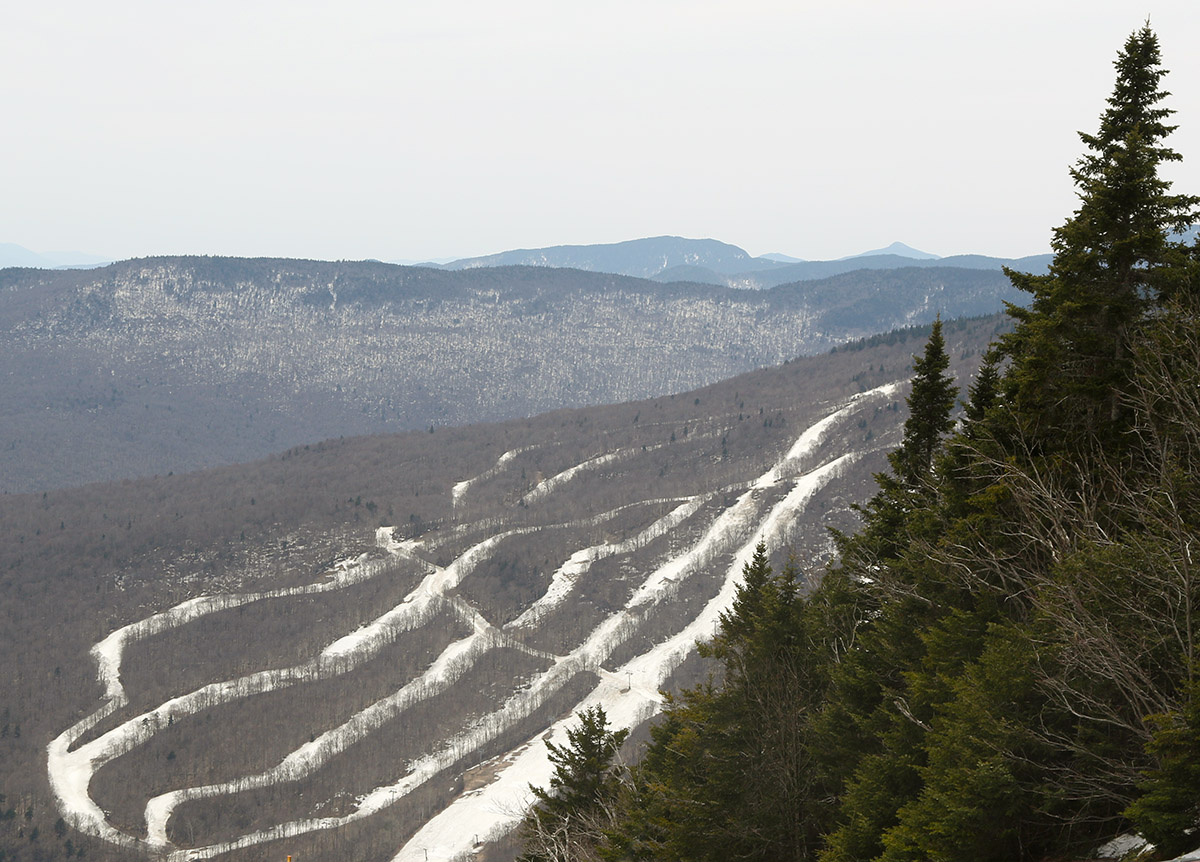
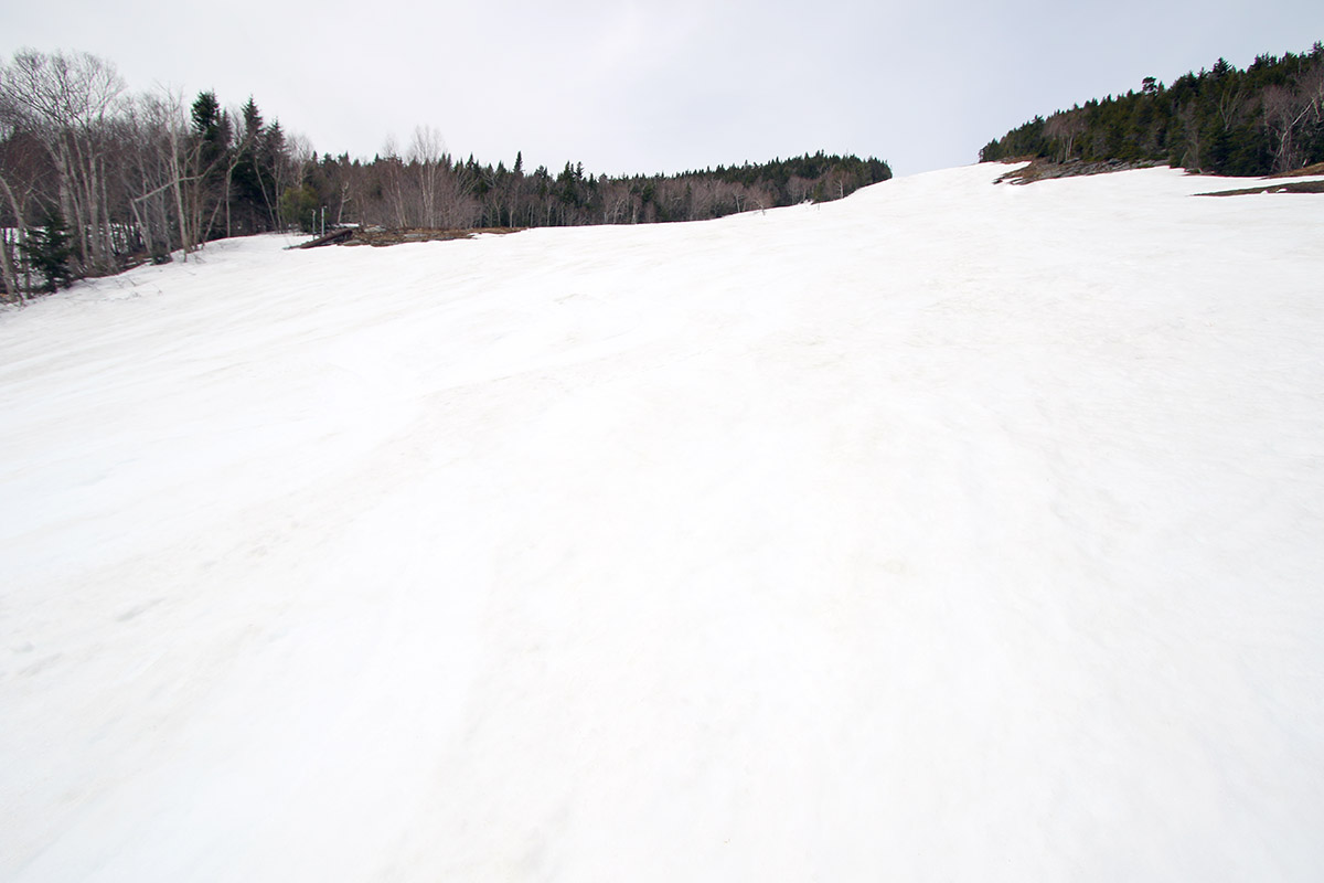
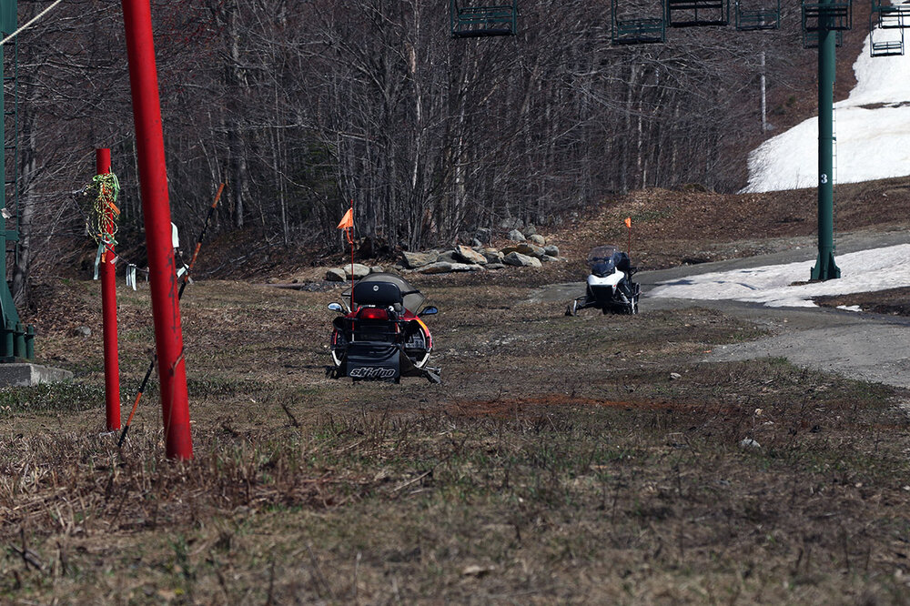
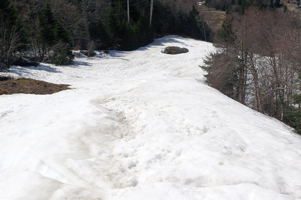
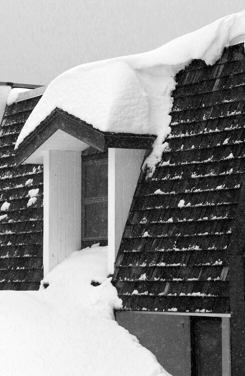
The forecast suggested Saturday was going to be the better weather day of the weekend, so I decided to make use of it and get in a ski tour. My previous tour was at Stowe, so I headed back to check out Bolton’s snow for this one. Based on what I’d seen on my last Bolton tour I figured the lower elevations of Timberline would be mostly melted out by this point, but the views from Burlington showed that there was still plenty of snow at the main mountain. Heading up the Bolton Valley Access Road, the first signs of snow were around the 1,400’ elevation mark, and there was still some snow left at the Timberline Base at 1,500’. On the whole though, there’s only patchy snow down on Timberline now, and it’s nothing that would be practical for turns. Up above 2,000’ at the main mountain there are still various areas of snow that offer up options for ski touring. On the lower mountain there are spots like Valley Road and Beech Seal that have continuous snow, and on the upper mountain there are numerous options with good coverage. I didn’t even bring my skins for yesterday’s outing, since I figured there would be enough areas melted out for easy hiking, and skinning might require dealing with some substantial gaps in coverage anyway. In the terrain off the Mid Mountain Chair, areas of continuous coverage start about 100 feet up from the base. I opted to hike up the Bear Run route, which has an access road, and I was able to travel on roughly 50% dry ground/50% snow. On the upper mountain, the hike was about 20% dry ground/80% snow using a combination of Sherman’s Pass and Schuss. I hiked up to where continuous coverage ended, which was in the plateau area at the top of Cobrass/Preacher. From there, I skied Sherman’s Pass to Spillway, and there’s a small break in coverage near the top of Spillway, but below that it’s continuous snow down to Mid Mountain. The Mid Mountain area is mostly snow with a bit of bare ground, and then once you get past the first bit of Beech Seal you can ski down to where the snow ends about 100” above the base area. Temperatures were probably in the 60s F, so the quality of the corn snow itself was fine, but there are a lot of areas of the snowpack that are sun-cupped, so the surface consistency isn’t great there. Stretches in the middle of Spillway and Beech Seal had smooth enough snow for nice turns thankfully, but there just hasn’t been that much skier traffic to help much with smoothing out areas beyond those. There will likely still be plenty of snow for turns in another week, but it won’t really be practical for an efficient tour; the snow coverage will get discontinuous enough that it won’t be great for a top-to-bottom descent without numerous gaps that require walking.
-
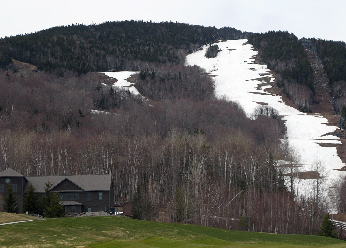
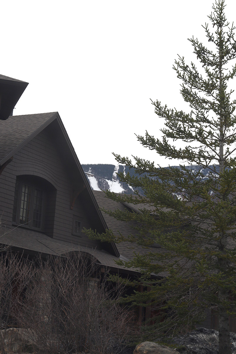
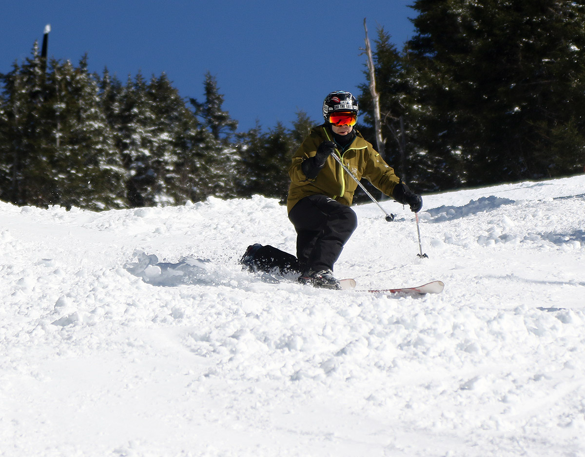
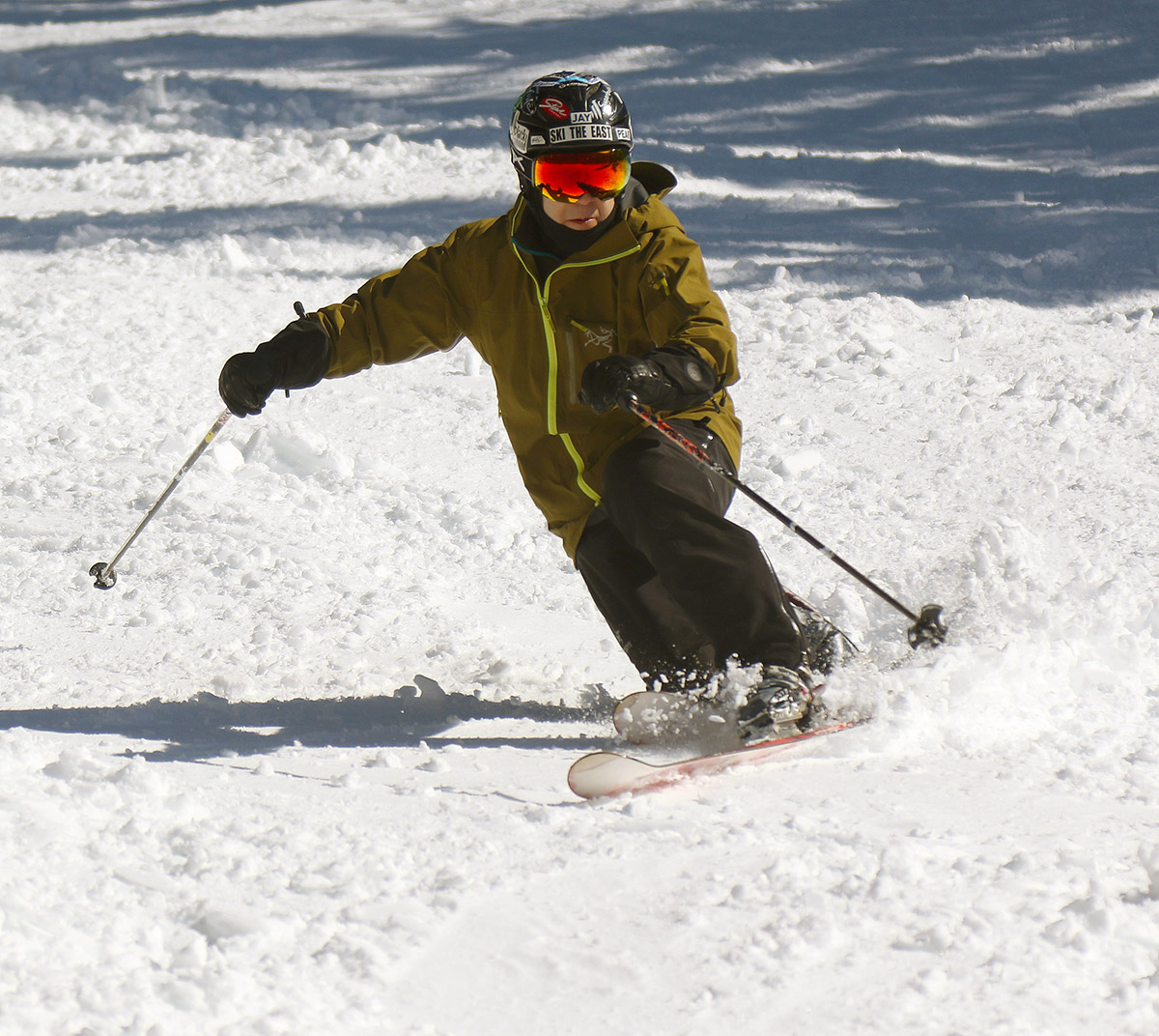
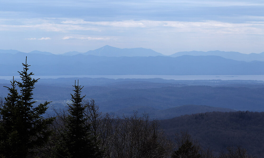
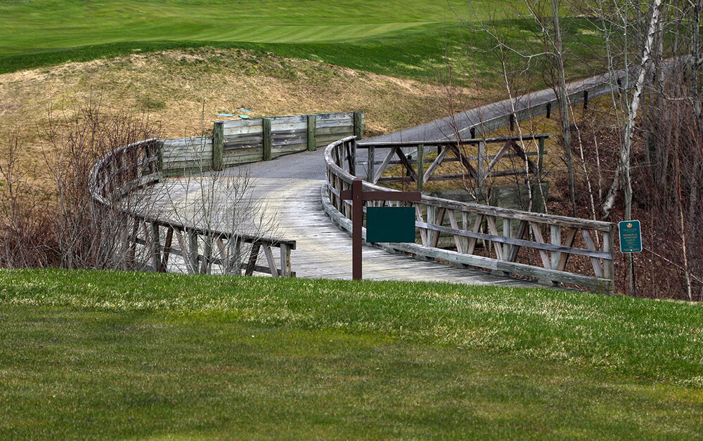
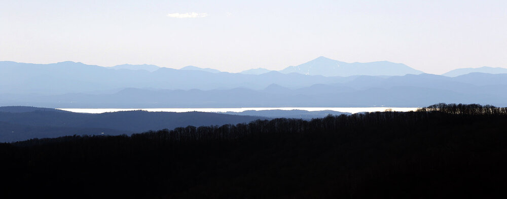
Yesterday started out beautifully sunny in the morning, so once it warmed up enough, I decided to head out for a ski tour in the early afternoon before the heaviest clouds built in later in the day. Temperatures by that point were up into the 50s F, so there really weren’t any concerns about the snow being soft enough for quality turns. Since I’d visited Bolton’s Timberline area on Thursday, I decided to mix it up and head to Stowe for this tour. I was hoping that the south-facing slopes of Spruce Peak were still holding enough snow to serve as relatively efficient touring terrain, and they were far better than just sufficient. Not only is the snow continuous all the way down to the MMSC parking lot level at 1,750’, it was even continuous all the way down to the Spruce Peak Village at 1,550’. Overall coverage in the area definitely seemed better than I typically see at the end of April, so some combination of the amount of snow made, our numerous late-season winter storm cycles, or our recent weather seems to have slowed melting in some of these lower elevation areas. The snowpack depth at the Mt. Mansfield Stake is a bit above average for this point in the season, but it can be hard to correlate the state of the high and low elevation snowpacks with how disparate those environments are in the spring season. Since snow coverage was plentiful and there was no need to hike, I was able to stay on my skins for the whole ascent. It was warm in the lowest elevations, enough that I was using some venting on my pants, but it was chilly enough up above 3,000’ around the Spruce Peak summit elevations that I closed the vents up and was fine putting on a shell. I saw a few other folks out for turns on the slopes of Spruce Peak, but there were fewer than a half dozen cars in the MMSC lot at any given time. The quality of the ski surface was definitely good – the corn snow is in great shape since we’ve had repeated freeze-thaw cycles. Most of the surfaces weren’t that perfect, unblemished corn snow that you can sometimes get on Spruce Peak – there were some irregular areas of melting and sun cups in spots. The nuances of the snow surfaces really depend on the weather patterns though, and I’m sure it takes just the right combination of freeze-thaw, sun, precipitation, temperatures, etc. etc. to really create those perfect, unblemished expanses of spring snow. Skier traffic can have a bit of an effect on that, but when the snow isn’t perfect, a bit of skier traffic can actually create some of the best snow for skiing since it can wipe away most of the imperfections and dirty snow that sits atop the snowpack. Since the opportunity to ski all the way down to the base of Spruce Peak usually isn’t there, I continued my descent all the way down the to the Spruce Peak Village, then hiked back up via Inspiration and along the 12th hole of the Spruce Peak Mountain Golf Course. It was nice to see things greening up in the valley – the disparity between the vegetation and coloring in the higher and lower elevations always makes for some interesting views this time of year.


-
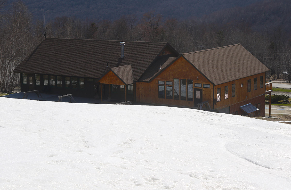
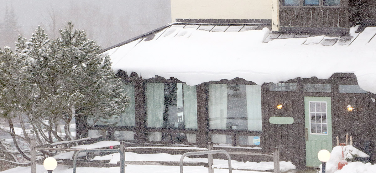
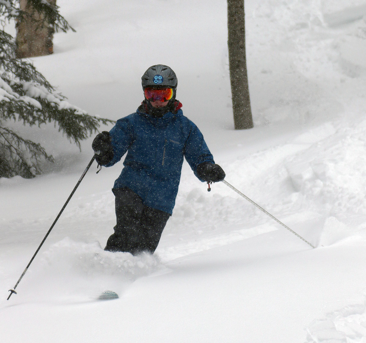
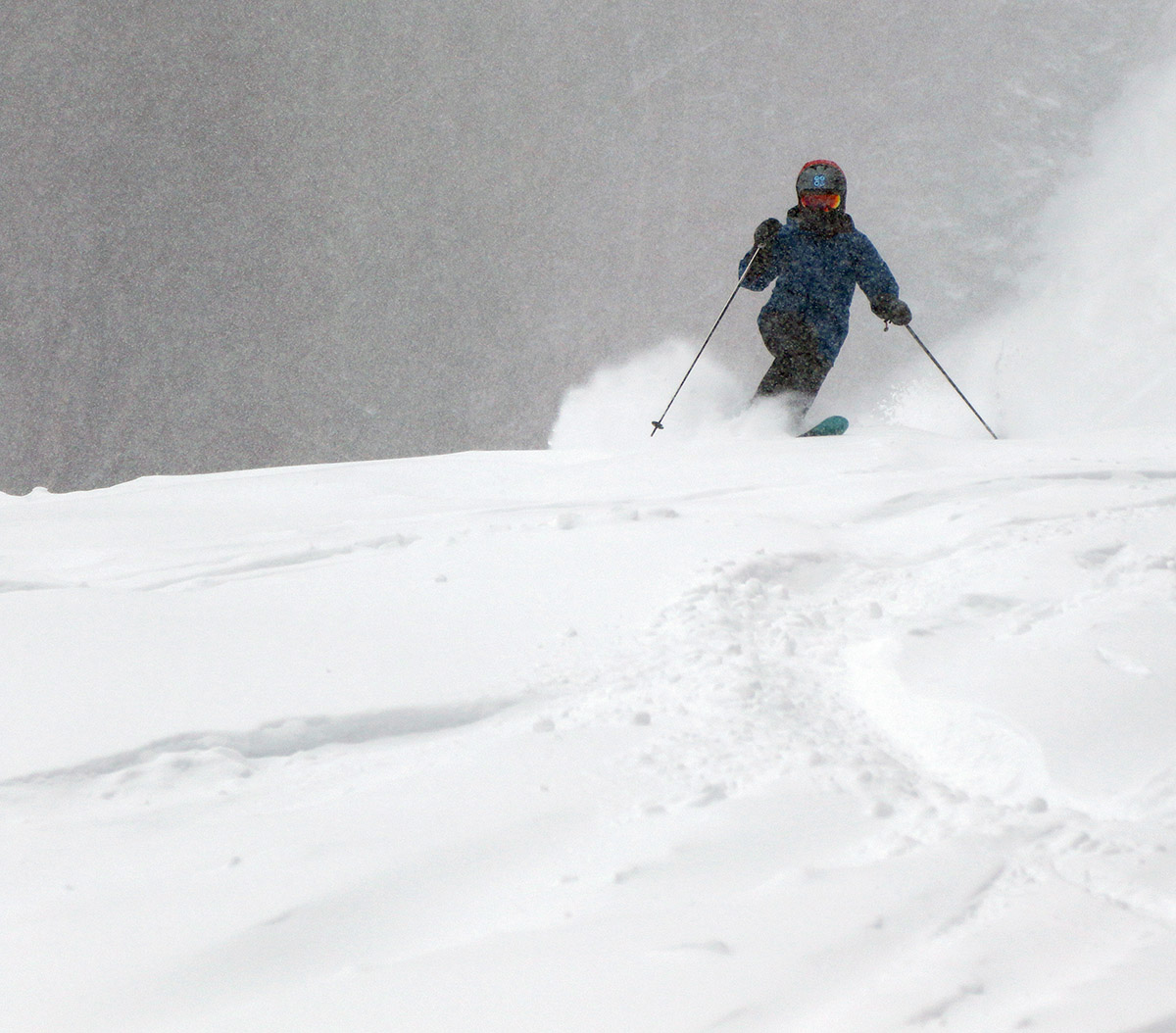
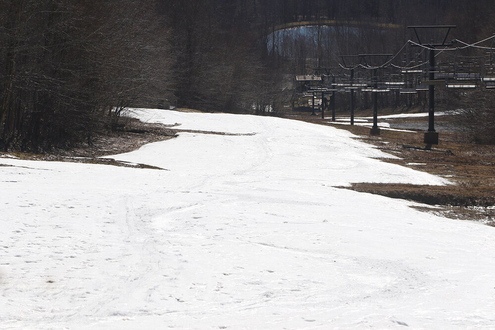
On Thursday I had some time to get out for turns in the afternoon, so I can pass along a conditions update from Bolton Valley. Thursday was beautifully sunny, but it definitely had a chilly feel with dry air being blown into the area by northwest winds. Even in Burlington, temperatures were only topping out around 50 F, and it felt brisk walking around the UVM campus to the degree that I was wearing my coat and hat. With the combination of relatively cool temperatures and winds even in the valleys, I wasn’t sure how the snow conditions were going to be in the higher elevations; if the temperatures were still in the 30s F at elevation, along with those winds reducing the ability of the sun to warm the snow, conditions could end up too firm for good turns. When I checked the midafternoon temperature on the Bolton Valley website, I saw that it was at 41 F, and as far as I know that reading is from the main base at around 2,100’. That was far enough above the freezing mark that I decided to head up for a tour. Ideally, I was hoping to tour down at Timberline, since the lower elevations and great western exposure to the afternoon sun down there give you the best chance of getting soft snow. We’re now at the end of April though, and I was skeptical about the amount of snow left down at Timberline. Those sunny afternoons and lower elevations are great for softening the snow, but they’re brutal on snow retention. On my way up to the mountain, I swung through the Timberline Base Area to take a peek at the snow, and low and behold, it looked like Showtime still held nearly continuous snow for turns. They must have really loaded up the snow on Showtime this year, and combined with a bit of natural snow bolstering from all those late-season storms, it’s definitely holding on longer than usual. There is snow all the way down to the Timberline Base Lodge at 1,500’, but there are a couple of large enough breaks in the coverage that I hiked roughly the first couple hundred vertical feet. After that I was able to put my skins on and skin the rest of the way up to the Timberline Mid Station at around 2,250’. There are a couple of tiny breaks in the continuity of the snow up to that point, but it’s essentially continuous. There’s also more snow above that point up on Intro, but the Mid-station plateau area seemed like an efficient starting point for the descent. The snow consistency was excellent – we’ve had lots of temperature cycling below and above freezing over the past week, so that corn snow has set up well. The combination of sun, temperatures, and a bit of breeze was perfect to keep a nice layer of peel away corn such that conditions were neither too hard nor too soft. I even saw a bit of winter snow left over from recent systems in shady areas up high that had been kicked around by a previous skier. That afternoon sun was bright – I had my darkest goggle lenses at 6% VLT, and they were a great fit for the intensity of late-April sun. It’s not too often that I use those lenses here in the Northern Greens with our penchant for snow and other active weather, but they fit the bill for this tour like they did on our sunny eclipse day earlier this month. I don’t think those near continuous turns down at Timberline will last too much longer – especially if temperatures start to increase the way the forecasts are indicating. It was definitely a treat to still be able to get Timberline turns in at this point of the season though, since it adds some variety to the mix before moving on to other touring spots with more snow as we move on toward May.

-
In the NNE threads we’ve had a lot of discussions about upslope snowfall trends throughout NNE and surrounding areas in the past – it can be tough to find specific discussions with the search tool, but it might yield some results. There’s definitely been plenty of conversation on why the upslope totals fall off as one heads southward along the Spine of the Greens, but an important one as I recall was that the Northern Greens have no mountain ranges to their northwest – it’s just relatively flat land where northwest winds suddenly encounter ~4,000’ of vertical relief. And, if you look at a topographic map, the Green Mountain Spine begins to turn in the northern part of the state such that it no longer has such a direct north to south alignment – it curves a bit to the northeast, setting the spine more perpendicular to northwest flow. Both the vertical relief and the perpendicular orientation are great for orographic lift. And, the Great Lakes help to keep more moisture in the atmosphere relatively to what would otherwise be present. As one heads southward along the spine, the orientation is more north-south, and there are more and more mountains/ranges upwind, so the northwest upslope isn’t as prolific. It’s funny, because just as I mentioned about all the large storm jackpots that seem come to the Southern Greens, I can recall many times where the flow off Lake Ontario heads right into that area, but it must not be as frequent or prolific enough to produce the same consistent results that it does in the Northern Greens. On the plateau/width concept, I’ve always thought that height/vertical relief was the bigger factor in promoting orographic precipitation, but I really don’t know the relative contributions between the height and width factors of a mountain range for orographics. PF or some of the meteorologists on here might be able to reply if they have a sense for that.
-
The explanation makes perfect sense, and of course it’s coming from someone who is literally involved in the process. I didn’t know that Smugg’s had switched to the single site methodology, but now that you’ve confirmed that it clearly explains the change in their snowfall numbers. From the perspective of skiers who are skiing all over the mountain at various elevations and aspects, it seems appropriate that you described it as “apples and oranges” vs. “right and wrong” or “good and bad”. A single site (hopefully an appropriately representative one) is probably more optimal for long-term record keeping and comparison, but it might be less representative in some storms vs. others than the range that was found when sampling various parts of the mountain.
-
On that note, I grabbed what was available for the season snowfall totals at the Vermont ski areas – the north to south listing is below. The numbers may increase for areas that are still open like Killington, Jay Peak, Sugarbush, etc., but typically the increases aren’t huge through the end of April and May. Jay Peak: 371” Burke: 180” Smuggler’s Notch: 264” Stowe: 289” Bolton Valley: 335” Mad River Glen: 242” Sugarbush: 249” Pico: 239” Killington: 239” Okemo: 133” Bromley: 135” Magic Mountain: 132” Stratton: 142” Mount Snow: 120” As you noted, I’m sure Stowe would be right up there above 300” if snowfall measurements were taken from ridgeline/summit areas like Bolton Valley and Jay Peak are presumably doing. I’m not sure what to make of the Smugg’s number though; they were traditionally right in line with the increasing snowfall numbers as one headed northward along the spine, but their numbers have been consistently on the low side all season relative to the other resorts in the Northern Greens. Perhaps they’ve switched to recording snowfall at mid-mountain or base elevations instead of near the summits. It wasn’t really a big season for upslope snow (December can be a big period it was relatively slow this season), so I thought that might be an issue for a west-side resort like Smugg’s, but it didn’t seem to prevent Bolton from getting roughly average snowfall, and it played out that way at our site in the valley with roughly average snowfall as well. That Smugg’s season total is still higher than anything reported from the Central Greens thus far, so that’s consistent with the usual trend. The snowfall numbers just fell right off a cliff once you get to the Southern Greens though. The snowfall typically drops off as you head southward, but this season showed an even sharper cutoff than usual - all those season snowfall numbers are even well below what we recorded for snowfall at our site in the valley at 500’. The perception of the snowfall in those Southern Greens resorts is very interesting. I can remember map after map after map this season showing projected storm jackpot zones in those areas, and some of them even played out that way in reality with pretty substantial hits of snow. Maybe those events just get big fanfare around here in the forum because they are more in line with systems that are affecting the more populated areas of the Northeast. I’m not sure exactly what the deal is, but the numbers are paltry, and it’s not as if it’s just one resort being conservative – that’s 120”-140” of snow for the entire season across five independent ski resorts. Mount Snow at the southern end of the state ultimately recorded less than a third of the snowfall that Jay Peak recorded at the northern end of the state, so the typical disparity was even more enhanced than usual this season. Ultimately, I don’t think a few big storms a season is really a great climate for a ski resort in the Northeast anyway, since the variability in the weather around here calls for more consistent refresher snowfalls to recover conditions back to something respectable. From what I’ve seen over the years, it’s not as if the northern areas are simply getting the same amount of snowfall just spread out more evenly throughout the season; the more consistent snowfall of various types vs. just large storms seems to end up in larger overall totals as well. I’ve seen people scoff at the disparity in snowfall from south to north because they assume the northern resorts are just inflating the numbers, but I think it’s perception – people seem to have a hard time integrating all the smaller, more frequent snowfalls into their perception of the overall snowfall vs. the larger, attention-grabbing systems.
-
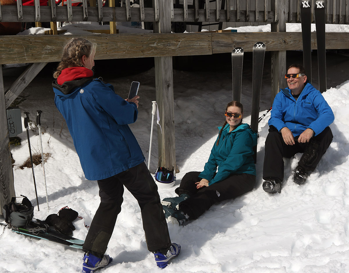
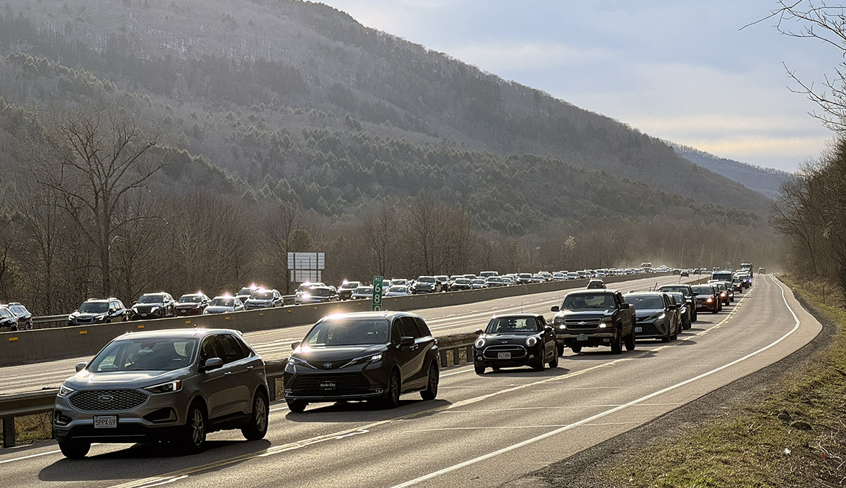
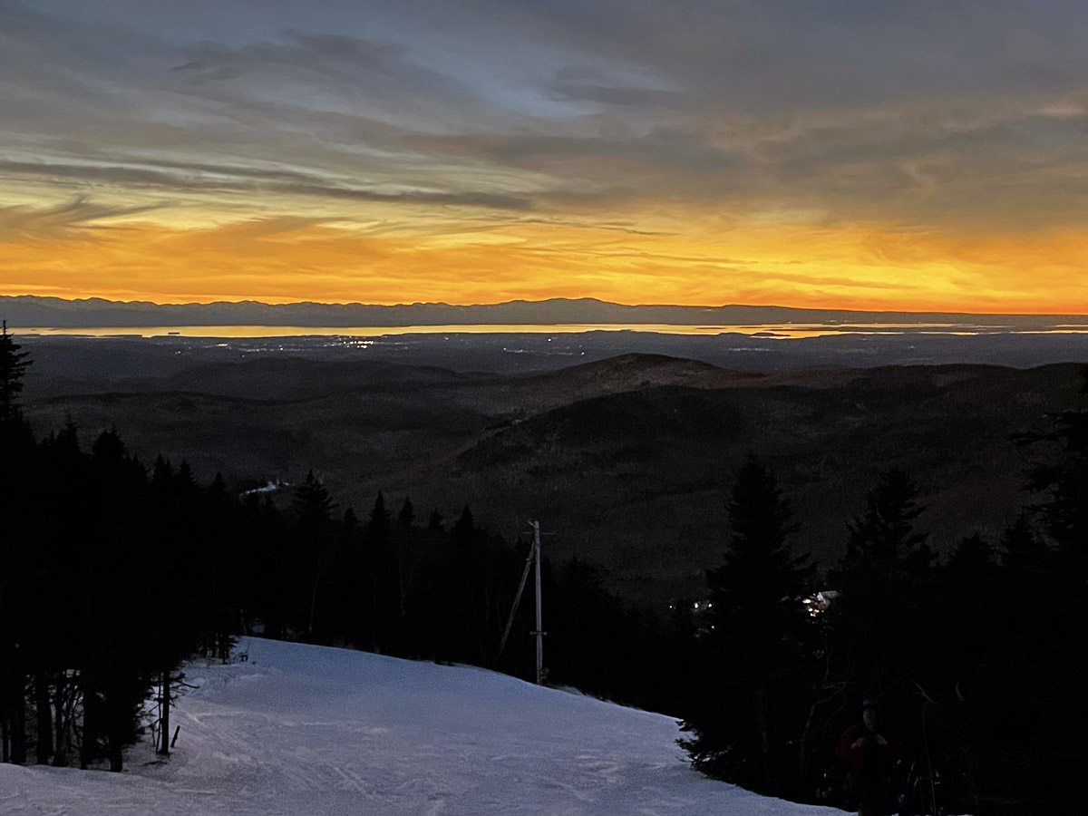
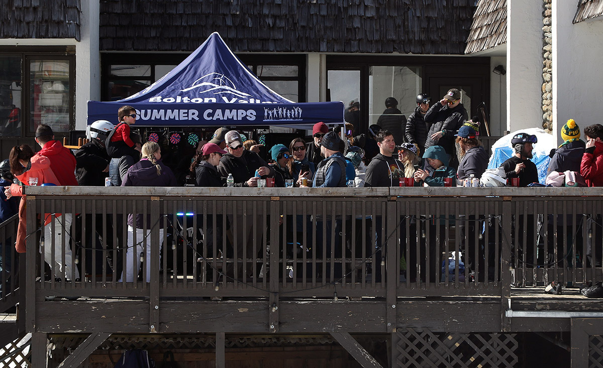
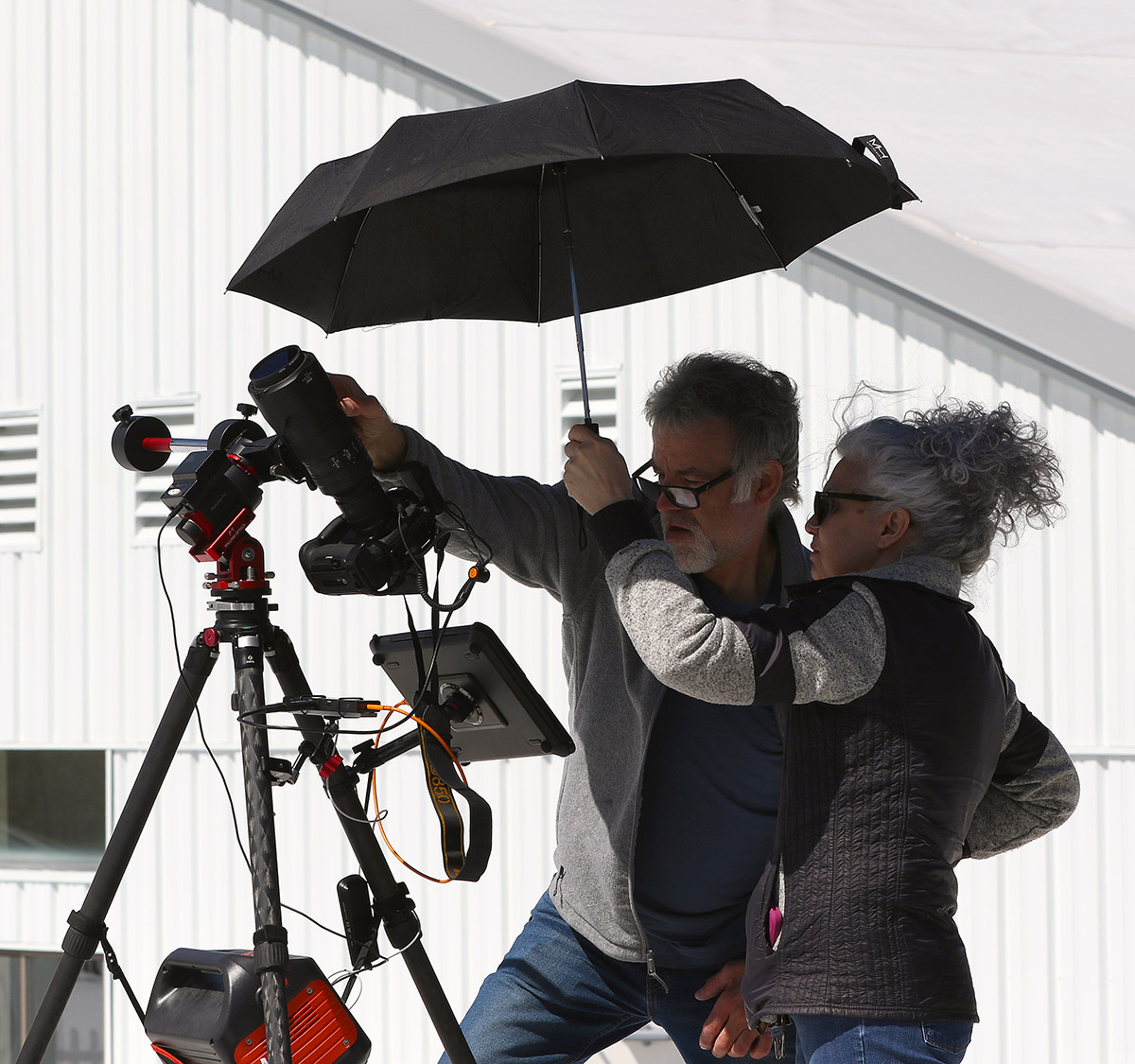
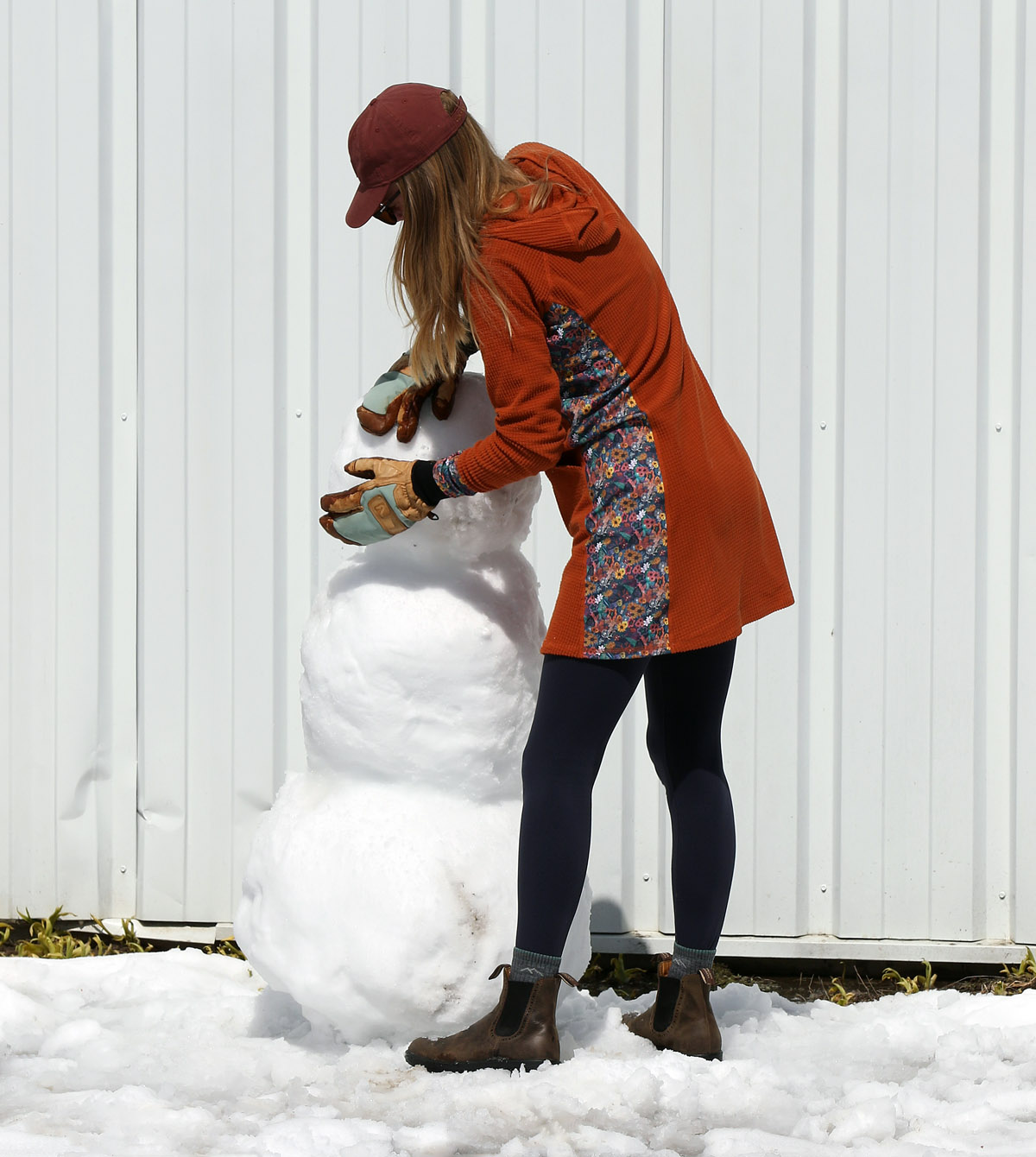
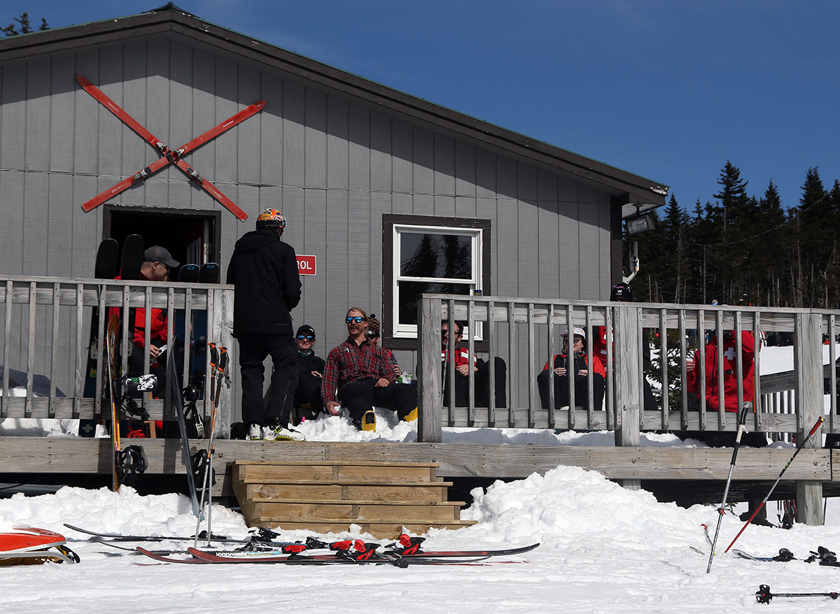
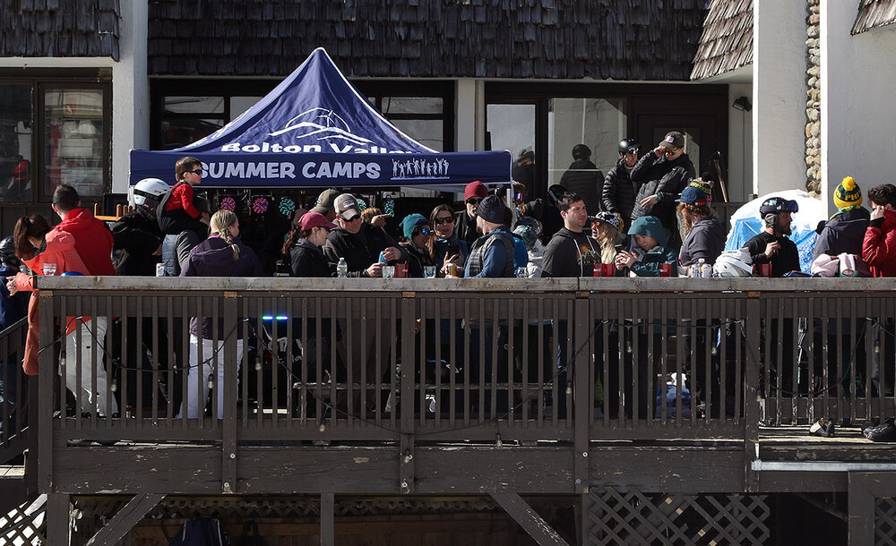
Saturday was really the last day of powder and cold snow conditions from Winter Storm Tormund, but the storm cycle had delivered three great days of skiing and riding on winter snow, which is certainly decent for April. On Sunday, temperatures were expected to move into the 40s F in the mountains, which would be enough to start the snow transitioning to more spring-like conditions. My wife and I decided to head up for some turns at Bolton in the afternoon to take advantage of the sun, warmer temperatures, and hopefully the soft snow that would arise from the change in weather. Temperatures were indeed warm as expected when we headed up to the resort in the afternoon – somewhere in the upper 40s F. The mountain was certainly hopping with visitors, but we’d arrived late enough that some people had left and we could park right up near the main base lodge. Sunday was the first time this season I’ve seen the spring party atmosphere really take off on the back deck of the base lodge, so that was a clear sign of the weather. The claim to fame in the Northern Greens is really the snowfall, and true to form there’s been a solid amount of storm days in the past few weeks, so the spring vibe is especially noticeable when warm weather hits. My wife and I were extremely impressed with how the snow had transitioned from winter into spring so beautifully. We’d waxed the skis diligently in preparation for the transitioning snow, both with a good coat of regular wax followed by a topping off with Zardos Base Boost™ (i.e. NotWax that I learned about here on the forum), but we would have been fine without it. The snow in the sun was excellent – it was soft without any stickiness. Temperatures on the mountain were such that snow in the shade was actually too hard and not as fun to ski, so the sunny snow was the place to be! We had some great fun on steep terrain options like Spillway and Hard Luck – coverage was fantastic and any snow in the sun was providing beautiful peel away turns. We were finishing up a last run on Cobrass and discovered that people had set up a snowball gauntlet in the Cobrass Café area, but we managed to make it through alive. Lots of activity at the Cobrass Café is definitely another sign that spring skiing had arrived at Bolton Valley! Monday was eclipse day, so that was certainly going to be the feature presentation, but our day also involved skiing as well. We learned that Bolton Valley was having a special eclipse celebration, and they were restricting access to the resort to only season pass holders and folks who had purchased lift tickets ahead of time. Getting the chance to view the eclipse from atop a mountain peak seemed like too good an opportunity to pass up. We weren’t planning to ski a full day, but we headed up in the midmorning period to make sure we could get a parking spot. The resort was unsure of exactly how many season pass holders were going to come, so they had to be ready for some very heavy crowds. They did have a note posted on their website that they sold out of the available day tickets for skiing. Vehicle traffic at the resort was very regulated through a single path which went up and around the Village Circle, then an employee checked your pass credentials on a tablet via Wi-Fi. We were directed to park in the second tier from the bottom in the main lot, and all the tiers above were filled at that point. We hung out in the car and did some reading and work for a while, and our plan was to do some skiing after lunch. The bottom tier of parking never filled up, so eventually we moved our car right down in front of the Bolton Valley Sports Center, which gave us great Wi-Fi access. We watched a couple nearby that was assembling a very elaborate photography setup for getting images of the upcoming eclipse. We started skiing in the early afternoon, and the conditions had definitely changed since Sunday. Now, the snow in the sunny areas of the trails was rather sticky, and not that great for skiing, but the shaded areas were nice. Monday was a bit warmer than Sunday, and the temperatures had clearly crossed a threshold for snow consistency. In areas where there was appropriate shade though, like the left side of Hard Luck, the turns were very nice. While riding the Vista Quad Chair, we met up with a father and daughter who were up visiting from Connecticut. They are both ski instructors at Butternut Ski Area in Massachusetts. The dad is actually working to visit all ski areas in New England with over 1,200’ of vertical, and Bolton Valley was one of those. He specifically chose to go with Bolton for this trip because of course they were in the path of totality, but he also saw that they had western exposure, which sounded like a good setup for the eclipse. He chose very wisely. At around 2:45 P.M. we decided to get ready for the eclipse, and we opted to view it from the Vista Summit. Bolton’s game plan was to stop the lifts around 3:00 P.M. for about an hour during the darkest period of the eclipse, during which they didn’t want people skiing around the mountain. The eclipse experience itself was, of course, spectacular. There were some high clouds around, but nothing of significance, and having a few clouds actually set up some fun perspectives and views. As the light slowly faded with the sun disappearing, one aspect of the sunlight that was very special was the fact that it had the intensity of a sunrise or sunset period, yet it was still at a high angle. That’s certainly part of what makes the ambiance and lighting unique. Seeing the backlit moon in person was impressive, and of course the color and intensity of the surrounding light is very distinctive as well. I’d seen the partial solar eclipse in 2017, but this was my first time being in totality, and that’s obviously special. My impression was that it felt like being in a sci-fi movie on another planet. I was immediately reminded of the way the planet Vormir is represented in some of the Marvel’s Avengers movies. You get the impression that Vormir is sort of in a perpetual eclipse state, but they did a really nice job setting the environment for that location, because that’s the first thing that came to mind as a comparison to the scene of totality during our eclipse. From up on Vista Peak, we were able to watch the darkness of totality creep across the Champlain Valley and see lights turn on throughout the Burlington area. One thing I hadn’t heard about the overall eclipse experience prior to the event was the sunset aspect – areas just outside of totality displayed sunset/sunrise colors. Another superlative, but rather unexpected aspect of the eclipse was that it actually reset the snow surfaces so that they skied beautifully. As is common, the temperature dropped substantially during totality, but it was also lower during the partial coverage leading up to and subsequent to totality. All in all, it was enough to remove the stickiness in the snow and reset the surfaces to something similar to Sunday’s great conditions. Having solar eclipse totality centered right here over the Northern Greens in April with plentiful, deep, spring snowpack for skiing, and having beautiful weather for it, has got to be a one-in-a-lifetime event. It seems that the event also created some once-in-a-lifetime traffic congestion. We didn’t notice any issues when we headed home from Bolton in the afternoon, but later that evening when I had to head to Burlington, traffic in the other direction (southbound) was backed up for miles on both I-89 and Route 2. It was like that for hours, and my wife said it had just cleared on Route 2 when I was heading home around 9:00 P.M., but even then, the southbound lane of I-89 was still back backed up all the way to our house. What I generally heard though was that even people who were stuck in the traffic said it was worth it to experience solar eclipse totality.


-
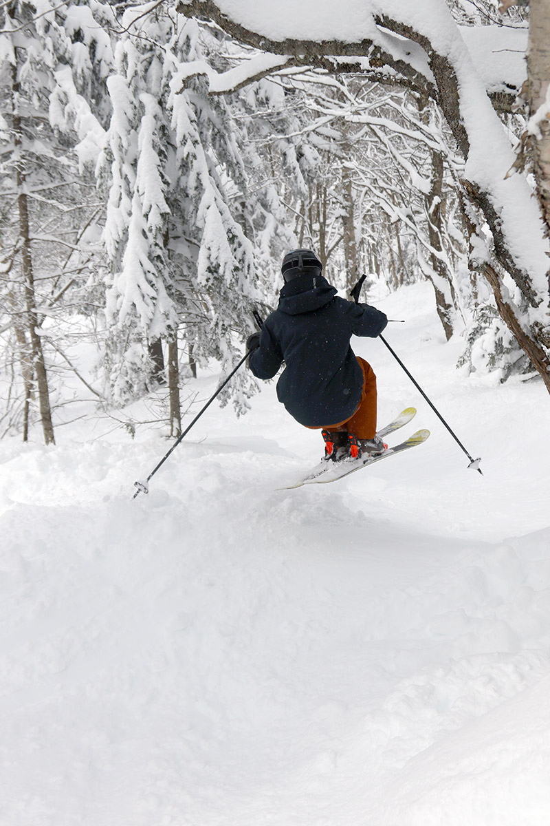
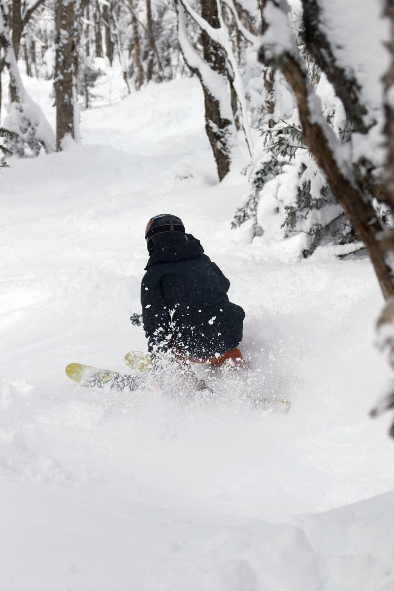
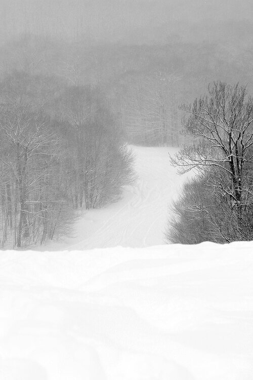
Saturday was the third day of our ongoing storm cycle, and Winter Storm Tormund had brought Bolton’s storm total to 32 inches after another few overnight. My wife and I headed up for a morning session of turns with our older son, and it was a great chance to see how conditions were looking as the system began to wind down. Bolton wasn’t kicking off lift service from the Vista Quad until 10:00 A.M., so there was no need to rush up to the mountain first thing in the morning. As a bonus, the Wilderness Chair was opening at 10:30 A.M. for the first time since the storm cycle started, so that represented a nice opportunity to get into some fresher snow. Snow was starting to mix with and change to rain in the valleys when we headed up to the mountain, but the snow line was still fairly low – certainly below 1,500’. More snow continued to fall all morning while we were out on the mountain, but it was of moderate to only occasionally heavy intensity. The clouds were also not as thick as they’d been earlier, and at times the weather was a mix of sun and snow, so the snowfall wasn’t accumulating as efficiently as it had over the previous couple of days. The upside of the thinner clouds was that the light intensity was much higher than it had been, so it made for some easier action photography. There was some wind when we first arrived up at the resort, and it really set up an overly wintry feel, but those winds dissipated before too long even up near the summits, and it started to feel more like a late-season ski day. Since temperatures had come down overnight, the new accumulations of snow were once again drier than what had been falling on Friday afternoon, so like I’d experienced Friday morning on my tour at Timberline, the quality of the powder in the morning was even better than it was in the afternoon. It does show the importance of typically getting out early for powder as we move through April, since the sunlight intensity is growing stronger and it more easily affects the quality of the snow. I brought my wife and son for a run through Vista Glades, since it had been so nice on Friday afternoon, and it delivered once again. Up at those elevations around 3,000’, the snow has been quite dry at any time of day, so you’re really getting some of the best conditions. We spent the rest of our session on Wilderness, taking advantage of all the new terrain it offered, and the lower traffic definitely helped supply a lot more fresh snow. Bolton Outlaw was skiing great, and we had some nice turns in the Outlaw Woods, and a couple of great runs in the whole length of Wilderness Woods. We explored some of the tree skiing terrain to the left of Peggy Dow’s that were really nice, and that’s a place I don’t visit too often. The freezing level seemed to be climbing as our session continued. Toward the end of the morning, on each run it seemed that the snow began to get wetter at a higher elevation. It did keep snowing all morning, but it was comfortable with the lack of wind and there was definitely an “April” feel to the storm yesterday because it didn’t have as much bite as a midwinter one. It looks like we’ll be moving out of the wintry conditions into more spring-like conditions in the coming days based on the forecast, so it should be fun to see how the snow changes. The snowpack should have some extra staying power after all the substantial late-season storms though.

-
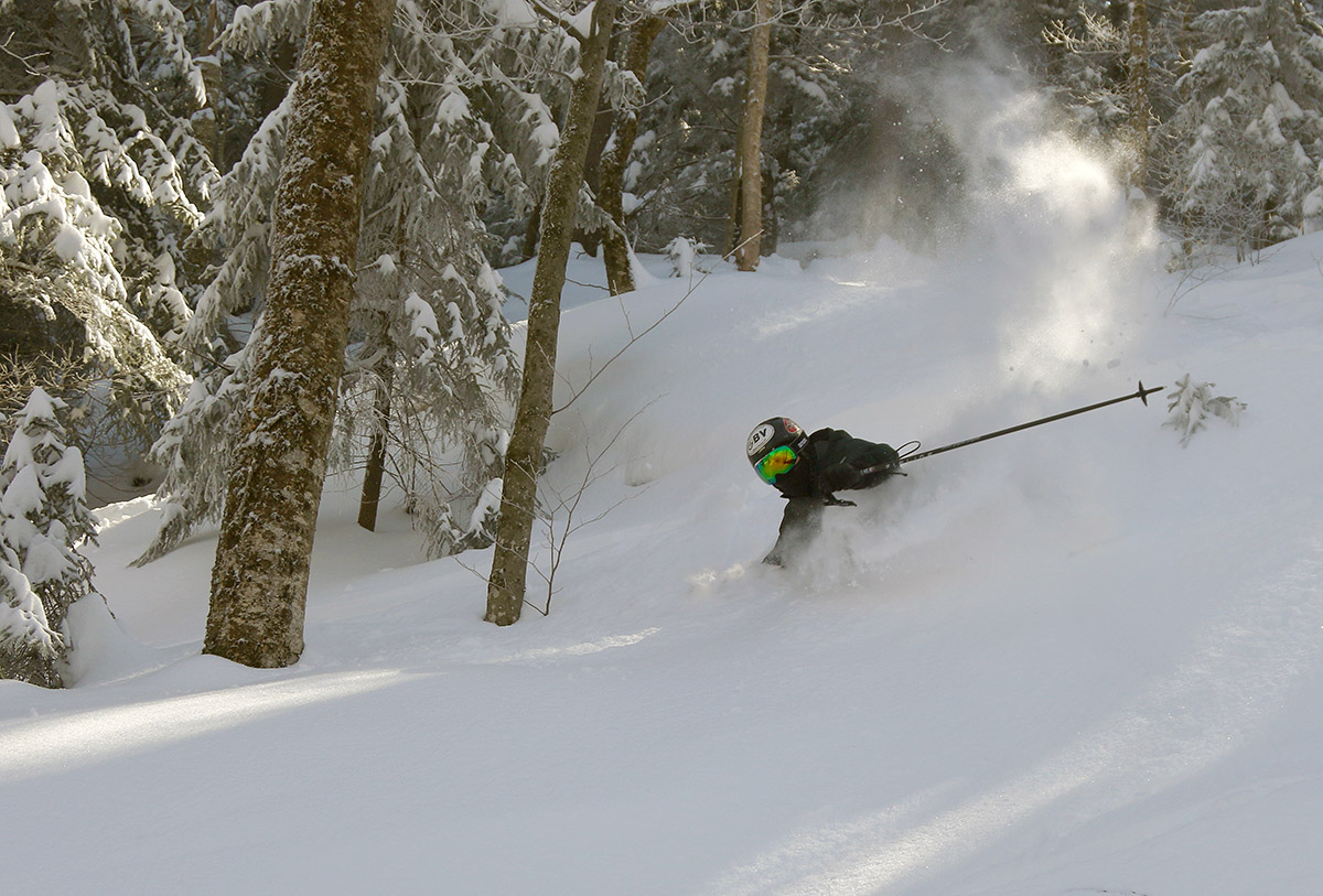
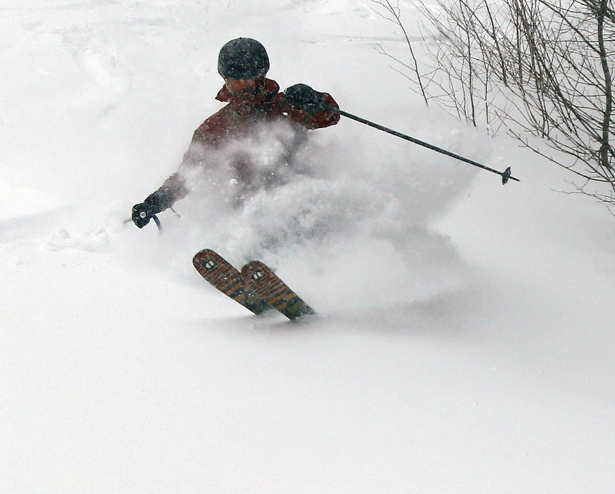
When I left home Friday morning, I’d packed an assortment of skis on the roof rack because I wanted to be ready to roll with whatever Winter Storm Tormund decided to throw at us for the next rounds of snowfall. Full fat Teles were definitely the call for ski touring at Timberline in the morning, and with the snowfall continuing throughout the day, stopping off for some lift-served turns later in the day seemed like a good way to mix things up and take advantage of the nicely shifted schedule that Bolton is now offering. In the afternoon before heading home from Burlington, I sent out a text to the family letting them know that I was heading to the mountain, and to try to catch up for some turns if anyone else was going to be there. My wife had let me know that my younger son might be heading up for some Friday afternoon turns, so I’d been watching my phone for an update about his plans. Low and behold, just as I’m heading down French Hill on I-89 in Williston, a red Subaru with a bunch of gear on the ski rack passes by on the left. It looked suspiciously like my son’s car, and before I knew it, I got a text indicating that he and his friends were right in front of me. Well, that settled that with respect to whether or not I’d be able to meet up for turns! It was raining fairly steadily as we drove through the lower valleys on our way to the mountain, and naturally we hoped that meant there was some nice snowfall occurring at elevation. Indeed, the snow line was pretty low, switching quickly to snow before we even hit 1,000’ on the Bolton Valley Access Road. Up in the Village, it was snowing pretty hard – much harder than what I’d encountered with I’d been out ski touring in the morning. The resort was busy with visitors, but there were enough people coming and going in the afternoon that we were quickly able to get a couple of parking spots right near each other in the top row of the main lot. Based on what I was expecting in terms of conditions, I grabbed my fat alpine boards for the session, since I knew we’d be encountering a lot more tracked conditions in all the dense new snow, and I figured we’d take full advantage of the opportunities the resurfacing would give us to jump into steep terrain. Main lift service for the afternoon was off the Vista Quad, so we hit a bunch of fun, steeper terrain like Vista Glades and Vermont 200 that made good use the resurfacing. Vista Glades was excellent, with all its stumps, rocks, ledges, bumps, and whatever other obstacles it contains well buried under a deep base and the thick layers of fresh snow. It offered lots of swooping and rolling terrain that made for a great ride. Even at higher elevations, the snow was a bit denser than what I’d encountered in my morning tour due to the warming of the day. Now that we were rolling into the second day of the storm cycle, plenty of folks had obviously been out enjoying the systems bounty, so we were mostly skiing tracked and packed snow, but it was skiing beautifully. The higher you went, the drier the snow was, but it was still quite decent down to even 2,000’. We did jump into some untracked areas as well, and that snow was certainly skiing denser than it had in the morning, but it was still plenty dry for some nice powder turns.


-
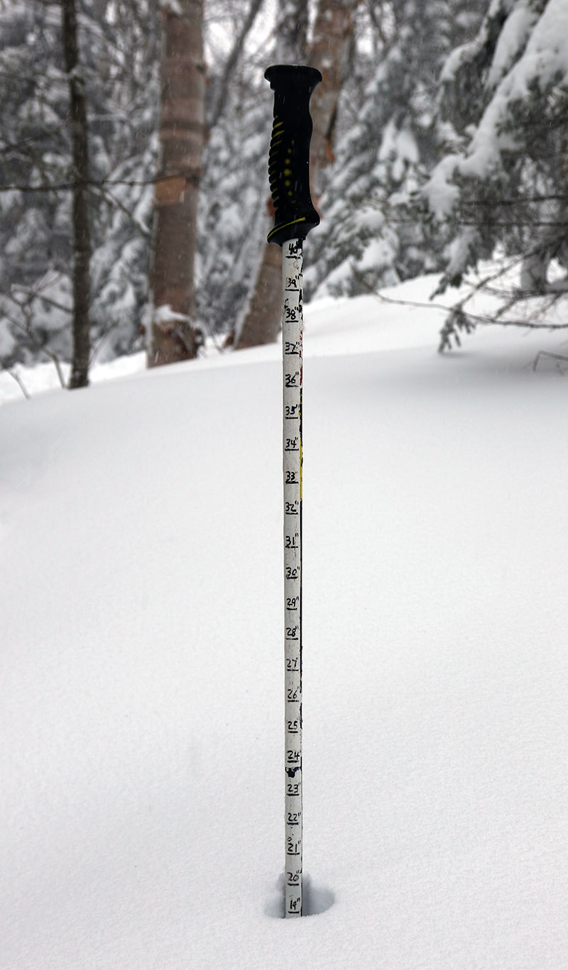
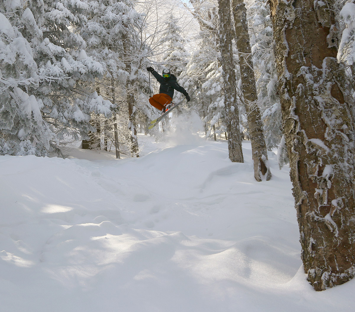
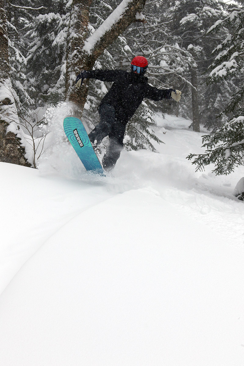
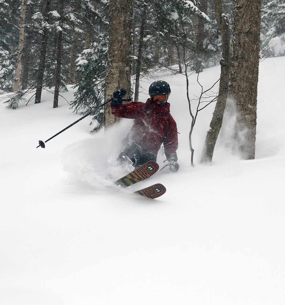
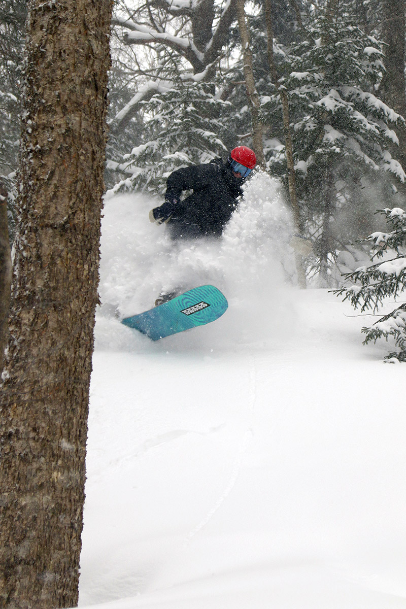
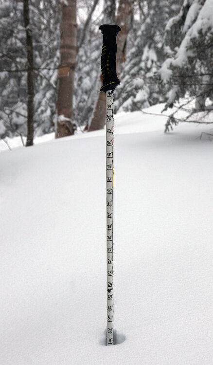
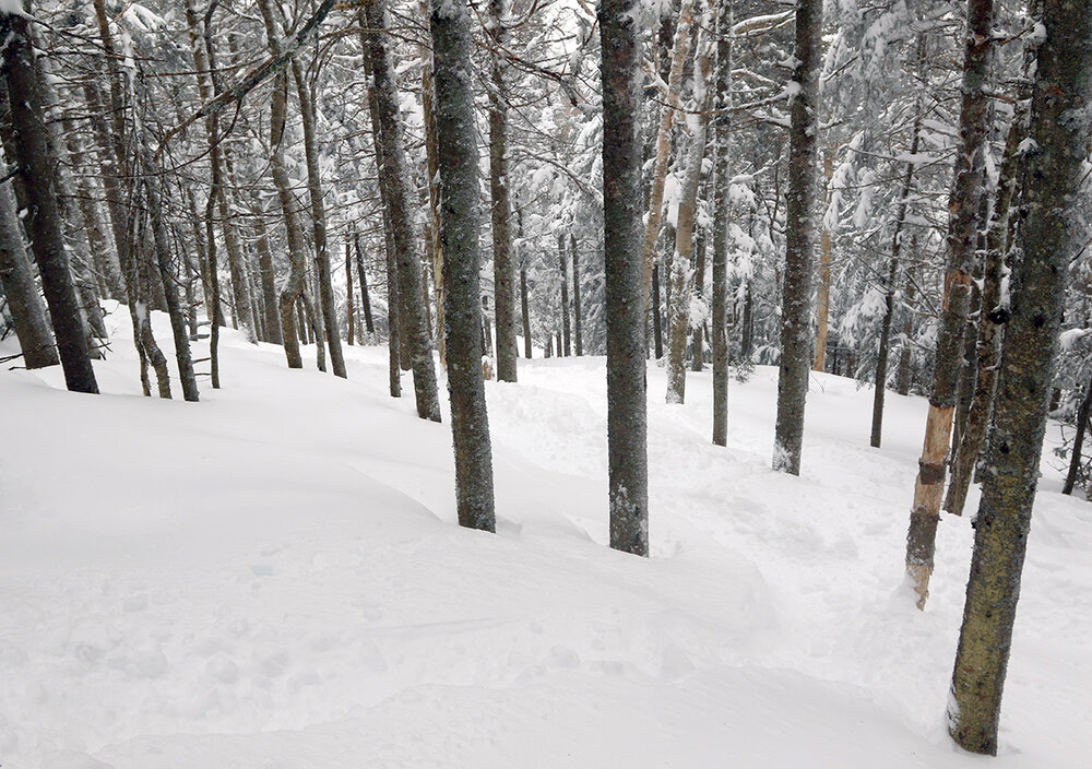
With Winter Storm Tormund still churning out the snow on Friday, I decided to head up to the mountain for some turns in the morning. For Bolton’s schedule at this time of year, the lifts don’t start running until noon on weekdays, so ski touring was the natural choice for morning turns. I was initially undecided about whether I was going to tour at Wilderness or on the Backcountry Network, but I ultimately didn’t end up touring in either place. On my way up the Bolton Valley Access Road, I was passing by Timberline and suddenly realized… duh, that was the place to tour! I’ve been touring almost exclusively out of Bolton’s main base area this season because of the access to the superior snowpack depth and snow quality provided by being able to start above the 2,000’ elevation. The snow depth and quality down at the base of Timberline at 1,500’ just hasn’t been there until very recently, and it had been so long since I toured down there, I’d almost forgotten it existed. But when the snow is good, you can’t beat the convenience of ski touring at Timberline with its shorter drive and immediate access to nicely pitched terrain, so once I was reminded, I jumped at the chance to start my tour there. Skier traffic was fairly light, with about a half dozen cars or so in the parking areas. There was some snow falling, but we were in a rather light phase of the ongoing storm cycle. I took depth measurements of the accumulations right at the Timberline Lodge as I was just beginning my ascent, and settled snow depths were right around 18 inches. From there, it seemed to increase by a couple of inches for each 500 feet of vertical gained. The resort was reporting 26 inches for a storm total at that point, and that would make sense for accumulations up around 3,000’ based on my measurements from those slightly lower elevations. Temperatures had cooled off overnight, so the most recent accumulations were drier and knocked the skiing up a notch relative to what I’d found on Thursday afternoon. Overall, it was still a moderately dense accumulation of new snow, but it had a little better gradient of density for powder turns. As I ascending the Timberline skin track on Twice as Nice, I was gauging my options for the descent. Even with the slightly drier snow topping off the ongoing accumulations, I knew from yesterday that having enough pitch was still going to be important for optimal power turns. I was leaning toward descending on Twice as Nice itself, since it has one of the most consistent pitches among the trail selections – it doesn’t have any heavy steeps, but it also doesn’t have the required compensatory flatter sections. My leaning changed when I watched a snowboard descending the trail with his dog, and I saw that he was bogged down and coming to a near standstill in one of the lower pitched areas. That was enough to convince me to head toward Spell Binder, where I knew I would at least get to sample the steep headwall section for some solid turns. As expected, the headwall of Spell Binder absolutely delivered. The turns were surfy and buoyant in the roughly two feet of fresh powder, and I could definitely feel the improvement that had come with that most recent drier snow topping off the rest of the accumulation. Just like Thursday afternoon, it was another session of plowing into the powder as deeply and aggressively as you wanted, and you were still nowhere near the subsurface. As a bonus, even the powder in the lower pitched areas skied fine, and I didn’t have any issues with speed. Either my 115 mm boards had surface area to spare for my weight relative to the snowboarder I’d seen, or he had some other issue (wax, etc.) keeping him from planing on those lower pitches. It was a great powder session to kick off the day, and with the storm continuing to roll along, it looked like there would be more fresh snow sessions on the way as we moved toward the weekend.


-
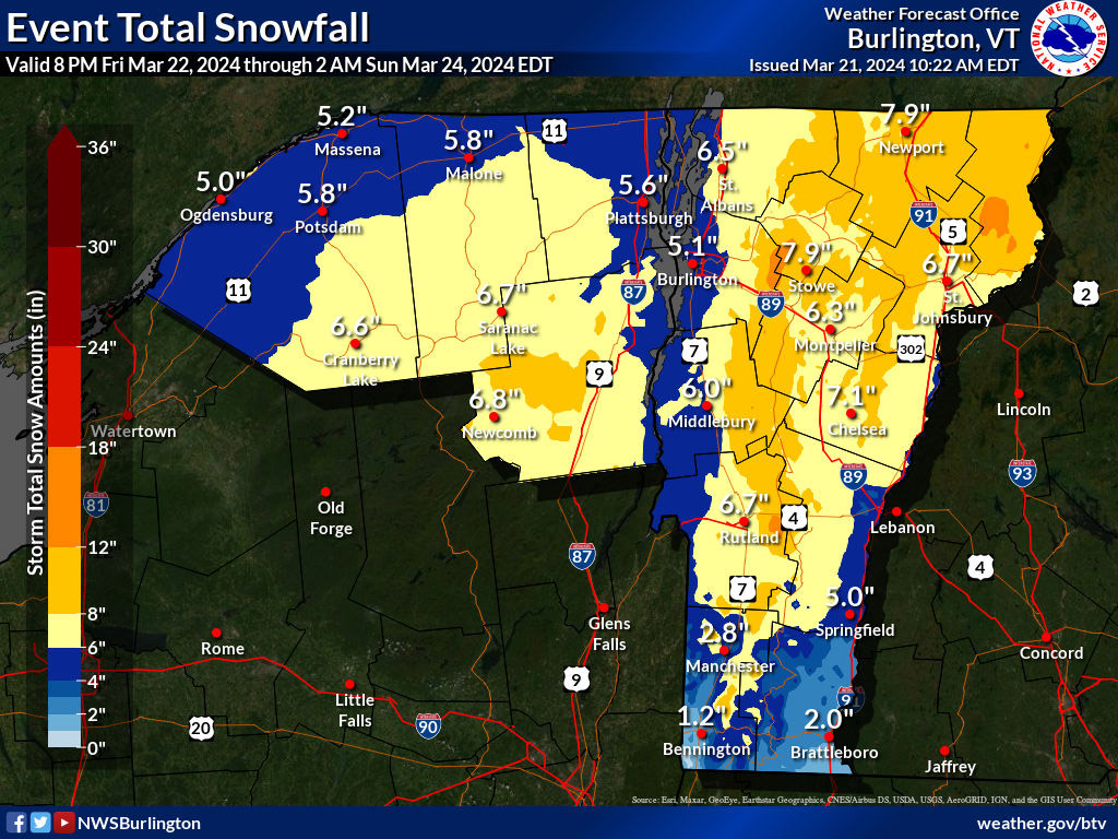
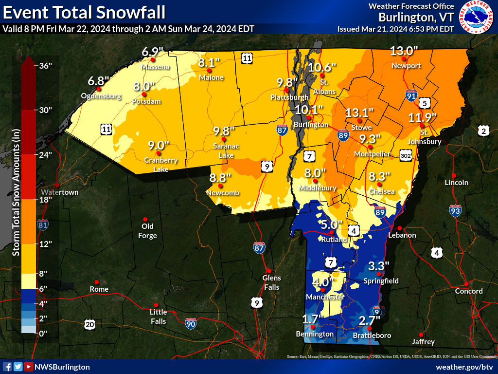
Since things have cleared out today, it looks like Winter Storm Tormund is final over in the area, so I’ve put together the north to south storm totals that I could find from the Vermont ski areas. A number of areas aren’t providing storm totals in their summaries today, but it looks like snowfall topped around 2 to 3 feet in the Central/Northern Greens. Jay Peak: 37” Stowe: 26” Bolton Valley: 32” Pico: 27” Killington: 27” Bromley: 22” Magic Mountain: 21” Stratton: 15” Mount Snow: 16”
-
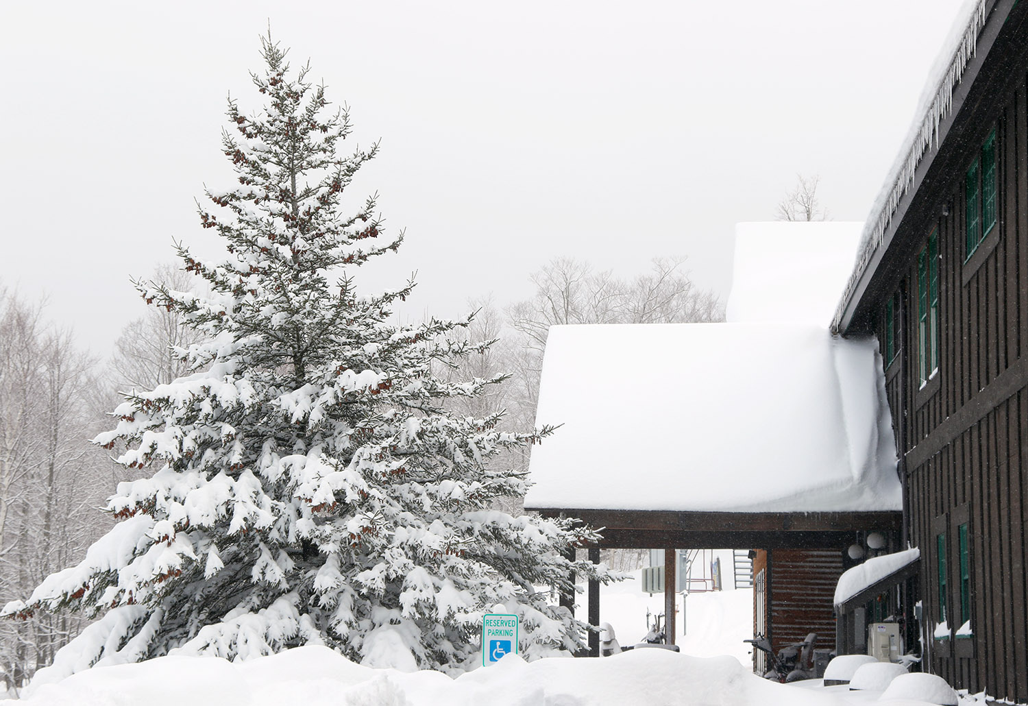
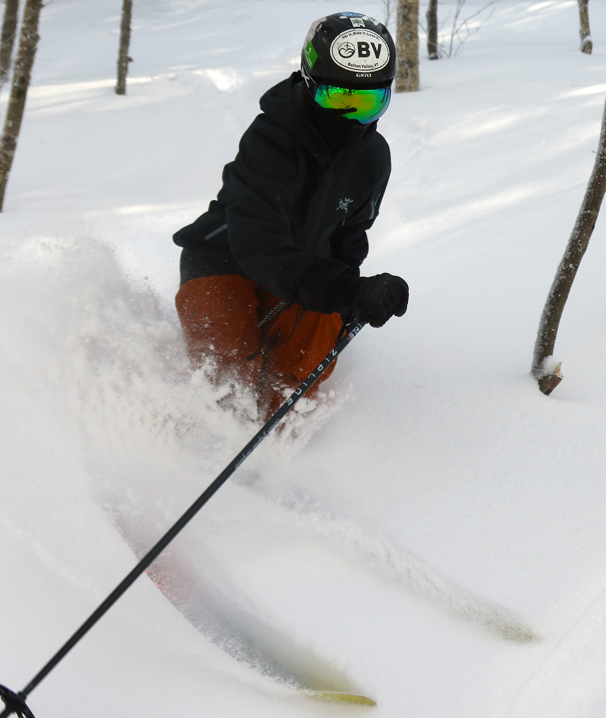
I was too busy to get up to the mountain for turns this morning, but in terms of lift-served skiing at Bolton, that’s not an issue because their current midweek lift schedule is 12:00 P.M. to 7:00 P.M. It’s pretty cool that they shifted to that schedule, and they aren’t even using the lights for it because daylight simply lasts so long, and their expansive western exposure really plays into that. I did have time to get out for turns this afternoon though, and despite the substantial snows that are being deposited in the mountains and even all the way down to the lowest valleys, the road conditions have been quite nice with April sun intensity and temperatures near the freeing mark. It wasn’t until I was up around 2,000’ on the Bolton Valley Access Road that the road held any snow, and even then it was just a bit of slush with the help of plowing and salting, etc. It was snowing hard when I arrived at the mountain, probably in the inch per hour range, but nothing too outrageous, then it lightened up a bit as the afternoon wore on. There was some wind at times, but at other points it would be nearly calm, even up to elevations just below the ridgeline. Temperatures were in the upper 20 s F, or maybe a little lower than that in the summit areas, but it was definitely comfortable. And the skiing… wow… what a resurfacing. I’m starting to lose count of the number of huge resurfacing storms we’ve had up here in the Northern Greens this season, but a quick look through my storm data from here at my site suggests the mountains have had at least 10 of them with an inch or more of liquid equivalent. That’s pretty impressive for a season that has been struggling to reach average snowfall around here, and it really gets one thinking about what an above average season can produce, since I don’t think we’ve had a solidly above average one since ’18-’19. In any event, I guess average to even a bit below average snowfall is certainly appreciated when it delivers like this. So we’ve had a decent number of these resurfacing storms this season, but this one… Winter Storm Tormund, it really put down a shellacking of the slopes. As soon as I dropped into my first few turns off the Vista Summit, I knew; there had to be at least two inches of liquid equivalent in that snow. This wasn’t just your typical “nice, this is definitely keeping me off the subsurface” type of snowfall, this was on that next level. This snow laughed at the thought of you getting anywhere near the subsurface. We’ve had about an inch and a half of liquid equivalent in the snow thus far down here at the house, and with the way that snow skied on the mountain this afternoon, they’re obviously well above that. The early morning report from the resort was 6 to 8 inches of new snow, so I was surprised with how deep it was when I was up there this afternoon. I routinely measured 16 to 20 inches off the Vista trails, with 24 inches common in some areas. I even got some 30 inch measurements, although those could easily have been in hollows or due to a little drifting. Bolton is reporting 24 inches as their top measurement as of this afternoon, and I’d say that’s right in line with what I found out there. The snow isn’t wet, nor is it super dense, but it’s dense enough that you are well protected from hitting anything below. As is typical with this type of snow, the best powder skiing required substantial pitch, and this type of resurfacing just begs for you to ski the steep stuff anyway, so I obliged and hit the really steep lines off Vista. The super steep sections of Devil’s Playground were a hoot – I always forget just how steep they are, but with this snow you can simply drop in and fly with reckless abandon. With the amount of liquid that’s already gone into the snowpack with this storm cycle, this is a major boost for the spring skiing season – at least with respect to the natural snow trails. The snowmaking terrain always lasts no matter what we get for spring storms, but having storms like these just opens up more natural snow options for much longer. And Winter Storm Tormund isn’t over yet according to the forecasts - it looks like it continues right into the weekend, so the storm totals and contribution to the snowpack will hopefully increase further over the next couple of days. Bolton was at 324 inches of snowfall on the season as of this afternoon, so it’s at least shaping up to be in the average range at this point.

-
Below is the north to south listing of available snowfall totals from the Vermont ski areas that I’ve seen posted for Winter Storm Tormund thus far for resorts that made midday/afternoon updates today. There are ups and downs along the spine, with no overt trends, but it looks like there was a relative max in the Bolton to Stowe stretch of the spine, and totals fell off a bit in the far north and far south. Magic’s 20” is standing out a bit from what Bromley and Stratton are reporting for being so close together in the magic triangle, but the Magic report is indicated as being from 8:00 P.M. this evening. Jay Peak: 18” Smuggler’s Notch: 15” Stowe: 20” Bolton Valley: 24” Mad River Glen: 18” Sugarbush: 15” Pico: 19” Killington: 19” Bromley: 15” Magic Mountain: 20” Stratton: 14” Mount Snow: 14”
-
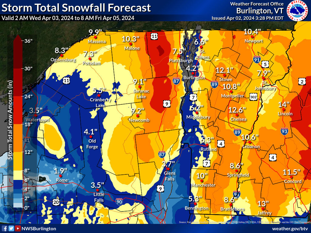
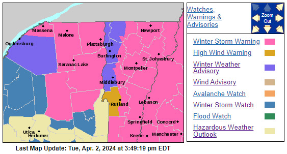
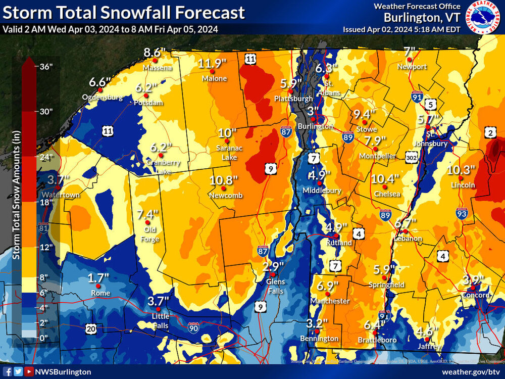
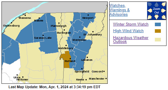
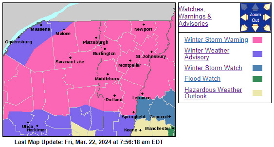
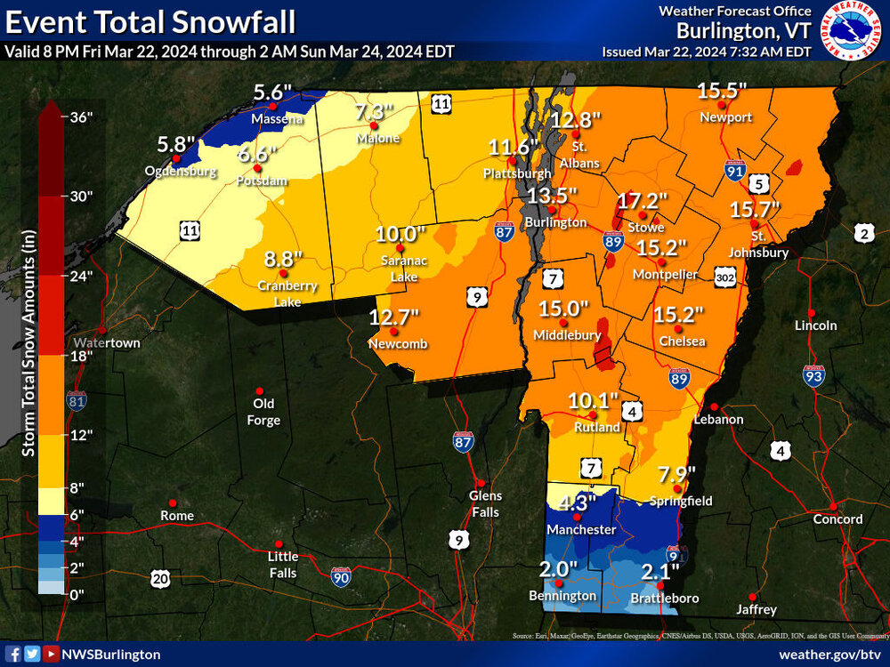
Some of the Winter Storm Watches put out by the BTV NWS have been converted to Winter Storm Warnings as confidence in the next storm system grows. Coverage of the 12-18” shading along the Greens on the Storm Total Snowfall Forecast Map has also expanded out farther into the lower valleys.

-
Here are the updated BTV NWS maps from overnight for the upcoming storm system. There’s definitely been an expansion of the area of Winter Storm Watches and the area of 12-18” shading along the spine of the Greens.
-
There’s lots of great discussion about the upcoming system in the BTV NWS AFD. The section below is pretty neat – it’s like they hired PF to write it: Area Forecast Discussion National Weather Service Burlington VT 1007 AM EDT Tue Apr 2 2024 As of 1006 AM EDT Tuesday...All things considered, a better proxy for this upcoming late season winter storm is the positive snow depth change. While far from perfect, it should provide better context on what would most likely occur compared to low probability worst case scenarios depicted by straight 10:1 or kuchera snowfall outputs.
-
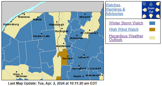
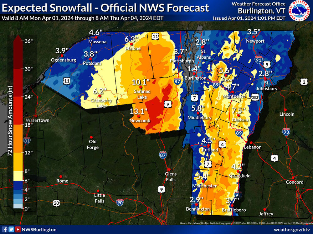
We were recently put under a Winter Storm Watch for a potential storm coming into the area in the midweek timeframe. There isn’t a headline snowfall map posted yet, but there is a preliminary map that includes some of the anticipated snowfall on the BTV NWS Winter Weather site. The current map only goes out to 8:00 A.M. Thursday, and the modeling suggests the storm won’t wind down until the weekend, so I’m sure the maps will be updated as we get closer to the event.
-
It’s been a busy week, so I haven’t been able to get out any pictures from last Sunday at Bolton Valley, but I didn’t ski this weekend so I had some time to catch up. Last weekend was an interesting dichotomy of days with Winter Storm Ronnie coming through – Saturday was an absolute blitz of a storm day as the pictures above indicate, but the storm had departed by Sunday and it was just one of those clear, calm, quiet, midwinter days with perfect temperatures that were just a bit below freezing. I used the term “quiet” to describe the weather, but that in no way described the number of visitors to the mountain. We arrived right around the opening time for Timberline, and the cars were already pouring into the resort. I’m not sure about the lore behind nobody skiing after President’s week, but the number of people out on Sunday clearly revealed that such an idea is a crock. People continued to come to the resort all morning, and by the time we left in the late morning period, Bolton had an employee stationed at the bottom of the Bolton Valley Access Road and cars were backed up onto Route 2. I’ve seen them station someone at the bottom of the road when it’s really bad or the resort is not running the lifts due to power/storm issues, but that wasn’t the case this time – there were just so many people coming to the resort that the parking was bursting at the seams. To punctuate just how many people were skiing around here, my friend Dave even came up from Boston to crash overnight Saturday at our place because he was skiing Sugarbush on Sunday. Apparently, everyone wanted to ski after Winter Storm Ronnie. In any event, the skiing was great, but the only thing that really stood out as exceptional was the weather. The snow had dried out and potentially consolidated in its lower levels somewhat overnight, and a bit of lighter snow had fallen as the storm departed, so the powder was not nearly as upside down as it had been on Saturday. The resurfacing had mostly been completed by the end of the day on Saturday, but by Sunday Bolton was reporting a storm total of 16 inches, and based on my analyses the were 1 to 2 inches of liquid equivalent in there. I’ve definitely been hearing talk of it being the best day of the season, but that was mostly hyperbole with respect to conditions around here in the Northern Greens. If you just went by the snow quality and powder skiing, it probably sneaks into the top 10 in terms of great days because of the weather factor, but it really doesn’t come anywhere near the top five. Even this season, which seems to be running a bit below average in terms of snowfall, there have just been too many storm cycles that finished off with quality champagne over a substantial based and a good front end of dense snow that knock last Sunday down several spots in terms of the powder skiing. It was still and excellent day to be out on the slopes though; it’s not every storm that we get that sort of weather right as the system departs.
-
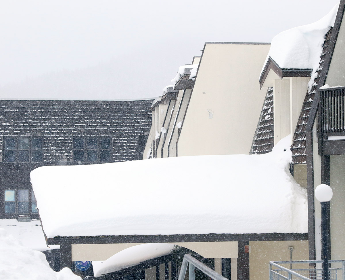
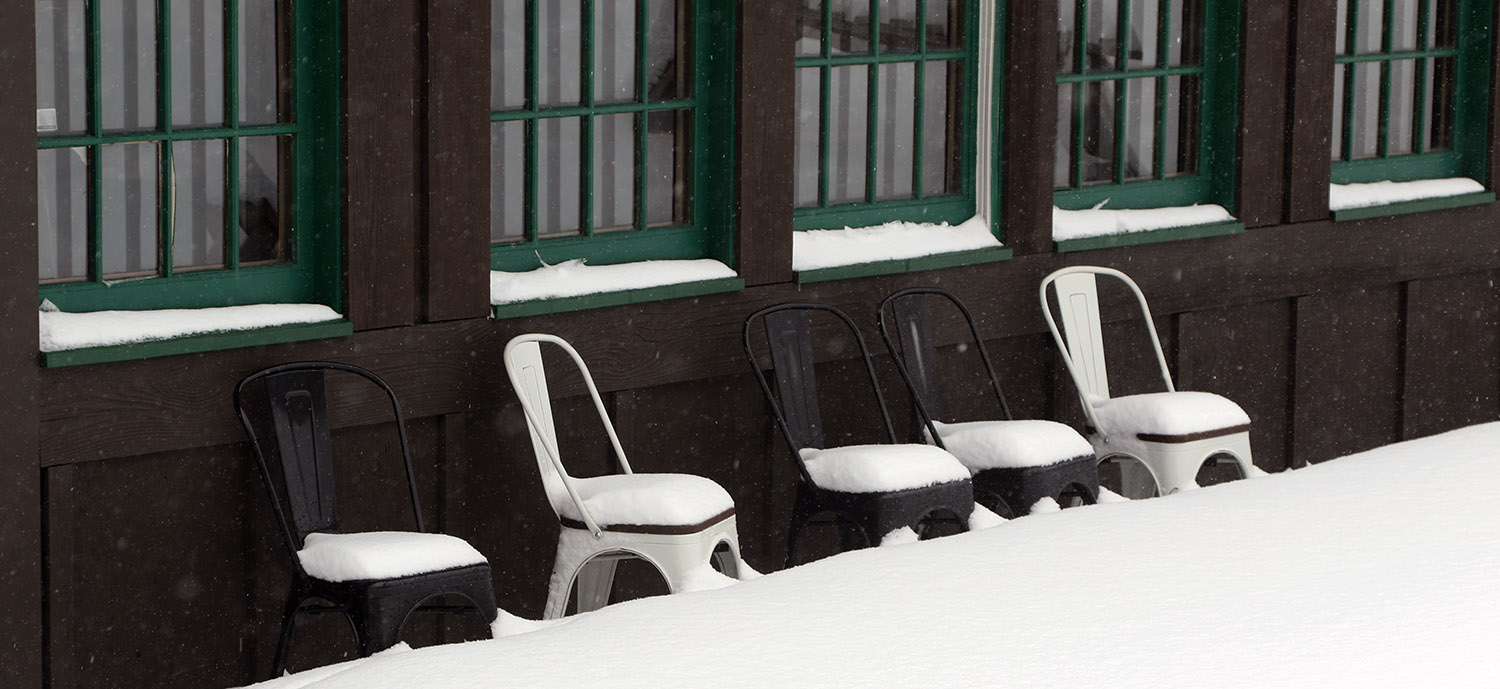
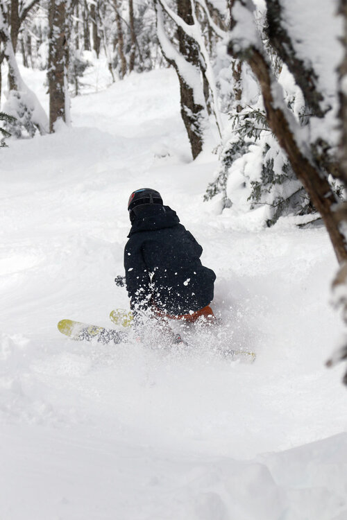
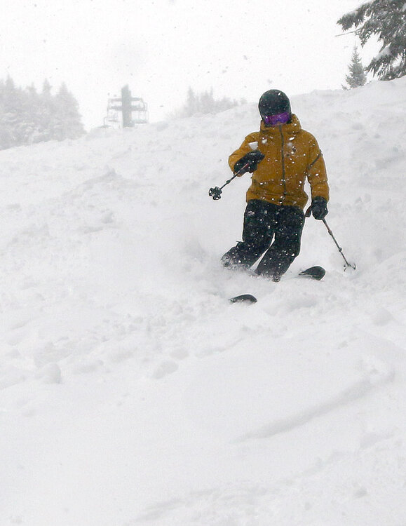
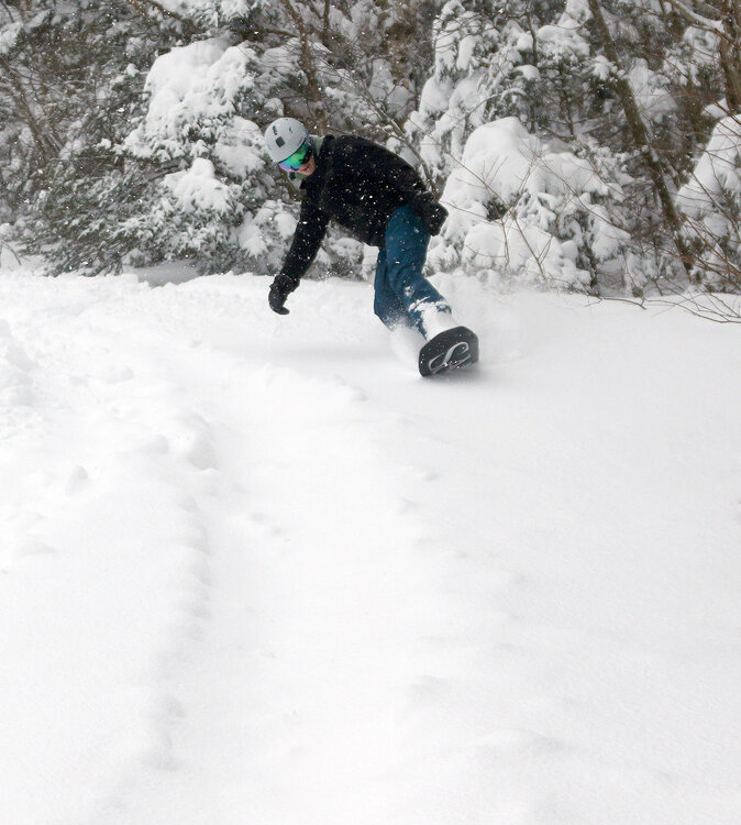
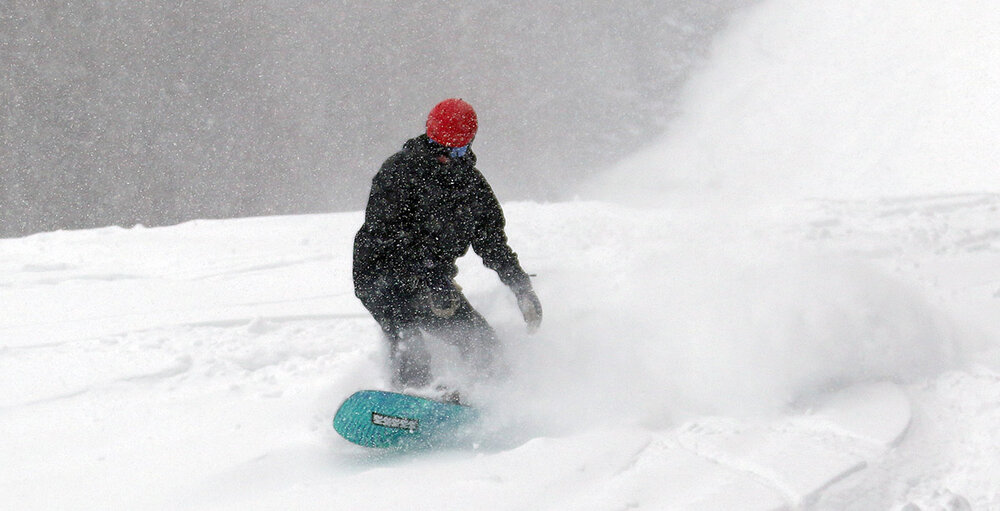
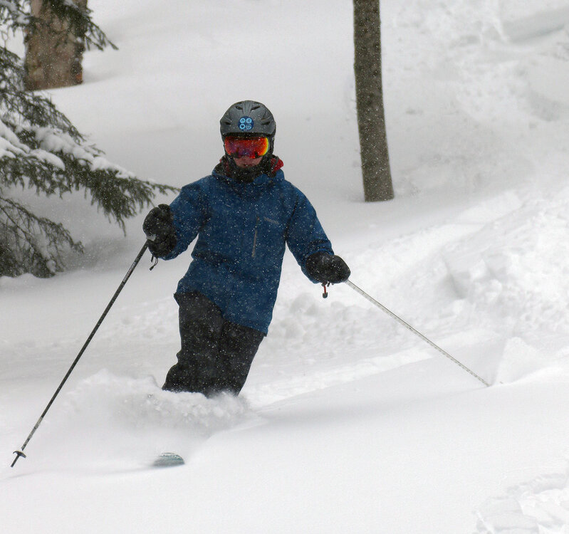
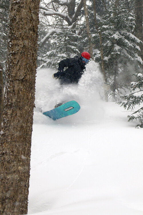
A few more snowy Saturday shots from Bolton:

-
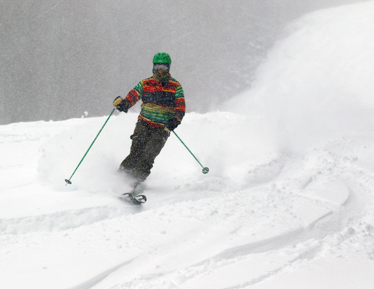
It’s been a few days of great skiing, so I’m only now catching up with reports from our recent sessions up on the mountain. On Saturday, Winter Storm Ronnie had begun delivering snow in the wee hours of the morning, and once things got going, heavy snowfall pounded the mountains all day. In our area, the flakes were relatively small, and my early morning liquid analyses from the snow revealed that it was a fairly synoptic-like 12.0 to 1 ratio. That ratio actually dropped as the storm continued through the day, with a 10.6 to 1 ratio for my afternoon analysis, and an 8.4 to 1 ratio for my evening analysis. Despite the relatively small flakes, the snowfall was still in the inch per hour range or more, so there was a lot of liquid coming out of the sky. The very heavy snowfall and small flakes made for some very tough photography out on the mountain, but we still fired away to get what we could. Although the storm was still in progress and we’d only received a portion of the anticipated accumulation by the time the lifts started running at Bolton, we still kicked things off with an early start. We were worried about the ascent of the Bolton Valley Access Road, but an uphill plow run had been done fairly recently, so it was actually quick and painless getting up to the Timberline Base. We quickly met up with one of my colleagues from work and his son, and my younger son and one of his friends from college as well, so we had a party of six exploring the mountain. There didn’t appear to be much elevation dependence with the snowfall, so we were happy to hang down at the relatively lower elevations of Timberline and make use of the great terrain there. While there hadn’t been a call for much wind with this storm, it was still blowing quite hard, and that was another incentive to stay down at the Timberline elevations for a while. We eventually did move up to the main mountain, skiing both Wilderness and Vista, and even by the summits up above 3,000’ the wind was similar to what we’d experienced down at Timberline. As the morning moved on, the wind decreased substantially to the point where it wasn’t even a factor. In terms of the ski conditions, the moderately dense snow had already put down an excellent resurfacing even for the first runs in the morning. The new snow was atop recent rounds of snow from previous storms, so that presumably helped, and with snowfall continuing all day at around an inch per hour, the trails were constantly getting refreshed. The resurfacing made the quality of the on piste turns really good aside from scoured over very high traffic areas, but the powder skiing off piste left something to be desired. With the dense snow falling, the powder was somewhat upside down, and its density allowed you to easily get bogged down on anything but steep terrain. That’s not to say that the powder skiing wasn’t still tons of fun, but you could tell it wasn’t up to the typical standards of a storm cycle in the Northern Greens where the snow gradually lightens into upslope fluff and really sets up some top notch powder. All in all though, it was an excellent session of storm day skiing at the resort. We stopped in for lunch with my son and his friend at Fireside Flatbread and had some excellent pizza – I got to try their barbeque chicken bacon ranch pizza that my son has been raving about. There weren’t any substantial lift queues to speak of, and it was likely that the ongoing storm kept some people from venturing out to the mountains. The drive down the access road was fairly tough when we finally left in the afternoon, so I can understand why that would keep some folks home, perhaps hoping to come out on Sunday when the storm had wound down.

-
Thanks, I updated it. I figured that 20" number was off, it was the 72-hour total and seemed to be the closest option available. The 24-hour total wasn’t appropriate because there had clearly been some snowfall before opening yesterday, and for some reason there was no mention of the actual storm total or a 48-hour total when I checked the report (most resorts were at least giving one of those). I see there is a 48-hour total listed on the Stowe website now though, and even though there’s no actual mention of the storm total, 48 hour totals this morning are a decent fit for storm totals.
-
The system that just came through the area was Winter Storm Ronnie, and the north to south listing of available storm totals from the Vermont ski areas is listed below. It looks like the storm totals peaked near Southern Vermont, but started to fall off approaching the Massachusetts state line where presumably some mixed precipitation came into play. Jay Peak: 18” Burke: 18” Smuggler’s Notch: 13” Stowe: 11” Bolton Valley: 16” Mad River Glen: 18” Sugarbush: 17” Middlebury: 18” Pico: 24” Killington: 24” Okemo: 25” Bromley: 30” Magic Mountain: 30” Stratton: 28” Mount Snow: 16”
-
The Winter Storm Watches were converted over to Winter Storm Warnings around here, which is of course a good sign that the pros at the BTV NWS are confident in several inches of snow. Indeed, the totals on the latest BTV NWS Event Total Snowfall map were bumped up, with that area of 12”-18” shading expanded substantially, and areas of the 18”-24” shading appearing along the spine of the Central/Northern Greens.

-
Yeah, as the BTV NWS typically does, they’ve generally bumped the accumulations up as their confidence in the forecast increases. That area of 12-18” shading in the Bolton-Stowe-Smugg’s region of the spine has expanded substantially to include the spine of the Central and Northern Greens, and off into the NEK. They’ve kept the Winter Storm Watches in place for now, and their forecast discussion nicely lays out their thinking.