

jrips27
-
Posts
3,462 -
Joined
-
Last visited
Content Type
Profiles
Blogs
Forums
American Weather
Media Demo
Store
Gallery
Posts posted by jrips27
-
-
-
One last ride coming up
-
 5
5
-
-
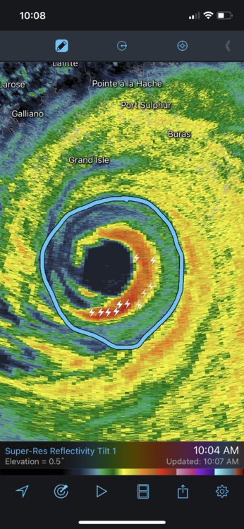
1 minute ago, eyewall said:
Some on twitter were trying to claim an EWRC has begun but I am not sure there is evidence for that in the recon data as of now.
Agree recon data doesn’t really show it. It does look like a moat is getting more pronounced around the primary eyewall on radar. Maybe a secondary one trying to form?
-
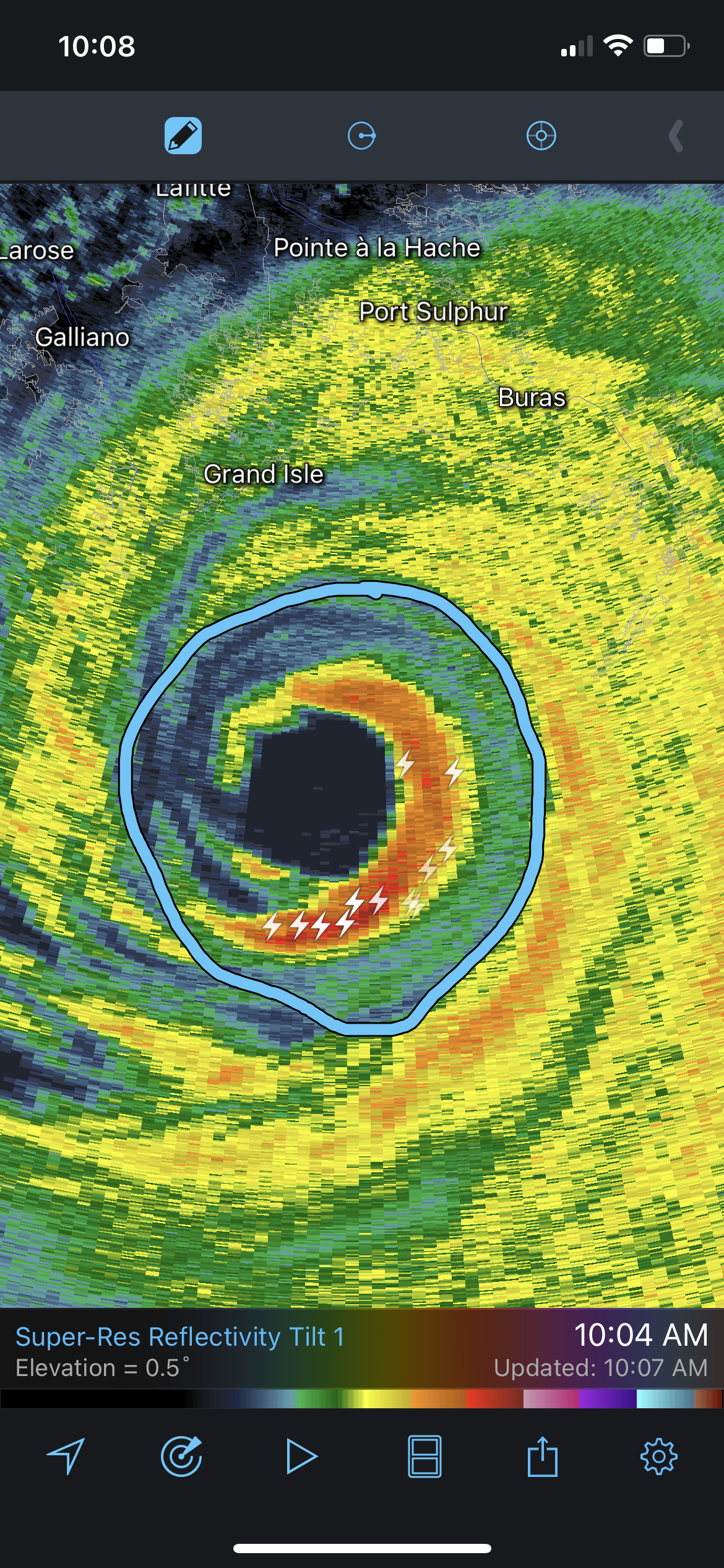
4 minutes ago, HillsdaleMIWeather said:
This is the same person who also just posted that the western eyewall was weakening not realizing it was just radarscope having an issue
How do you know there is an issue with RadarScope? Regardless, western eyewall on every radar site I can find does show some degradation compared to an hour ago. Jack is a pretty smart dude as well.
Clearly this really only matters for the weather weenies out there and is still a horrible and life-threatening situation for all of SE Louisiana.
-
3
-
 2
2
-
 1
1
-
-
-
-
-
-
Here’s the tweet
-
1
-
-
-
Surreal
-
5
-
-
First warning was issued for Newnan at 11:44. Looks like they had 20-30 minutes of lead time.
Great job NWS Peachtree City. I know it was a slam dunk signature most of the time but they didn’t play the waiting game. Hopefully saved some lives with a long warning.
-
2
-
-
This motion is disgusting. Great video.
-
2
-
 1
1
-
-
Newnan was in a slight risk all day pretty much. Just goes to show how storms don’t care about SPC outlooks
-
2
-
-
Seems to really be ramping down. Hope it stays that way. If it got over to the 675/75 area that would be disaster as well. This was really bad though.
-
-
Man. Not a good situation for Newnan. That’s a populated area down there. Hope this loses some steam before then.
NWS Peachtree City may have to pass off duties in an hour or so if it holds together. Coming right at them.
-
Going to need to watch the cell to the north of the long track one near Cedartown, GA. It’s got a little space now and is taking seemingly the same path as previous cells today
-
Going to have to watch that cell heading toward Clanton, AL.
Starting to get that look.
-
we’ve got the ole “a tornado is possible” that no one will see
-
Just now, cheese007 said:
I seem to recall not warning tornadoes being an issue for that office? Maybe another? Feels like this discussion has been had before
We’ve definitely had that discussion about this office in Peachtree City. That are notoriously pretty stingy with warnings
-
5
-
2
-
-
Man Helena is right in the path seemingly. Been talking to my Birmingham friends getting them to call anyone they know down there.
About to hit a very densely populated area
-
-
Zoomed in on Alabama

TIMS model verification, December 31, 2021 - January 3, 2022
in Tennessee Valley
Posted
We are over 7” now at 2900 feet near Gatlinburg. Here was about an hour ago. I’m celebrating my 25th birthday today so had to snow chase. It’s been awesome. Enjoy everyone