

Mailman
-
Posts
1,482 -
Joined
-
Last visited
Content Type
Profiles
Blogs
Forums
American Weather
Media Demo
Store
Gallery
Posts posted by Mailman
-
-
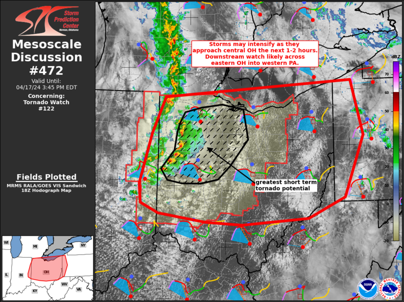
Mesoscale Discussion 0472
   NWS Storm Prediction Center Norman OK
   0112 PM CDT Wed Apr 17 2024

   Areas affected...extreme eastern IN...much of OH...and western PA

   Concerning...Tornado Watch 122...

   Valid 171812Z - 171945Z

   The severe weather threat for Tornado Watch 122 continues.

   SUMMARY...Storms moving into northwest OH may intensify the next 1-2
   hours. All severe hazards remain possible across Tornado Watch 122.
   A downstream watch will likely be needed in the next couple of hours
   across eastern OH into western PA.

   DISCUSSION...Convection has slowly intensified into early afternoon
   as storms move into a somewhat more unstable airmass. Stronger
   heating has allowed low-level lapse rates to steepen ahead of the
   line of convection. This will support potential for increasing
   gusts. Furthermore, low-level instability remains quite large, with
   0-3 km MLCAPE greater than 125 J/kg. Regional VWP data shows
   enlarged, and favorably curved low-level hodographs, and low-level
   rotation has been noted in velocity signatures via region radars.
   Further intensification of these cells is expected over the next
   couple hours across northwest into central Ohio.

   As convection continues eastward, a similar environment is expected
   to extend across parts of eastern OH into western PA. A downstream
   watch will likely be needed by 20z/4pm EDT.

   ..Leitman.. 04/17/2024
-
Hmmmm. The activity around Canton is dissipating.
-
Flash Flood Emergency.
BULLETIN - EAS ACTIVATION REQUESTED Flash Flood Warning National Weather Service Pittsburgh PA 707 PM EDT Thu Apr 11 2024 ...FLASH FLOOD EMERGENCY FOR OAKDALE AND CORAOPOLIS... The National Weather Service in Pittsburgh has issued a * Flash Flood Warning for... West Central Allegheny County in southwestern Pennsylvania... North Central Washington County in southwestern Pennsylvania... * Until midnight EDT tonight. * At 707 PM EDT, local law enforcement reported thunderstorms producing heavy rain across the warned area. Between 2 and 3.5 inches of rain have fallen. Additional rainfall amounts of 1 to 2 inches are possible in the warned area. Flash flooding is ongoing. FLASH FLOOD EMERGENCY for Oakdale and Coraopolis. This is a PARTICULARLY DANGEROUS SITUATION. SEEK HIGHER GROUND NOW! HAZARD...Life threatening flash flooding. Thunderstorms producing flash flooding. SOURCE...Law enforcement reported significant flooding in Oakdale. IMPACT...This is a PARTICULARLY DANGEROUS SITUATION. SEEK HIGHER GROUND NOW! Life threatening flash flooding of low water crossings, small creeks and streams, urban areas, highways, streets and underpasses. * Some locations that will experience flash flooding include... Robinson Township, Cecil-Bishop, Kennedy Township, Coraopolis, Imperial, McDonald, Sturgeon-Noblestown, Oakdale, Glen Osborne, Glenfield, Haysville, North Fayette Township, Enlow, South Fayette Township, Collier Township and Midway. This includes the Parkway between mile markers 57 and 60. PRECAUTIONARY/PREPAREDNESS ACTIONS... Move to higher ground now! This is an extremely dangerous and life-threatening situation. Do not attempt to travel unless you are fleeing an area subject to flooding or under an evacuation order. Turn around, don't drown when encountering flooded roads. Most flood deaths occur in vehicles. -
-
-
-
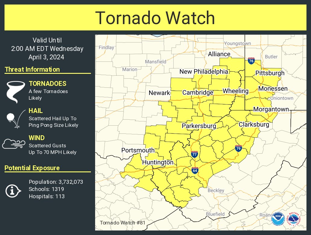
Just seems to have been a flood event for the most part.
-
-
-
Shaved moderate risk to the west a bit.
-
7 minutes ago, KPITSnow said:
I’d have to think this cloud deck will have to break up rather fast to see any appreciable severe weather. 54 degrees at my house and while I see a break in Ohio it isn’t exactly huge
It actually looked like it was filling in.
-
-
Looking forward to an early spring, honestly. Snow in March doesn't do much for me.
-
-
Made it to 4".
-
3.25" and still snowing.
-
Has really picked up in the last half hour or so. Probably over 2" now.
-
Saying there's 1.5" outside might be generous. Hmph.
-
Coming down good and proper here.
-
 2
2
-
-
Places in eastern Ohio already measuring 4".
-
1
-
-
-
Seems like clippers tend to overachieve around these parts.
-
1
-
-
4 minutes ago, Homie J said:
What’s the next chance for snow? Or is it time to throw in the towel?
Way too early. March is the new January.
-


Pittsburgh/Western PA Spring 2024
in Upstate New York/Pennsylvania
Posted
Not much of anything down this way, either.