TravisWx
-
Posts
94 -
Joined
-
Last visited
Content Type
Profiles
Blogs
Forums
American Weather
Media Demo
Store
Gallery
Everything posted by TravisWx
-

December 11th-12th Potential Winter Storm
TravisWx replied to Thundersnow12's topic in Lakes/Ohio Valley
Thanks! Ended up with about 12” of concrete here in Rogers City. -
December 11th-12th Potential Winter Storm
TravisWx replied to Thundersnow12's topic in Lakes/Ohio Valley
At least 10 inches of concrete snow on the ground right now. Still more coming down. Our dog seems to approve.- 147 replies
-
- 13
-

-
December 11th-12th Potential Winter Storm
TravisWx replied to Thundersnow12's topic in Lakes/Ohio Valley
APX calling for 10-15" here by tomorrow morning. -
December 11th-12th Potential Winter Storm
TravisWx replied to Thundersnow12's topic in Lakes/Ohio Valley
30 degrees, 25 mph east wind gusts, moderate snow in Rogers City, MI. -
December 11th-12th Potential Winter Storm
TravisWx replied to Thundersnow12's topic in Lakes/Ohio Valley
Trend is my friend right now.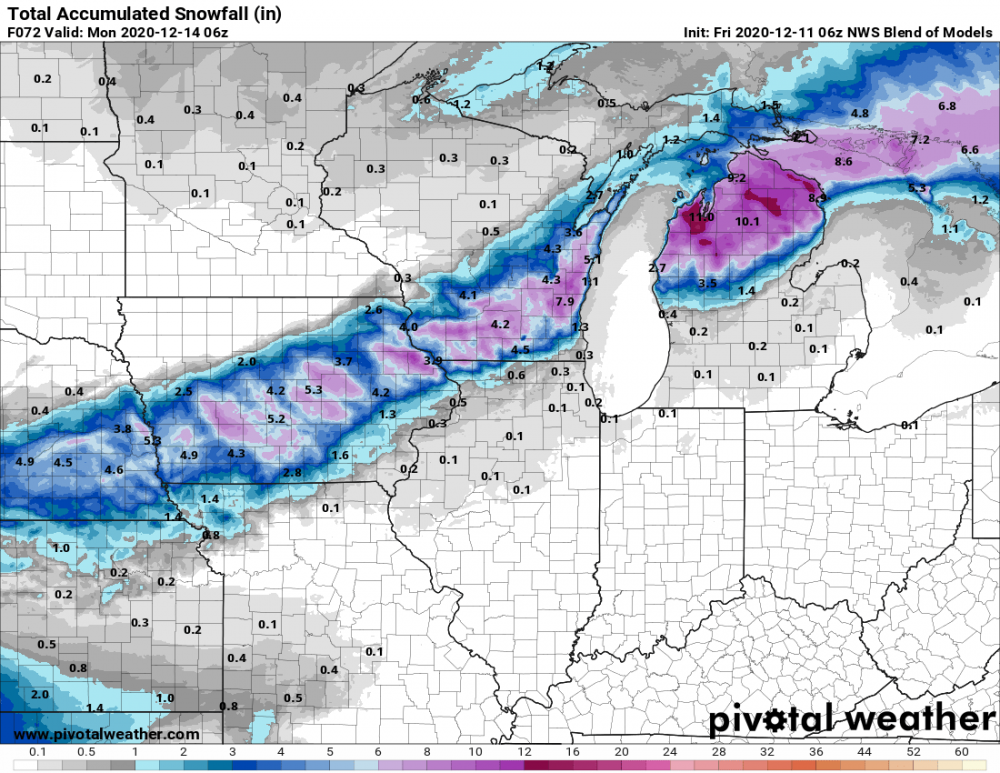
-
December 11th-12th Potential Winter Storm
TravisWx replied to Thundersnow12's topic in Lakes/Ohio Valley
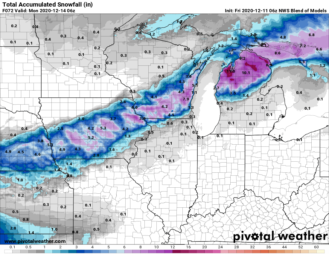
Yipes. Both those runs show presque isle county getting slammed with lake enhancement. . -
December 11th-12th Potential Winter Storm
TravisWx replied to Thundersnow12's topic in Lakes/Ohio Valley
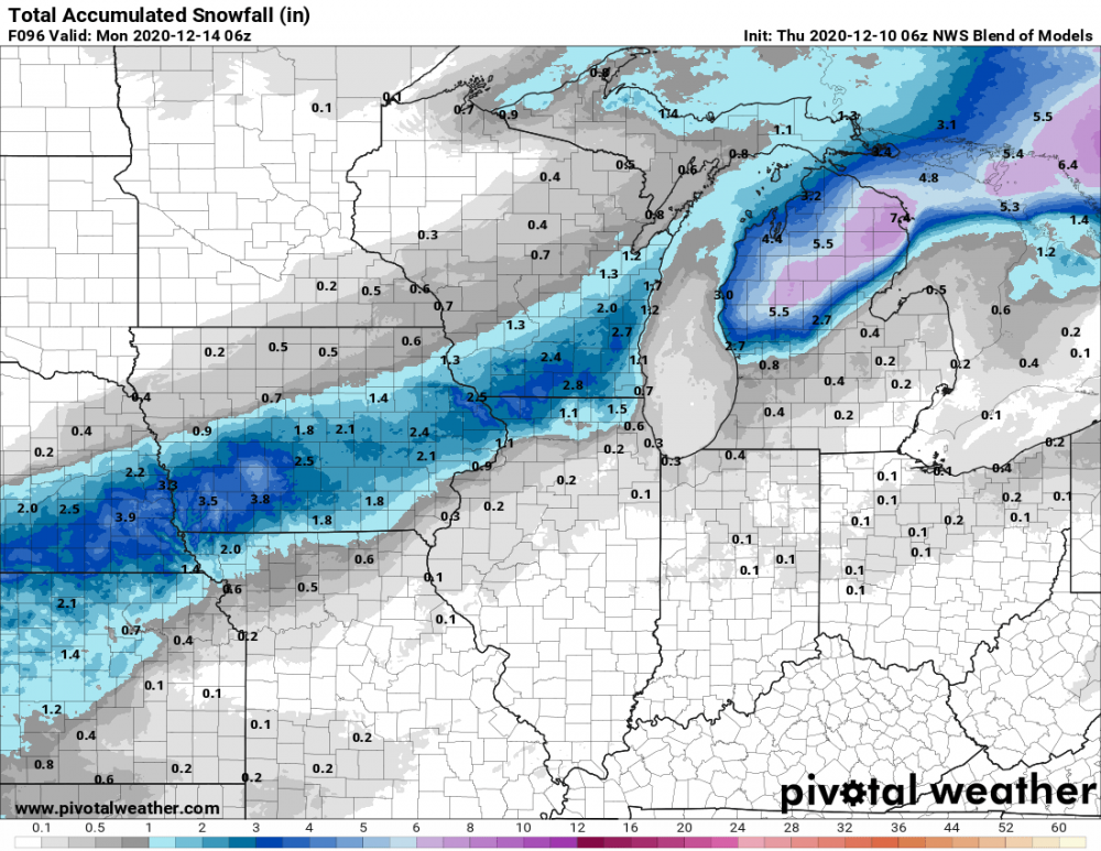
00z NWS Blend just loaded up. Looks a bit more amped for northern lower MI. Continue to show me in the solid 7”+ range. -
December 11th-12th Potential Winter Storm
TravisWx replied to Thundersnow12's topic in Lakes/Ohio Valley
APX just hoisted a WSW for my area. -
December 11th-12th Potential Winter Storm
TravisWx replied to Thundersnow12's topic in Lakes/Ohio Valley
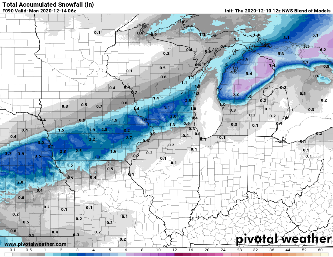
12z NBM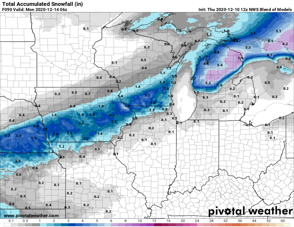
-
December 11th-12th Potential Winter Storm
TravisWx replied to Thundersnow12's topic in Lakes/Ohio Valley
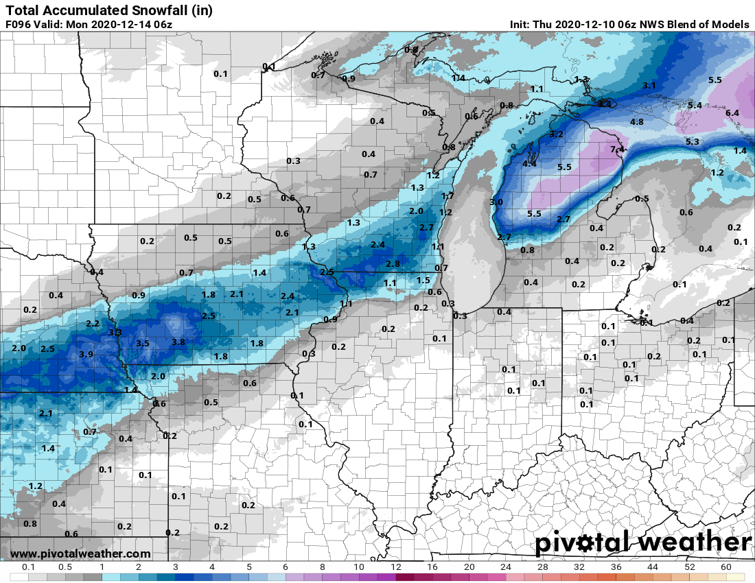
NWS 06z blend. I'll take the 7" for NE MI. Gotta get something on the ground soon. It's like a barren wasteland around here.