
.JPG.79118a3ad1baaeec7c8450bdb03170d6.JPG)
BuildingScienceWx
-
Posts
419 -
Joined
-
Last visited
Content Type
Profiles
Blogs
Forums
American Weather
Media Demo
Store
Gallery
Posts posted by BuildingScienceWx
-
-
1 minute ago, qg_omega said:
Pounding grass?

Your bet with Seymour Snow isn't looking good...
-
 1
1
-
-
7 minutes ago, backedgeapproaching said:
Certainly no "damage". Zero outages in SVT via Green Mountain Power. Temps were 30-32 though in the elevated East Slopes most of the night, so prob a decent glaze in spots I would assume.
Doesn't appear to be much. My place in VT (West Dover) is currently sitting at 29.8F. Precip from here on out is spotty at best.
-
1
-
 1
1
-
-
2 minutes ago, Sey-Mour Snow said:
A real weenie woulda moved to the highest hills of Woodbridge/Bethany there's some 600' elevations there big difference from the shoreline
Bethany has a few roads in the northern section of town over 800'. I lost a bidding war to one of the houses at 820'...
-
1
-
-
9 minutes ago, Spaizzo said:
It really does especially for ct.
.I thought this was pretty well modeled by the HRRR up until 7am or so when the radar should light up again with the deepening low to our south.
-
2
-
-
6 minutes ago, MJO812 said:
Yep mood flakes
I thought it was a decent improvement, but that doesn't mean much considering where we were.
-
1
-
-
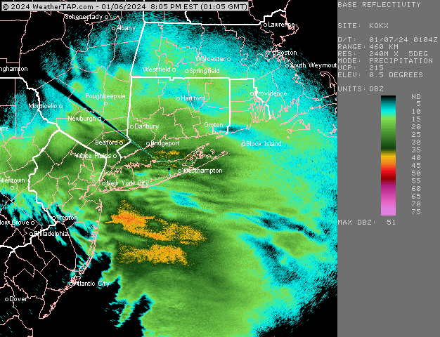
3.86" of rain. "Pack" wiped.
-
Pouring and roaring outside right now. 1.28" in the bucket.
-
1
-
-
This website is always neat to check out during larger storm wind events:
-
3
-
-
Starting as snow in our area. No mention of that in the forecast.
-
1
-
-
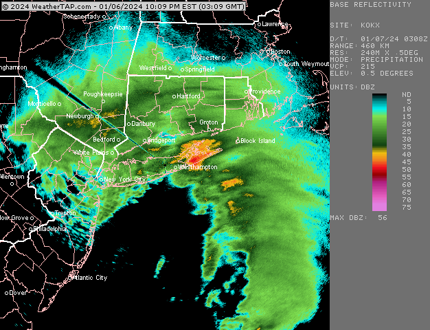
Wrapping up here. Stayed down in CT for the storm. Pedestrian storm around these parts. 4.1" storm total. Good luck up there to my northeast, though looking at the radar I think you'll enjoy your afternoon.
-
2.1". 30.2 / 29.8. Enjoy that band to our north, looks amazing. Not looking promising to meet out WSW criteria at the moment.
-
2 minutes ago, Ginx snewx said:
Wind was a surprise. Damn cold feel.
Agreed on the wind. The snow is certainly underperforming here. 1.6" and the temp has increased 1 degree in the last hour. 30.0 / 29.7
-
1
-
-
1.1". 29.1/28.8. Went through some moderate to heavy bands, snow growth isn't terrible, but it isn't great.
-
1
-
-
Moderate snow. 0.5". 29.1 / 28.8. 35-40dbz band about to roll through.
-
-
-
First flakes around 5:15pm. Light snow with the radar filling in to the south. 31.5/24.4
-
1 minute ago, Sey-Mour Snow said:
Go to Canada.
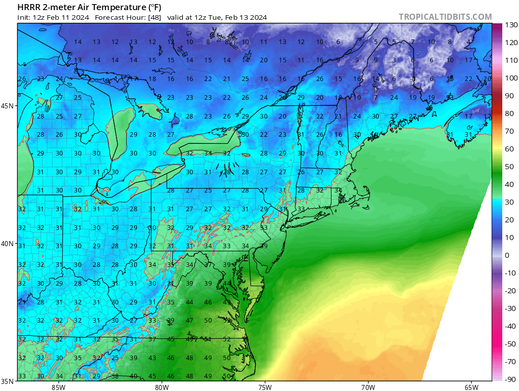
Thanks Jon, but in looking at that positive depth chart, my house is in the bullseye lol. My wife isn't going to like it, but I'll offer to take the kids....
-
Trying to determine if I should stay in CT or head up to my weenie spot in southern VT. I was originally going to stay down here but it's hard to deny the north trend. Front-end looks more exciting in CT (but I'm on the southern edge currently and tainting looks likely), but that h850 easterly flow into VT at 2300' would probably do pretty well. I NEED SNOW in my life. Any suggestions?
-
Still pouring outside. Absolute soaker once again with 2.75" and counting from this event. Over a foot (of MF'n rain) month to date. I'm up to 76.75"+ on the year. Certainly the wettest on record at my place.
Heading to our VT place at 2300' with the family this morning... we'll enjoy the mud.
-
1
-
-
3.67" of rain, closing in on 70" of precip for the year in CT. The place in VT has dropped to 32F with snow on the doorstep.
-
1
-
-
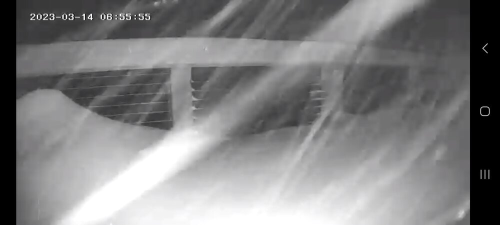
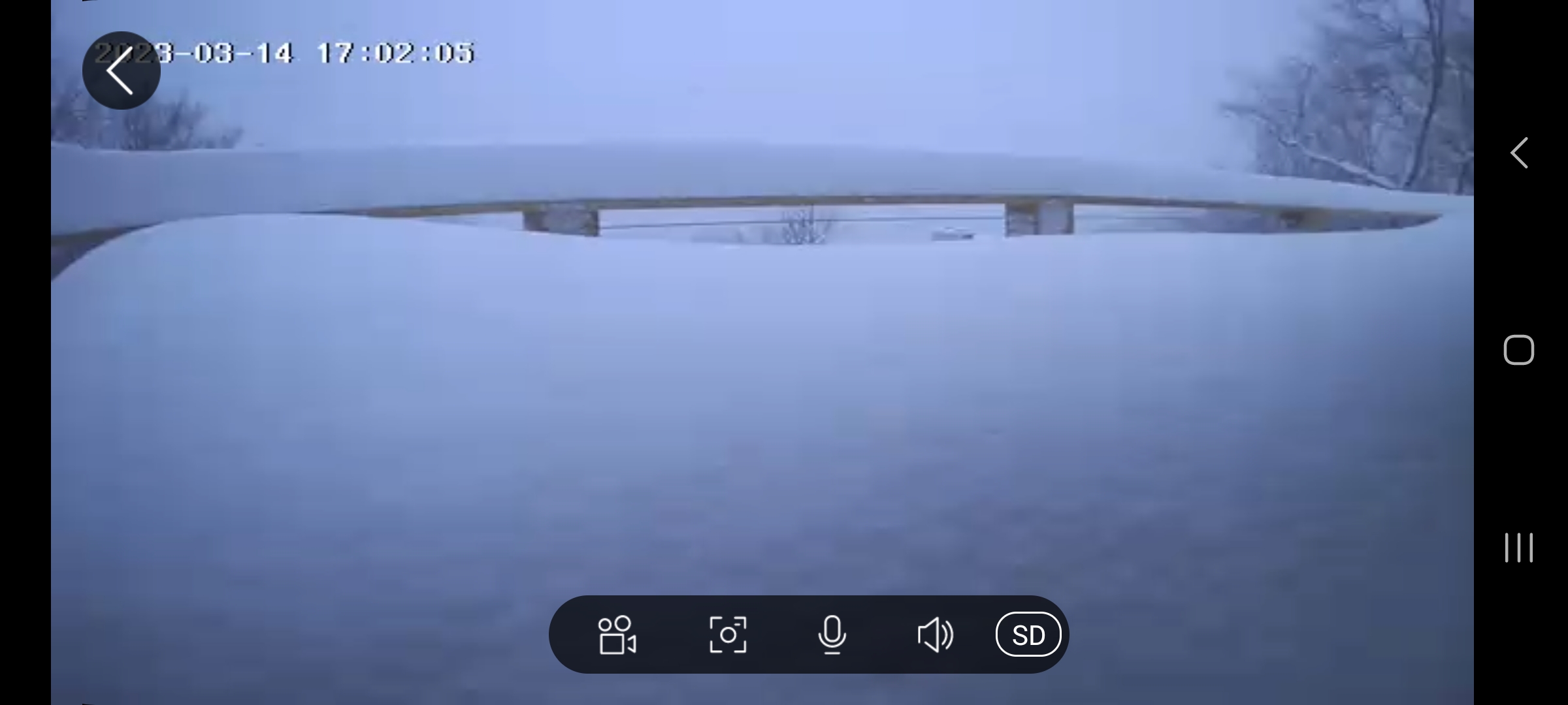
1 hour ago, powderfreak said:
38” on the level in West Dover, VT

West Dover has been getting smoked all day via radar and my webcams. The railing is 42" in my photo. I cleared the deck this past weekend so that's all new.

-
5
-
2
-
 1
1
-
-
2.2" of heavy mashed potatoes here in Bethany, CT. Temp has been hovering around 32F the whole day. VT house looks like 3' now.
-
1
-
-
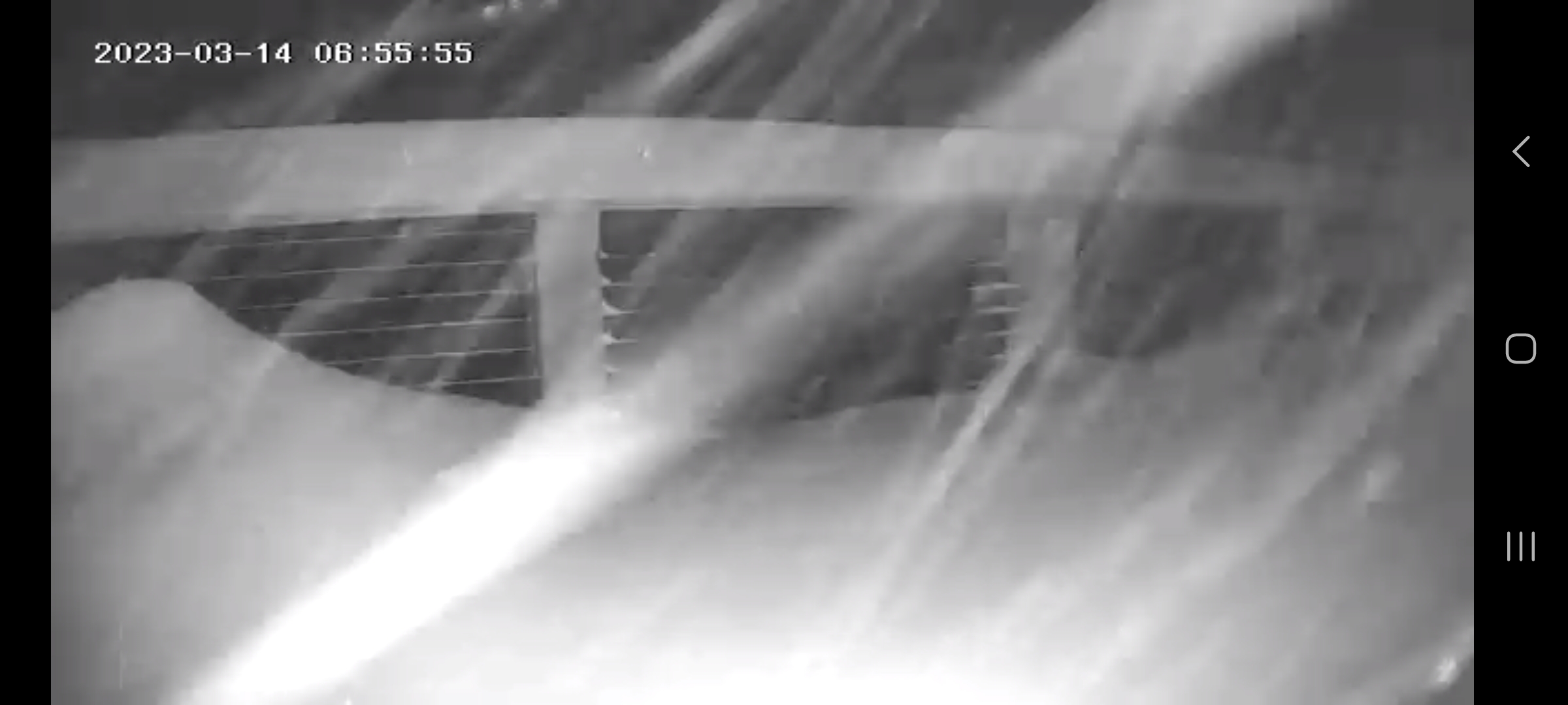
My place in VT is getting buried. Hard to tell how much, but my guess would be at least 12-16". (Those are 8x8" posts).
-
3
-
 1
1
-
Following a Miller A/B hybrid type coastal potential, Feb 13th ... As yet untapped potential and a higher ceiling with this one
in New England
Posted
I would've bet serious amounts of money at terrible odds 24 hours ago that there would be no chance that Dover DE received more digital snow than Worcester in any model run leading up to this event...