-
Posts
17,315 -
Joined
-
Last visited
Content Type
Profiles
Blogs
Forums
American Weather
Media Demo
Store
Gallery
Posts posted by wolfie09
-
-
On the other hand today is looking like a winner, mid-upper 50s forecasted..Windows open activated lol Temp up to 45°..
-
 2
2
-
-
Mid 20s on Monday is impressive for this time of year, obviously lol Actually all 3 days are quite a bit below average..
SundaySnow showers likely. Cloudy, with a high near 32. Breezy. Chance of precipitation is 70%.Sunday NightA chance of snow showers. Mostly cloudy, with a low around 13. Chance of precipitation is 40%.MondayMostly cloudy, with a high near 25. Blustery.Monday NightMostly cloudy, with a low around 16.TuesdayMostly sunny, with a high near 33.Tuesday NightPartly cloudy, with a low around 20.-
 1
1
-
-
-
I'm rocking with the GFS, gives me almost 6"

-
 1
1
-
 1
1
-
-
1 hour ago, tombo82685 said:
@wolfie09is this area a decent spot? Not to familiar with down in your hood
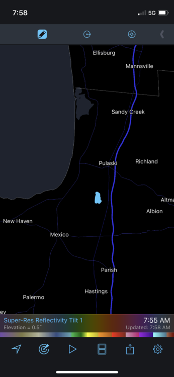
Yeah dude that's still pulaski or "fernwood", pretty much the same weather as here.. Early in the season could be some issues with the warm lake..TBH it all depends on which way the wind blows lol Each year is different, once outside the tug it's pretty much equal footing for the lower elevations.. Obviously being a little farther east of 81 would be beneficial as well..Area wise it's nice, country oriented with low crime, just minutes from 81 and lake Ontario..The village isn't NYC but it has all you need besides a hospital (Oswego).. Location wise you would be 30 min from Watertown, 25 from OSWEGO, 35 to syracuse (25-30 to the burbs) and around 35 min from Fulton..So you have plenty of other shopping or dinning destinations.. Good luck with the search my man..I would just advise to find the house that fits you and not necessarily snow chase unless it's the tug haha, litterly any location can get it depending on the year.. Unfortunately this area really underperformed this year...
-
-
NY baseball teams have some pull or money haha..
New York City mayor Eric Adams reportedly will reverse "the private-sector vaccine mandate specifically for performers and athletes" in New York City on Thursday, according to Sally Goldenberg of Politico.
That would mean that unvaccinated players like Kyrie Irving would once again be eligible to play home games in Brooklyn's Barclays Center, just in time for the upcoming NBA playoffs.
It would also mean that unvaccinated players on the New York Yankees and Mets would be eligible to play home games when the MLB season begins in April.
-
 1
1
-
-
-
A more potent shortwave crossing our region Saturday will bring an
even cooler airmass for Saturday Night, with temperatures at 850 hPa
dropping down towards the negative teens Celsius by periods end.
While a mix of rain and snow is possible Saturday evening, this
cooler airmass will promote snow showers across our region, with
lake effect snow by late Saturday Night. Several inches of snow,
especially across SW NYS remains possible by late Saturday Night.
Cyclonic flow in an anomalously deep upper level trough will be over the Northeast Sunday. A cold front will usher in cold air across the eastern Great Lakes leading to much below normal temperatures for the start of next week. Some guidance, as low as - 20C at 850mb by Monday morning will most likely fuel lake effect snow showers across the eastern Great Lakes with concentration southeast of the Lakes. Accumulating snow is possible Sunday through Monday morning. The core of the cold air will move east as the trough becomes negatively tilted off the New England coast. Snow showers will taper off Monday and a slow warming trend will occur into early next week.-
 1
1
-
-
It's 44° here with some drizzle but I've also heard a few pellets and maybe even seen a stray flake lol
-
-
-
You guys beat me to the punch lol
He's signing for 4 years 120 mill with 72 mill guaranteed..He is now the highest paid WR in the NFL..
-
-
-
-
-
Kbgm
The long term is looking unsettled and cold. 850 mb temperatures likely stay below freezing with temps as low as -18C late Sunday into Monday so highs will struggle to get to near freezing Sunday and Monday. 500 mb height anomaly means in the NAEFS area already 2 sigma below climatology but there is still some spread in the ensembles on where the coldest pocket of air will be so left temps to the NBM rather than lowering the temperatures closer to the 25 percentile for the late weekend into early next week. Also with the longer days and higher sun angle it is starting to get difficult to get temperatures to stay in the low to mid 20s during the afternoon. Forecast soundings show a shallow cloud depths with the cold air and thus likely breaks of sun allowing some heating and temperatures likely slightly warmer than what models are showing for Sunday and Monday afternoons. Lake effect snow is also a concern with the ice cover mostly gone with the recent warmth and the lake temperatures up ever so slightly so chances of precipitation were raised to a chance from Saturday afternoon into Monday morning. Wind direction and band organization is uncertain at this time though some accumulating snow is likely somewhere across the Finger Lakes region into northern CNY. A slow warming trend begins mid next week -
Kbuf

Though cold air advection, a mild boundary layer should keep
precipitation that falls Thursday Night and Friday as plain rain,
and not until after an upper level low passes by will it become cold
enough aloft to support snow showers. These snow showers, Friday
Night across the higher terrain will become possible everywhere by
Saturday morning as temperatures at 850 hPa cool to -5 to -7C. As
these 850 hPa temperatures drop towards the negative teens Saturday
Night lake effect instability will begin to produce lake effect snow
downwind of the lakes on a northwest flow. With favorable moisture
within the snow DGZ, it is possible that several inches of snow will
accumulate SE of the Lakes.

&&

.LONG TERM /SUNDAY THROUGH TUESDAY/...
There is very high confidence that we will be experiencing below
normal temperatures throughout this period...especially Sunday and
Monday when the mercury will average a solid 10 deg f below typical
late March values.

The reason for the cold weather will be phased negatively tilted
longwave trough that will be start the period over James Bay and
eastern Canada. As we move out of the weekend...there will be a
deamplification of the longwave pattern so that the coldest air will
eventually be shunted to the east. The cold northwest flow with H85
temps in the minus teens c will support at least scattered lake snow
showers with likely pops being introduced southeast of Lake Ontario.
-
-
Little bit of "winter" chill in the air today with mainly 30s, although we did briefly hit 40° before dropping back into the upper 30s..
-
-
-


.thumb.jpeg.b9e232a6b43e01b7eeee3144246db864.jpeg)
.thumb.jpg.269685d68174a926c85239dbc22ba9cf.jpg)


.thumb.png.c845abd5ea128b9d125d885d0695d102.png)
.thumb.png.0f8388687f14316f32d83fe60694408e.png)


.thumb.png.ce83ab37773668be8c9f98eec4f56dd7.png)


.thumb.png.91fe9f130ddae3bbf7b698580fd8a01f.png)
.thumb.png.5015de2d0526c59a86afcd5eed3e4cce.png)
Upstate NY Banter and General Discussion..
in Upstate New York/Pennsylvania
Posted
The real"snowbelt" is just east of pulaski and the 81 corridor, like Altmar/Orwell area, elevation between 500-800'ASL.. Unfortunately you won't find much out that way.. This obviously doesn't include the last couple garbage years.. Outside of that it depends on the year, some years Fulton has had 50" more than mexico and vice versa..We are at the mercy of the wind direction lol