
vortex
-
Posts
473 -
Joined
-
Last visited
Content Type
Profiles
Blogs
Forums
American Weather
Media Demo
Store
Gallery
Posts posted by vortex
-
-
14 minutes ago, SchaumburgStormer said:
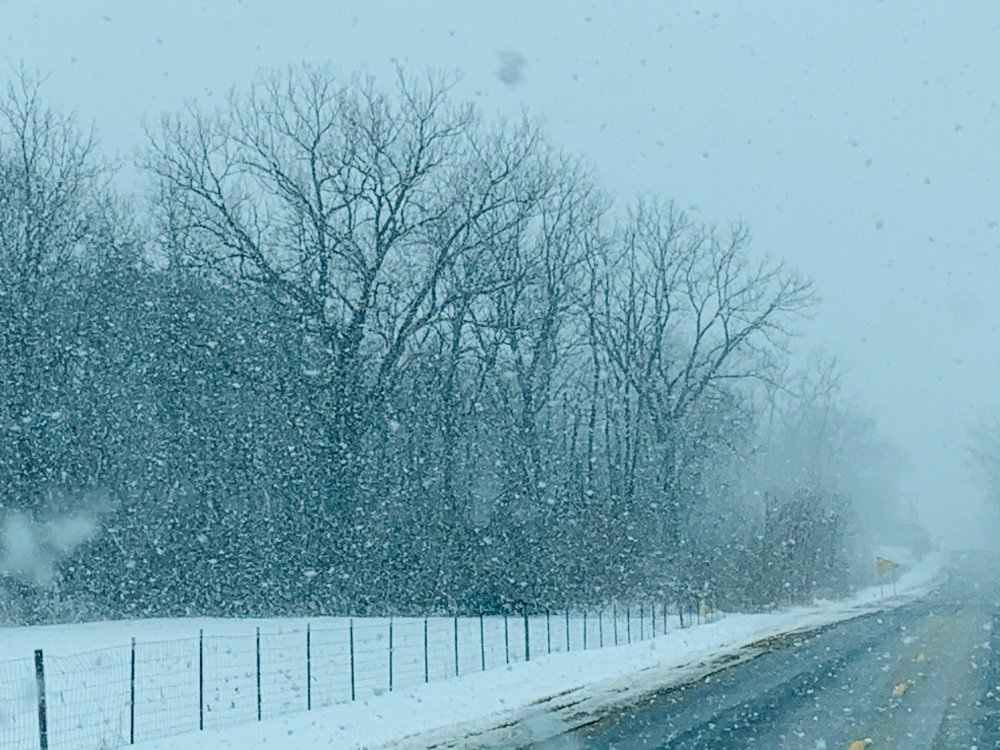
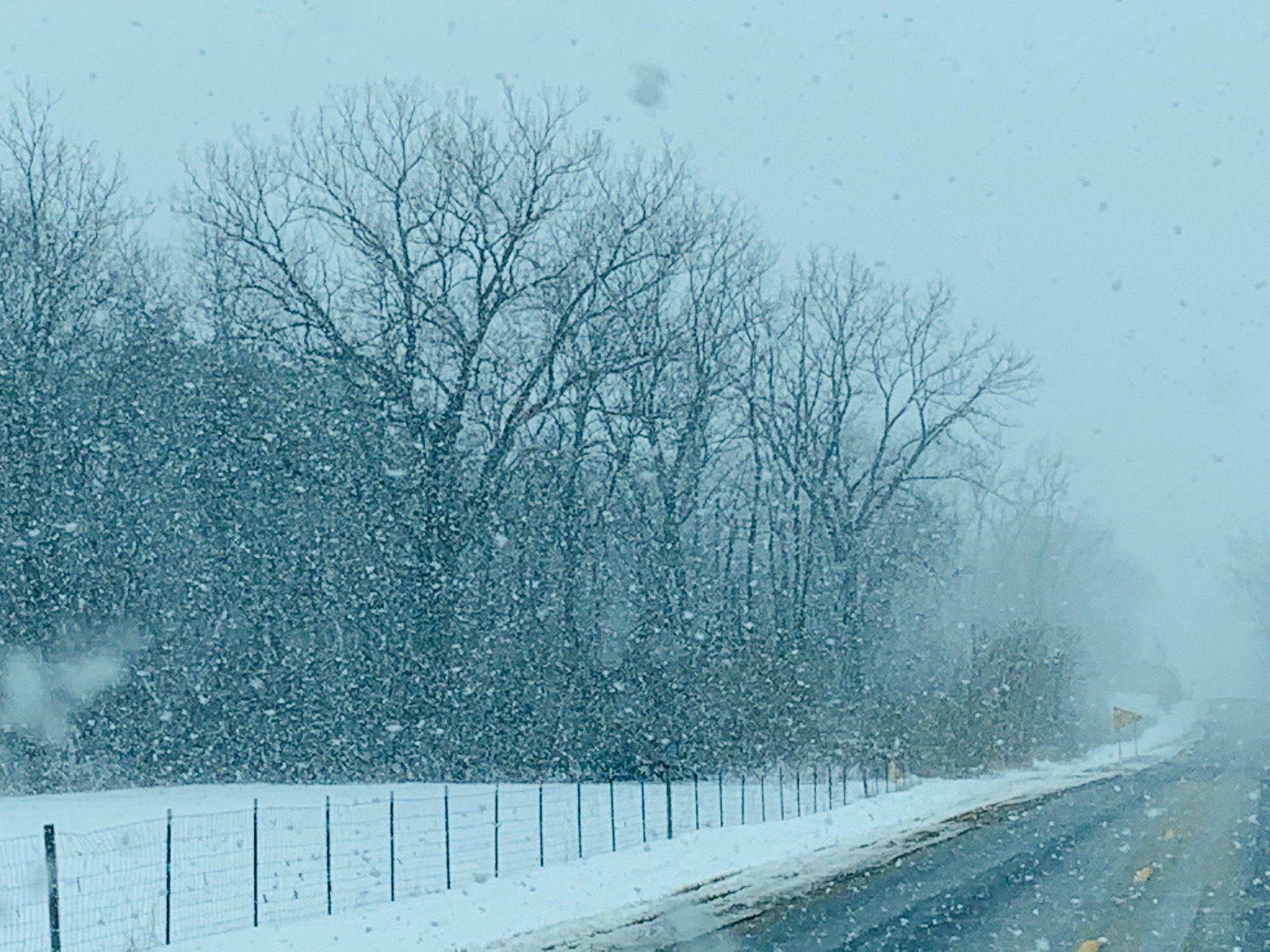
Shit isn’t good out here in the stix. 19” base of powder that had plenty of time to dry out with -20 dews is blowing like crazy.
Snagged this from a Facebook group, but it’s a fair representation of our east/west roads.

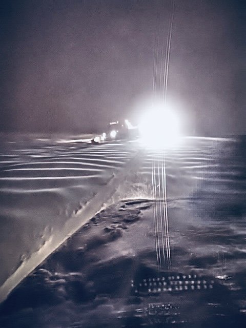
Same here. Plow in ditch. Taken by county highway plow.
-
 4
4
-
-
30 minutes ago, Chicago WX said:
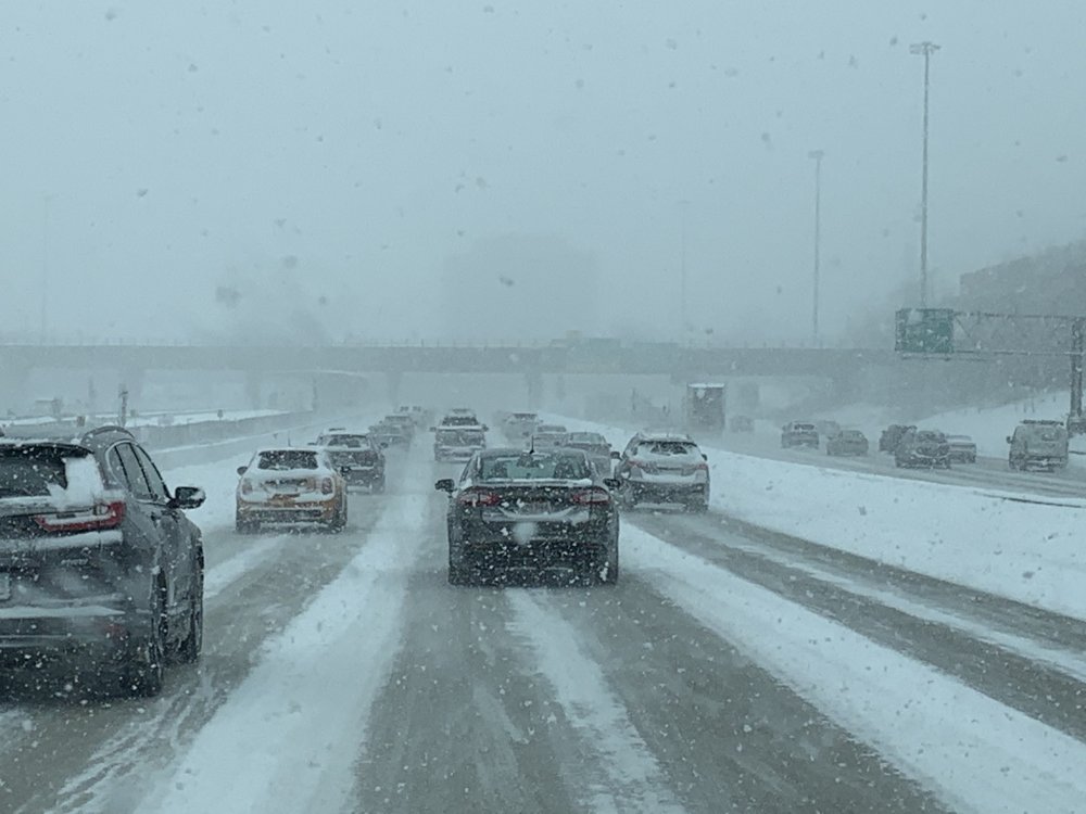
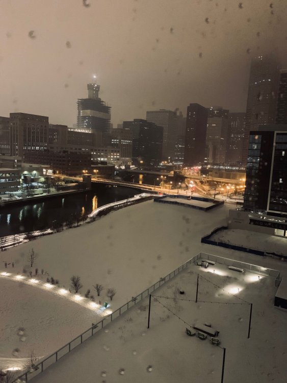
Conditions are something here. Just so much snow, it’s like fog. Just measured 3.2”. So in addition to part one’s 2.2”, up to 5.4” storm total. Will measure again at midnight. Going to be a long night.

Just measured 4.1” here about 4.5 miles NW of the city. Currently sitting in a heavy band and poring snow.
-
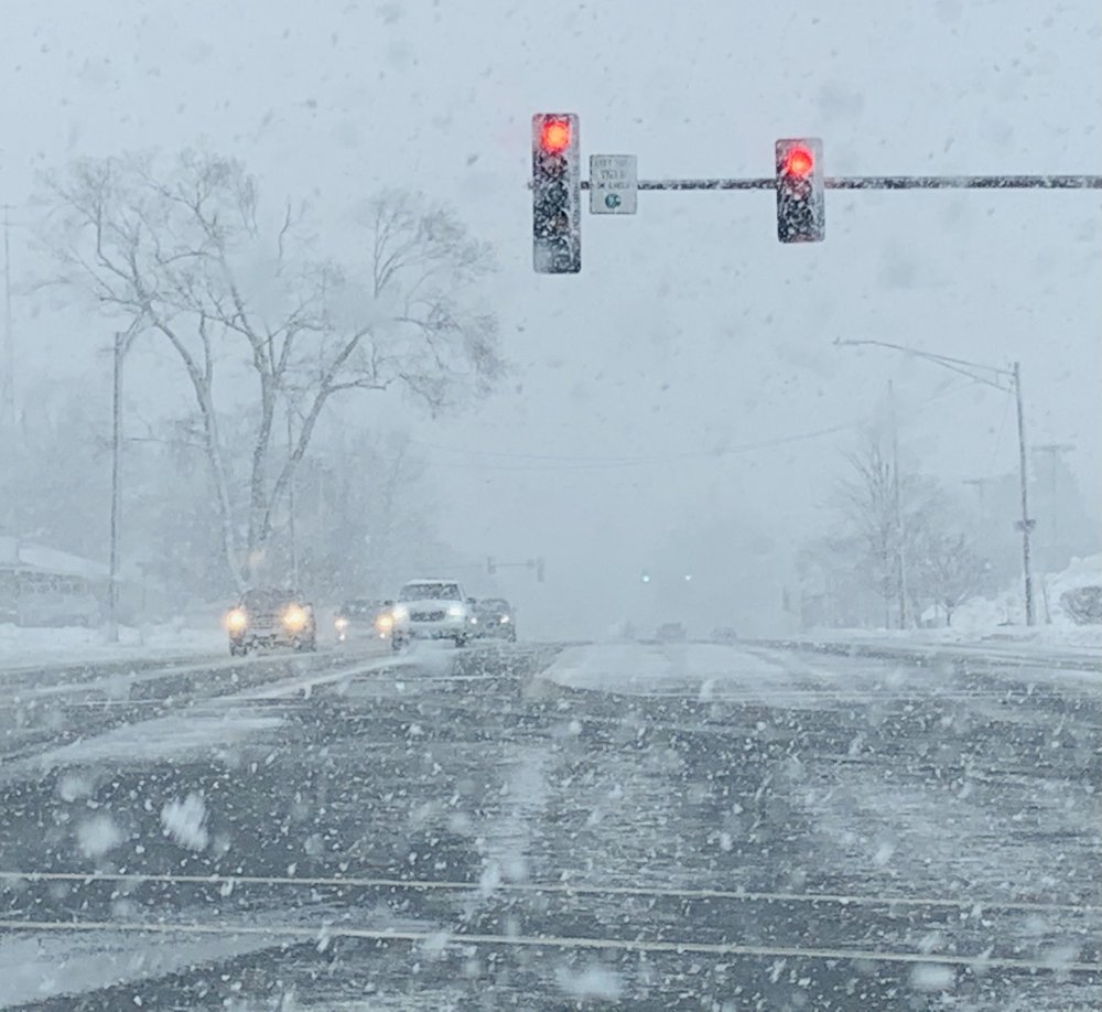
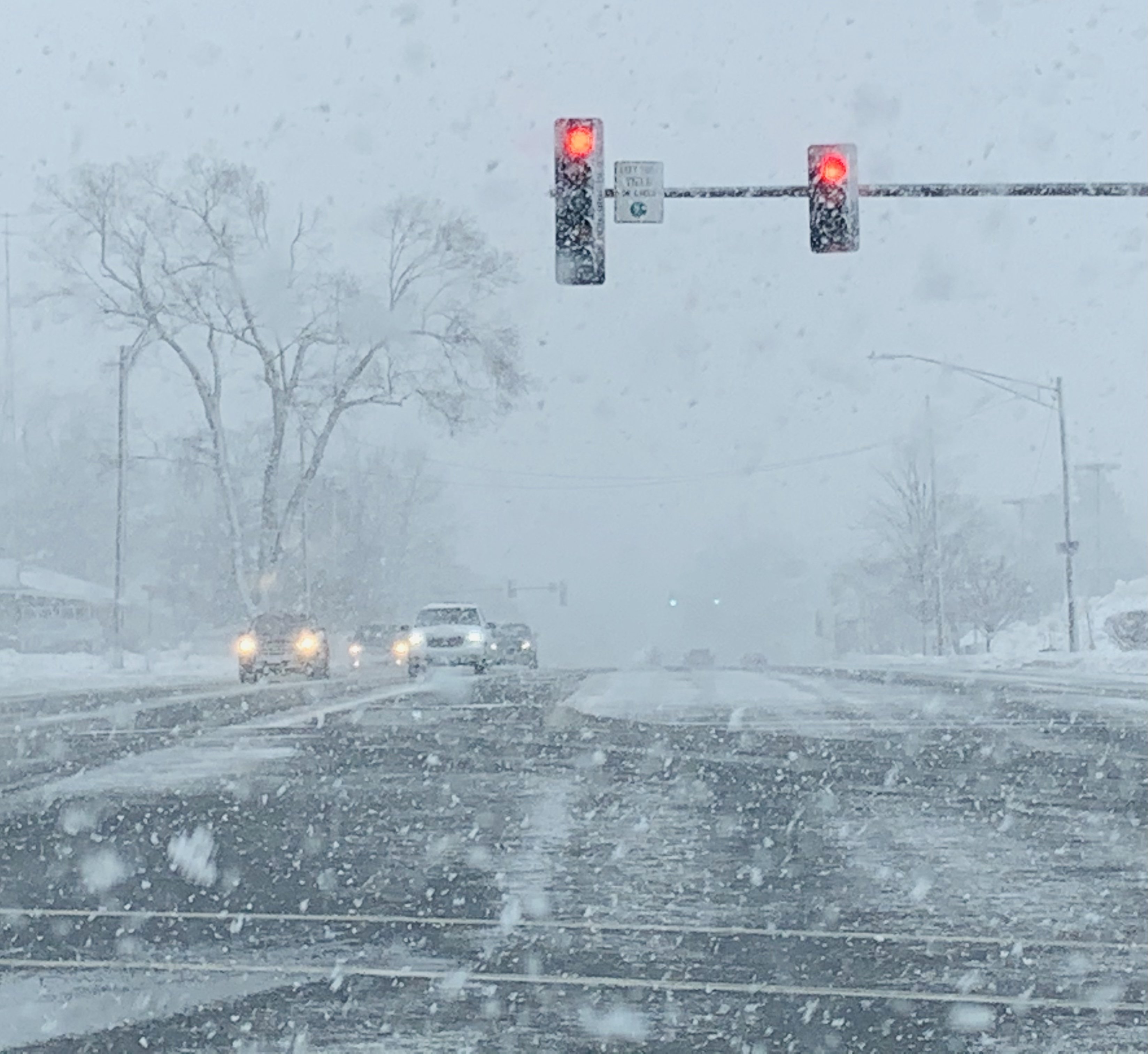
51 minutes ago, Chicago WX said:
Dumping snow. Getting that foggy look.
Similar look to 99, in terms of visibility and flake size.
-
Outbound Ryan Expressway
-
1
-
 2
2
-
-
Guesstimate about 1.5” or so here.
-
Rain, snow and sleet mixture here after the initial heavy snow burst.
-
18 minutes ago, tuanis said:
Should have no problem accumulating with rates like that. Did temps drop with dynamic cooling?
It’s still 35 here but sticking pretty good.
-
4
-
-
2 minutes ago, Chicago WX said:
Started as 5 minutes of pingers, and then all snow. Coming down pretty good right now. Some decent size flakes in there too.
Coming down good.
-
2
-
-
1 hour ago, Chicago WX said:
Last gasp snow still snowing decently here. Measured the snow on my backyard bar (concrete top) and it had 9.5" on it. That's untouched since the storm began. So total storm total has surpassed dd's, considering compaction/settling. Finally, the drought is over, lol.
And a minor rant, which vortex probably shares, but the few local observers around really don't know what the f*ck they're doing with snow measurements. Always some nonsensical amounts. One county CoCoRAHS observer reported 2.7" of snow on 0.71" precip this morning at 5:00 AM. The storm was 99% snow. And the ratios certainly weren't that sh*tty.

Yup. They are absolutely terrible.
Guarantee most wait until the snow has completed stopped until they measure.
Probably measuring under a porch or something. Lol.
-
 1
1
-
-
Pic from last night. Cool how bright it was out from the snow.
-
3
-
-
6 minutes ago, Chicago WX said:
Who knew this was going to be a 30+ hour snowstorm (first to last flake)?
Coming down rather hot here right now. Loving it. And great pic Alek. And everyone for that matter.How much you end up with?
I’m sure metro wastewater will say 3 inches. Lol. -
20 minutes ago, A-L-E-K said:

They grow up fast
Yes they do!!
Cute kid.
I lost some of my pics from my son playing in the snow, sucks, actually think the ex took them to spite me. Haha.
-
2
-
-
6 minutes ago, Chicago WX said:
Same here. Winds getting gusty too.
I was trying to remember the last storm that I saw 10"+...and pretty sure it's Jan 5, 2014. This storm won't do it either for me, so the wait will go on...but geez, that's really awful.

Snowing there?
-
Driving north on 57 and rain snow line was just north of Peotone .
Heavy snow at 57 and route 30
-
1
-
-
Down to 32 but mostly rain now.
-
2 minutes ago, Chicago WX said:
I’m downtown today, and it’s been lightly snowing for an hour or so. Mostly rimed flakes. But as you said, flake size is real nice right now. If we can hold onto to that for the meat and potatoes of this event, then...

Definitely.
Looks like some better returns about to swing through shortly.
-
Just started snowing here. It’s been all snow with some nice flake size.
-
13 minutes ago, SchaumburgStormer said:
Low balling.
Definitely lowered them from earlier.
-
1 hour ago, Chicago WX said:
It’s been steady. Hope it’s the king again. But all other models are decreasing snowfall for here, for various reasons. And I’m still a little leery about that much snow, in a short amount of time. I think I’d make a call of 3-6” right now, all things considered.
Plumes down to 5.6” here.
Nice group between 6-8 but also a nice group between 4-6. Lol.
I’ll go 6” here.
We definitely overdue. -
-
7 minutes ago, janetjanet998 said:
LOL at 12z PARA for us
such a waste of 1.4 inches of precip
Southern cutoff is rough.
-
1 hour ago, Chicago WX said:
A lot to like if you're in and around Chicago on the 12z NAM. Mid/upper level lows all take a nice track for a band of heavy snow. Think I-80 to the border is going to cash quite nicely. I think most times, these systems like to bleed a little further north than forecasted. Read the overnight AFD from LOT, and they have the heaviest a little farther north...I-88 to far north central IL. And mainly rain from I-80 to the south. Again, I think it's more I-80 on north for the heaviest snows...and the changeover to all rain, after a brief start of frozen, looks solid for the southern CWA.
So your saying Accuweather’s forecast of 8-12 in our area is wrong? Haha.
More than likely the typical last minute nudge north will screw us. Still thinking we get a few inches as things look now. That I-80 snow barrier is a killer. Lol
-
10 hours ago, A-L-E-K said:
D10 putting out major msp blizzard vibes

-
1
-
1
-
-
Last few bands were all snow here. Maybe around an inch total.


February 14-16 Winter Storm Part 2
in Lakes/Ohio Valley
Posted
What you have for storm total so far?