

lokee
-
Posts
384 -
Joined
-
Last visited
Content Type
Profiles
Blogs
Forums
American Weather
Media Demo
Store
Gallery
Posts posted by lokee
-
-
16 minutes ago, StormChazer said:
Hahah, yeah, Dew point temps are in the mid to upper 20's in NE OK, with those NE winds, that's going to mitigate that from moderating much. I really do think the eventual freeze line is going to be along Wagoner county east of Tulsa.
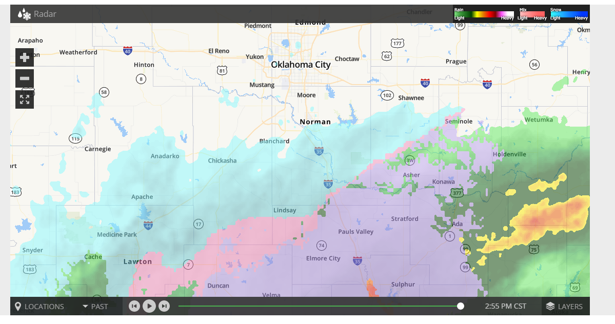
I took this screen shot for you of the radar. If you draw out the freezing line to the NE you are pretty close.

-
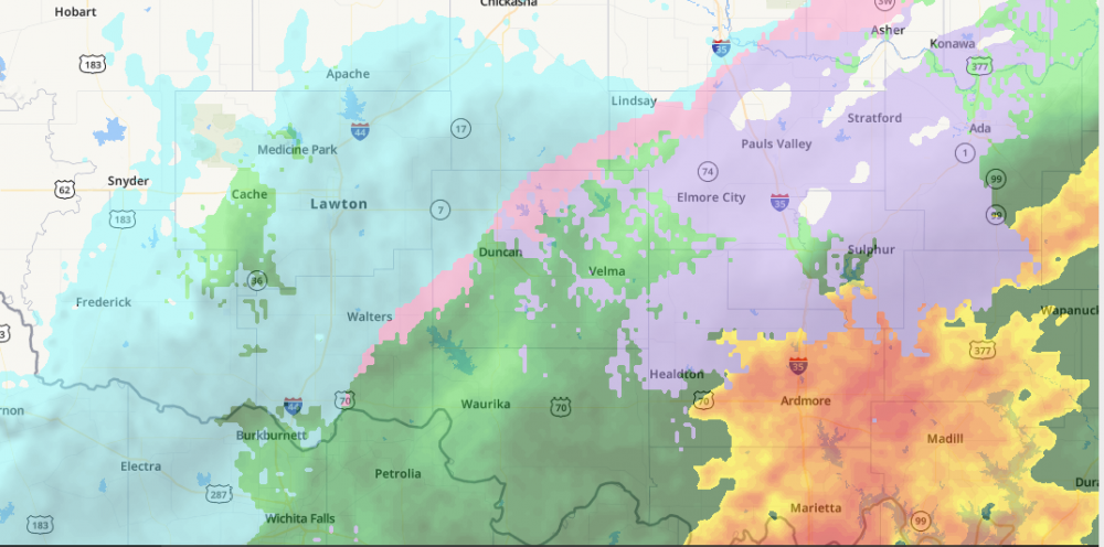
3pm radar for much of Southern Oklahoma.

-
Weather Service in Norman had Okc with a high of 40 today. We are at 34 now. Also Norman pulled Central Oklahoma and along I-44 just West of Tulsa into Winter Storm Warning.
-
 1
1
-
-
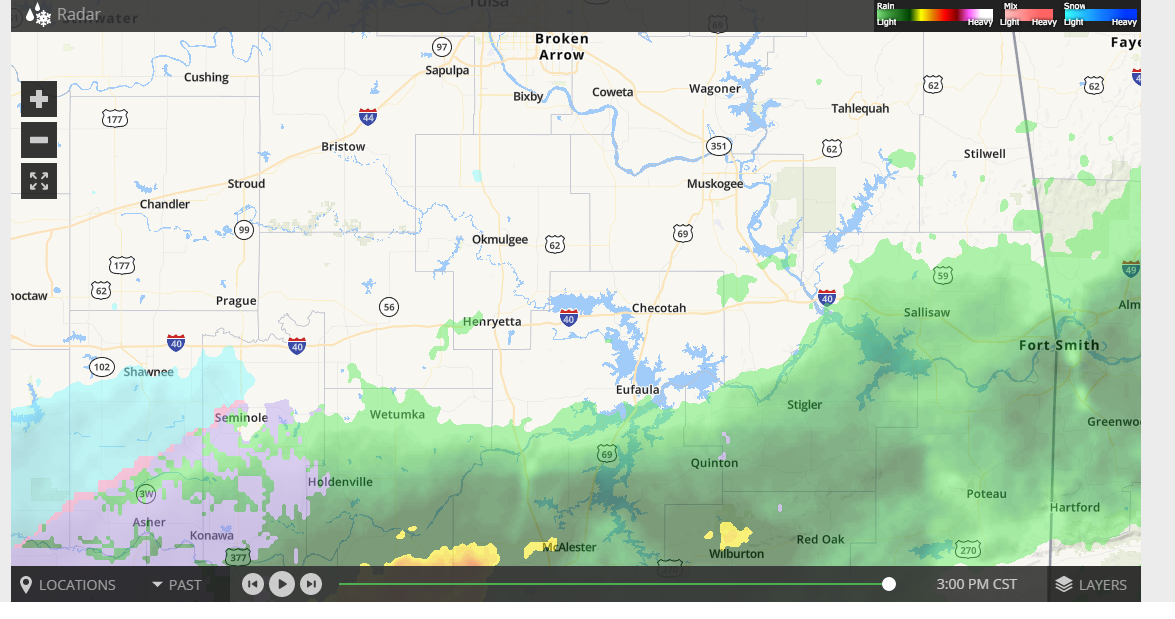
Present radar for Southern Oklahoma at 2:15 Thurs afternoon. Models had much of this as rain starting out.
-
Tuttle is going with the Canadian He thinks the Euro is to far West.
-
3 minutes ago, Wx 24/7 said:
So while we are eagerly awaiting the 00z model runs, which site(s) do you all use for your model data? Didn't know what the pros/cons are.
I use pivotal. I was using College of Dupage before pivotal
-
23z HRRR at hour 18 still has the Low in the Gulf to the SE of Victoria.
-
18z hour 36 has the low to the SE of Texarkana
-
I will take that for Okc
-
Hour 26 on the 18zHRRR has the low in the Gulf south of Beaumont then brings it back to the East near the Lufkin area.
-
That new Nam run gives Okc with the snow Wed afternoon and the snow on the backside on Thurs 9.5 inches of snow
-
Just now, rockchalk83 said:
A little slower, too? Or are my eyes deceiving me....
I am seeing it as well.
-
18z Euro has the Low pushing into DFW then up toward Joplin.
-
12/29 06 GFS looks like my previous post
-
12/ 29 06 Nam looked liked 12/29 00 GFS
-
Canadian picking up the snow Wed afternoon in Oklahoma.
-
3 minutes ago, StormChazer said:
Considerable jump east, and the Euro has been following it recently.
FWIW Aaron Tuttle seems to think the Euro is too far west and will move east again. He also thinks there's good merit to what the HRRR was picking up on, on Wednesday.
I was on the same broadcast.
-
1
-
-
Previous runs of the Nam were showing snow around the Noon time Wed in the Okc metro area.
-
Ice Storm warning for much of SW, Central and North Central Oklahoma. Half an inch to an inch of ice expected.
-
Norman put out a watch for Western and Central Oklahoma for ice.
...WINTER STORM WATCH IN EFFECT FROM MONDAY EVENING THROUGH
WEDNESDAY MORNING...

* WHAT...Significant icing possible. Total ice accumulations of
  one tenth to four tenths of an inch possible.

* WHERE...Portions of central and southwest Oklahoma and
  northern Texas.

* WHEN...From Monday evening through Wednesday morning.

* IMPACTS...Power outages and tree damage are likely due to the
  ice. Travel could be nearly impossible. The hazardous
  conditions could impact the morning or evening commute.
-
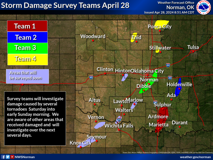
Weather Service in Norman posted this graphic around 9am Thursday morning.
-
Weather guy from Tulsa that is on my FB page. "
Enjoy yourself today. From here on out expect COLDER temps. NO NEED TO RUSH OUT FOR BREAD, MILK, AND TOILET PAPER, just yet! Right now, it still looks like mostly rain, but Monday will be a cold, wet, windy and raw day. Cold enough to change over and mix in with some light freezing rain and very very light snow here Tuesday. OKC and NW Okla. will have much more. Data is changing so please stay tuned. The thing that I am more confident about are the temperatures. Tuesday morning we could see our first freeze of the season in Tulsa."10510517 Comments32 SharesLikeCommentShare -
GFS is not letting it's idea go.
-
Mike Morgan is jumping on the board for NW and Western Oklahoma. He uses the Euro most of the time.

MO/KS/AR/OK 2020-2021 "Winter" Discussion
in Central/Western States
Posted
Just saw a report on F/B from the Texas State Park System. Big Bend State Park has gotten 12 to 24 inches of snow.