
DopplerWx
-
Posts
3,398 -
Joined
-
Last visited
Content Type
Profiles
Blogs
Forums
American Weather
Media Demo
Store
Gallery
Posts posted by DopplerWx
-
-
Just now, NorthHillsWx said:
Taken Verbatim, Raleigh and points south and east should not like this run of the NAM, no matter what clown maps may show. I don't think this is a big sleet storm. I think "pink" will be more of a rain and wintry mix. No accumulations in that time period. Good news is, it's the NAM! Probably still a little too amped. Discredit at your own peril though this close to go-time. Still a decent storm regardless. NE parts of the state look to jackpot the more model runs I see.
look at the soundings, pretty close to a sleet souding on 06z and 12z looks even worse.
-
upstate to clt thru rdu and greenville all snow at hr 51. another good gfs run coming.
-
 1
1
-
 1
1
-
-
upstate and clt folks, a thing of beauty. feels good to have the 3km nam on our side with cooler upper levels this run.

-
 6
6
-
-
wow, on 3km nam charlotte gets rid of the warm nose after hr48 and then we have an all snow sounding if sfc temps cooperate. interesting...
-
3
-
-
interesting nws gsp is leaning towards this being rain/snow vs sleet. hope they are right.
-
1
-
-
6 minutes ago, BullCityWx said:
Good luck with that sleet diagnosis
when is the last time you saw the nam overdo a warm nose only to have it trend colder as we got closer to verification? the warm nose will likely be stronger than advertised. believe these 8-10" outputs at your own peril.
-
1
-
-
anyone who has tracked nc/sc storms knows this is a warning shot from the nam. 3k showing that stout of a warm nose and it has only trended stronger. this is a sleet storm for upstate to clt and if i were in rdu i'd be concerned as well. we all know how this usually ends up.
-
1
-
 2
2
-
-
Just now, griteater said:
So far, the precip looks very uniform on the NAM which is nice to see. I've seen it in recent years actually not be as heavy with precip as it's reputation would suggest. At any rate, I think the globals are too light with precip
Grit, that warm nose the nam is painting for Charlotte scares me. Seen this movie before...
-
precip looks a bit further north on the gfs out to 69
-
2
-
-
as the 12z nam runs, just look at the northward shift in precip for weds before our event in the last 24hrs.


-
if the 00z euro had a bit more precip northward into nc i think we would have seen a 1-2" system, model just didn't have enough precip to spit out snow at the sfc level even though soundings looked near ideal for snow. would much rather have this issue than our usual fear of the warm nose screwing us. give me cold upper levels and ill worry about precip, especially in this pattern.
-
6
-
-
7 minutes ago, The Alchemist said:
I know this is not what the forums are for, but my wife and daughter are headed to a Dr. appointment down near Southpark. Can anyone give me an update, this seems to be happening fast.
roads are fine
-
1
-
-
1 minute ago, Queencitywx said:
Downstream reports are encouraging for at least an inch in the city. We'll see.
yea those returns coming northward look insane.
-
pouring here in southpark, windshields already getting covered.
-
IF we can keep this heavy band just west enough to move over clt we will be in business for a little time of some mod snow I believe
-
SNOWING IN SOUTHPARK
-
1
-
-
fwiw gfs at 06z had nothing for clt and now 12z has ~1" accums.
-
good lord the nam. cut it by 80% and i'll still be ecstatic. wild that clt has has not even a trace in april since 87.
-
1
-
-
You had my curiosity, now you've got my attention.
-
nam showing the tongue of precip over clt now, similar to the hrrr. precip shield is healthier and further inland as well but looks like ran in eastern sc.
-
Gfs shifted precip west again vs 18z
-
2
-
-
yea this is pretty close to game on for eastern carolinas

-
nam much further nw with precip at 54. this is a massive shift.

-
fv3 not as good as 06z. heavier returns a bit east.
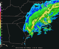
One More Shot: Feb 20-21 Event
in Southeastern States
Posted
A beaut