96blizz
-
Posts
2,530 -
Joined
-
Last visited
Content Type
Profiles
Blogs
Forums
American Weather
Media Demo
Store
Gallery
Everything posted by 96blizz
-
You just have to know how to play it. I just have fun with them.
-
You could circle half of these and get accumulating snow here - the indies will be interesting.
-
I know this. But it was a great opportunity to post that gif.
-
-
EPS better for our area. An eternity to go.
-
Same. Monmouth County. No storm compares. This one seems too fast to match it as well. Boxing Day was 2nd.
-
“I’m Dreaming of a Wet Christmas...”
-
Don’t. lol.
-
With the first system trending closer I think the favored areas see 1-3” or so. The problem seems to be if the Wed/Thurs storm doesn’t deliver up here a White Xmas could be in serious jeopardy!
-
Exactly. The vort is over the ocean right now! I posted my humorous article about this last winter. May be time to dig it up.
-
The weenies in the big cities never learn. I see so many “lock it in” comments it’s hilarious. I’m a huge believer in climatology as well - and 2’ of snow in NYC in December with a tucked low is supremely anomalous. sure it can happen and modeling favors it now - but I wouldn’t lock anything in yet.
-
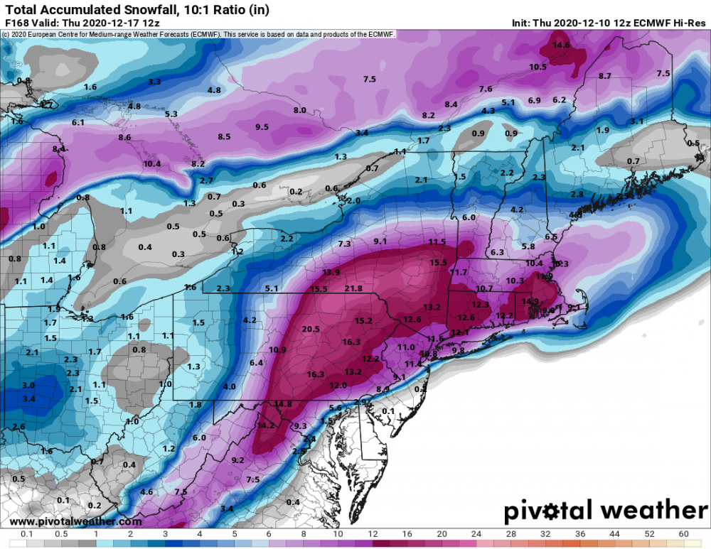
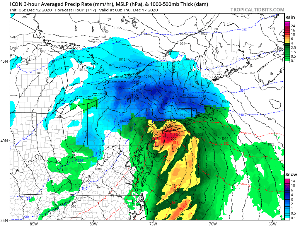
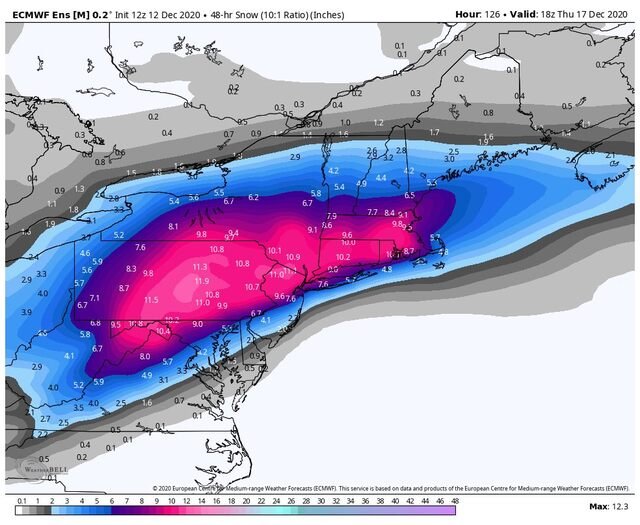
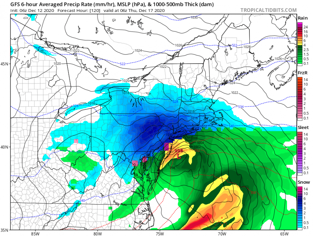
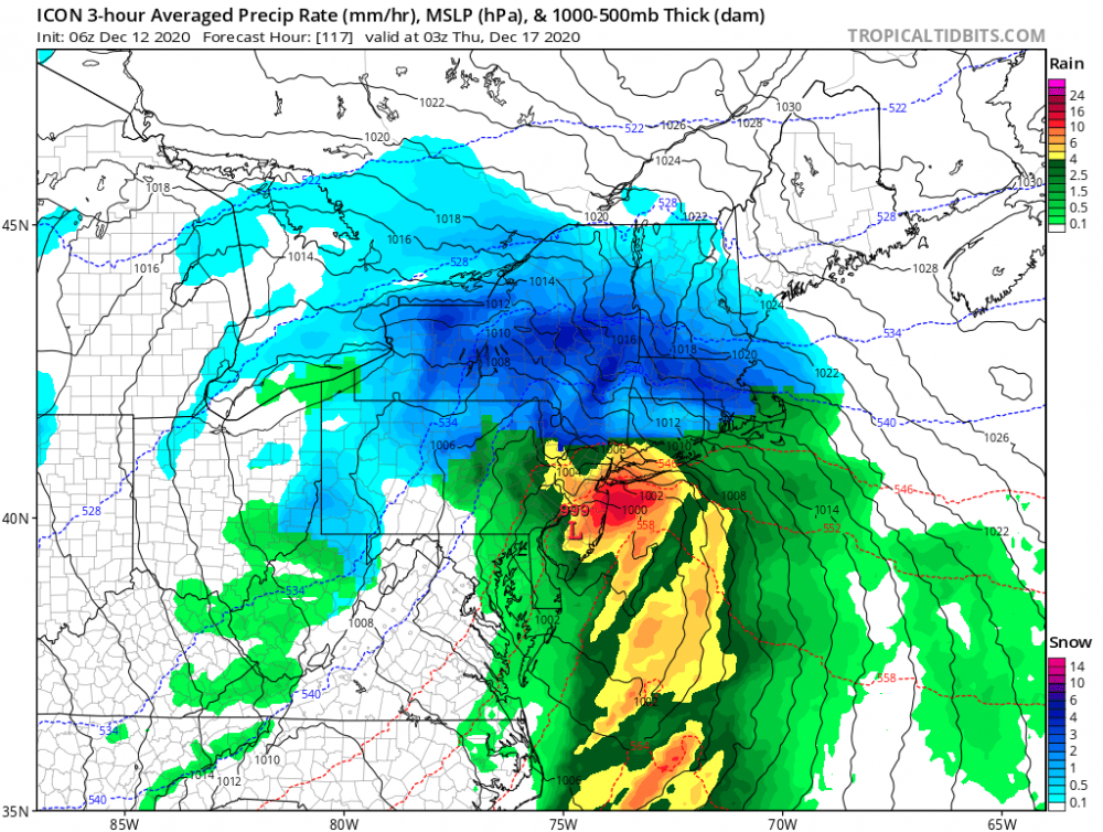
5 days to go is an eternity for a system like this. GFS at 6z was also NW by a good bit. For our area we just need a couple of things to happen. The High position is off allowing for the primary to drive further North. The system isn’t as wrapped up allowing for a larger moisture field. The Euro at 12z had about .4 LE of snow for Binghamton - 0z had 1” plus and there are DAYS to sort this out Having done this for 30+ years I know well enough to not give up! Are the odds against us now? Sure. But modeled snow is just that... FWIW - I also lived the first 39 years of my life in NJ/PA near 95, so I know heartbreak with storms like this as well as most! EDIT while a terrible model the 6z ICON shows what’s still possible and how it could happen. Run a low inside NJ that’s less consolidated than the Euro and we see many inches of powder. (2nd image)
-
Close to a crusher for all up here. Long way to go