
medmax
-
Posts
344 -
Joined
-
Last visited
Content Type
Profiles
Blogs
Forums
American Weather
Media Demo
Store
Gallery
Posts posted by medmax
-
-
-

Meanwhile a few miles north of MDT...-
 1
1
-
-
Is there a coastal SFC low yet?
-
1
-
-

Light to moderate snow here in Hershey/Hummelstown. About 2” on the ground. -
15.5” on 1.4 for KMDT. EDIT THIS HAS BEEN ENTERED
SO ILL GO BIG
19.3” on 1.6 at KMDT
Want to account for a small amount of sleet or snow pellets at some point that I know will come

-
If this where to verify JNS and I could be top dogs. Its looking like a special day for all good luck and stay safe. nothing but love from FHS for this EPIC event.
Sitting here in the Hershey/Hummelstown area having flashbacks to the Kuchera models before the December bust when 20” was reduced to 9” by pingers and dry slotting.
We will see. -
If my house floods, that’s the least of my worries. The capitol will be underwater essentially LOL.
My house is about 35-40 feet above the swatara about 6-7 miles from the Susquehanna. It gets high but we joke that if our house floods so will all of Hershey and Middletown. -
Don’t worry, it the Christmas frontal snow doesn’t work out, we might not care that much, because we are busy tracking this potential coastal storm that could be en route a few days later according to the 12z GFS.
This pattern is loaded with opportunities over the next few weeks!


I’ll take 10” before the NY pls. I’ll take an active pattern over the crappy zonal stuff of last year. -
I read somewhere the NWS is taking the forecast discussion off its site and only available to Mets. Is that true?
That’s terrible! I love the forecast discussion
-
1
-
-
This is what I referred to. JMA and CMC want to hold back energy on this huge artic front. Maybe?

Miller type A? -
ICE STORM: LOL @ 372

Which means rain, right? -
Checking back in [mention]mappy [/mention]. About 5-6” with sleet here near MDT for the past two hours.
So um, same boat.
-MM -
About an hour ago there was a lightning strike here in the Hummelstown/Hershey area
-
Any chance we flip back tonight during waking hours?
*shudders as wind-driven pingers hit the window* -
Any chance we flip back tonight during waking hours?
-
Already up to 6" and now mixing sleet in Middletown
Due north up Middletown Rd along the Swatara near Hummelstown. Similar conditions. Still 50:50 mix, going back and forth. Very dynamic.-
 1
1
-
-
SN+/Pingers mixing in Hershey/Hummelstown area.
-
That portion of the disco hasn't been updated since about 10 last night. However, overnight and early morning guidance (6z) have continued to support that notion of a 24+ axis somewhere between I-99 and I-81 northeastward toward the Poconos. Exactly where is likely going to eventually be determined by today's near term guidance as the event unfolds. Still trying to adjust to the fact that we're trying to pinpoint the highest totals within a nearly region wide foot plus in all guidance for us haha.
I think CTP has a good handle with their current snow map. I do like that general area of Lewistown to Selinsgrove up to Williamsport for the best opportunity to get to two feet or perhaps beyond. For State College I'm thinking 14-18", but definitely a shot to get past 20 or so. Gonna depend how far back those CSI bands set up the first half of this evening, and to a lesser degree how well the storm accumulates rate and ratio wise during the WAA phase of precip today. If State College does get into the thick of it, I'd look at the 7 mountains region of US 322 between there and Lewistown for something ridiculous. Again, this is pinpointing where these excessive totals might pop up within the general 10-20" this whole region stands to see.
Making a fairly safe call of 14-16" for the backyard (Altoona), it's weird saying that much is a "safe" call haha. They're sort of in the same boat as State College with perhaps the outside chance of seeing 20.
How do you think we do near MDT? Not sure how much mixing we are gonna get here. Also some models show dry slotting
-
1
-
-
ha! all good. we dont mind people dropping in to check out met's thoughts and what have you, but we won't be talking about PA snow very much down here, and many won't even be welcome to entertaining posters from the area. Just something to keep in mind

No worries! Wishing you guys the coldest of vertical columns all day long today and tomorrow...-
1
-
-
And for those popping in from PA, thanks for stopping by! Just remember this is a very DC/Baltimore centric forum, so don't be surprised if we never talk about PA and shun your snow
 . But here's a local met's snowmap for you
Tapatalk gives me these highlighted sub forums to select from and I hadn’t realized this one damn time I clicked into MA instead of NY/PA. Sorry guys. Haven’t been back to this forum for a few years. When I lived in Boston, I was a regular to the SNE forum. Native to York (Dover), PA. FWIW, my car is from Owings Mills, MD[mention=5196]medmax[/mention]...it was a bit of an inside joke. My kind take? South Central PA isn’t part of this forum and the majority of people here won’t see a significant storm. I’d wager that many of those people don’t care to hear about how much of a “pummeling” the mountain dwellers in the Blue Ridge receive, let along folks outside of our forum. INCIDENTALLY, It just got its winter tires on last week!

-
See what you did?

-
Well I’m prob equidistant from MDT and Hershey as the crow flies... so I’d be very interested as it applies IMBY
[mention]mattie g [/mention] not a regular so I think I’m doing this right
-
Well I’m prob equidistant from MDT and Hershey as the crow flies... so I’d be very interested as it applies IMBY
-
I’m in Hershey. Yesterday was jackpotted here. Now I’m not sure what the hell to expect. Trend early in the day was westward. Now it seems more of an oscillation between models. Guess... we nowcast?
My prediction is 10-30” of some sort of mostly frozen precipitation.-
1
-


Central PA - Jan 31 to Feb 2 Winter Storm
in Upstate New York/Pennsylvania
Posted
Guys... used my ego snowblower for the first time. Soooo cool.
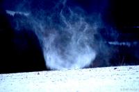
The air outside smells like we are in for a big one.
See you tomorrow...