

KAOS
-
Posts
1,499 -
Joined
-
Last visited
Content Type
Profiles
Blogs
Forums
American Weather
Media Demo
Store
Gallery
Posts posted by KAOS
-
-
-
3 hours ago, H2O said:
Wind howling. It knocked over a couple bags of leaves. Why isn’t there a state of emergency?
Seriously... there was a bag of trash floating down my street.
-
 1
1
-
-
4 minutes ago, NorthArlington101 said:
GFS didn’t really shift south any but some of the heavier stuff is more spread over the MD/PA border and trails down into DC. Suggests 1” is achievable in PSU land with somewhat cooperative temps… snow TV should make it down to DC.
I am cool with snow TV given my location. Honestly, that would be the best case scenario. IMO
-
12 minutes ago, stormtracker said:
Hey gang! Hope next week works out. Unfortunately, I will not be on this journey with you mofos...I'll be in fucking South Carolina for Thanksgiving. But just know, I'm tracking with yall. Let's get the band back together! It's about time!
I hope we can fire up the bus and get a radio show going this winter. Cheers!
-
 1
1
-
-
37 minutes ago, Scraff said:
Pink lightning!? I want some of that! Or I’ll just keep drinking.

I just saw purple lightning. Maybe I should start drinking?
-
 1
1
-
-
-
Rattling my house... and this house almost NEVER rattles.
-
-
And now thunder with more flashes...
Also, it is raining moderately.
-
just now...flashes of lightning in the dena.
-
2 hours ago, NorthArlington101 said:
This is such an unbelievably cool passion project! Thanks for all the resources!
Thanks for the kind words!!! That means a lot.
I am glad you, and hopefully others, are are enjoying it. Otherwise there would be little point in sharing it here.
Now I need to figure a way to get the search location passed to the other pages such as the Forecast Map. That should also remove the geo-location loading screen for all pages but the Main (Forecast) page.
I have an idea....
Edit: I figured it out. Now just have to re-write a bunch of code.
-
1
-
-
Search added. As you can see, we are global....
-
1
-
 1
1
-
-
Winter Storm Watch issued November 19 at 5:14AM EST until November 23 at 7:00PM EST by NWS Baltimore MD/Washington DC* WHAT...Heavy snow possible. Total snow accumulations of 6 to 12 inches are possible with locally higher amounts along the ridgetops. Winds could gust as high as 50 mph. * WHERE...In Maryland, Garrett County. In Virginia, Western Highland County. In West Virginia, Western Grant, Western Mineral, and Western Pendleton Counties. * WHEN...From Thursday afternoon through Saturday evening. * IMPACTS...Visibilities may drop below 1/4 mile at times due to falling and blowing snow. This may lead to whiteout conditions and may make travel difficult. The strong winds and weight of snow on tree limbs may down power lines and could cause sporadic power outages.
-
Added threats to main page...
Going to add a global search function next
-
Added floating header and footer to pages.
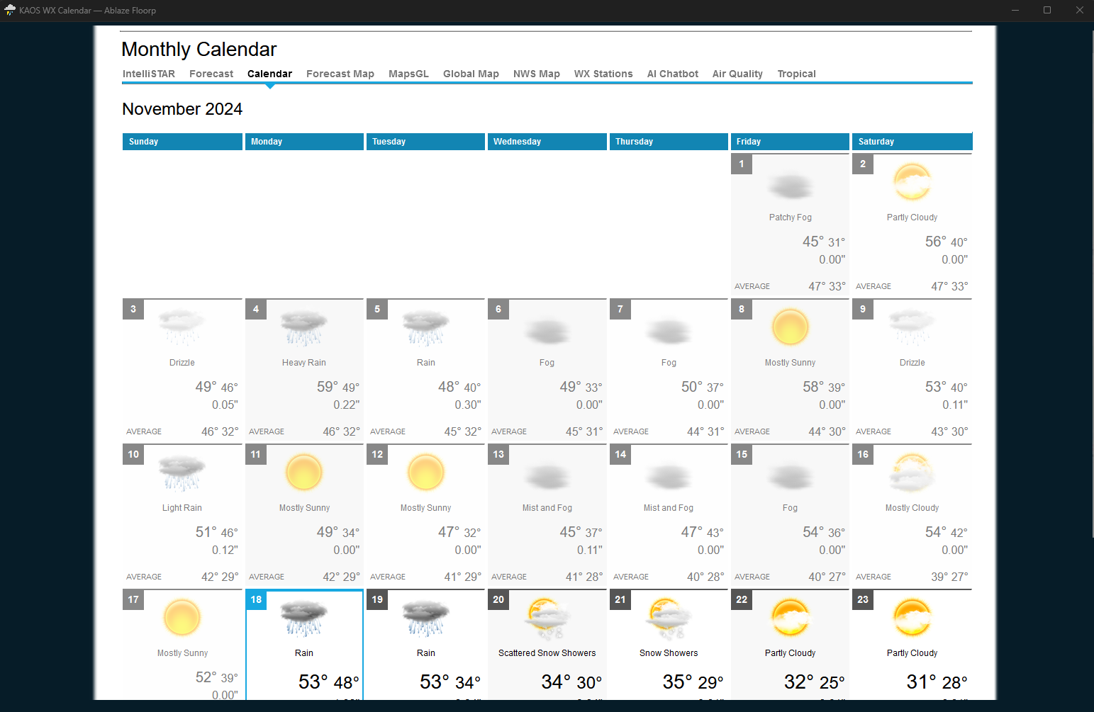
I'm going to add a calendar....
-
1
-
-
-
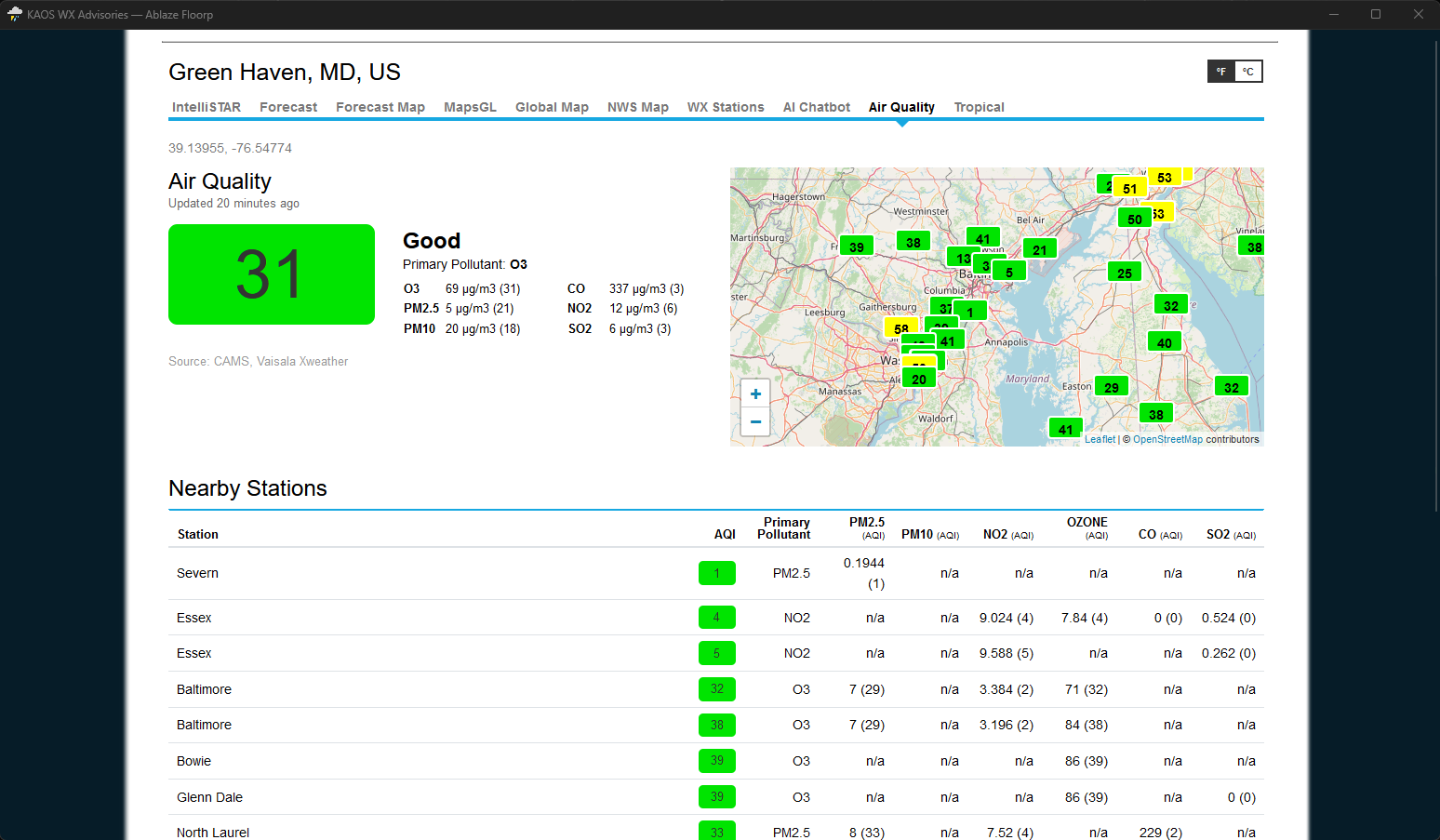
I have added an Air Quality page....
-
1
-
-
All pages have been updated to new "theme" shown in the post above.
-
1
-
-
-
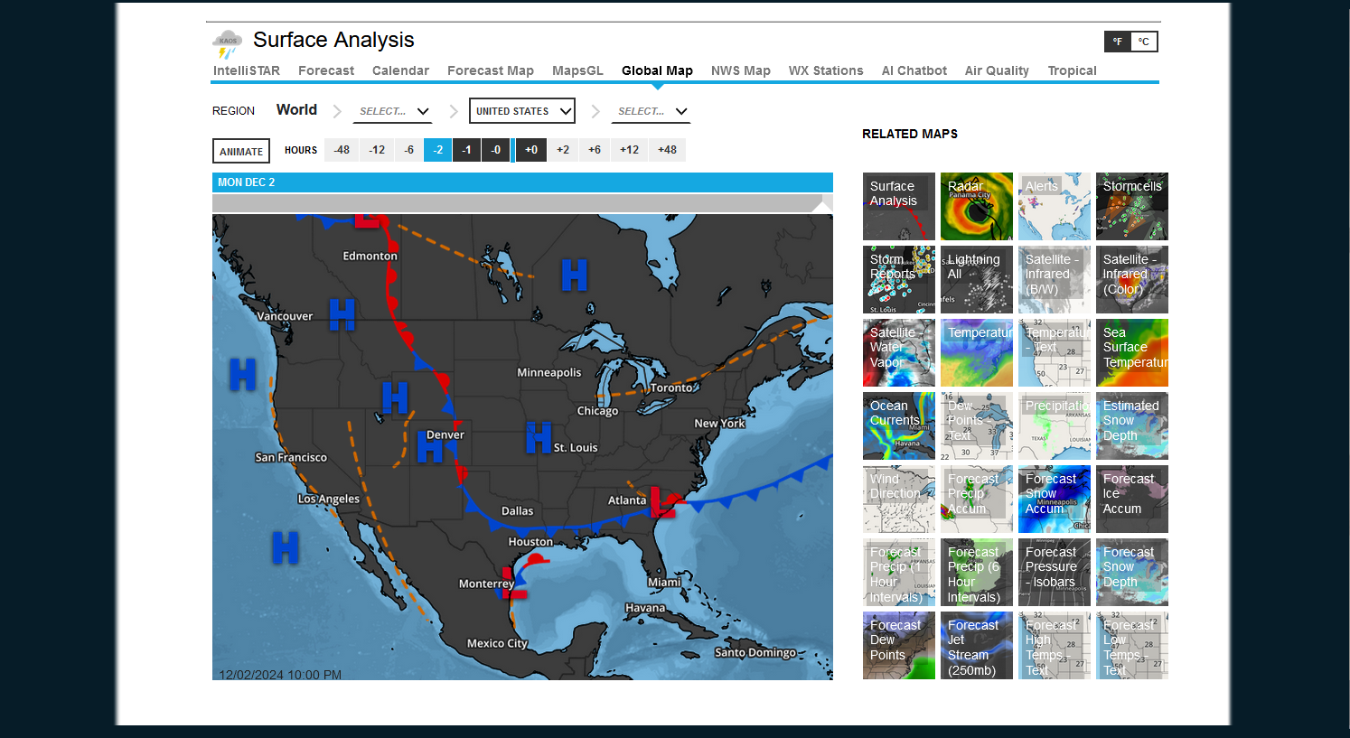
I am thinking the QPF/Radar Label should be renamed. Combined?
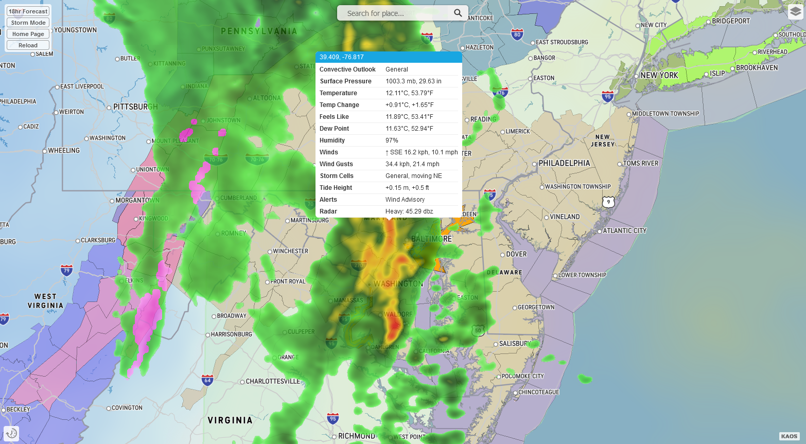
It consists of the following layers...
fqpf-accum-gfs:80,fqsf-accum-gfs,fice-accum,fpressure-msl-isobars-gfs,fradar-gfs
Edit: Changed most of the tab labels and positions. Added options for kuchera and 10to1 ratios.
-
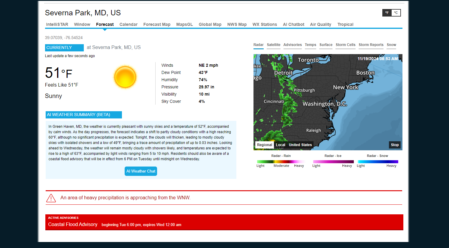
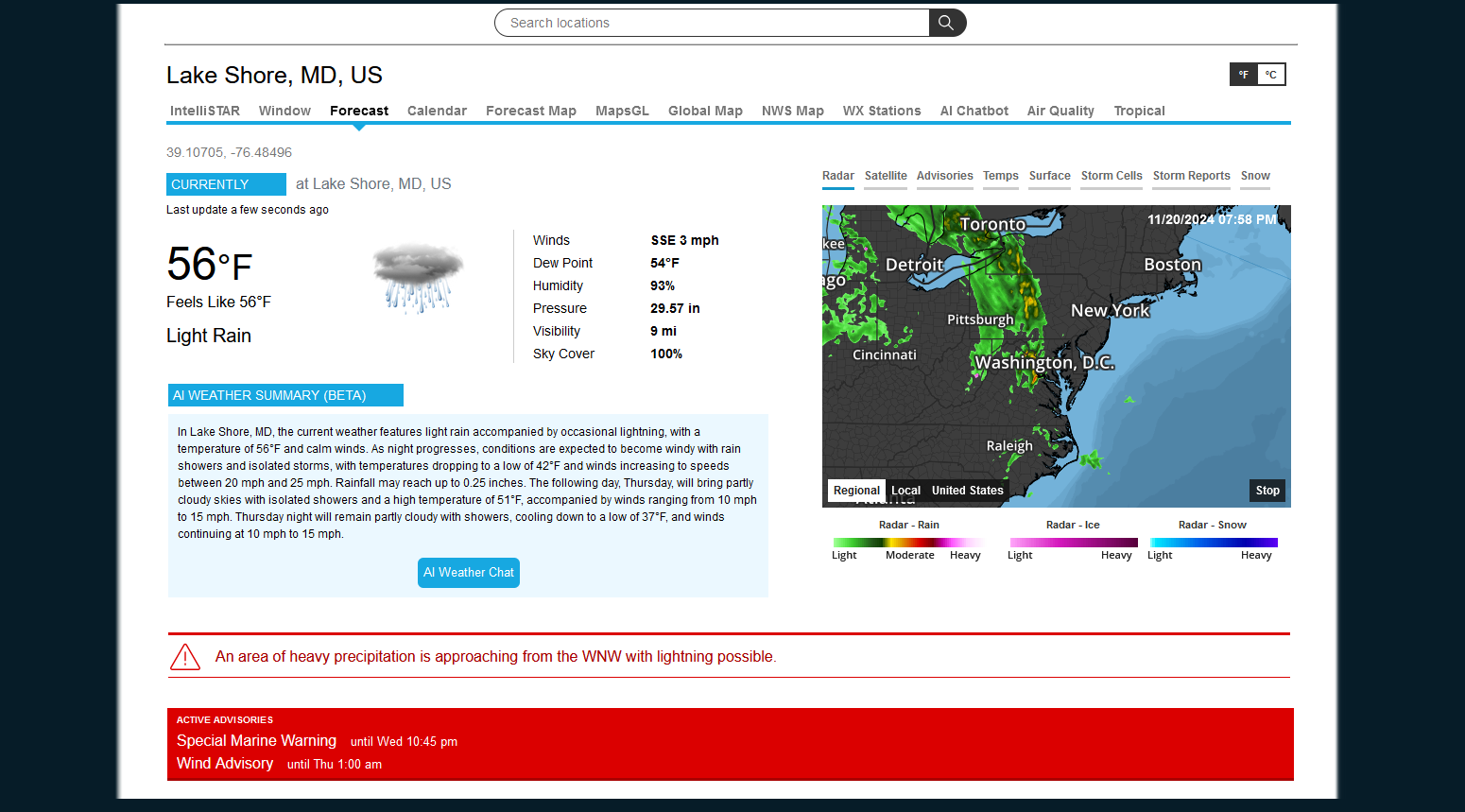
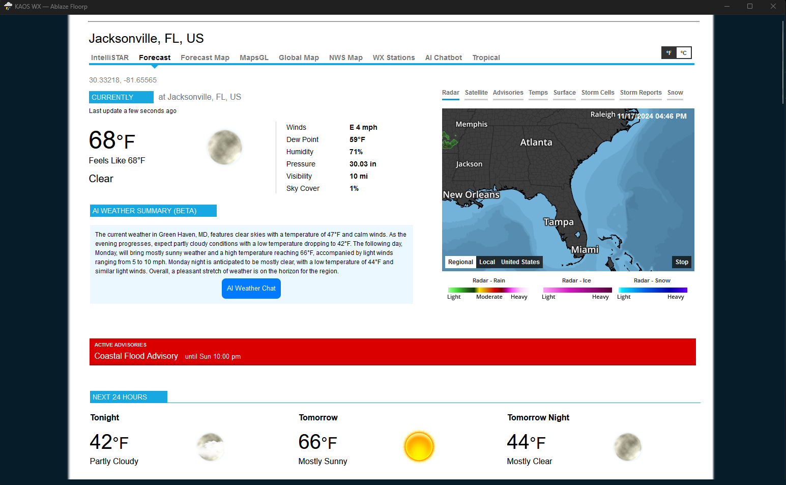
The current weather as of 11 AM on November 15, 2024, is mostly cloudy with a temperature of 50°F and calm winds.
-
Advisory view on forecast page now shows a summary instead of details. Details are provided via a modal (popup) window.
Tropical has been moved from the forecast page and now has its own page.
Removed advisories page since all that info has been incorporated into the forecast page.
Some maps, etc. have been changed within the intellistar emulator (desktop version).
Many small updates.
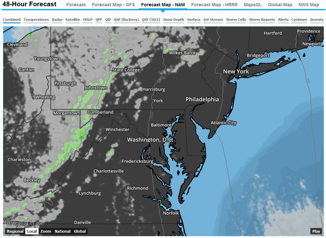
Next I may work on providing NAM and HRRRR model data to the 48-Hour Forecast Map. Currently using GFS.
I am open to suggestions and as always, let me know if you encounter any issues.
Direct link to 48-Hour Forecast Map....
https://kaosfactory.github.io/wxblox/geo3.html
NAM and HRRR have been added.
So now we have GFS, NAM and HRRR models.
-
23 hours ago, Solution Man said:
Nice job
Thanks! It has been a good deal of work.... but as always, I will continue to make "improvements".
-
There are currently three active storms in the tropics:
1. Tropical Storm Man-Yi
- Location: Coordinates 10.6°N, 136.6°E
- Maximum Wind Speed: 93 kph (58 mph)
- Active As Of: November 14, 2024, 3:00 PM (GMT+9)
2. Super Typhoon Usagi
- Location: Coordinates 18.8°N, 121.6°E
- Maximum Wind Speed: 241 kph (150 mph)
- Active As Of: November 14, 2024, 8:00 AM (GMT+8)
3. Tropical Storm Sara
- Location: Coordinates 15.7°N, 82.9°W
- Maximum Wind Speed: 64 kph (40 mph)
- Active As Of: November 14, 2024, 12:00 PM (GMT-6)-
2
-
1
-
11/21-22/24 Little Something.. But first flakes for quite a few.. MAYBE
in Mid Atlantic
Posted
Snow is very close... hoping to get something before rain. It is going to be a close call.