

eaglesin2011
-
Posts
819 -
Joined
-
Last visited
Content Type
Profiles
Blogs
Forums
American Weather
Media Demo
Store
Gallery
Posts posted by eaglesin2011
-
-
Most likely still Snow Globe TV for most of the area, if your up in the Early Moring hours.... Temps prob wont even get to freezing in most of the area... So wherever the banding sets up is going to be key if we get any accumulation......
-
 1
1
-
-
My guess is that we get a a few hours of snow globe flurries or snow showers because of moderate temps & not much moisture .. but hey if a dusting to inch out of it I would call that a win.. .lol
-
1
-
-
4 hours ago, Stormpc said:
Glimmer is accurate. Looks like it's OVER to me. Especially SE of RIC.
Yep, looks like it could be over for thiis month unless we can get a coastal to form & draw in more cold air with one of these systems before the 25th..(even that would prob bring a changeover at some point) the cold air just refuses to come down this way & the precip for early next week looks like to be trying to leave the building now too) A snow shower on the 17th maybe it for awhile around here....
-
 1
1
-
-
Long ways out still.. I still am ignoring next weeks V Day storm for here.. Maybe we will get some snow tv for a few secs at best (IMO) but again, looking to see what happends behind it and how much cold air it brings in is going to be Key....
The 19-20th storm could be a real boom or bust too... I Like the area it is in now but by this time next week we should have allot better idea of what may happen...
-
3
-
-
Problem is the cold air just hasn’t set in & may not completely for any of these storms…
The V Day storm is pretty much certain to be all rain here. Hopefully it will start to pull the cold air down after it.. Then set up the storms starting next weekend…
We also don’t want the 20th storm to go too far north .. could start & then end as rain if that happens..
Hate to say it but probably won’t know allot more until after the V day storm passes…
At least there looks to be a few more chances in the upcoming weeks…lol
-
Yep…A bunch of teaser systems now showing up on the models starting the night of the 17th through the 22nd. Would still like to see more cold air move in.. Especially if one of these develop more into a coastal as depicted above.. We rarely ever avoid a mix/ changeover when that happens..
-
1
-
-
Hell for how the last few years have been I’d cash out now for that result in a second if I could.
Especially with the marginal temps still on the 19th…
-
2
-
-
Yeah, I saw the 19th chance too .. I would like to see a few models in a row keep the snow chance around before calling it a real possibility…
-
1
-
-
Seems about right to me.. The cold air just isn’t there.. I wouldn’t expect anything wintery around here until around the 22nd the way things are looking right now…
-
1
-
-
nice snow glob snow shower going through Virginia Center Commons
-
2
-
-
got a very light dusting in my part of Glen Allen ... could get another flurry/ snow shower later but wouldnt count on anything more then that...
-
1
-
-
current radar looks decent but really means nothing until goes over the mountains/dry air.....
-
1
-
-
Yep.. Clouds moving into the area now so temps should start to drop now... See if this area can get lucky with a heavy band tommrow morning & avoid the dry air.. Not like we are missing much if it dosnt happen...
-
3
-
-
Honestly, its not certain yet in the Short Pump area ..Could still be nothing .
At this time... Wrost case senerio looks to be 1 to 2 inches, mostly on grassy surfaces...
-
1
-
-
agree that should be no reason to cancel ...Just saying it could still snow going to depend how the two systems come togehter and the timeing/temps..
-
 1
1
-
-
24 minutes ago, RVAman said:
There will not be an inch or anywhere close to it. We may not even see any snow at all. Meeting will be fine buddy.
May not have anything at all but still could get snow in this area.. Its far from certain at this point but either way its shouldnt be anything major, since temps are expected to be right around freezing or above for most of this event in this area .....
-
1
-
-
After this weekends cold shot, I personaly think we are done in this area with any accumulating snow chances for the month…
However a few degrees/miles could be the difference again for the Thursday night / Friday storm… Tomorrow’s high temperature will give us a good indicator of what may come( if anything) if it dosnt warm up as much as expected for those of us just north of Richmond metro..
-
1
-
-
Probably will warm up just enough to avoid any more snow (except possibly on the very back end of that precip)
-
1
-
-
Yep hanging on to the back edge . Still coming down nicely at the moment
-
1
-
-
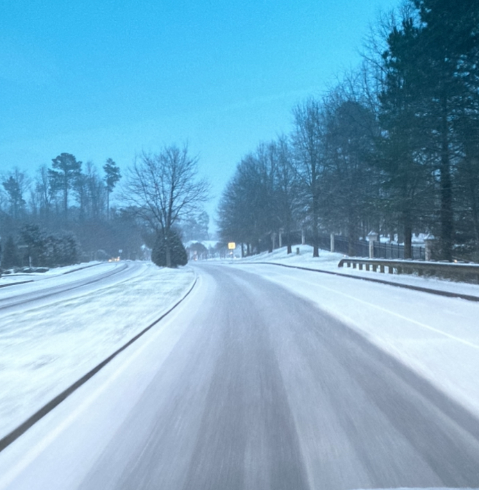
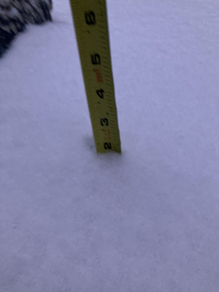
Getting close to 2 inches here in Glen Allen 295 /Staples
breaks the streak at least

-
6
-
-
Big last burst started to cave the roads right as this starts to pull away ..
-
2
-
-
Looks like that maybe it for accumulating snow here.. At least we got a decent dusting …
pos freezing rain in early morning hours… Travel still could be interesting in the morning at least on the back roads
-
Big flakes now hopefully the turnover holds off a few more hours.. definitely on the line for sure
-
1
-
-
It prob will turn back over from sleet and rain to snow /sleet rain a few times depending on intensity . Again a few miles is going to make a difference of what everyone gets. It’s back to light snow here in my part of Glen allen at the moment
Richmond Metro/Hampton Roads Area Discussion
in Mid Atlantic
Posted
Seems like allot to write for something that has virtually no chance of happening but hey, guessing your use to doing it for this forum at this point… lol