

eaglesin2011
-
Posts
885 -
Joined
-
Last visited
Content Type
Profiles
Blogs
Forums
American Weather
Media Demo
Store
Gallery
Posts posted by eaglesin2011
-
-
1 hour ago, RIC Airport said:
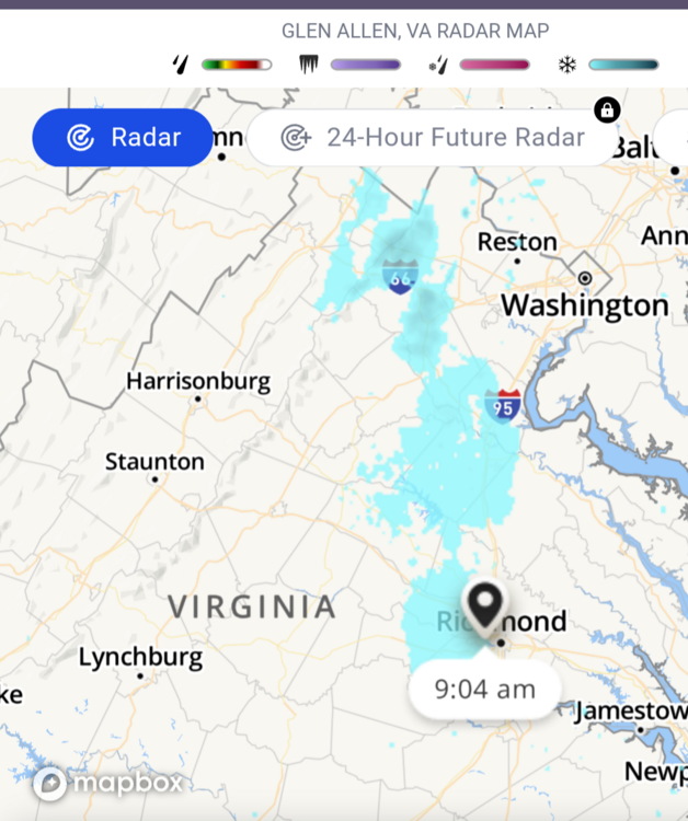
It looks like the storm total at Richmond will be 2.60", a new daily record. The CLI will be sent around 1:30am, but if that is correct, today will go down as the 2nd wettest January day on record.
The below dates featured the previous top 3 wettest January days at RIC.
Date	         Value
01/06/1962	 3.31"
01/23/1935	 2.51"
01/28/1952	 2.07"
Also, RIC had a wind gust to 59mph at the 9pm ob so the higher winds that the NAM showed yesterday looks to have verified, at least in spots.
This event is far from over the rain maybe but not the wind.. Pretty sure I just had the highest gust yet come through and knocked out my power for the first time for a few minutes…
schools already calling off for tomorrow…
Next week is starting to look interesting starting on Mlk day/night
-
 1
1
-
-
Right now its just not cold enough to have anything last for more then a few hours around here...
We may get lucky over the weekend & get a quick dusting( only to have it washed away)but most likely it wont even turn over long enough to do even that .....
The 15th-20th looks to be at least cold enough air for something to happen... So we will see....
-
1
-
-
I be willing to bet it turns back into a hurricane at some point even if short lived… once it gets off the coast..
20 minutes ago, Normandy said:The only mildly interesting thing to watch is if Idalia gets off the coast earlier and / or unexpectedly depeens. Other than that the main show ended and everyone is decompressing I’m sure.
-
 2
2
-
-
The surge and flooding is going to be the real story of this storm for a larger area then the wind … Even when it gets up to SC
https://waterdata.usgs.gov/fl/nwis/rt
https://waterdata.usgs.gov/sc/nwis/rt
https://tidesandcurrents.noaa.gov/stationhome.html?id=8727520
https://tidesandcurrents.noaa.gov/map/index.html?region=Florida
wouldn't doubt that some of the outer bands make it into SE VA …defiantly a few quick spin up tornados will be around most of the day with the outer bands as well....
-
The surge and flooding is going to be the real story of this storm for a larger area then the wind … Even when it gets up to SC
https://waterdata.usgs.gov/fl/nwis/rt
https://waterdata.usgs.gov/sc/nwis/rt
https://tidesandcurrents.noaa.gov/stationhome.html?id=8727520
https://tidesandcurrents.noaa.gov/map/index.html?region=Florida
-
can defiantly see the overall size starting to increase.. means more precip in a wider area .. especially down the road

-
3
-
-
Most storms this season haven't missed. It's just been just been too damn warm
-
Yeah, another storm where it will be very warm just hours before the storm..
We will see what happens. But hopefully don't lose the precip again before the temp drops.. Probably won't know know exactly what will happen untill Sat evening lol
-
A little bonus streaker dropping in for some of us , for the next hour
-
What radar are you exactly looking at that dosnt show the light snow on it?
Looks like the 2nd band southwest of us is drying out so who knows if we will get anything else in this area after this first batch comes to an end
-
Doubt it will last much past 3am here. We are back to the light/barely accumulating snow here for now. Looks like we will have a break for a bit, then hopefully we can avoid the dry air and get the 2nd batch to fill in coming up from the southwest part of the state if it doesn't die out. Prob about 1/2 to an inch here in Glen Allen
-
Back to Moderate snow here in Glen Allen prob getting close to an 1/2 lol

-
2
-
-
The heavy Bands make all the difference for sure.. hopefully we can hit another one b4 the storm heads out and the dry air moves in
-
Yep, looks like we hit a nice band, roads starting to get covered here in Glen Allen .. band seems to be moving east into RIC, so back to light /smaller flakes for the moment here
-
Yeah, starting to mix but if course it dosnt matter when it's still 39
Need some heavy rates now ..lol
-
1
-
-
Just rain here in Glen Allen.. looking a tad better with precip so we will see
-
The cloud tops have lowered, definitely darker out there now..
-
Well we will find out how good the models really are in the next few hours . The temps are still is in the mid 40s anyway, but models are showing dry air moving in right when the heavier precip gets to this area and basically put up a wall around the Richmond area.
-
Gonna need to cash in during the transfer here. The 6pm -10pm timeframe will be key hours here if we get anything measurable or not, most likely...
(Assuming the models are right and the dry air takes over again)
-
It's more where the storm is developing and yet again we are right in the middle of the two storms. So dry air is what is the killer again as the Main storm transfers over to the coast..
We could get lucky if we get a good band to hit but the models have all been showing the transfer point for the snow right around this area . Owell enjoy the pics from the north/coast if none of you are heading that way
-
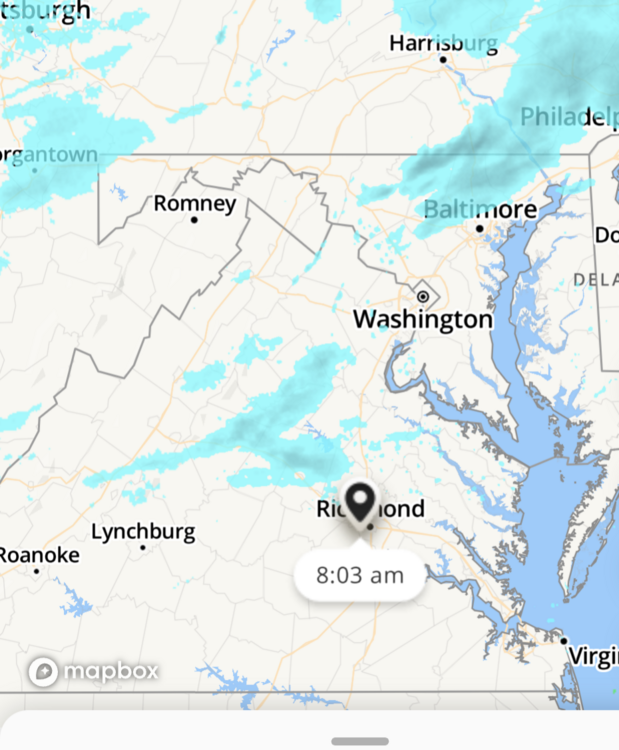
Not gonna be fun looking at the radar for the next day or so.. It's gonna look something like this for this area. Just getting fringed & missing most if not all of the good precip.
This current one now, looks like a runner sprinting away from our area .lol
F Dry air .lol

Let the radar hallucinations begin
-
With this next storm we could still get zippo even if the low moves closer, because of dry air/phasing of the possible two lows..
If we can get over 2 inches ... I'll call that a win with this one, guess we will find out soon .
-
12 minutes ago, RVASnowLover said:
haha. You got it all wrong. Am I snow weenie? Heck yes! But I’m realistic that this is Richmond and around here you have to take whatever you get.
I was being kinda sarcastic.. We all know it takes a village to get a decent snow here..
Talk to me when it's actually snowing/exceeded the amount on the long range Lol
-
35 minutes ago, RVASnowLover said:
12z suite not going to get it done. Looking at 1-2”, maybe 3 if we get lucky
Lord, your obsessed with getting a big storm... Be happy with the models 1-3 prediction's and hope we don't get dry slotted all together..


Richmond Metro/Hampton Roads Area Discussion
in Mid Atlantic
Posted
Been looking at this timeframe for awhile now…guessing after Friday’s storm clears the models will come in more of an agreement… It dosnt look like anything major but looks like it will break the streak of no Accumulating snow in this area..
Hopefully we can get it come through overnight.. wouldn’t mind a little more south trend at this point too…