CASH_COOP
-
Posts
410 -
Joined
-
Last visited
Content Type
Profiles
Blogs
Forums
American Weather
Media Demo
Store
Gallery
Everything posted by CASH_COOP
-
Fixed
-
@MAG5035incoming !!
-
Only managed 0.17” qpf. That’s rough
-
I went out around 5 and the only road that was snow covered was Bullfrog Rd.
-
2.9”. Bust
-
Same here. High gust was 36
-
The active wind advisory covers up the watch for other counties
-
Somerset to Lancaster Counties. 3-6”
-
4.8” was final at the house. About the same here at Fairfield course. Lots of branches down
-
Not bad. EJ reports 3” in Emmitsburg less than 10 miles away. I’m closing in on 5” here
-
That means MDT should at least report 2” storm total.
-
Gettysburg school district just closed for tomorrow.
-
RAVENS Yes there’s Ravens fans from PA!!
-
Went from 6 to 12 in 6.9 seconds
-
Good starting point. Just need a Cashtown jack. When that shows up we can take models serious.
-
Time for the big daddy hat?
-
Yeah, when I’m out driving around I’ll look around at how people install these home stations ( on roof tops, next to black top driveways etc). I hope they don’t take their observations too seriously.
-
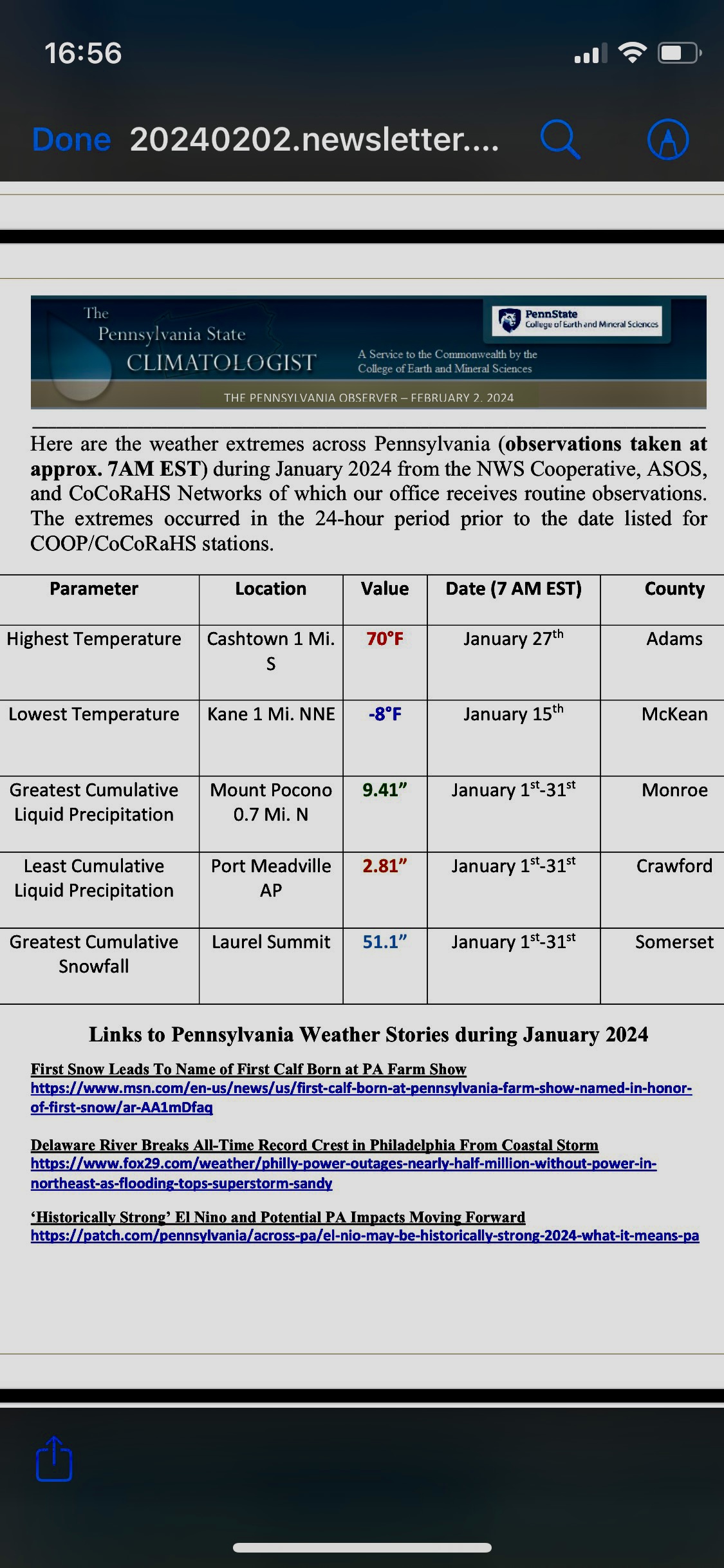
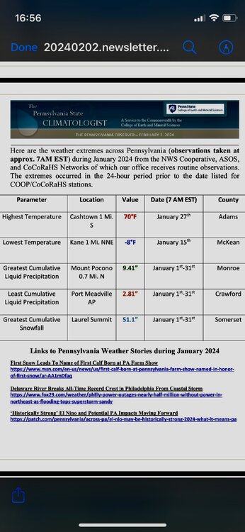
Cashtown takes the prize for warmest temperature across the state for January. Not exactly what I was rooting for.
-
I measure off of 2 snowboards that are cleared off every 6 hours
-
M4.1”. Snow depth is 7”. Marking this storm down as a win!!
-
This has been a great winter week. Snow on snow, temps below freezing. Liberty mountain has to be lovin life.
-
Just hit 3”. Still mod snow at 23 degrees.
-
Me like
-
Livin on the edge
-
No kidding. Pretty cool.