

mattskiva
-
Posts
490 -
Joined
-
Last visited
Content Type
Profiles
Blogs
Forums
American Weather
Media Demo
Store
Gallery
Posts posted by mattskiva
-
-
4 minutes ago, yoda said:
Eastern Loudoun cell looks interesting
Under it right now. Rain, some wind but nothing spectacular, a little thunder, no lightning.
-
Just now, Deck Pic said:
Yeah...I can see how it wouldn't compare to the 5 events where you got less snow
It certainly doesn't compare to the December event where most of Loudoun got a foot.
-
That's a lot of sleet!
(apparently an artifact of the forecast changing from "snow and sleet" to "freezing rain and sleet")
-
5 minutes ago, PWC Split said:
SN+ now in Haymarket as the snow has beaten the IP in the last 5 minutes. Big, heavy flakes falling.
Same in Aldie. Huge flakes right now. SN+
-
1 hour ago, nj2va said:
NWS Pitt going with 4-12” for Garrett County (from south to north), 4-6” for Canaan, and 0.1-0.15” ice accretion (as of their last update which was 3am today).
Not really buying that. I get the idea that any CAD would scour out more quickly (or never exist at all) at 3200 feet, but we're not talking about CAD with the snow scenario, and even if sea level at that latitude is in the 40s, it seems unlikely that the huge different in elevation would result in so much less accumulation in Tucker than in Garrett. In the vast majority of scenarios, Canaan sees more accumulation than Garrett (though there are certainly some exceptions).
-
1.5" Aldie
-
38 minutes ago, EastCoast NPZ said:
Some light snow at times. No accumulation. Nothing but wet ground . Not a storm for some of us south of 70.
Do you do anything but complain? Not enough rain in the summer, not enough snow in the winter.
-
4 hours ago, nj2va said:
Here's the text of the WSWatch for the mountains...should be a fun event there this weekend...hoping this afternoon's Euro with the warmer solution isn't right.
Had plans to go to Canaan, really hard call on what it's going to be like up there. They've gotten rain from a bunch of storms in Dec but above 3,000 feet there might be enough cold for this not to be a total disaster. I like the 2-8 inch forecast... reallly you could almost say 0-12" because it could easily bust high or low up there.
-
Just now, Ji said:
amazing how the blue always just stops short of @leesburg 04 house
And yet somehow Loudoun always ends up near the max totals for the region (with the exception of the more southern storms).
-
3.5” roads are a mess
-
Snow/sleet here now, just over 2"
-
1” here, ripping snow right now.
-
Sounds like things are rough down in the Northern Neck. PDS warning for "flash flood emergency"
BULLETIN - EAS ACTIVATION REQUESTED
Flash Flood Warning
National Weather Service Wakefield VA
952 PM EDT THU OCT 11 2018

...FLASH FLOOD EMERGENCY FOR MIDDLESEX, KING AND QUEEN,
NORTHUMBERLAND, RICHMOND, WESTMORELAND, KING WILLIAM, LANCASTER,
AND ESSEX COUNTIES...

The National Weather Service in Wakefield has issued a

* Flash Flood Warning for...
  Northwestern Middlesex County in eastern Virginia...
  King and Queen County in east central Virginia...
  Northwestern Northumberland County in eastern Virginia...
  Richmond County in east central Virginia...
  Westmoreland County in east central Virginia...
  Central King William County in east central Virginia...
  Northwestern Lancaster County in eastern Virginia...
  Essex County in east central Virginia...

* Until 345 AM EDT.

* At 947 PM EDT, Doppler radar and automated gauges indicated heavy
  rain across the warned area. Three to five inches of rain have
  fallen, and an additional two to four inches are possible. Flash
  flooding is occurring with water rescues reported in Richmond
  County.

  This is a FLASH FLOOD EMERGENCY FOR Middlesex, King and Queen,
Northumberland, Richmond, Westmoreland, King William, Lancaster, and
Essex Counties. This is a PARTICULARLY DANGEROUS SITUATION. SEEK
HIGHER GROUND NOW!

* Some locations that will experience dangerous flooding include...
  King William, West Point, Tappahannock, Warsaw, Montross,
  Champlain, Saint Stephens Church, Robley, King And Queen Court
  House, Callao, Center Cross, Kinsale, Morattico, Heathsville,
  Farnham, Haynesville, Jamaica, Millers Tavern, Newland and Coles
  Point.

PRECAUTIONARY/PREPAREDNESS ACTIONS...

Move to higher ground now. This is an extremely dangerous and
life-threatening situation. Do not attempt to travel unless you are
fleeing an area subject to flooding or under an evacuation order.

Be especially cautious at night when it is harder to recognize the
dangers of flooding.

Please report flooding by calling 757-899-2415, posting to the NWS
Wakefield Facebook page, or using Twitter @NWSWAKEFIELDVA.
-
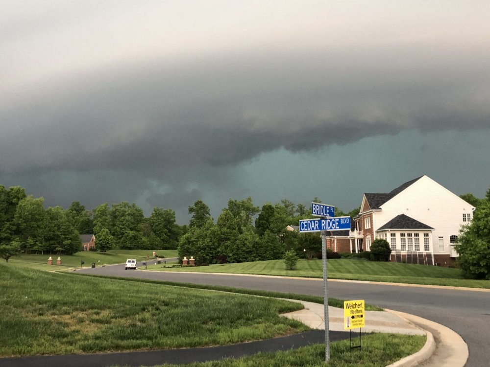
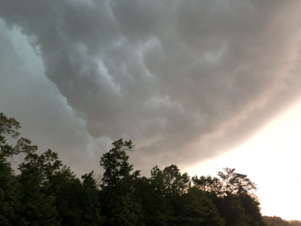
Visible rotation on this cell near Aldie - anything on radar?
-
On 5/29/2018 at 4:57 PM, North Balti Zen said:
It could be the development above the town means that the town itself may have to be largely abandoned - not sure how any property there gets insurance after this.
This, too. Why on earth would any company insure any property in downtown EC at this point?
-
On 5/27/2018 at 9:49 PM, PrinceFrederickWx said:
This x 1000
This is a big issue in my county and a lot of other areas in this state. I had a stormwater inspector here flat out admit to me that they don’t inspect anything in our neighborhood after its completed other than driving through to make sure there’s “general compliance” by the builder. Other states are much more regulated in this regard.
I would frankly find it very surprising to learn that there are states that are more regulated than Maryland, in any capacity. Well, maybe California, but even that has to be pretty close.
-
Just now, smokeybandit said:
Meh
You people will 'meh' anything.
Admittedly, no hail so far at my location, just heavy rain, and not too much wind. But lots of very loud CG strikes very close to me.
-
Very impressive lightning with the cell over my area (near South Riding). Lots of big CG strikes, looks like positive strikes if the radar is to be believed.
-
1 minute ago, mattie g said:
Almost none, which is why I laugh every year at the title of this thread.

It was certainly severe in parts of the area - it seems like the storms may have weakened as they approached the metro. Loudoun, Fauquier and points west got it pretty good.
-
Media reports of a possible tornado south of Dulles, according to family. Anyone else hear this? Would make sense - hearing social media reports of trees uprooted and snapped in half in South Riding, about 5mi north of my location. This was about an hour ago, just getting online now
-
Sky was really unusual as the first storm (the Charles Town cell) moved in here. I would guess we had gusts >70mph based on past storms and what the trees did. Very intense gusts followed by 0.89" of rain in about 30 minutes and quarter sized hail. I think the worst of it was actually to my north, closer to Ashburn.
-
 6
6
-
-
-
78/69 at KIAD, 80/70 at KHEF. I am showing 82/72 about 10mi to the SW of IAD. Much warmer than I expected. Full sun since noon.
-
Snowmageddon 1 without a doubt. Living in Loudoun County, we got a foot more snow out of that one than '96.
I do remember '96 fondly, though. The negative for me in that one was that there was a lot more mixing which kept totals down a bit. My parents lived in Carroll County, MD and got crazy amounts in '96.


2019 Mid-Atlantic Severe Wx - General Discussion
in Mid Atlantic
Posted
I'm just on the eastern edge of that cell, it's pretty windy here.