

GoAPPS
-
Posts
163 -
Joined
-
Last visited
About GoAPPS

-
Snowing in Asheville now. 34°.
-
As Met pointed showed above, the GFS and now several short-range models are showing a deformation zone forming as the trough goes neutral and the cyclone begins occluding, wrapping moisture back into the colder air mass on the northwest side of the system. The window is very narrow, so odds are low, but it could surprise some folks with a burst of snow.
-
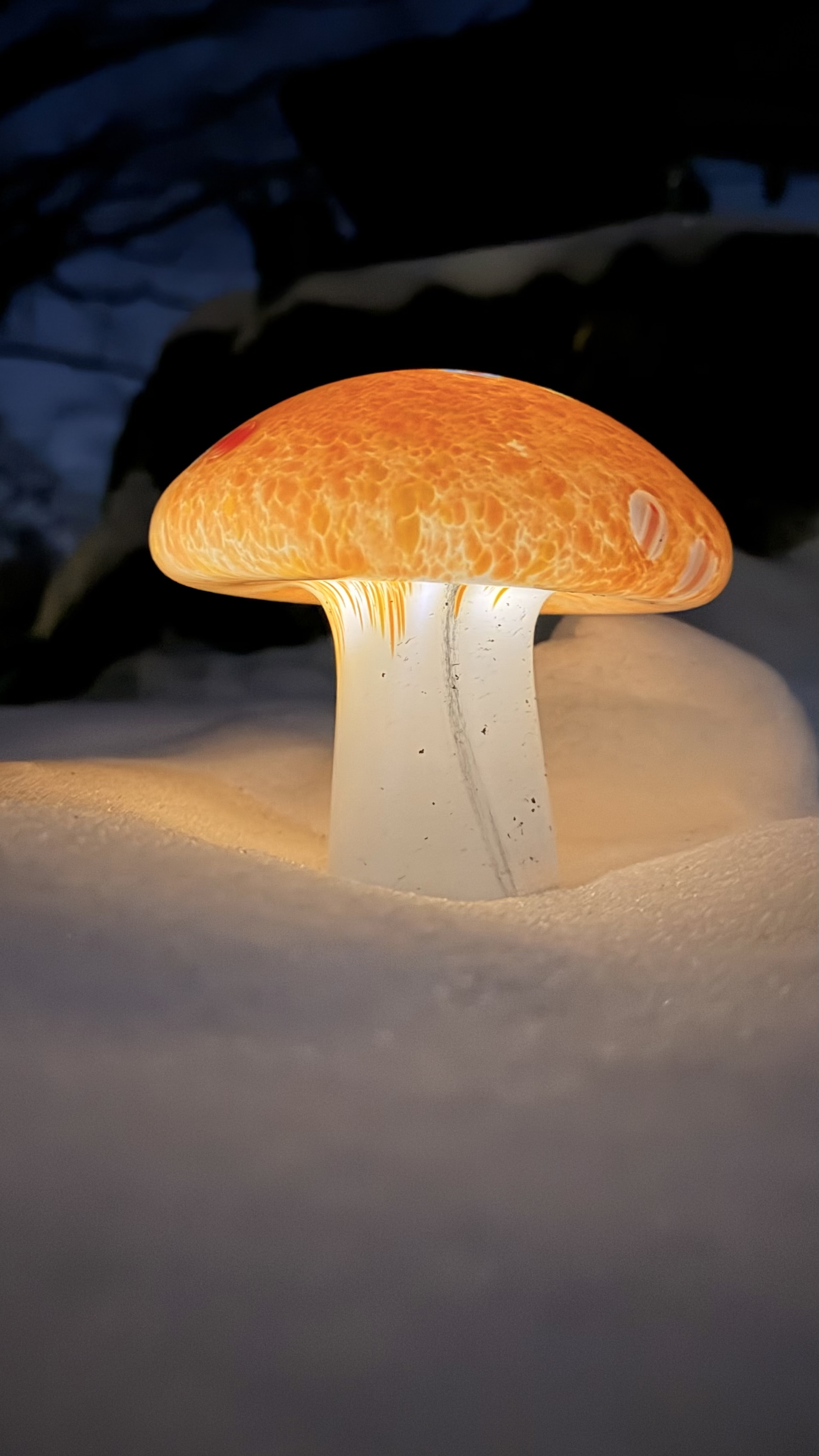
The Costco mushroom yard lights look great in the snow!

-
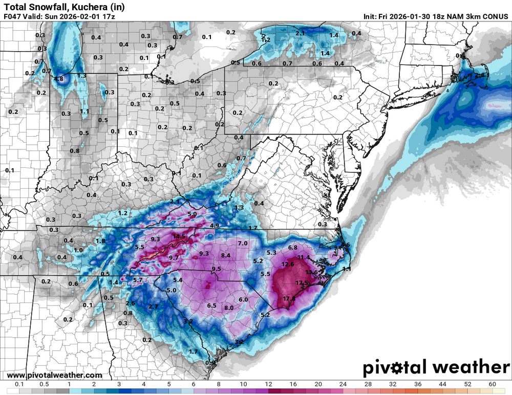
It's only through 1 p.m. tomorrow. Here's through 1 p.m. Sunday. Also adds a good thumping of NWFS for the mountains.
-
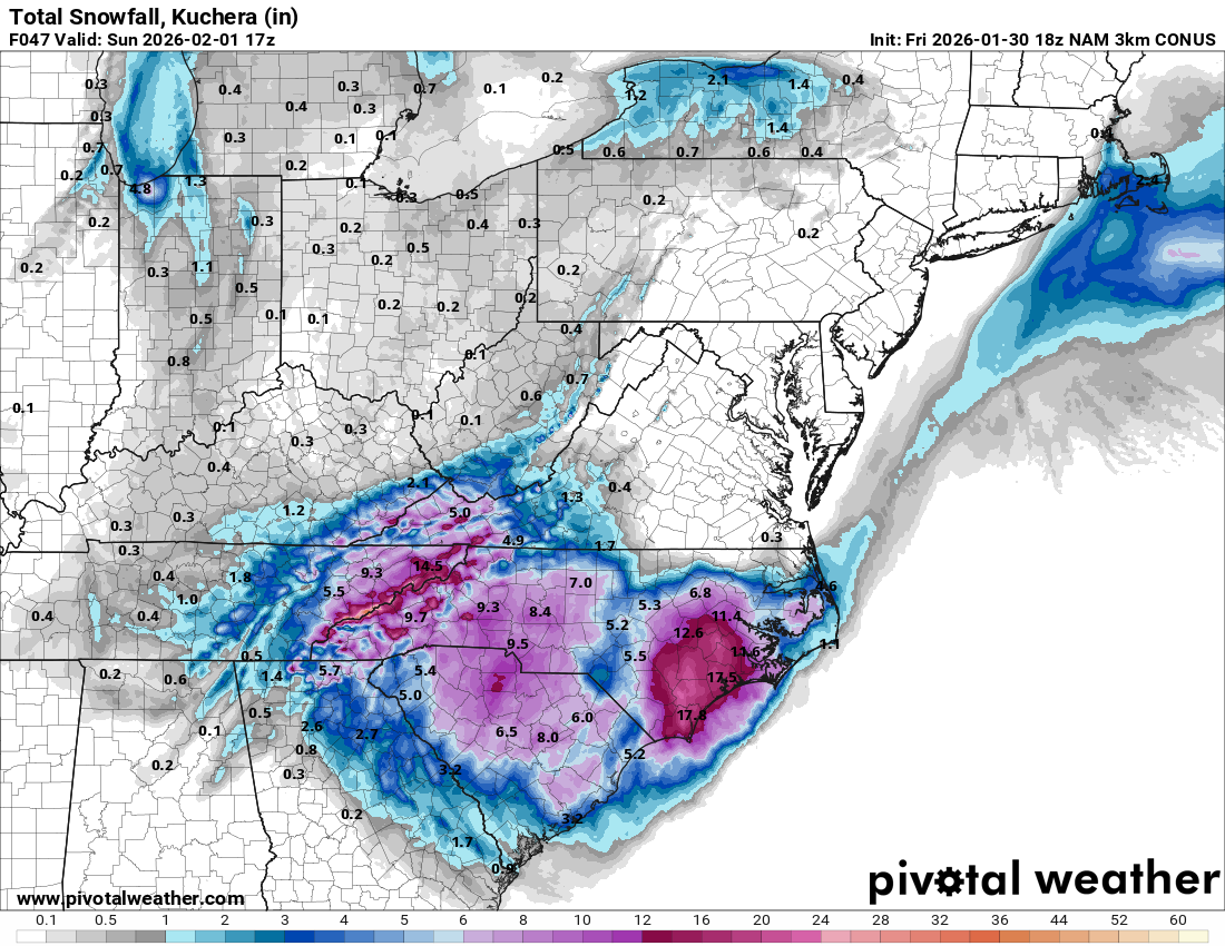
Latest GSP Forecast Discussion has some interesting tidbits. By Saturday, guidance digs the potent upper low in the vicinity of the Upstate as it evolves into a negative tilt and instigates subsequent surface cyclogenesis along a coastal baroclinic zone. The upper low will be anomalously deep with H5 heights in the bottom 1st percentile to near all time record low for the southeast. This will be an unusually cold snow event for the western Carolinas and northeast Georgia with very cold temperatures in place as the snow occurs. Some members of guidance depict temperatures in the low 20s to teens during peak snowfall rates on Saturday and even the warmer solutions keep temperatures at 30 degrees or lower. Furthermore, forecast soundings indicate incredibly cold profiles with a deep dendritic growth zone and plenty of forcing in part from strong DPVA with the upper low. This will result in rare SLRs ranging from 15:1 to 20:1. Surprisingly, guidance is in very good agreement with SLRs with only small differences between the 10th and 90th percentiles. Thus, it won`t take much liquid QPF to realize several inches of snow. The very cold temperatures will also increase impacts to travel with snow sticking very efficiently to roads.
-
That's a good bet, but I'd wait until Friday morning before making a final decision.
-
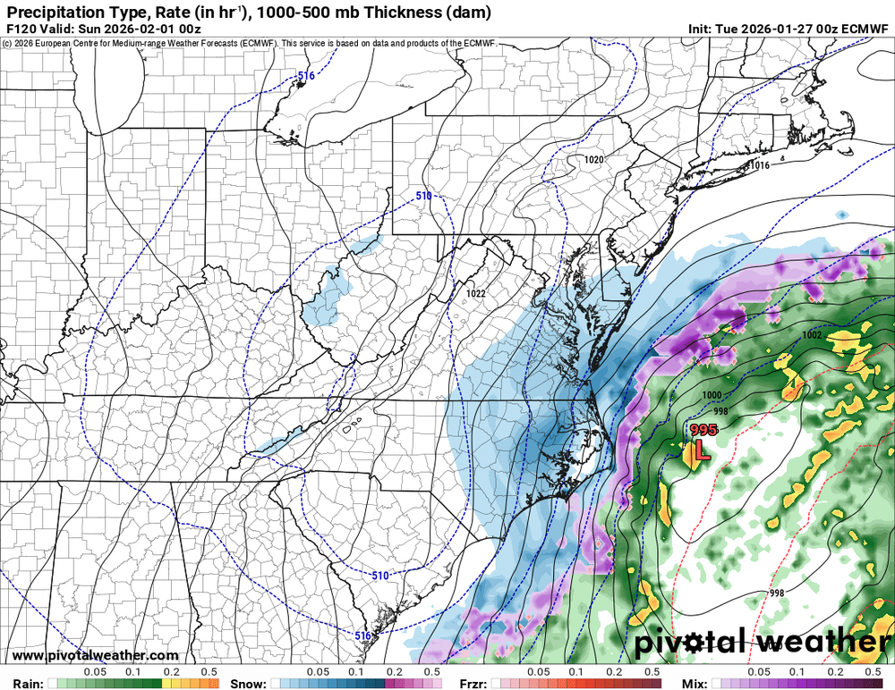
Timing is everything with this weekend's system. The Euro phases the upper low later and farther east, leaving the mountains with cold air aloft but limited divergence and moisture. The GFS phases earlier, allowing stronger upper-level divergence to overlap deeper moisture and throw precip back into the Appalachians.
.thumb.png.f17dd585b2d225e04aa7a57040fc60cd.png)
-
Up to 33 degrees in West Asheville with only a light glaze.
-
I’m guessing those lower totals in the southwest mountains are from the Euro amping the system so much that it changes over to just plain rain? Not complaining, if we’re not gonna get any snow, I’d rather it just be rain.
-
Any thoughts on an undermodeled CAD leading to the surface low tracking further south than modeled?
-
That wind could bump us from a 2 to a 4 or even worse.
-
We better pray that doesn't verify.
-
I really hope this is snow and not ice, not just because ice sucks, but also because Asheville and the surrounding area could really use a break from infrastructure-wreaking storms.
-
I'm really hoping these suppressed solutions don't pan out, though it would be hilarious if Wilmington got more snow than Asheville for the second year in a row. Last year it was 2.6" for Wilmington and 1.9" for Asheville.
-
Next Tuesday is looking tantalizingly close.


.png.b342977ca471a322d61332d123effc23.png)
