

Greensnow
-
Posts
132 -
Joined
-
Last visited
Content Type
Profiles
Blogs
Forums
American Weather
Media Demo
Store
Gallery
Posts posted by Greensnow
-
-
23 here with a sleet and freezing rain mix. More sleet than FRZ so that is good news. Never saw a flake.
-
33 with some 32 readings starting to sprout up. Should be starting to see some mix in the next two hours.
Really worried about ice up here. All models have .40 to .60 and local weather started to highlight the problems once you get close to .50. Still calling for heavy sleet to cut down on ice but we will see.
-
Down to 34 and 33 just to the north of me. Really dipped in the past hour-4 degrees.
-
 1
1
-
-
245 PM Update:
Cold front has slowed to a crawl across the CWA, and currently
runs from somewhere between Elmira and Towanda PA, and more or
less along or just north of the Susquehanna through Broome
County, and up the Unadilla River before curving up into the
Adirondacks. Freezing temperatures are lurking just behind the
front. Despite hovering right around 32 degrees at BGM, we`ve
yet to change over to snow or even a mix. Snow seems to be
struggling to stick to the ground around Elmira and Ithaca.

By 6 PM, we should start to see the cold air drop southeast a
little faster, with the overlying warm nose finally taking shape
behind the front, with mixed precipitation in a strip across
most of Bradford PA and Broome Counties, and on up across the
upper Susquehanna. The freezing temperatures, with overlying
warm nose, will spread into the Wyoming Valley, Poconos, and
Catskills (especially Sullivan County NY) after 11 PM or
Midnight, with light snow taking over in the Wyoming Valley
around dawn.

Over NE PA and into the Catskills, including the Wyoming Valley,
rain will slowly change over to a mix of sleet and freezing
rain, with some snow mixed in, later tonight, from north to
south. Soundings suggest the cold air depth will be sufficient
for refreezing to sleet much of the time, though this may vary
on elevation, with potentially more glazing in the higher
elevations than in the valleys once the cold air finally gets
in. Freezing rain totals have been incremented up slightly, with
areas of 0.25 to 0.45 inches of flat ice possible in the higher
terrain areas of the Catskills, Poconos, and mountains
surrounding the Wyoming Valley. The valley itself will see
varying amounts of 0.10 to 0.25 inches, with locally a half
inch to an inch of sleet.
-
Seeing the "ooze" of cold in the Southern Tier of NY. 29-30 in and around Ithaca but 38 in and around BGM.
-
BGM
.SHORT TERM /THURSDAY THROUGH FRIDAY/... 415 PM Update... Rain will change over to mostly snow across the Finger Lakes and along/north of the Thruway by dawn, and across an area roughly north of the NY-17 to I-88 corridor by late morning, with the cold front slowing down ahead of an incoming shortwave trough. The shallower cold air will continue to slowly move south and east, undercutting warmer air just aloft. This warm nose will become more entrenched as low level (925-700mb) flow backs more to the south. By late afternoon/early evening, snow will still be the main precip type roughly north of the 17/88 corridor, with a zone of mixed precipitation extending into the northern Tier of PA. The "battleground" (pardon the cliche) will be across the Southern Tier of NY, where a sharp gradient in snowfall amounts will end up taking shape. For example, some of the higher end snowfall amounts (8 to 12 inches) will sneak into northern Broome County, while the Tri-Cities will be in the mix zone, potentially with an unusual amount of sleet. The cold airmass moving in is fairly deep, with a freezing layer extending upwards of 2000 to 3000 feet AGL, which favors refreezing of precip (thus sleet vs freezing rain). The leading edge of the colder air mass should become more shallow as it slowly pushes south through complex terrain into NE PA Thursday night. The risk of freezing rain will be greatest in NE PA and into Sullivan County NY, but there is still considerable uncertainty in the cold air depth, and its southern extent. Parts of southern Luzerne County may not see freezing temperatures until the tail end of the event, while areas further north in Lackawanna and Wyoming Counties could tip over to sleet. Somewhere in between, a narrow strip of freezing rain amounts over a half inch are possible Thursday Night into Friday morning. For this reason, we`ve extended the Winter Storm Watch south and east again, where the icing risk has increased, but where timing is still on our side. We upgraded another row of counties in NY to a warning, where time is getting short, and the precip changeover will occur by midday tomorrow. -
-2 currently and got down to -9. BGM said Elmira got down to -20.

-
BGM Friday Night

Friday night is starting to show the hallmarks of an extremely
cold night under Arctic high pressure. Though model guidance is
already quite low for minimum temperatures, this is a situation
in which guidance typically struggles to keep up. The
atmospheric column will be extremely dry, to the point that
model precipitable water value values are just three to six
hundredths of an inch; it simply just does not ever get lower
than that around here. This along with snow on the ground should
promote ideal radiational cooling, and there is concern that
the bottom could really fall out for temperatures. Our forecast
has large majority of the area reaching well below zero; in many
cases by double digits. This already skews below most guidance,
but it should be noted that there is at least a chance for some
locations to hit 20 below.
-
-5 currently in Clarks Green.

-
-4 right now in Clarks Green. Going to be a mess tomorrow night and Monday.
-
BGM is definitely buying the warm surge leading to a mix for a significant part of this event. Every model has a big initial thump that would trigger a WSW for most of NEPA but they have not issued a watch for any of their eastern counties into NYS.
 At this time, the Scranton/Wilkes Barre area looks to see quite a bit of
sleet mixing in Monday morning if this current track forecast comes
to fruition and snowfall amounts would likely remain below
warning thresholds (6" in 12 hours for PA).
-
Down to 8 right now. See some observations down around 0 NE of me in Susquehanna County.
-
Sitting at 5 still up here!
-
1
-
-
21 here. Crazy yesterday. First time in probably three years that we had a day with nothing but snow showers and squalls yesterday. Got 3" from the main storm and then probably 2" with everything else. Not expecting to get above freezing regardless of what the NWS says. Not my first rodeo.
-
23 up here with light snow. BGM has been slowly raising the totals and we should do 3-4". Wasn't expecting much but enjoy down south! Saturday night into Sunday has moved more to a snow changing to a mix up North. Finally winter!
-
Big difference N v S today in PA. 37 up here at 12:30. Some snow tomorrow?!
-
Got about an inch up here last night but already starting to creep towards freezing and it will be gone by this PM. Rain tomorrow and BGM not bullish on frozen next week.

-
Didn't know what those white things falling out of the sky this AM were up here. Just enough to remind you that it can actually snow.
Seriously- I have been up in NEPA for 25 years and have more white St. Patrick's Day vs Christmas Day. Seemed very likely when I first moved up here but for the past 20 years our winter weather is January through mid-April. Probably colder Easter Sundays than Christmas Days as well which is crazy.
-
Yeah-this is going to be bad. I am in Healthcare and while Omicron might be more mild than Delta its transmission rate is so high that hospitalization becomes the primary issue. When we get this next wave in early January it is impacting a healthcare system with significant supply and clinician shortages. I have been optimistic that we were almost through this but extremely worried about our ability to handle a large wave of patients into an already taxed system.
Need a distraction-like SNOW! Feels like early May up here.

-
Damn-still 40 up here at 11:30AM. Crazy the difference in 120 miles sometimes.
-
PA Totals from BGM on yesterdays light snow:
...PENNSYLVANIA...

...BRADFORD COUNTY...
SAYRE 0.7 S                  0.4 IN    0730 AM 12/09   COCORAHS
1.0 E SAYRE                  0.1 IN    0700 AM 12/09   COOP

...LACKAWANNA COUNTY...
VANDLING 0.1 NNE             0.8 IN    0700 AM 12/09   COCORAHS
ARCHBALD 1.6 SW              0.6 IN    0748 AM 12/09   COCORAHS

...PIKE COUNTY...
MILFORD 8.7 NW               0.6 IN    0700 AM 12/09   COCORAHS

...WAYNE COUNTY...
CANAAN - 11                  0.5 IN    0700 AM 12/09   COCORAHS
-
Crazy-snowed most of the day up here and the high was 32. 28 right now.
-
 1
1
-
-
28 minutes ago, Bubbler86 said:
And Kim Lemon's last night on Wed.
Wow. Went to F&M in the mid-80's. Blast from the past.
-
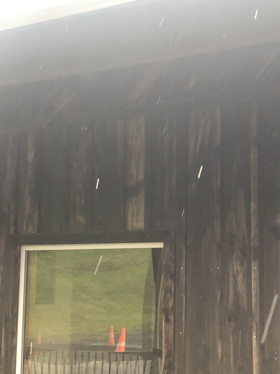
LOL-First Flakes 2021!
 Right off Exit 197 I-81.
-
3
-

Central PA - Winter 2021/2022
in Upstate New York/Pennsylvania
Posted
Yes-looks like >.75 inch in the Poconos on the Lackawanna/Wayne county line. Springbrook and Moscow also with heavy freezing rain. Susquehanna and most of Lackawanna just heavy sleet.