

friedmators
-
Posts
1,208 -
Joined
-
Last visited
Content Type
Profiles
Blogs
Forums
American Weather
Media Demo
Store
Gallery
Posts posted by friedmators
-
-
No ERC imminent per flight level winds.
. -
How long does it take SSTs to recover after a hurricane pass?
. -
The band headed into Sarasota and points West had some hurricane force winds off the deck.
. -
The eye is warming fast.
. -
1 minute ago, wkd said:
I've been using COD radar for a long time but I still can't understand how you get to this radar graphic. What Nexrad should I click on?
subregional..choose off FL then click nexrad
-
 1
1
-
-
VHTs going up everywhere.
-
ITS PUKING SNOW at the 78/287 intersection.
-
 1
1
-
-
About 8" 78/287 intersection
-
1
-
-
-
-
Just now, mikem81 said:
How did it compare to 12Z. More interested in trend at this point....
identical in NJ
-
HRRR trying to start the party early tomorrow.
.-
1
-
-
Great front end thump for everyone but with the storm so close to the coast on models now, these dry slots almost always penetrate deeper inland than modelled. 8-12 is a very realistic call.
The NAM always has a tendency to show snow instead of sleet with tucked lows. I’d love to not be a 850 line jockey for once.
.-
1
-
-
-
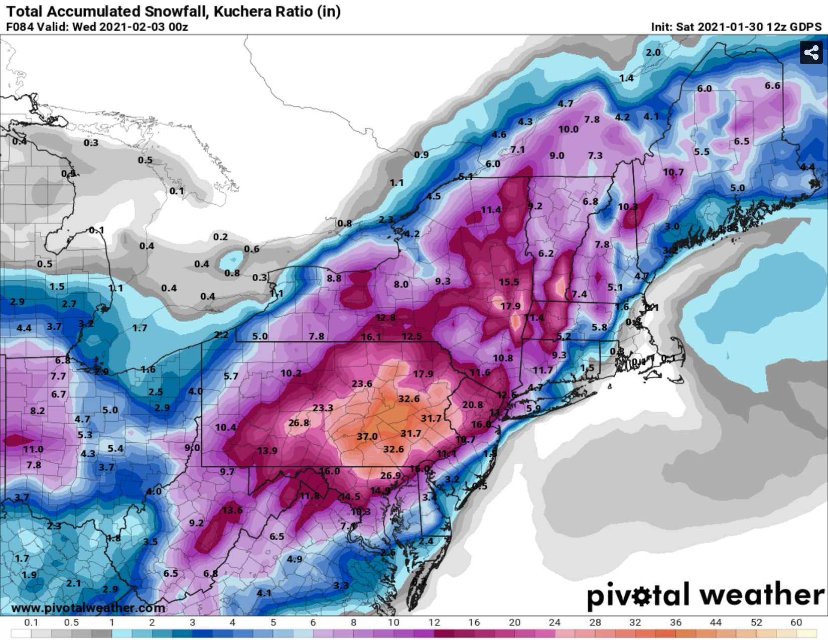
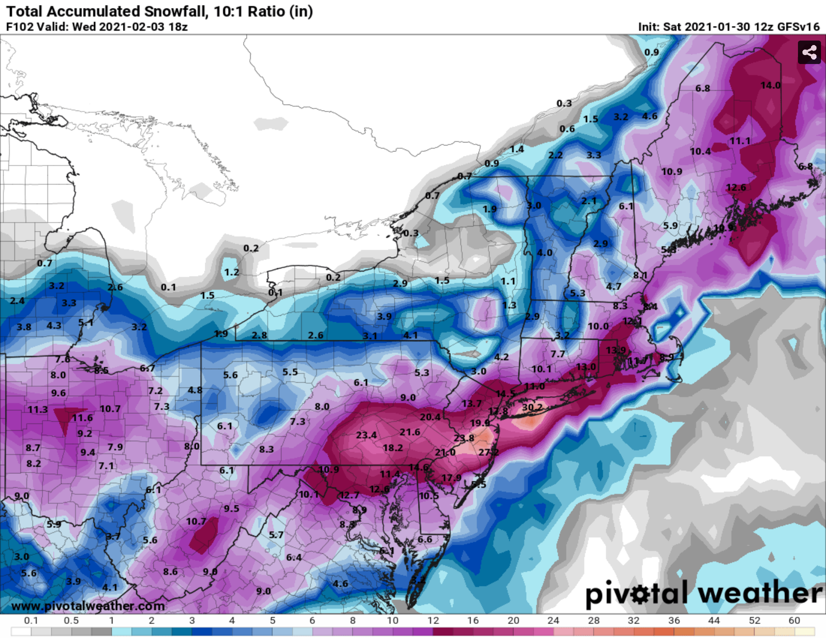
I'd also like to see other than a 10:1 snow map. From 30 miles north of NYC I'm thinking ratios will be more like 12 to 14:1.

.-
1
-
-
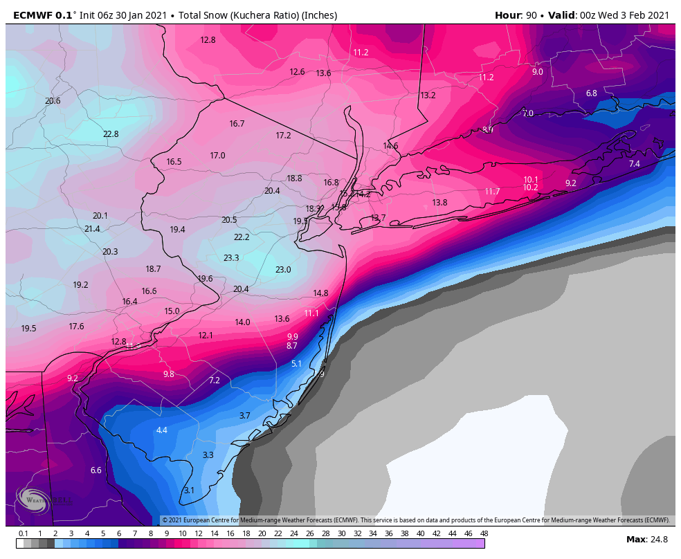
You can see at 60-66 the Euro picks up on the fact there will be an insane mega band near or just north of NYC
Do you have access to Omega? Are we in the DGZ?
. -
I expect Blizzard Warnings between 195 and 80 for sure.
.-
2
-
 1
1
-
 1
1
-
-
-
-
-
-
-
-
GEM with the CNJ death band...nice little 20-30"
-
1
-


Category Five Hurricane Lee
in Tropical Headquarters
Posted
30C EW spike is pretty intense.
.