

pondo1000
-
Posts
1,727 -
Joined
-
Last visited
Content Type
Profiles
Blogs
Forums
American Weather
Media Demo
Store
Gallery
Posts posted by pondo1000
-
-
-
Nobody…..Noooooo-body, does cold/dry or warm/wet winters better than we do around here.
-
 1
1
-
-
Bump (for shits & giggles)
-
Crazy to me that we can’t even score a clipper out of this pattern.
-
41 minutes ago, buckeye said:
Flurries finally
Radar really anemic
-
4 minutes ago, Crowbar said:
Think we’re just in a bad spot - no LE, and we need just the right path to get any good snows.
Feel like we do fairly well with clippers but those have allude us as well.
-
5 minutes ago, dilly84 said:
Dead for me. Be lucky to see 1" in Knox. CMH people getting anything yet or just virga?
Nada here in far southern DE county
-
I don’t know boys & girls, think the dry air wins out on this & Euro ends up right.
-
27 minutes ago, Crowbar said:
Curious if schools will open - wife teaches in Columbus and kids go to Olentangy.
Live in Olentangy SD too. You fart a flurry & kids are off! Columbus will be open I bet.
-
9 minutes ago, Crowbar said:
I think they're the same - it's when you get down toward Pickaway/Fairfield etc where the WSW criteria is lower, but someone more knowledgeable than me can chime in. I'm in Delaware County as well on the west side of Alum Creek
Cool. I keep thinking DE County & north was 6+ of snow for a warning
-
10 minutes ago, Crowbar said:
Of course, you're correct - WWA just issued
I forget, criteria for warning in DE County versus Franklin County?
-
7 minutes ago, buckeye said:
I’m guessing, ILN will put those northern tear of watches over to advisories and leave the warning counties as warnings. Unless we see something dramatic with the euro which is very unlikely at this point. Probably something like 3 to 6 across Columbus 2 to 4 once you get into Delaware County. Admittedly, i feel like that’s conservative, but my guess on what they go with. I’ll throw out my guess later.
But recently, how many times have we seen advisories get upgraded back to warnings once the storm evolves hopefully that’ll be what happens this time.Sounds reasonable. Euro & Canadian are red flags & just can’t be tossed. Fingers xssd we get lucky!
-
1 minute ago, buckeye said:
About the same…if you stare at it long enough you might be able to convince yourself it ticked stronger and north
Yes! So you’re saying there’s a chance! LOL
I really hate myself for being this into snow. I often think how/why/when this passion started. I have yet to figure it out. I will say it is therapeutic getting on here to banter & chat about it. So thanks to you all!And I just want one big one for my 12 year old to experience. You would have thought we had a blizzard overnight with that 1 inch. He came down so excited! I don’t think he’s ever seen a single snowfall over 5 inches!
-
2 hours ago, buckeye said:
the difference between the euro and gfs is crazy. Unfortunately the euro team also has the uk on it's side. The gem kinda splits the diff.
So, does the gfs ever win a battle like this inside 60 hours or is it ALWAYS the euro?
What did “the king” do at 18z?
-
16 minutes ago, 614teacher said:
GFS still looks ok as of 12z for Columbus? Or do we just think trend is going to keep screwing us?
.Unfortunately, GooFuS is on an island right now.
-
Welp, that was fun. Used to disappointment I guess around here.
-
53 minutes ago, buckeye said:
More concerned with a south trend …Euro looking scary, it is really heading that way and some of the other models are starting to trend that way too.

Really surprised because these kind of systems almost always trend stronger further north. 12z runs will be telling whether it’s a flip or a flop.Yeah, not good. Hopefully we can still salvage something more than just a duster but the big dog potential seems to be fading.
-
16 minutes ago, buckeye said:
definitely been awhile. Even better question might be when was the last time we had maps like this inside 72-84 hours that actually panned out?
Yes! Good point!!!
-
6 minutes ago, buckeye said:
Hope I'm not jinxing it but I figured i'd unlock the door here, turn the lights on, and open the ohio discussion on this one. Possibly our first major snowstorm in.....??????
This is all the 12z runs from today. The consistency is crazy but I'm still trying to figure out how we get screwed out of this one, (If it's possible we'll find a way).

Sure would be nice! When is the last time we had maps like that in these parts inside 72-84 hours?!
-
1 hour ago, buckeye said:
I’ll be posting a bit, just finishing some calculations
Give it a shot! You may surprise yourself! I think you have it in you.
-
Appears to be the new norm for winters around here.

-
Not sure it can get any worse around here in regards to winter but this winter is sure gonna give it a shot!
-
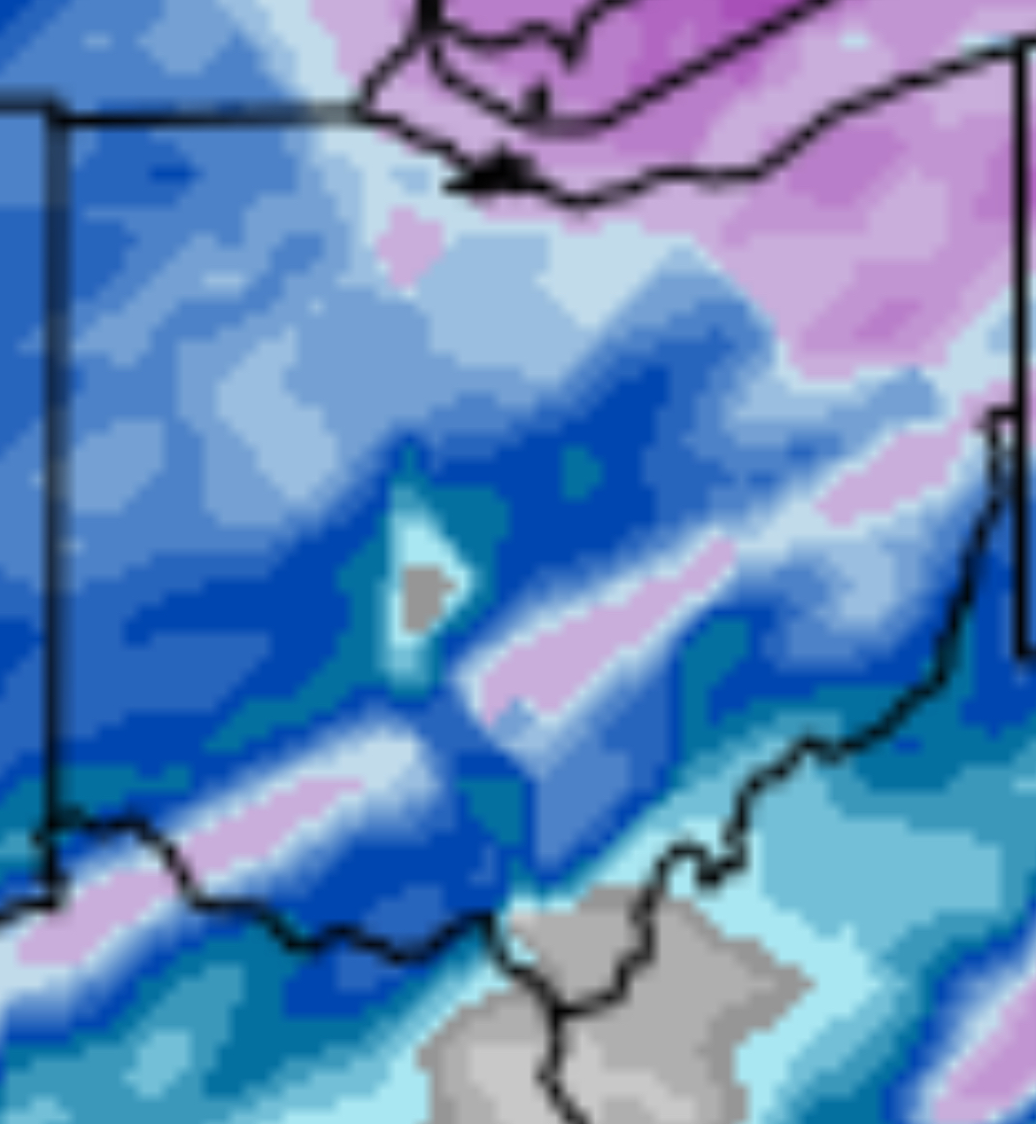
29 minutes ago, TheClimateChanger said:
Looks like some 7 to 10 inch totals in parts of east central Ohio.
7 here in Powell
-
7 hours ago, michsnowfreak said:
Knowing Easter is March 31st this year, I joked with my mom as we handed out candy to trick or treaters through snow squalls, that with a snowy Halloween, we would have no snow on Christmas and a white Easter. One down...one to go.
Yeah, feel like snow on Halloween seems to be the kiss of death.


Let’s talk winter!! Ohio and surrounding states!! 24'-25'
in Lakes/Ohio Valley
Posted
Snow globe!!!! Go to bed with heavy rain & mud, then wake up to snow & white! Pretty outside!