goldsborosnow
-
Posts
469 -
Joined
-
Last visited
Content Type
Profiles
Blogs
Forums
American Weather
Media Demo
Store
Gallery
Posts posted by goldsborosnow
-
-
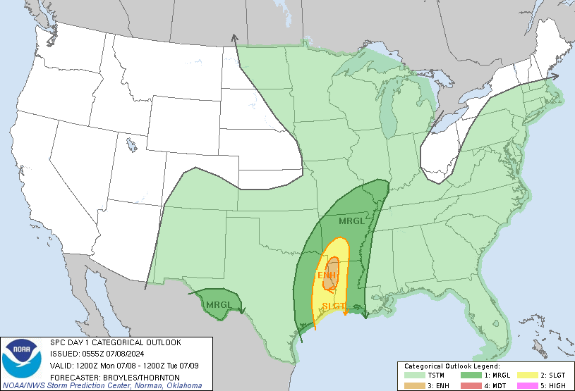
1:30pm SPC update:

...Carolinas to the Middle Atlantic region...

   Southern-stream shortwave trough will deamplify as it becomes
   absorbed within the base of an amplifying northern-stream trough and
   move off the Atlantic Seaboard early Friday. The northern-stream
   trough will continue through the Carolinas and Middle Atlantic
   region during the day accompanied by a cold front. Modest low-level
   moisture with dewpoints in the upper 50s to lower 60s F will advect
   through the warm sector along a 50 kt low-level jet. This in
   conjunction with some cloud breaks will destabilize the boundary
   layer with MLCAPE from 500-1000 J/kg possible. Some thunderstorms
   may be ongoing along the NC coast early Friday in association with
   the leading shortwave trough. Farther upstream, storms are expected
   to intensify along and ahead of the cold front as the boundary layer
   destabilizes from VA into NC and possibly as far south as SC.
   Strengthening mid-upper wind profiles accompanying the
   northern-stream shortwave trough will support 40-45 kt effective
   bulk shear supportive of embedded organized structures with storms
   developing within the evolving squall line and some supercells with
   any storms developing ahead of the line. Damaging wind appears to be
   the main threat,  but isolated tornadoes are also possible. Severe
   threat should end by early evening as the cold front moves offshore.
-
.
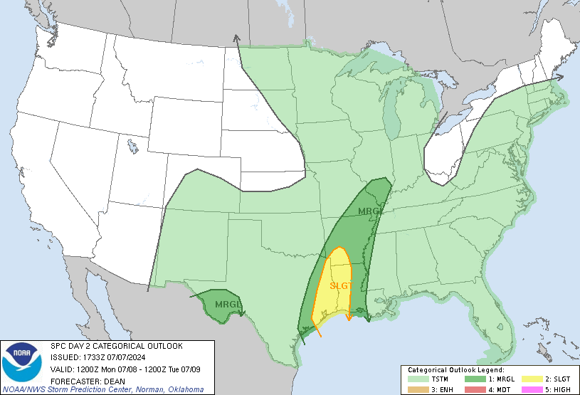
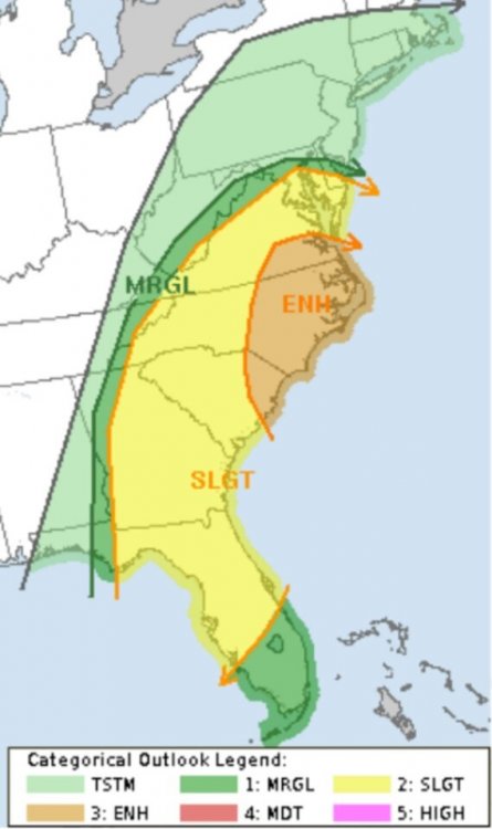
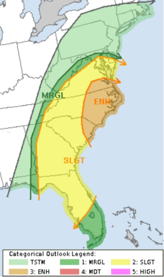
Marginal Risk for Eastern NC, VA, SC, and Central Florida tomorrow afternoon.
-
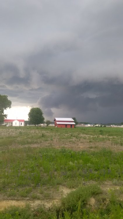
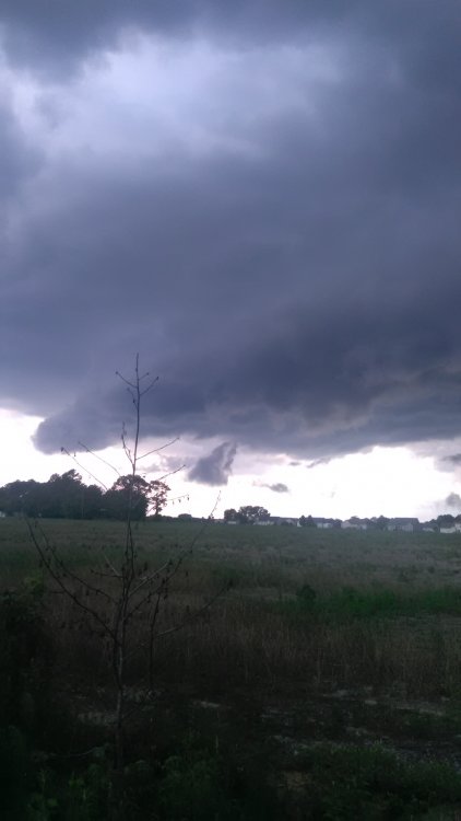
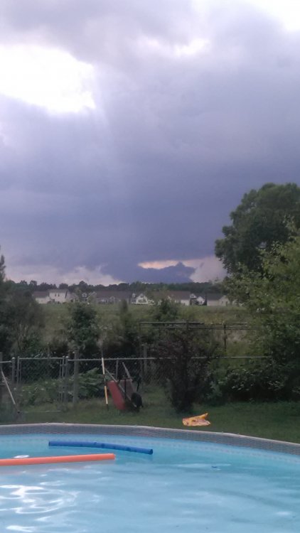
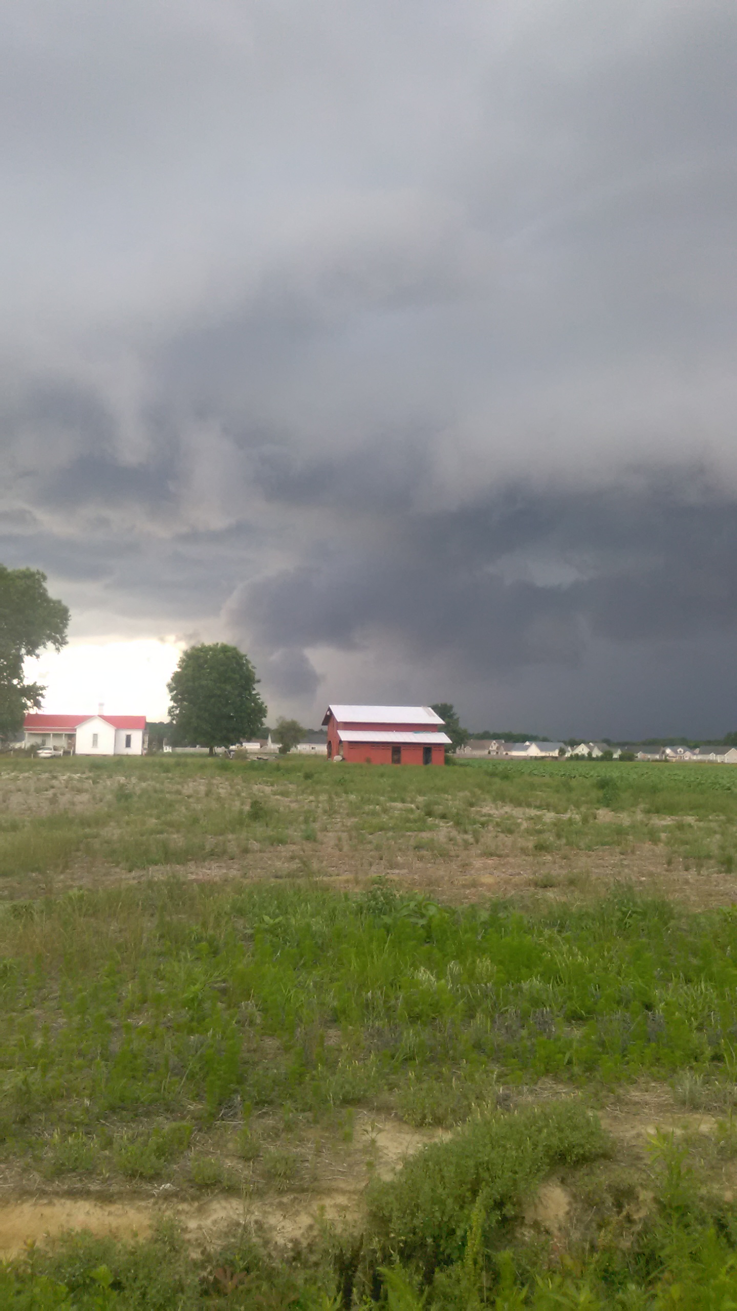
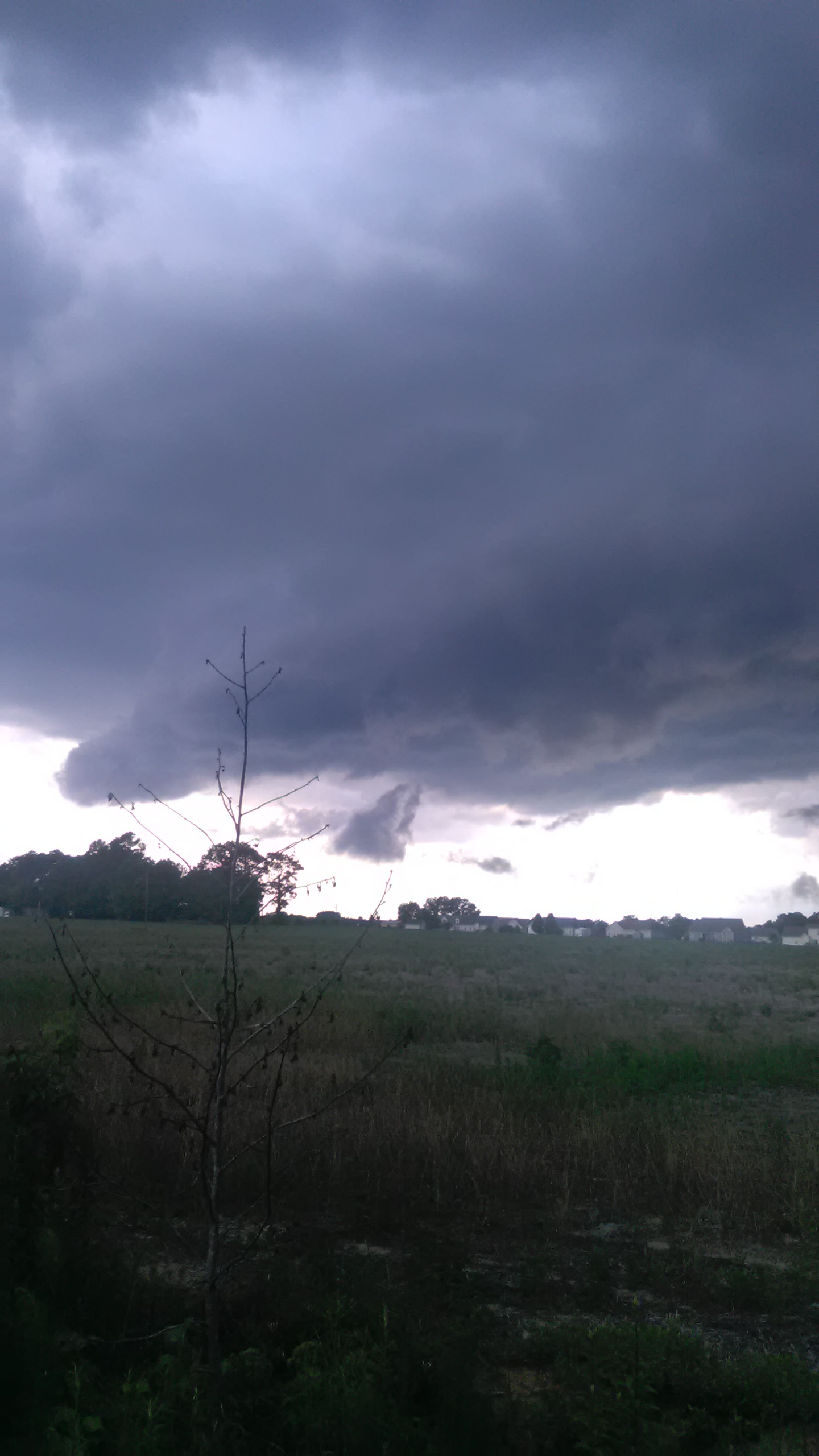
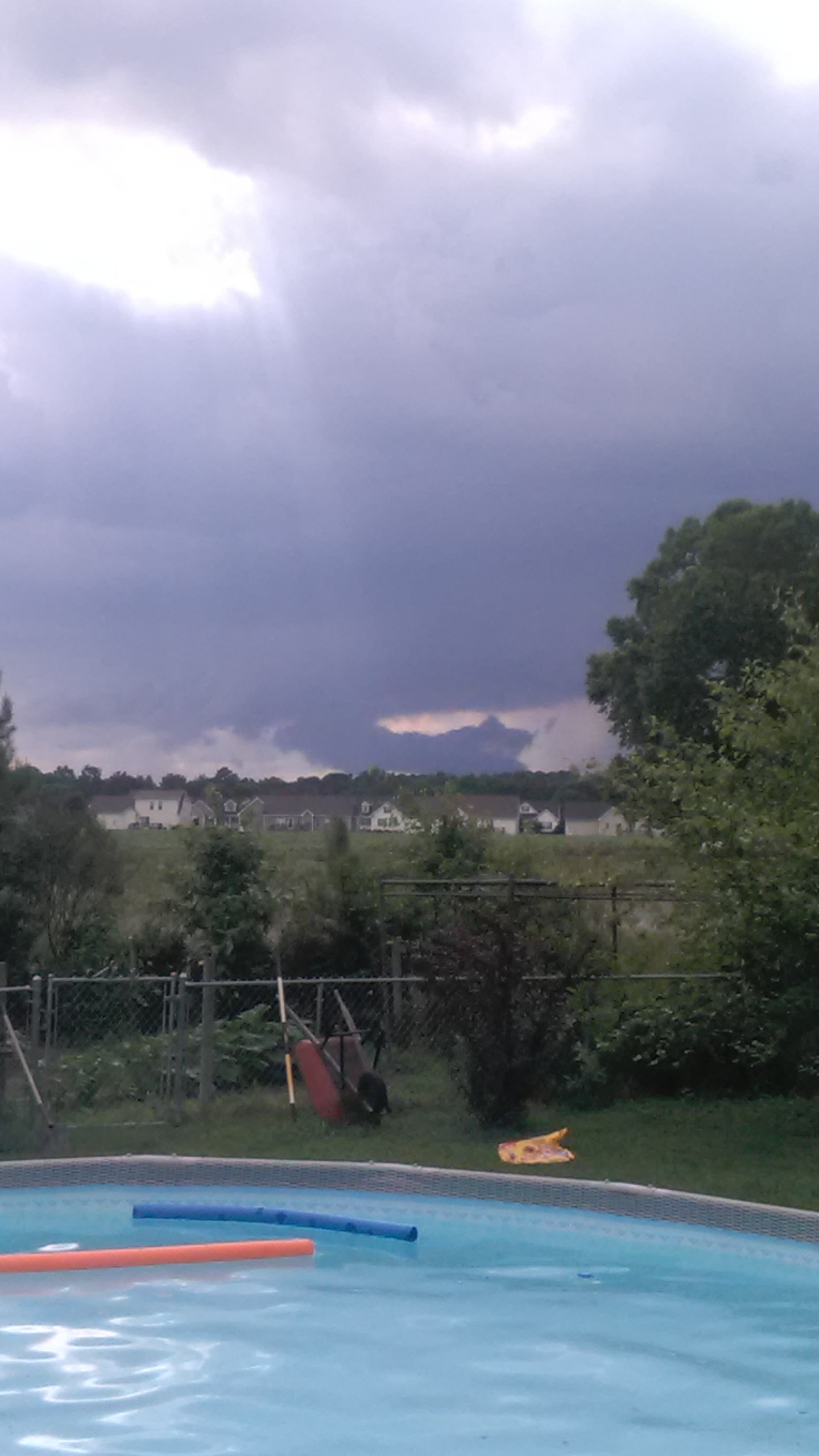
1.71" inches of rain yesterday at the house in Pikeville and was able to observe the wall cloud associated with the tornado warning near Downtown Goldsboro.
-
-
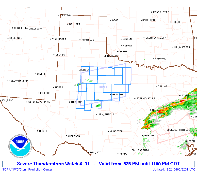
Tornado Watch coming soon.

-
The SPC has an enhanced risk for Eastern North Carolina on Friday.
-
 1
1
-
-
Received an inch yesterday for a two day total of 2.25".
-
1.25" over the last 24 hours in Pikeville.
-
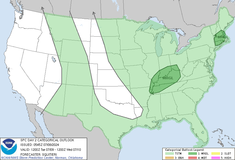
SPC went with a much larger slight risk area with the 2:00am update.
-
Light snow falling in Downtown Goldsboro.
-
2
-
-
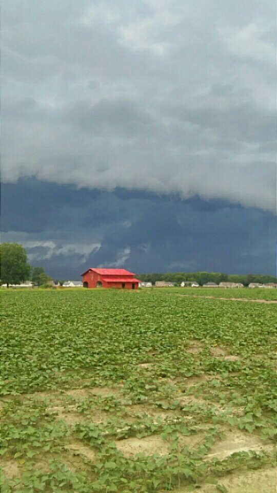
Pictures of the severe thunderstorm taken from Pikeville about an hour ago.
-
3 minutes ago, Solak said:
It's probably archived here somewhere. I remember Brick's kid's ball games getting rained out something like a gazillion times

There was a thread titled "The Big Wet" during one of those summers. I can't remember the year, but it was in the 2012 or 2013 time frame.
-
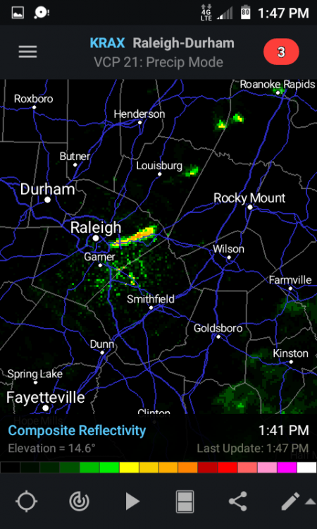
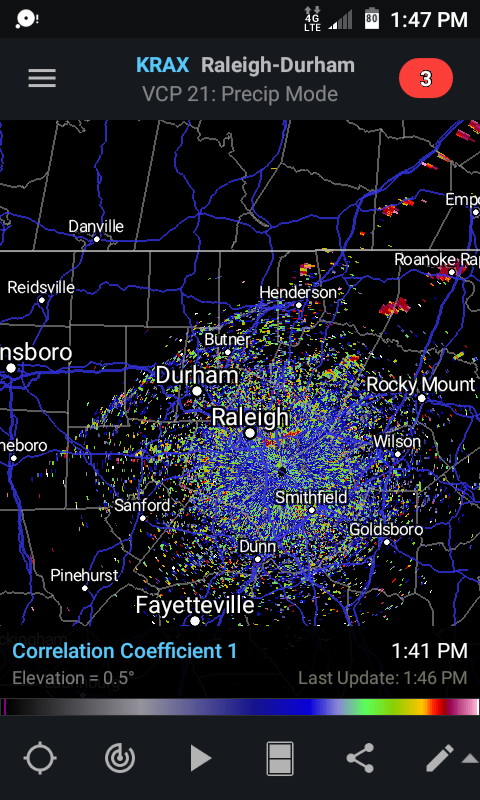
Showers developing east of Raleigh and the cold front itself showing up just west of Durham.
-
"gulf coast convection may rob moisture transport"
-
1
-
-
I just hope that the Jags are up to beating the Patriots and if not them, hopefully which ever NFC team they face can get it done in the Superbowl.
-
1
-

The Lawn, Garden, Fishing, Things You Do In Warm Weather Thread!
in Southeastern States
Posted
We picked up a few of those in Fishing Creek near Tarboro yesterday.