goldsborosnow
-
Posts
469 -
Joined
-
Last visited
Content Type
Profiles
Blogs
Forums
American Weather
Media Demo
Store
Gallery
Posts posted by goldsborosnow
-
-
1.99" in Pikeville yesterday for a two day total of 5.01".
-
3.02" of rain in the last 24 hours in Pikeville NC.
-
1.20" in Pikeville during the last 24 hours. The cool, cloudy weather is keeping things damp too.
-
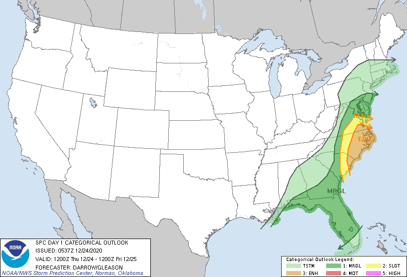
A Slight Risk has been added to the Coast with a Marginal Risk extended inland to Raleigh.

-
We are seeing a rain/sleet mix in Goldsboro NC.
-
1.66" of rain in Pikeville overnight for a three day total of 3.19".
-
1.13 inches of rain in Pikeville yesterday and overnight.
-
The new day one outlook from the SPC maintains the enhanced risk for Eastern North Carolina. The discussion mentions the potential for supercells during the afternoon followed by a squall line later in the evening.
-
The SPC has upgraded to an Enhanced Risk for Eastern North Carolina now. They seem to like the idea of supercell development in the warm sector ahead of the main line in addition to QLCS spinnups with in that line.
-
 1
1
-
-
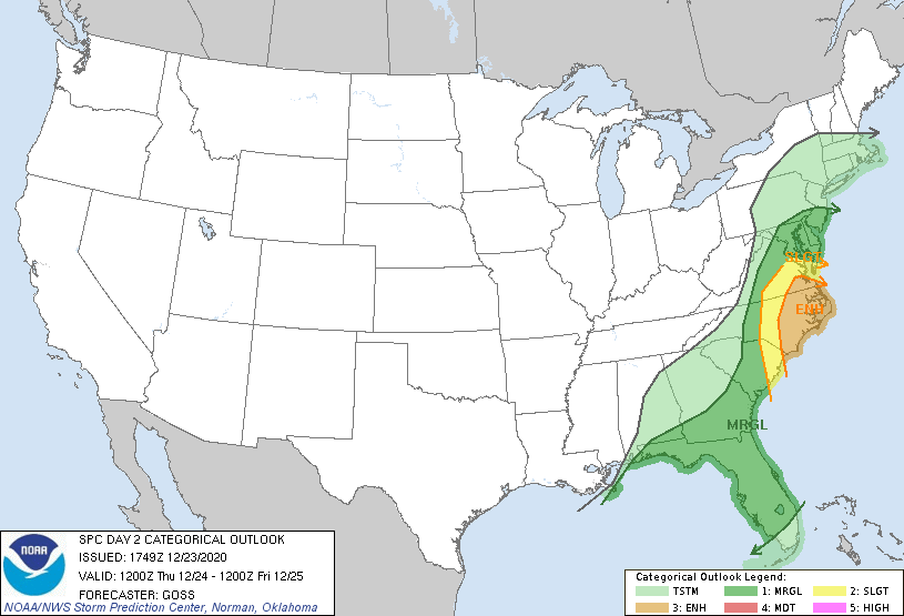
How about a day three slight risk for Eastern North Carolina on Christmas Eve?

-
1
-
-
16 hours ago, Windspeed said:
ACE is now at 170. Probably going to hit 180 if Iota rapidly deepens into a Cat 4. The Greek list has been a season in of itself.
Is there a way to tell how much ACE the regular names were responsible for vs how much the Greek names were responsible for?
-
5.56 inches in Pikeville NC with quite a few flooded roads. My parents in Tarboro had 10.5 inches for the two day storm total.
-
23 minutes ago, yotaman said:
Warm and humid. Currently 76/73 at 11 AM. Waiting on the cold front to pass.
It just passed by the Wayne/Johnston County line. The temperature dropped 9 degrees over about a five mile distance. 72-63 degrees.
-
1.61 inches of rain in Pikeville, plus we lost power for about an hour due to a downed tree.
-
Ended up with 1.05" from Beta.
-
.65 so far in Pikeville with heavy rain to my west over Johnston County.
-
1.86" of rain yesterday evening here in Pikeville and places around me got a good deal more than that. There were quite a few flooded roads in Wayne County as the sun set yesterday.
-
It gets more interesting the more you think about it. Unfortunately, we have to wait until next year to add to the sample size.
-
We felt it in Goldsboro NC
-
So there were at least 15 tornadoes between the February and April severe weather events plus there were likely a few more scattered throughout the year and we've already had a hurricane make landfall in Eastern NC.
-
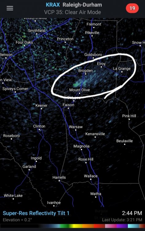
Both radar anomalies have reappeared in Wayne and Duplin Counties. Third day in a row. There aren't any fires in the area.
-
1
-
-
7 hours ago, Solak said:
I asked NWS Raleigh about it, and they couldn't confirm anything at the time,, either. Interesting, given the length of time it showed up on radar.
What ever it is, it's back today.
-
1 hour ago, Solak said:
I asked NWS Raleigh about it, and they couldn't confirm anything at the time,, either. Interesting, given the length of time it showed up on radar.
Yeah they said some people had called them. LOL. The funny thing was that another similar area was showing up further south in Duplin County. I was working in 911 yesterday, so we definitely confirmed there weren't any fires/smoke plumes in the area. I guess it's just one of those mysteries of the Earth kind of things.
-
1
-
-
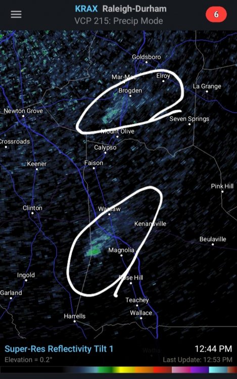
6 hours ago, Solak said:
Is there a decent size brush fire burning South of Goldsboro/West of Kinston? Radar is showing a good size stationary plume along Hwy 117. Nothing showing on satellite.
I saw it as well. We sent a Mt Olive police unit out to the area, but there wasn't any sign of smoke or anything else unusual. The NWS Raleigh office called the center asking the same thing, but we couldn't confirm anything.


June Observations 2021
in Southeastern States
Posted
1.43" in Pikeville NC yesterday. 6.45" so far this month.