

Crazy4Wx
-
Posts
203 -
Joined
-
Last visited
Content Type
Profiles
Blogs
Forums
American Weather
Media Demo
Store
Gallery
Posts posted by Crazy4Wx
-
-
1 minute ago, StormChaser4Life said:
IR presentation definitely improving but can't really say for sure it's bombing till we get aircraft in there to get accurate wind readings and new pressure info
After watching canes for 20+ years you do get that feeling that this bombing out based on all available sat data.
But, without dropsondes I do agree that you can’t verify.
-
1 minute ago, StormChaser4Life said:
I'm starting to get skeptical of this hitting 130 before landfall. Ida really running out of time. If it doesn't really bombs away in next 6-10hrs I'm thinking a low to mid cat 3 more likely. Regardless of whether it's a cat 3 or 4, surge and rain will still bring a lot of destruction along with the 110+ gusts.
Umm…have you looked at IR. It is bombing out. There is just no Aircraft measuring it right now…and won’t be for another 80 minutes.
-
Latest NHC path nudged East a little. One more nudge and New Orleans gets that eyewall.
-
One more wobble north and Ida will steamroll into New Orleans. The NW track seems to have the eye wall 5-10 miles to the west.
Also, looks beautiful right now.
-
7 minutes ago, cptcatz said:
I don't mean to downplay the potential surge from Ida, but at this point in the gulf Katrina was an enormous 902 mb cat 5 monster which was pushing much more water than Ida is now or probably will ever. We'll probably never see anything match Katrina's surge.
Been 16 years since Katrina. Sea level has risen ~3 inches since then. You need less surge each year and there is more water around. 3 inches might not sound like much, but it does make a difference.
-
 1
1
-
 3
3
-
-
12 hours ago, EastCoast NPZ said:
I've seen many many worse winters out here than this one. Not great, but ok. Prolonged cool weather. No big or prolonged torch. Good 24 day stretch of snow cover in my new location, but a far cry from that from winchester south.
It looks done in the snow department, now I hope only for occasional cold shots to keep the grass, weeds, bugs, and flowers dormant as long as possible.
Remember, this is the year of the cicadas. Brood X. Those bugs are coming
-
1 minute ago, Ravens94 said:
50 more miles south is for sure possible
If the low truly forms in NC/SC I say it tucks I’m around the mouth of the bay.
-
If all the models had the low forming around MD/VA and it forms 150 miles to the southwest around NC/SC what does that mean for central md?
-
I will take pingers over freezing rain...let’s see how this goes
-
1
-
-
Game time off the coast of NC...let’s see what she does.
-
3
-
-
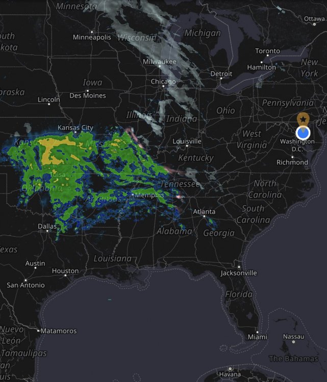
Damn...on radar this storm is fetching all the way to the TX/Mexico border
-
Just now, psuhoffman said:
Hug the icon.
I think from DC to Portland everyone is hugging a different model
-
2
-
-
Just now, Weather Will said:
Midnight Monday


That is a beautiful low placement
-
Current low in Kansas seems to be moving due East, maybe a smidge southeast.
-
Good news is it held serve, didn’t go north.
-
4
-
 1
1
-
-
Just now, WhiteoutMD said:
we will have sleet but change to back to snow this will be a HUGE event
Agreed! You never get 3 days of straight snow in AA. Take a little sleet...be happy with over 12 inches on this run.
-
1
-
-
Is the low in South Carolina?
-
 1
1
-
-
Low is south a bit, isn’t it
-
1
-
-
How good is the RGEM at this range?
-
As long as my kids can go sledding this is a win!
-
4
-
-
Looks juicy
-
1
-
 3
3
-
-
3 minutes ago, Eskimo Joe said:
He is in Maine. Pretty sure any movements to the NW are later in the storm evolution.
-
3 minutes ago, Eskimo Joe said:
To really score a big boom, we gotta have the 850 low pop earlier somehow to cutoff the surge of warm air aloft.
When would we know if this happens?


Major Hurricane Ida
in Tropical Headquarters
Posted
I get the feeling that there might be a 20ft+ storm surge in this