winter_warlock
-
Posts
3,368 -
Joined
-
Last visited
Content Type
Profiles
Blogs
Forums
American Weather
Media Demo
Store
Gallery
Everything posted by winter_warlock
-
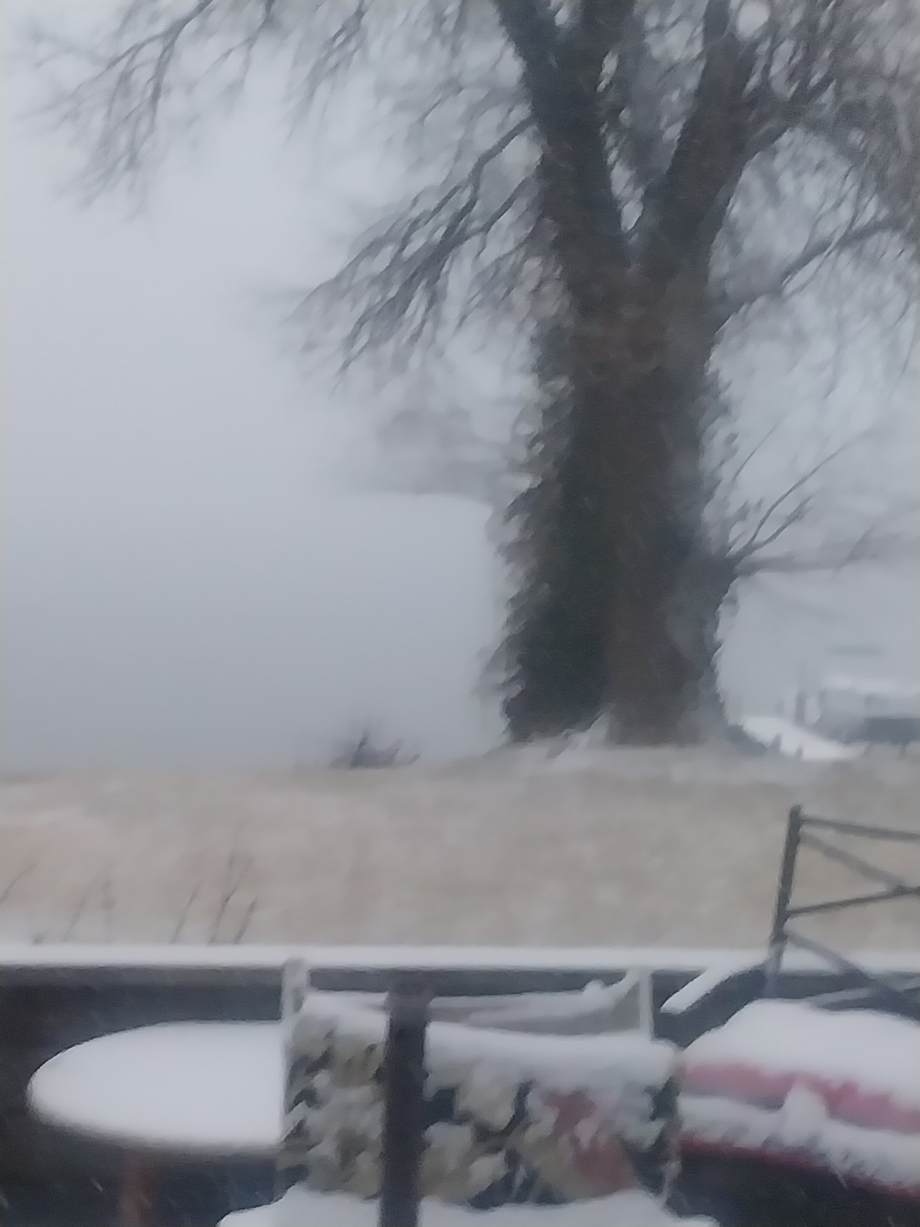
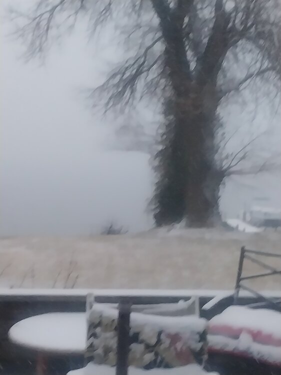
30 degrees moderate snow here. And about .5 of and inch
-
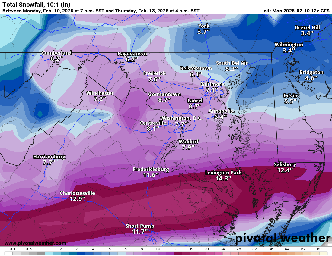
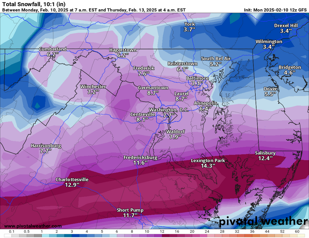
Richmond not getting a foot lol
-
10 days to go. Gonna be a wild ride lol
-
Cmc has different look. More south and east. Snow to 95
-
Gfs takes it too far west. I95 is slow to rain but 10 days out. It won't look like that in days to come lol
-
Ur right wakefield barely saying much more then 1 -3 for Richmond. They. Aren't putting alot of stock in the Snowmaps... From Wakefield .....
-
Agreed I'd take a 6 -12 inch storm any day !! They are kinda rare in central md!!
-
Amen brother!!
-
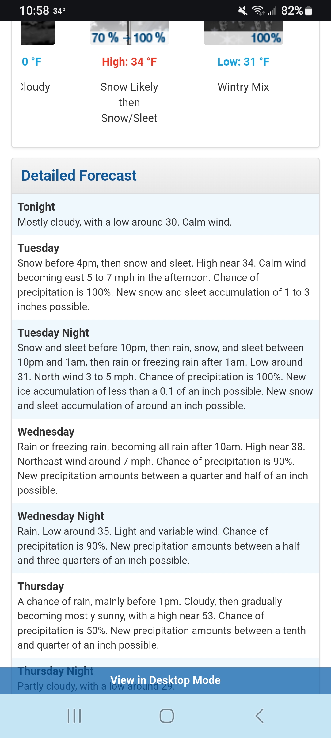
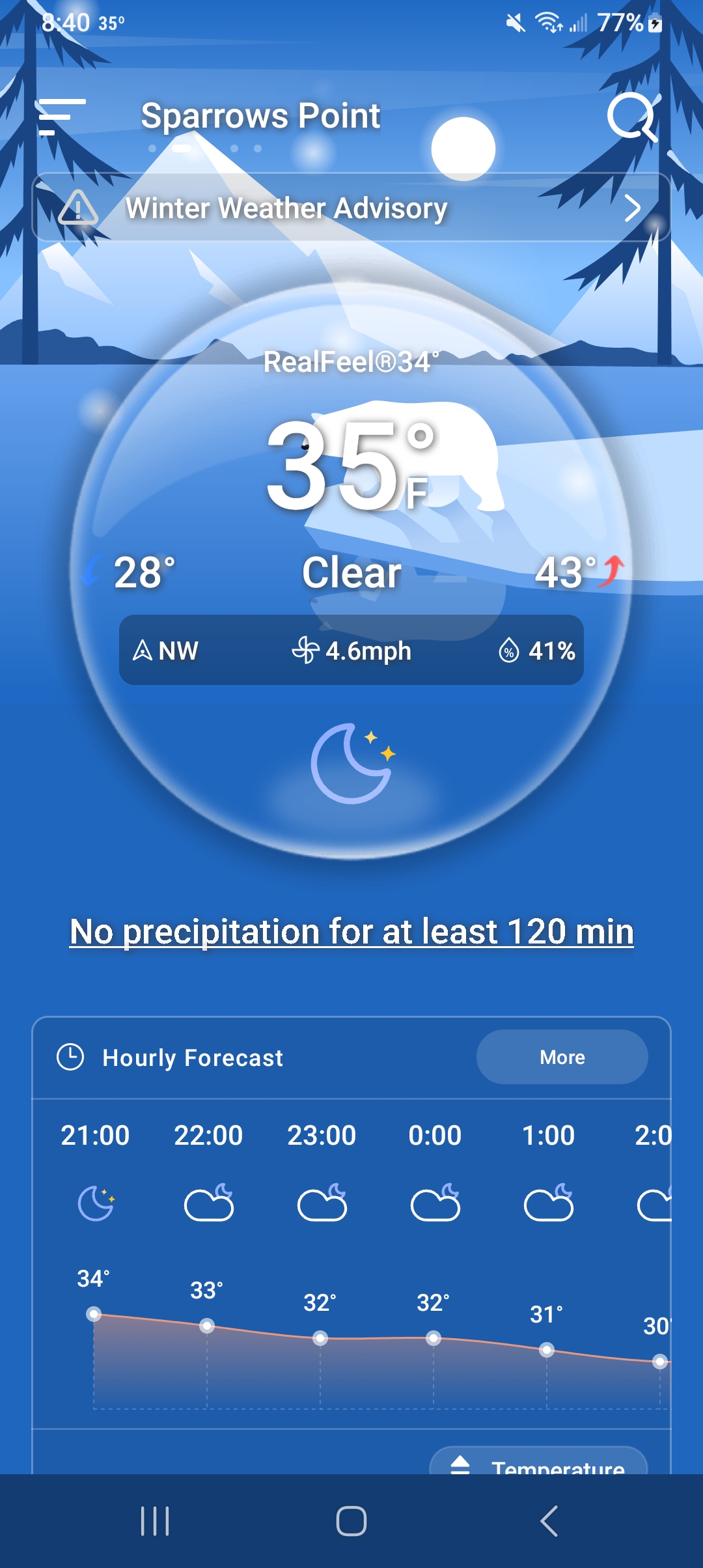
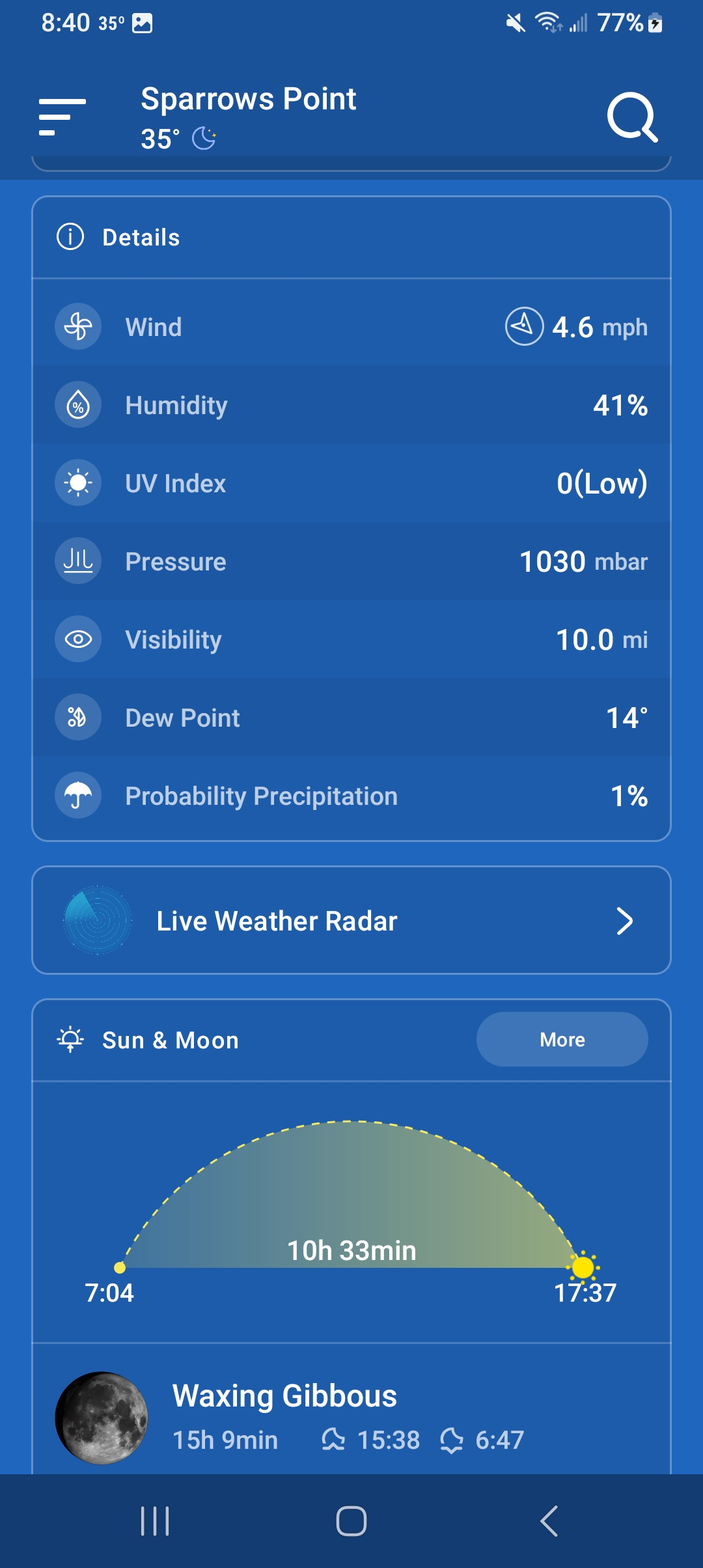
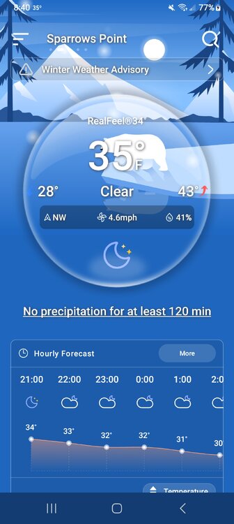
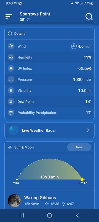
At 8 40 pm. Sparrows point MD...
-

February 11-12; 12-13: Are they real??
winter_warlock replied to stormtracker's topic in Mid Atlantic
Ok -
February 11-12; 12-13: Are they real??
winter_warlock replied to stormtracker's topic in Mid Atlantic
Ok if u look at the model. It shows rain in short pump and Salisbury yet it Shows outrageous snow totals. They are wayy over done down there lol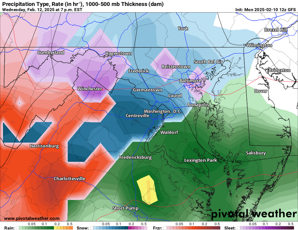
-
February 11-12; 12-13: Are they real??
winter_warlock replied to stormtracker's topic in Mid Atlantic
Yeah but if u look at the model it shows rain down there also so I think that 11 inches is wayy overdone -
February 11-12; 12-13: Are they real??
winter_warlock replied to stormtracker's topic in Mid Atlantic
7 inches in baltimore is fine with me lol -
February 11-12; 12-13: Are they real??
winter_warlock replied to stormtracker's topic in Mid Atlantic
Good!! -
February 11-12; 12-13: Are they real??
winter_warlock replied to stormtracker's topic in Mid Atlantic
Why? -
February 11-12; 12-13: Are they real??
winter_warlock replied to stormtracker's topic in Mid Atlantic
I'll take that half a foot!!! -
If ya believe that will happen I got beachfront property in Kansas I'll sell ya
-
February 11-12; 12-13: Are they real??
winter_warlock replied to stormtracker's topic in Mid Atlantic
Almost gfs time.. -
February 11-12; 12-13: Are they real??
winter_warlock replied to stormtracker's topic in Mid Atlantic
Well it's the ICON so... lol -
February 11-12; 12-13: Are they real??
winter_warlock replied to stormtracker's topic in Mid Atlantic
Ty bro! -
February 11-12; 12-13: Are they real??
winter_warlock replied to stormtracker's topic in Mid Atlantic
Snow map wise it looks similar to 18z -
February 11-12; 12-13: Are they real??
winter_warlock replied to stormtracker's topic in Mid Atlantic
Looks north to me -
February 11-12; 12-13: Are they real??
winter_warlock replied to stormtracker's topic in Mid Atlantic
Some never learn lol -
February 11-12; 12-13: Are they real??
winter_warlock replied to stormtracker's topic in Mid Atlantic
Yessss -
February 11-12; 12-13: Are they real??
winter_warlock replied to stormtracker's topic in Mid Atlantic
More like 3/4 of the forum lol