

TalcottWx
-
Posts
28,610 -
Joined
Content Type
Profiles
Blogs
Forums
American Weather
Media Demo
Store
Gallery
Posts posted by TalcottWx
-
-
32 minutes ago, RUNNAWAYICEBERG said:
Shmegma and pope using 2m temps maps as their last resort to will this away from sne.
You HATE to see it.
-
6-12“, lollies to 14" or 15".
-
 1
1
-
-
I had joked about winter hitting on the 12th. My wife is being induced on Monday. It looks like Winter Storm Shea is a go.
-
4
-
-
9 minutes ago, 40/70 Benchmark said:
I would hope it would be sooner...
Lol
-
 1
1
-
-
-
Just now, FXWX said:
Nice... yes... it was all about good rates and on the right side of the low / mid-level freezing line...
It's trying to flip now here in Weatogue. Sn/ip mix.
-
49 minutes ago, FXWX said:
31 here... 3.9" before the flip to freezing rain.
3" Weatogue. Really good for lower elevation.
-
I'm in Windham county, Moosup, for a wedding nearby. We have rain snow mix it's coming down. Mostly rain. Have pellets and snow intermittently. Appears to be snowing at home in Simsbury.
-
1
-
-
2 hours ago, STILL N OF PIKE said:
The latest collective optimism from reading a few subforms is that Feb 10 on will rock (maybe hopefully probably )
I do not think anyone has a clue that correlates to good predictability going out to mid February relating to sensible weather (because it’s insanely complex)
I see reason for some optimism but that is all I would say at this point , bc you can usually find that in most patterns and not that many end up producing well for SE SNE , higher probability more for general SNE (especially if active ) and especially CNE , I think most tend to produce pack for elevated NNE as long as they are active (regarding feb 10 to march 10 period )and that is just the Climo
Feb 12th 2024... Shea's bday.
-
1 hour ago, CoastalWx said:
High of 38 here.
39f off a low of 8f here.
-
1
-
-
3 hours ago, qg_omega said:
One week of winter ends Sunday for the year, no changes
Good one.
-
This system blows. Windex these
-
1
-
-
On 1/13/2024 at 8:20 AM, CoastalWx said:
Kevin is right.
21 hours ago, weatherwiz said:Kevin is right.
Never say this out loud.
-
2
-
 2
2
-
-
On 1/13/2024 at 7:54 AM, ORH_wxman said:
Figured I would start a different thread for this because it has continued to improve on model guidance over the past 24-36 hours. Sunday afternoon is starting to look pretty prime for some squalls.
If we go over our old school WINDEX checklist, we look for below ingredients:
1. Low level moisture
2. steep lapse rates
3. strong LI spike (source of lift)
4. Cyclonic PVA (really this just enhances #3, but it can make an event higher end)
All 4 of these ingredients are present in a pretty big way on Sunday.
We have LL moisture in the 65-90% range which is excellent.
We have extremely steep lapse rates (TTs near 60!) and saturation up to around 600mb
Have a huge LI spike of 16-18 in 12 hours and to assist that we have strong PVA with that nice shortwave.
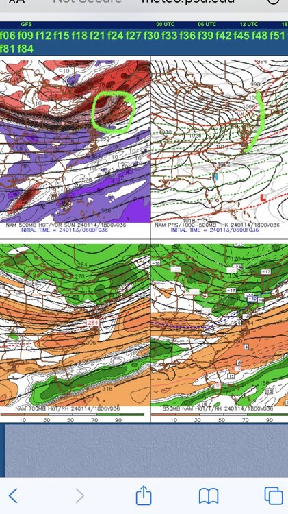
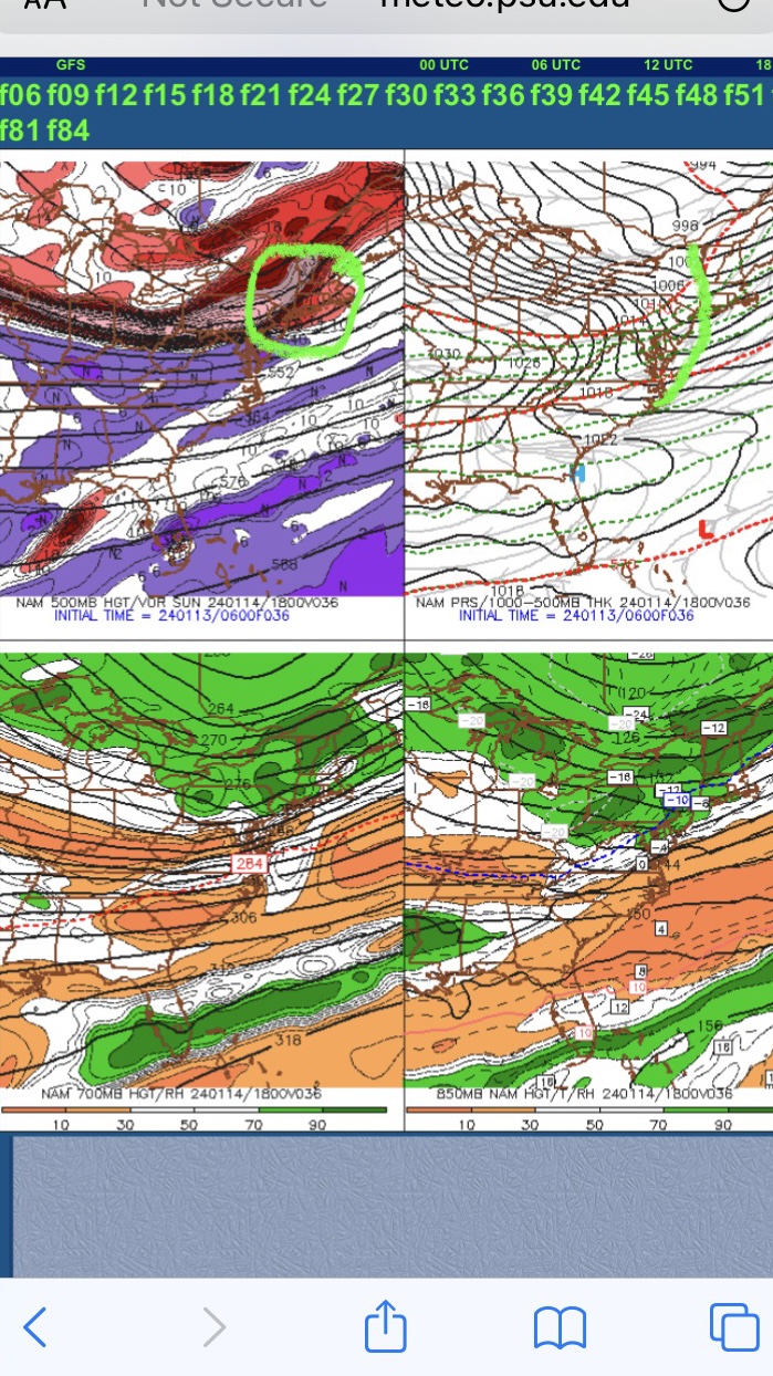
Below is the 06z NAM for tomorrow afternoon…you can see where I circled the potent vortmax (there’s our strong PVA) and then you even have a sfc response from with that clear kink in the isobars (marked on the right)…that helps veer those winds to more southerly component ahead of the front which is what we like to see because it helps pool moisture…same thing we look for in warm season Tstorm/severe threats.
These types of setups are where you can pick up a quick 1-2”…perhaps even an isolated higher amount if you get into some good squalls…in addition, we’re going to have rapidly falling temps from the mid 30s down into the lower 20s within a few hours, so we’ll need to watch for flash freeze on roads in some areas.
I want to be different and tell you this is a BAD, BAD thread. BAD BOY!
-
2 minutes ago, TalcottWx said:
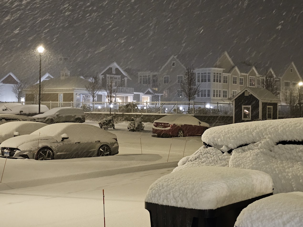
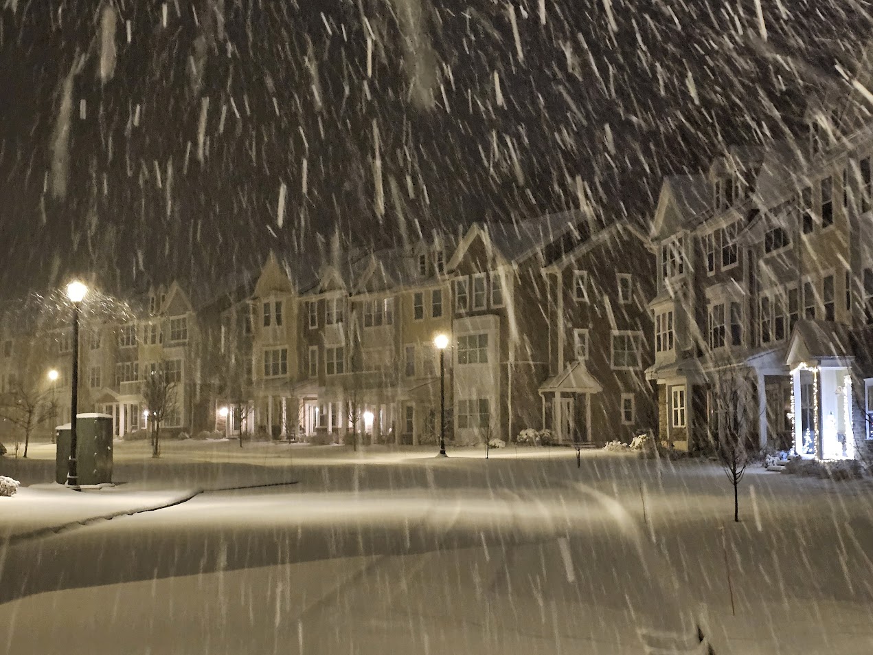
Moderate snow, Simsbury.
Starting to mix already.
-
Moderate snow, Simsbury.
-
1
-
-
13 hours ago, dendrite said:
Yeah it’s trying to accumulate at 33-34°…pass me the kuchie
Either kiss my coochie or pass the kuchie
-
1 hour ago, CoastalWx said:
That band yesterday on the rt 44 corridor was sick. Didn't last long, but based on the 4-6" reports in 90 min or so...that was intense.
I stopped reporting my totals because it got so ridiculous.
-
1
-
-
2 hours ago, weatherwiz said:
Not a bad forecast! Wish I hit in some aspects a bit better though in the discussion.

Great map!
-
 1
1
-
-
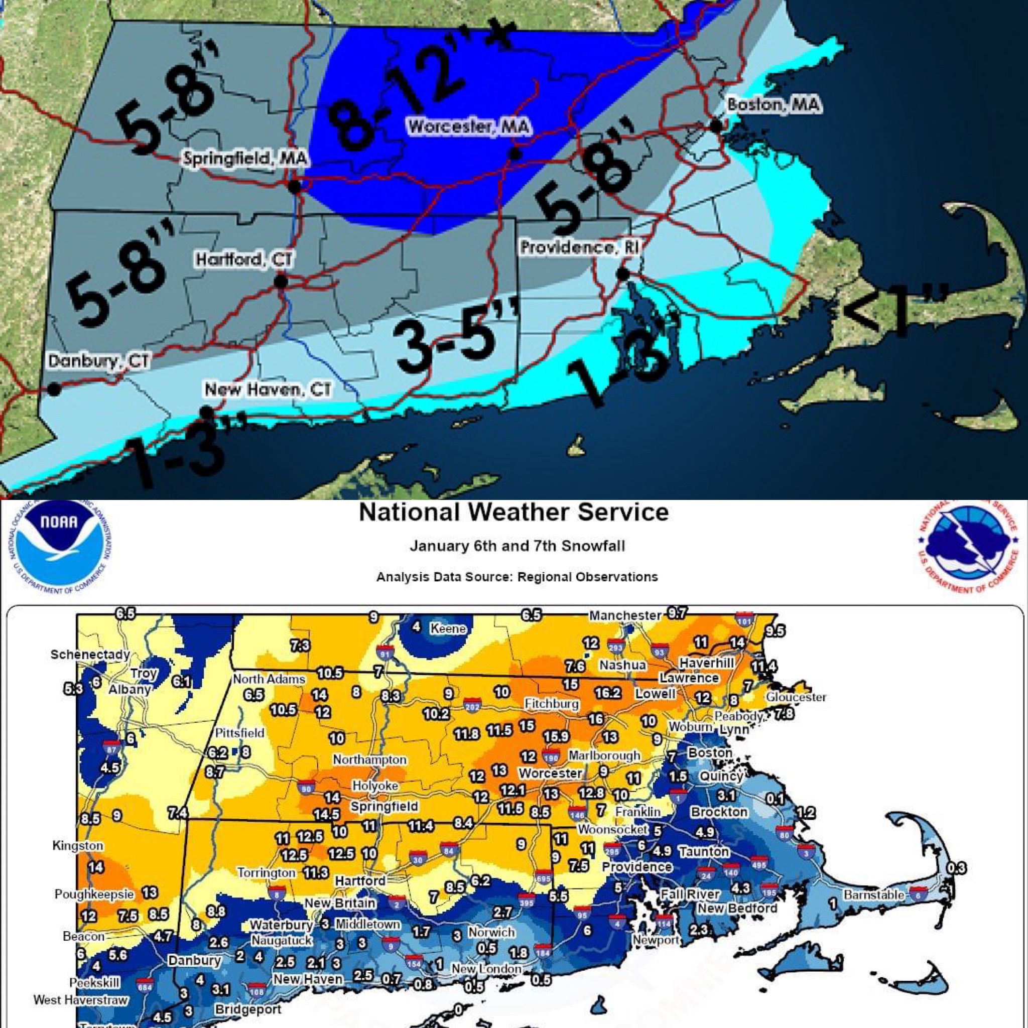
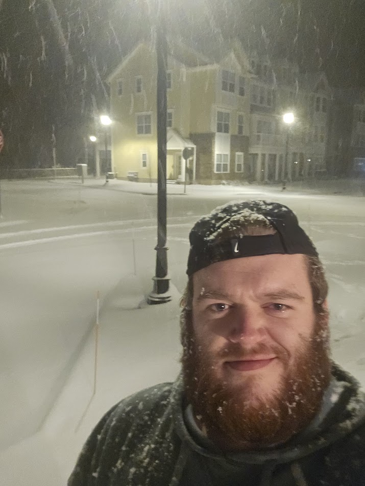
I slept all day after cleaning up; my snowfall total in Weatogue was 11".
Someone at higher elevation in West Simsbury measured 12.5"
Awesome storm, snowing currently now.
-
2
-
-
If you open up KBGM, you'll see what's Coming.
-
7" Simsbury
-
4
-
-
6 minutes ago, WxWatcher007 said:
Euro is pretty robust with part two tomorrow in CT.
Impressive. Thanks for mentioning.
-
Following a Miller A/B hybrid type coastal potential, Feb 13th ... As yet untapped potential and a higher ceiling with this one
in New England
Posted
Snow in Simsbury, Tears in Tolland