

mempho
-
Posts
601 -
Joined
-
Last visited
Content Type
Profiles
Blogs
Forums
American Weather
Media Demo
Store
Gallery
Posts posted by mempho
-
-
As long as you never turn on the heat, you can generally get the house cool enough that it will stay semi-comfortable without AC except in extended blowtorch patterns.I hear you. Had the full court press to turn in the AC last night. Could not do it on principle.
. Pro
Truth be told-- heat is optional in our area of the country - AC is not (if you still want to be productive).
Sent from my SM-G950U using Tapatalk
-
 1
1
-
-
Anyone know what the state all-time record is for October?
Sent from my SM-G950U using Tapatalk
-
94/96/97 last 3 days. Looking at 97/98 today but I wouldn't be shocked if we hit 100 either.
The previous all-time high for October in Memphis was 95 (set 3 times). Very "impressive" - to say the least.
Sent from my SM-G950U using Tapatalk
-
1
-
-
100 officially. First 100 here in 4 years (which is amazing in itself) - but on September 16th, no less.What was your final high for the day?
I'd put exclamation points on all that but I'm not happy about any of this weather. They are cancelling fall sports events for the youth here due to heat.
Sent from my SM-G950U using Tapatalk
-
1
-
 1
1
-
-
KMEM has just hit 95 before noon, on this, the 16th day of September, 2019.
-
1
-
1
-
-
On 9/7/2019 at 2:47 PM, jaxjagman said:
ational Weather Service Nashville TN
204 PM CDT Sat Sep 7 2019

.DISCUSSION...
At first glace, this 7 day forecast could definitely fit more into
the brutal dog days of July rather than the second week of
September as far as the heat is concerned. Good thing we have this
weekend in which today has given us a very nice reprieve from the
heat and humidity as the area enjoys the weather behind a nice
frontal passage. Temperatures so far this afternoon have only
reached the low to mid 80s (and that last sentence might not be
uttered again until mid to late September). A relatively cool and
dry night can be expected tonight with clear skies and light
northerly winds. Sunday will be another day with Highs in the 80s
and dry weather continuing before the heat is on.

For the work week...High pressure builds over the region for the
first half of the week. With minimal cloud coverage and not much
in the way of convection really expected, Monday and especially
Tuesday-Thursday look to be rather HOT for this time of year with
heat index values nearing/surpassing the 100 degree mark.
Seasonal High temperature normals are generally in the low 80s
so forecasting mid to possibly upper 90s seems a little brutal for
those really wishing it could be a little more like pumpkin spice
weather. So don`t close those pools just yet cause summer is
hanging on strong.

By Friday and next weekend, the ridge finally breaks down and
better chances for afternoon and evening storms can be expected.
With this expect Highs to be a few degrees cooler but still near
and above the 90 degree mark. Another front looks to approach the
region late in the weekend which will hopefully provide the
ending of the July heat in September.
Wrong!!!
-
Personally, I like the cool temps, so bring it!On "positive" note, that great winter pattern that many were expecting during late winter(including me) looks like it will finally arrive during mid-spring. Well part of it anyway as the Pacific is about cooperate in placing a trough into the EC(big ridge out West) making our weather that much more miserable. Excessive cold rain was not enough salt in the wound. Now, we have the opportunity for excessive, really cold rain. So excited about this pattern change. So, so.....so....excited.
Sent from my SM-G950U using Tapatalk
-
1
-
-
These are things to be happy about!Never fails. Cold March and April on the way!
Sent from my SM-G950U using Tapatalk
-
1
-
-
Wow, guys- I admit I'm a bit jealous. Still, I'll be able to have a chance for a nice run at 16F in the AM- I don't imagine that's possible at 25 below!
Sent from my SM-G950U using Tapatalk -
Got in 10 miles this AM before church with a wind chill of 12. Just rode home with the windows down-- soaking up this fresh air!
Sent from my SM-G950U using Tapatalk-
1
-
-
Did you see the pics in the main thread of possible trees debarked and boxcars overturned (presumably along 231 in northeast PC) ?Near the time of landfall there was a 35 mb pressure difference between the two reporting buoys at Panama City and Panama Beach, located maybe 10 miles apart.Tyndall AFB was reporting 924 mb when the station went off-line (with northeast winds gusting to 119 knots). If the usual ratio of RFQ to back side prevailed, Mexico Beach or some location a bit closer to Panama City possibly would have been 1.3 to 1.5 times that with the same pressure. (1.3 x 120 = 156 knots, about 175 mph right?). But I suspect the ratio may have been more like 1.1 in this storm due to unequal radar signatures indicating squallier conditions on the normally weaker side, so perhaps 132 knots instead. I don't think we will ever know except from secondary evidence and that will include damage that might have been partially due to wind and partially due to storm surge. In any case, the 918 mb pressure tells most of the story.
I think you'll find that very much in support of what you're saying.
Sent from my SM-G950U using Tapatalk
-
 1
1
-
-
Screw it- I enjoy the free speech - trolls notwithstanding.Meh, I like the community that posts here. I also enjoy the discussions more. The ****show was extreme, yes, but not typical of most landfall threads here. Mods volunteer their time so I'm not going to criticize, but I do wish the meteorological thread had went into Storm Mode last night when it became clear that we were going to have a major landfall.
Having said that, I enjoy not having to type a bloody damn disclaimer every time I want to analyze development, modeling or a forecast, or be careful about my opinion if is not in line with an official agency.
Sent from my SM-G950U using Tapatalk
-
The main thread had devolved when everyone really wants to know if they'll be able to "party with thousands" soon again.
Sent from my SM-G950U using Tapatalk -
40 minutes ago, Polka1 said:
Such a bad spot. When I watched them make the decision to drive over the bridge near Port St. Joe and head that way I couldn't believe it. I had watch when they traveled through to Port St. Joe earlier in the feed and it was clear that the whole are was super low. More importantly the only road to get out was basically on the coast.
I've made that drive before between Panama City and Port St. Joe and your perception is correct. There's a reason that people like Josh didn't go over there- lack of options.
-
Mexico Beach-- there's just no shelter there.He has a place further e. Not much but could make a difference.
I had him scout mexico beach overnight as i was leaning that way but this morning we both thought pc was solid with that out to the e if he needed to move.
Sent from my SM-G950U using Tapatalk
-
Where on Mexico Beach? Have you been there?plenty of places to safely ride out this storm for chasers. weather channel crew with mike betties is being over dramatic
PCB is the eastmost point along the shoreline that has structures with a reasonably good chance of surviving without structural failure.
Sent from my SM-G950U using Tapatalk
-
22 minutes ago, mreaves said:
Ok but the fact still remains that the infrastructure and population density in the NY-NJ area is so much larger than this area of FL. There isn't $65 billion worth of property in the region to destroy. That's all I'm saying.
How much is all the property in the region worth?
-
You didn't actually "get" Ivan unless you were on Perdido Key.Local (cough) emergency meeting came out with line “Folks, this is only 1 mile an hour away from being a Category 4 storm. So I can’t stress enough how serious this is that you evacuate now.” Over and over.
I’ve been following Michael here while my DH was glued to the weather channel and they throw around words like “catastrophic” and yes I KNOW any Hurricane is not just some simple event. This is why things go so horribly wrong.
We don’t own a home directly ON the beach or the Gulf. Nowhere near a storm surge impact zone like we were in Opal. Left for that one, which was about the same amount as hysteria as this one if not more. Stayed for Ivan. Wind, rain, missed the tornado, power went out but because of our location we get the power back on first thankfully.
So we evacuated this morning along with no one else. Opal was a traffic jam.
What gets me is he is from Tornado alley in his hometown. They come out of nowhere any time, any day. And he’d rather live here than ride out a hurricane that you know is coming and you’re prepared for.
The TV and the weather channel is just all wrong in my opinion. If it’s so dangerous, why are they here? Why are they staying? Why are they still alive after all this time?
I know where they are staying and what that place looked like after Opal came through. I hope they’re on an upper floor.
Sent from my SM-G950U using Tapatalk
-
7 minutes ago, the ghost of leroy said:
There’s more to the equation than dewpoints, this shows water vapor higher up in the atmosphere. Don’t know about the scale, though. NASA’s fancy GOES page doesn’t have one

Thanks! There may be some dry air in the upper levels but that should mix out some when this gets caught in Michael's circulation. For a long time now, things have felt more reminiscent of August or early September than of October. Our dewpoints (and overnight lows) have been way, way above normal (consistently +10 to +15) for weeks now and that's been a southeast phenomenon. That's not to say dry air entrainment won't occur (it does that in August, too, ala Katrina) but I would expect that dry air punch to be like you'd expect from an August hurricane rather than an October one.
Also consider that the shallow shelf waters are going to not provide much in the way of cooling the way they typically would. Obviously, this thing will have to undergo RI for any of that mean much, though. If it does rapidly strengthen, then the rapid forward motion isn't likely to allow much time for either to do its work, though.
-
Just now, the ghost of leroy said:
Yeah. No dry air
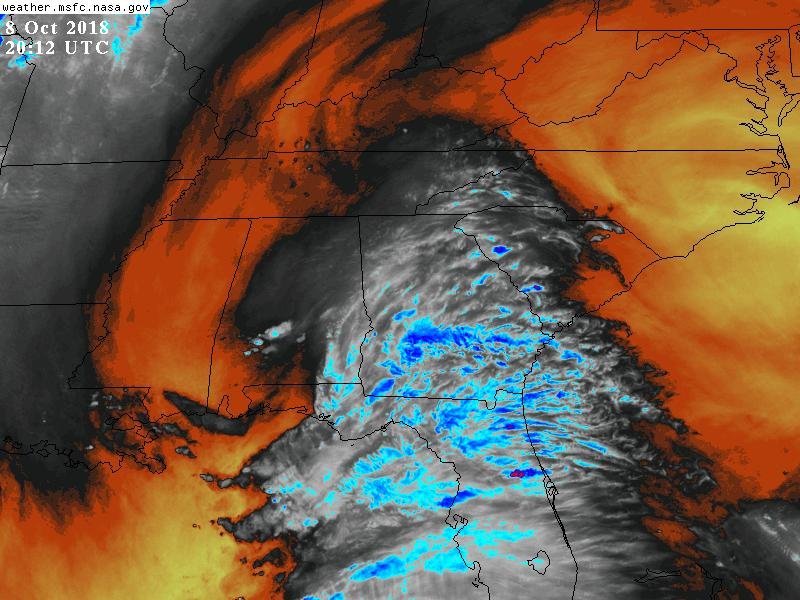
What's the scale on that map? Dewpoint is 68 at Memphis right now, 68 at JAN, and it's 70 in Albany, GA. That's not exactly a huge differential.
-
1 hour ago, Hoosier said:
What do you think it peaks at? Say if it gets to cat 3, I have a hard time believing it would weaken 2 categories by the time it makes landfall. Maybe if it were moving slower but it looks to have relatively steady speed.
I live in the southeast and, if people are thinking this is going to be weakened by dry air entrainment from off land, I think they'll be disappointed. There is no dry air in the southeast just like there hasn't been since May. It's all still one big swamp here- and I'll say that's the difference between now and say- Hurricane Lili. Now, I heard there may be some dry air over the Yucatan but this thing isn't going to be gagging on dry air from the north this time.
-
1
-
-
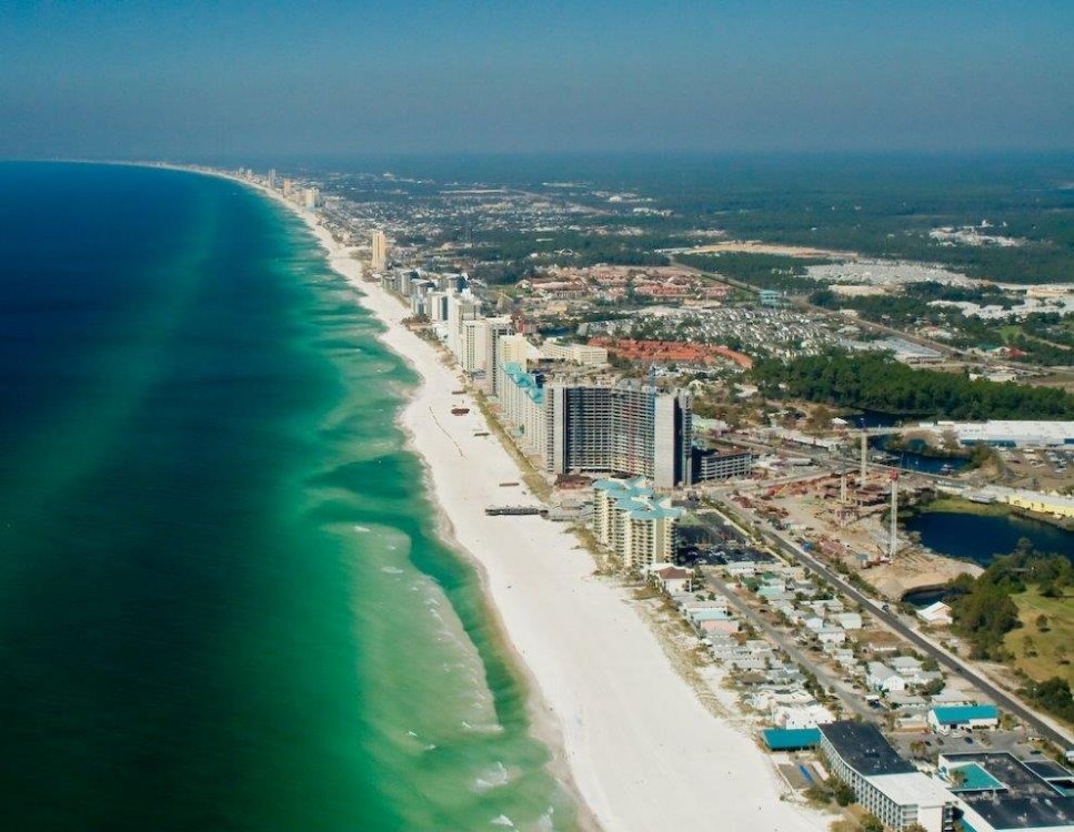
Great illustration of why I have no desire to live in Florida. Nice to visit but a terrible place to live.Fantasy GFS said, "Here ya go!"
Sent from my SM-G950U using Tapatalk
-
 1
1
-
-
It is appalling and it's another discussion entirely but that's why people can't agree on "facts" anymore.why isn't this more appalling to anyone? This guy is a fraud and has no real journalistic integrity. He has been the main shot on TWC for a number of hour and hes been rocking/acting the whole time. What a joke
Sent from my SM-G950U using Tapatalk
-
Unfortunately, I have to work these days or I'd happily go. The only time I ever chased was during Ivan and we were significantly inland. We couldn't even figure out how to get past the contaflow but- yeah-- if I could make a living doing it and had the resources of a network, I wouldn't hesitate to do it. That's not saying I wouldn't be scared-- I'm sure I'd be terrified at times - - but I'd know that going in and I'd know that there's at least some risk- no matter how well you plan (and I would plan extremely thoroughly) -that things could still go wrong.All this pecking at a keyboard... Where's your camera at?
Sent from my Pixel 2 XL using Tapatalk
Sent from my SM-G950U using Tapatalk

January 2020 Mid/Long Term Discussion
in Mid Atlantic
Posted
BUT
Does not equal "good for the planet"
Sent from my SM-G950U using Tapatalk