
sethtoast
-
Posts
17 -
Joined
-
Last visited
Content Type
Profiles
Blogs
Forums
American Weather
Media Demo
Store
Gallery
Posts posted by sethtoast
-
-
On 2/3/2024 at 7:06 PM, wishforsnow said:
I seen more people out on the canal today and they were on both sides of the bridge. Stupid idea. This is the first time in the 28 years I lived here I seen people out on the ice outside the snowmobilers going across.
It's so rare to have a frozen but snowless Portage that some people had to take advantage I guess.
I have no idea how MTU is going to handle Winter Carnival in this weather. I thought last year was bad but 40° and rain on the night of is just going to be brutal
-
4 hours ago, OrdIowPitMsp said:
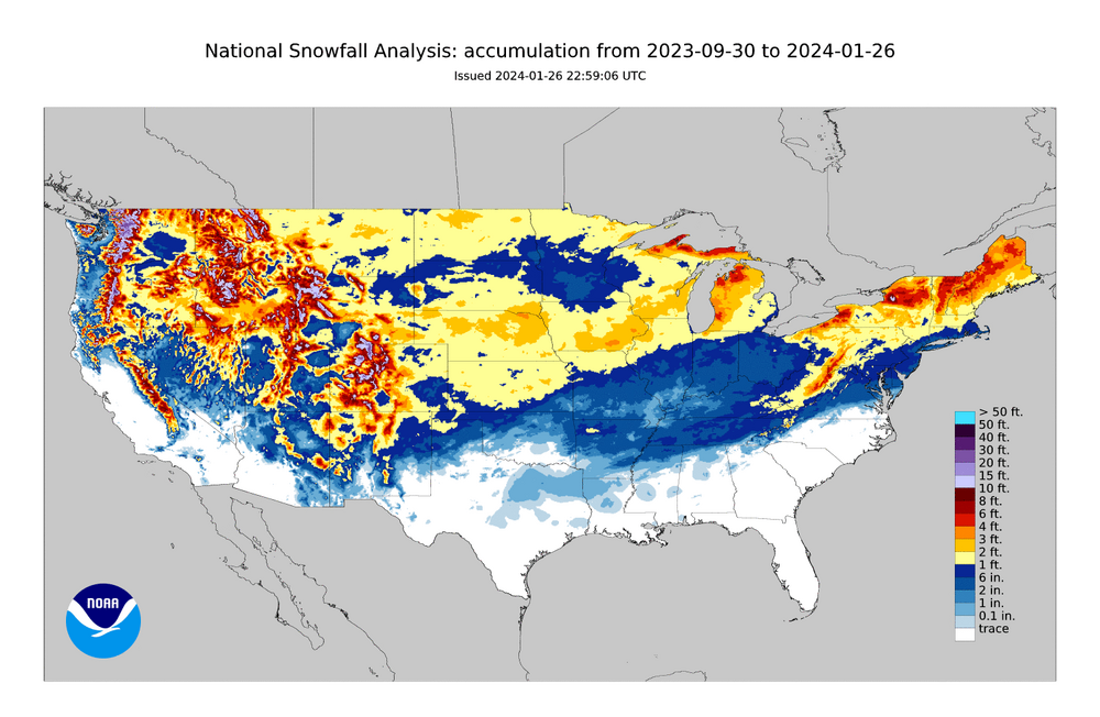
The great upper midwest snow hole of winter 23/24 is very evident on the total seasonal snowfall map. Most of northern Minnesota is around the 5th to 10th percentile for current average snow depth.
MSP making up for last year
-
 1
1
-
-
How is this dude able to make 10 alt accounts in the time it took me to make one
-
 3
3
-
-
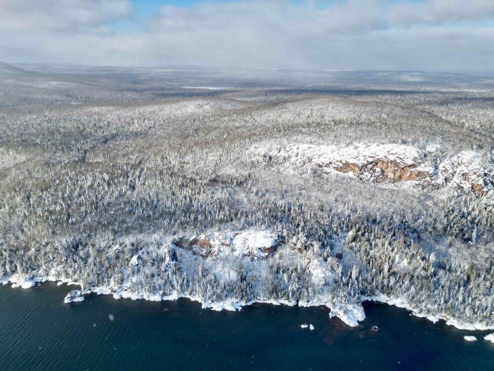
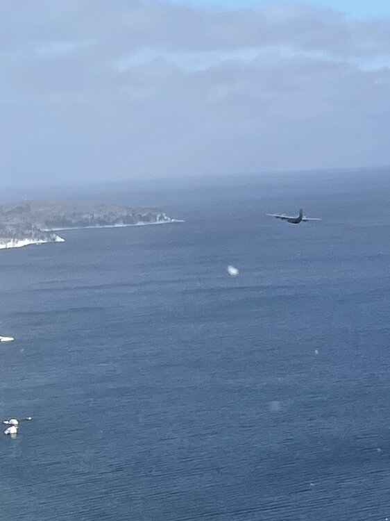
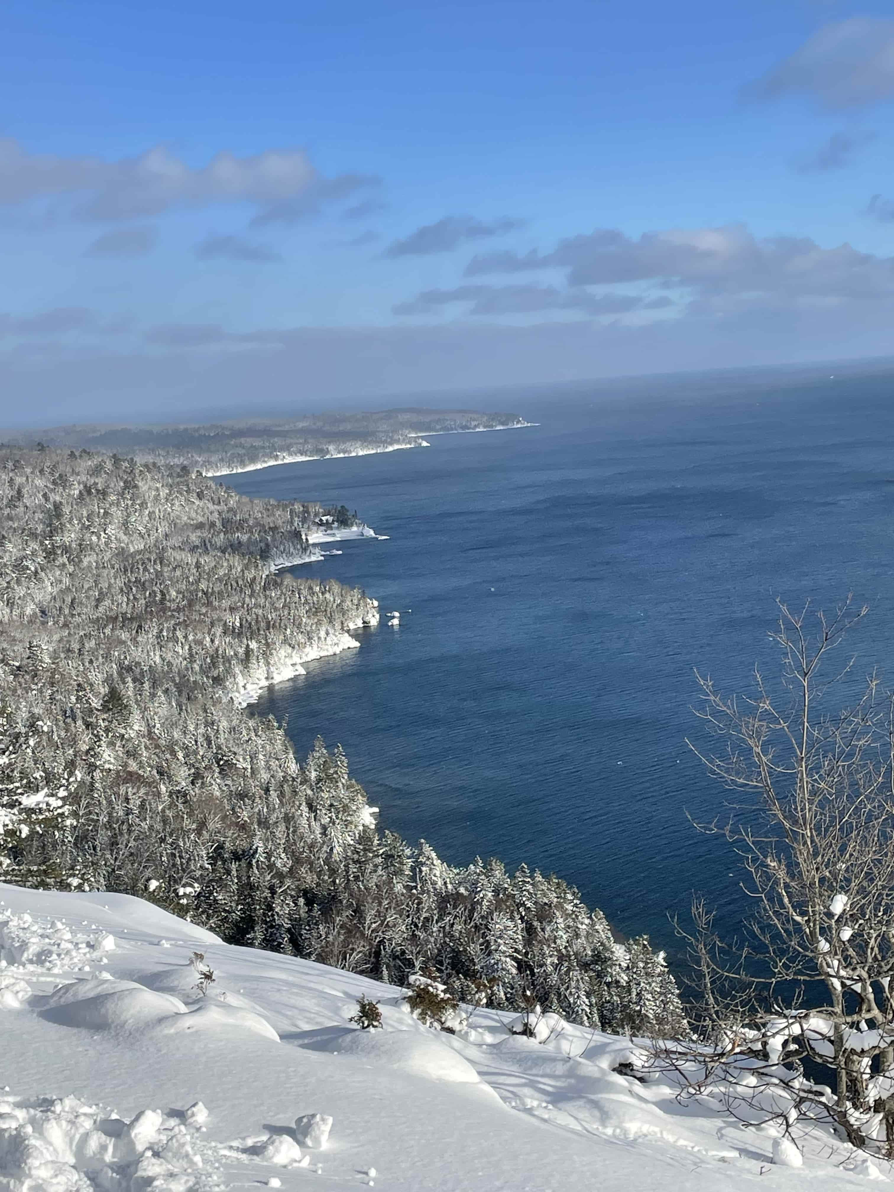
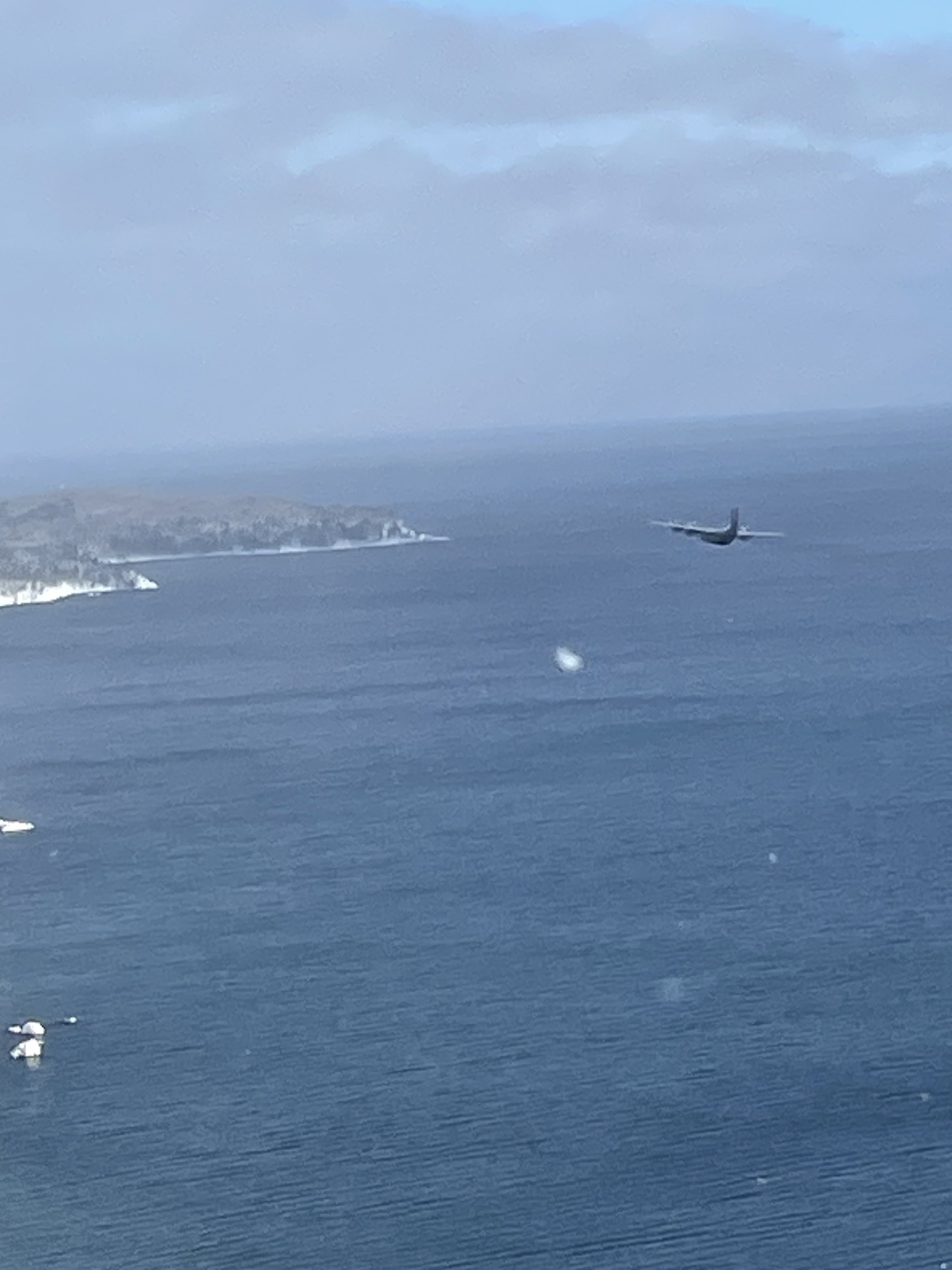
Absolutely gorgeous past couple of days in the Keeweenaw. Blue skies and snowy trees are a rarity even up here (the former is the real challenge to capture).
Bonus High Resolution Images - https://imgur.com/gallery/1bV8ocV
(Some photos are not mine. I didn't have the reaction time to get the C-130 that snuck up on us)

-
10
-
-
00z GFS looking a lot better in the extended. Even the ensemble is trending cooler with less PAC air
-
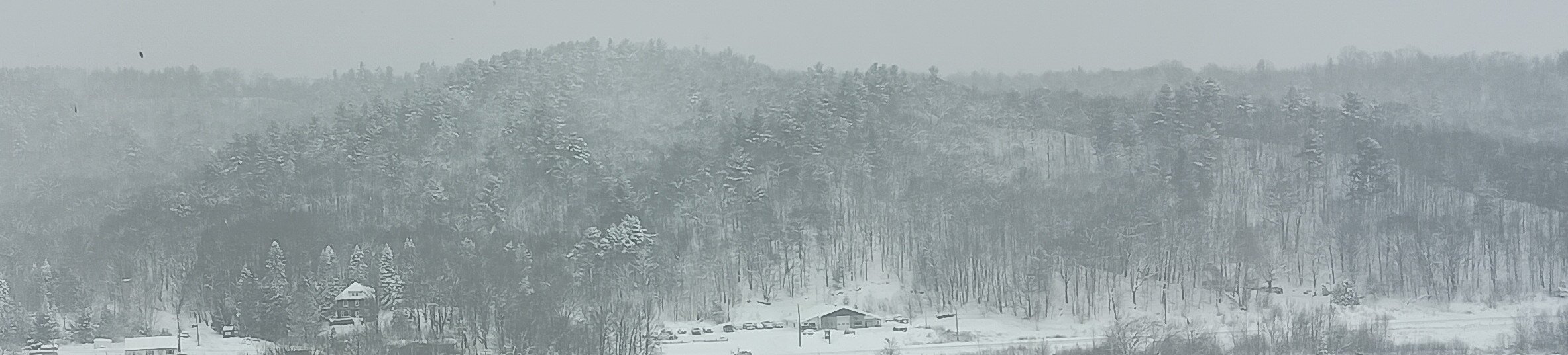
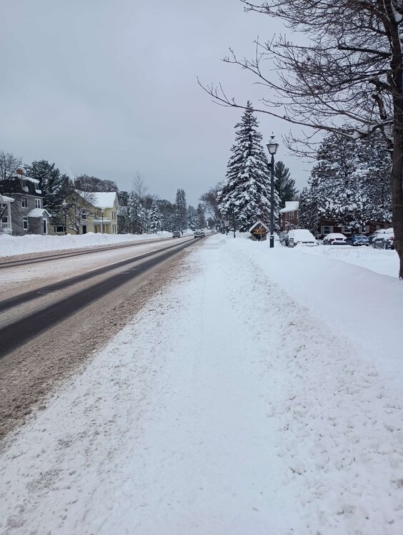
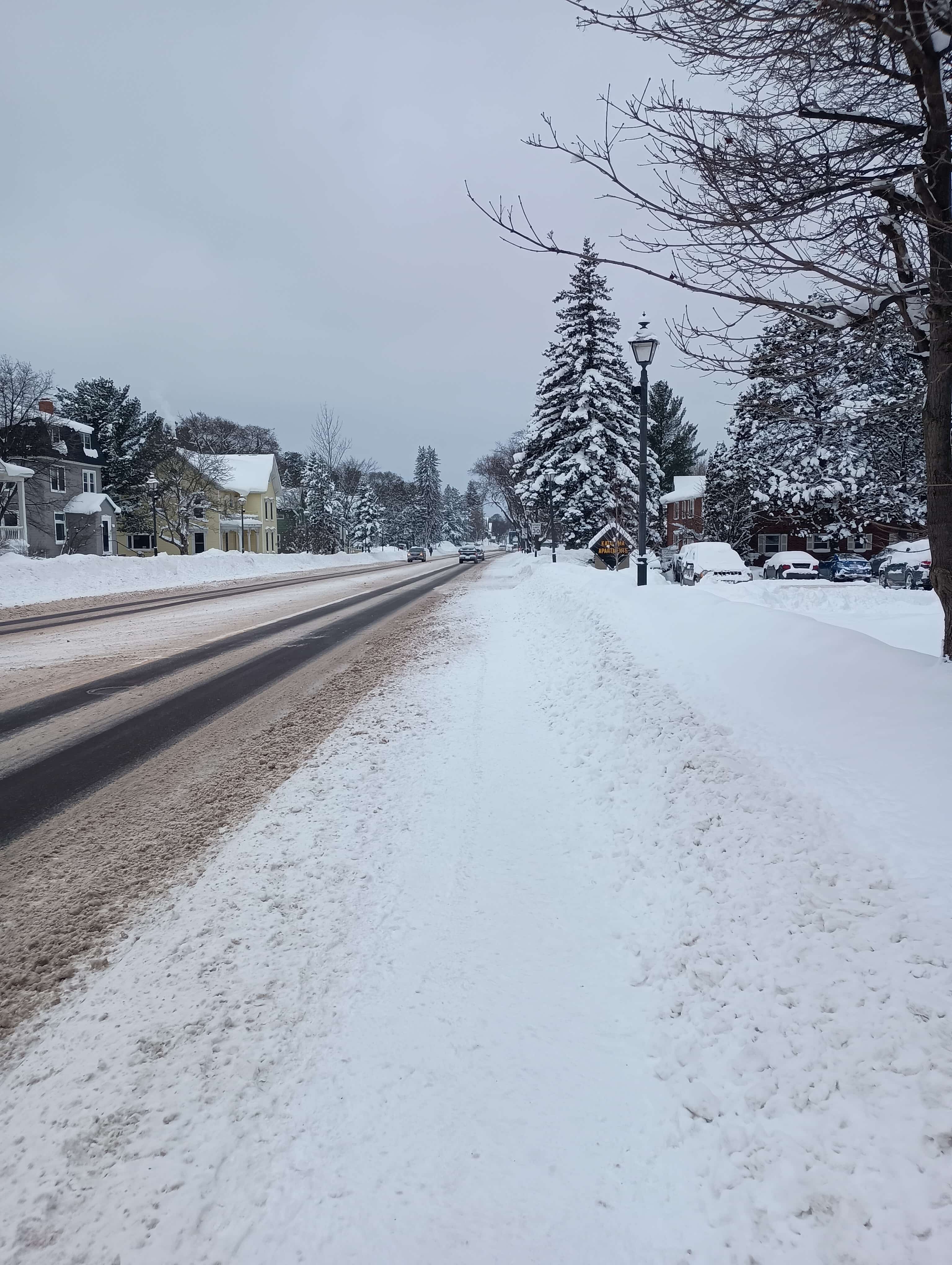
Some pics from the Houghton area today. It's a lot prettier than my cheapo android camera and the 2 MB forum file size (Seriously, is it still 2003 in here?) can capture.
.thumb.jpg.bca6a34a33e040126f4643e438f021e2.jpg)
.thumb.jpg.d777566fc50ff0114c151ecbd1e529ab.jpg)
-
4
-
-
13 minutes ago, WestMichigan said:
Similar here but not quite as much. GRR is reporting 13" snow depth and a peak of 15" a couple of days ago. 28.6" so far this month at the airport which brings us to less than 9" below normal for the season. Quite the turnaround for a sub 2" December. Even the monthly temperature departures might go negative after today. This has been a great week for the west wind favored LES areas for sure.
Had a lull in snowfall last night. Looks to be picking back up, but as plates / columns so not expecting a huge day of accumulation.
I'm still 4 degrees above normal for the month at KCMX. I really doubt we'll get much lower than that given the dumpster fire of a pattern we have next week. In any case, I don't really have much of a right to complain at this point.
-
Back down to 1/4-1/2 mile visibility out my window. Looks like we've returned back to dendrites so hopefully we can squeeze a bit more out of this before the warmth sets in this weekend and next week. This week has definitely been a top 10 event for me, although I'm sure you can guess by now I haven't witnessed as many winters as most people here, and most of them were in Chicago suburbs.
-
3
-
-
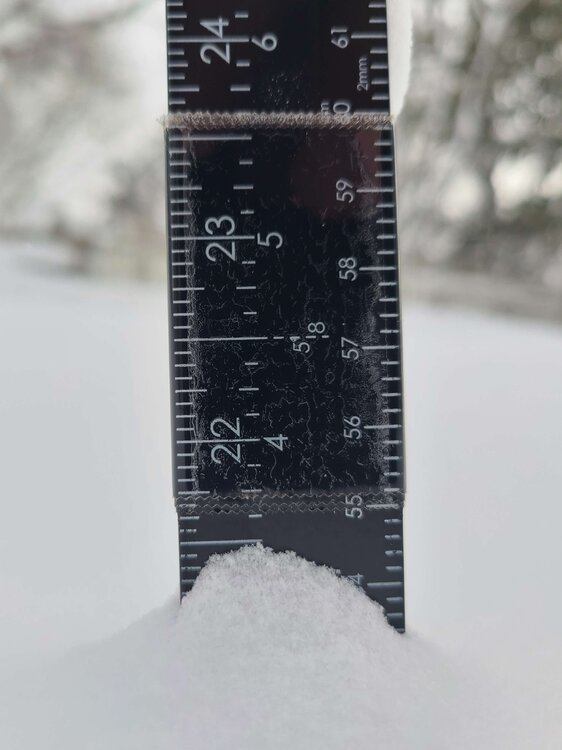
1 hour ago, Lightning said:
Trust me I know that photo well!! I didn't even need to look at your location.
Where did you get your measurement from or did you measure it? Just wondering if that was an in-town measurement.
It's from a friend who lives about half way up the hill in Hancock. I personally don't have a backyard so that's the closest local measurement I can get. Now that I'm looking at the actual photo it's more like 21.5" but still not bad considering we started from basically 0 and barely got any synoptic snow from the initial low on Friday.
I would note that Calumet and northwards was hit by a pretty strong shore-parallel band yesterday through to this morning. They've probably gotten an extra 8-12" that we haven't received.
-
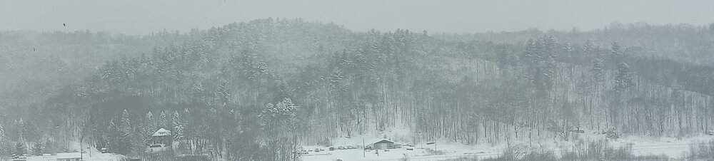
6 minutes ago, Lightning said:
About where are you located in Houghton?
The above photo was taken from an MTU building. Without doxxing myself too much I'll say I'm within walking distance of campus.
-
Lake Effect still ongoing from last Friday's system and subsequent cold air mass. Was down to 1/4 mile visibility just from falling snow until about 1 this afternoon. 22" IMBY so far and still going pretty strong.
I pre-emptively apologize for having the best winter wx climo on the subforum
-
1
-
2
-
-
Only have had 5 cumulative hours of subzero temps so far. The lakes being nearly ice-free up to this point has definitely helped with that.


.jpg.160f992bcf468a9c898f8995c1353a19.jpg)
.jpg.451545822a5e367168d58ea8ee34d2d6.jpg)

February 2024 General Discussion
in Lakes/Ohio Valley
Posted
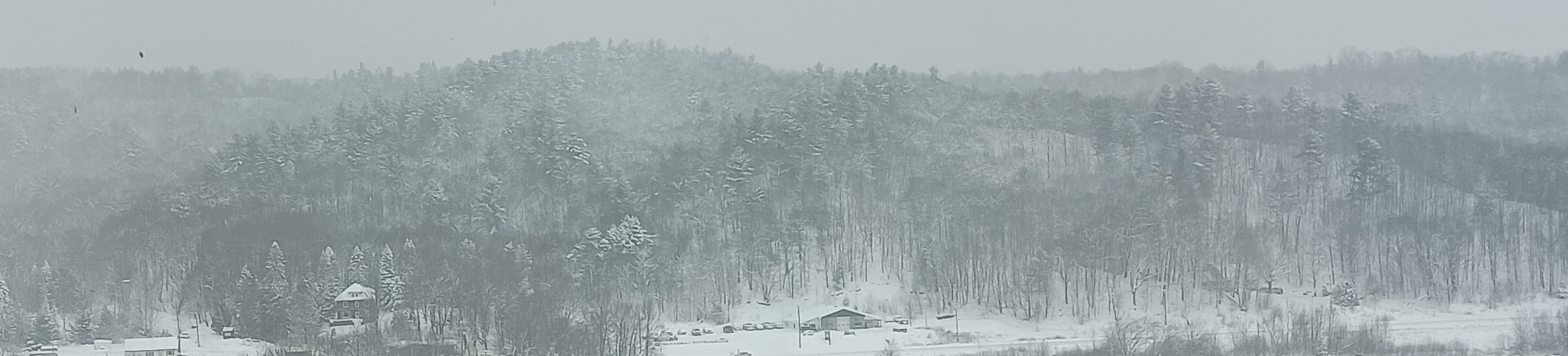
They gave up over a week ago. I had a ski trip planned in the Porcupine Mountains but had to cancel because it looks like this at the moment