AccuChris
-
Posts
772 -
Joined
-
Last visited
Content Type
Profiles
Blogs
Forums
American Weather
Media Demo
Store
Gallery
Everything posted by AccuChris
-
Measured another inch in Lebanon over the last 2 hours so storm total so far is 2”
-
Just measured 1” in Lebanon with steady snow
-
I, too, am surprised how quickly the airmass has modified today under generally cloudy skies. Low in Lebanon overnight before the clouds dipped to 7° and all morning was in the teens but now at 32°.
-
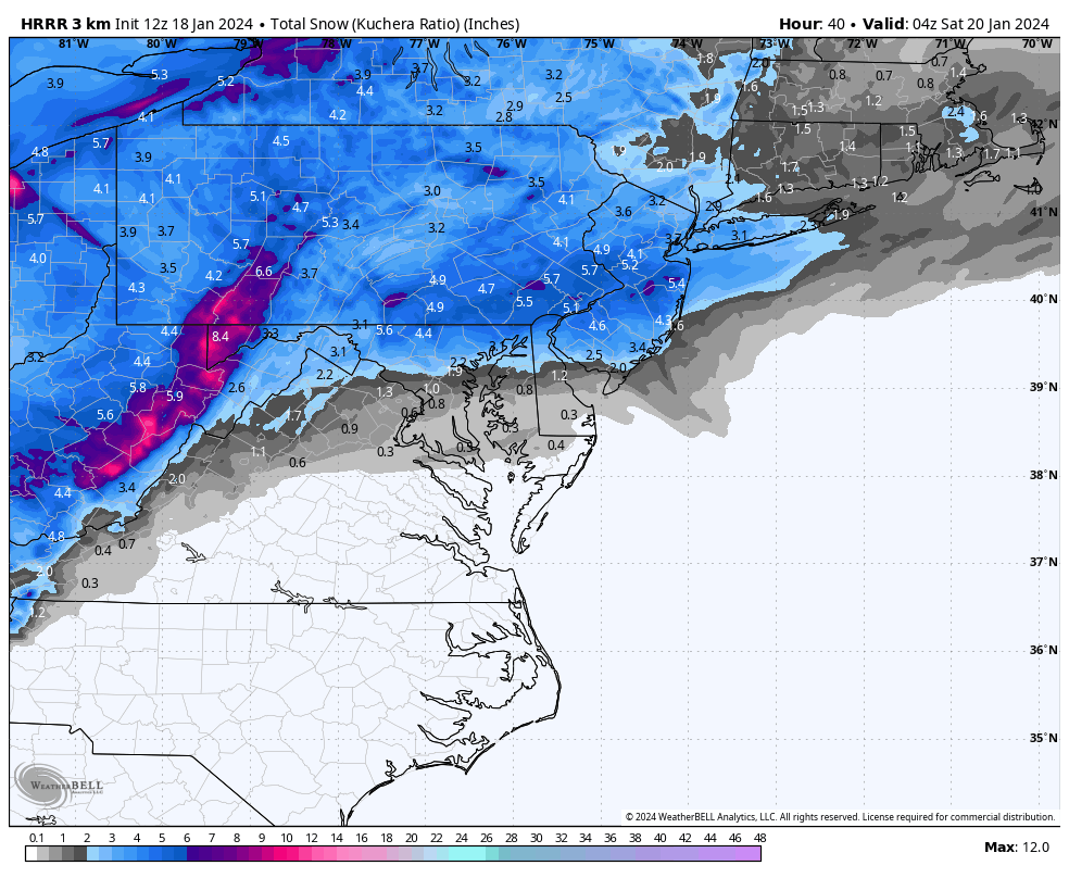
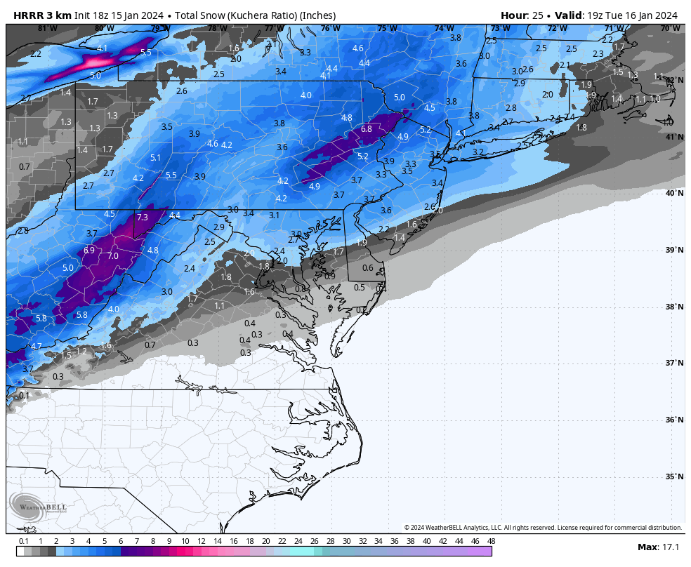
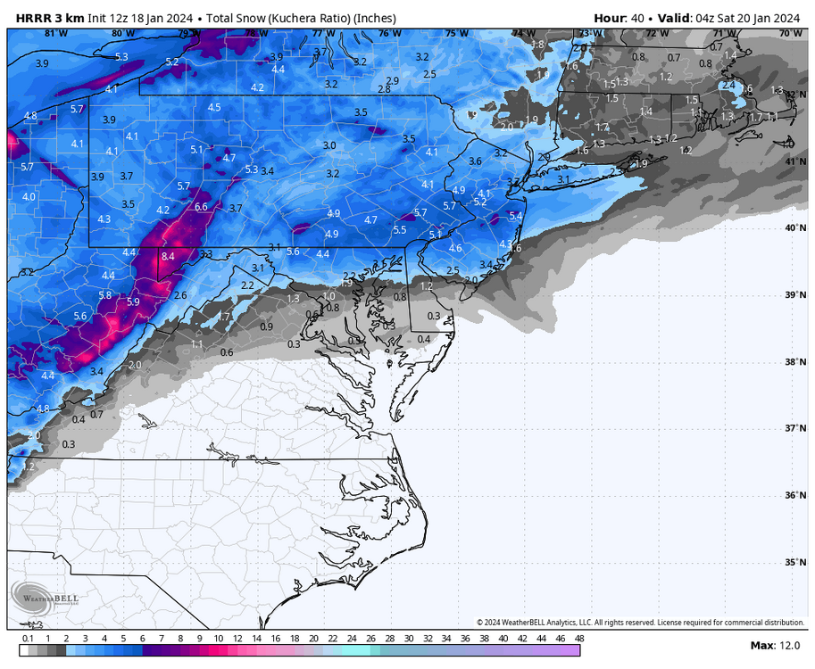
Another kuchera snow map from latest long range HRRR
-
Up to 3.5” now in Lebanon with steady snow still falling
-
Snow has picked up again in Lebanon, added another half inch this morning making is 3” so far. Wind picking up a bit. Temp 23°
-
2.5” in Lebanon with very fine flakes falling
-
1” officially measured in Lebanon with steady snow
-
1/2” of snow in Lebanon and winter storm warning just issued for up to 6” of snow
-
Lebanon currently at 23° and DP 17
-
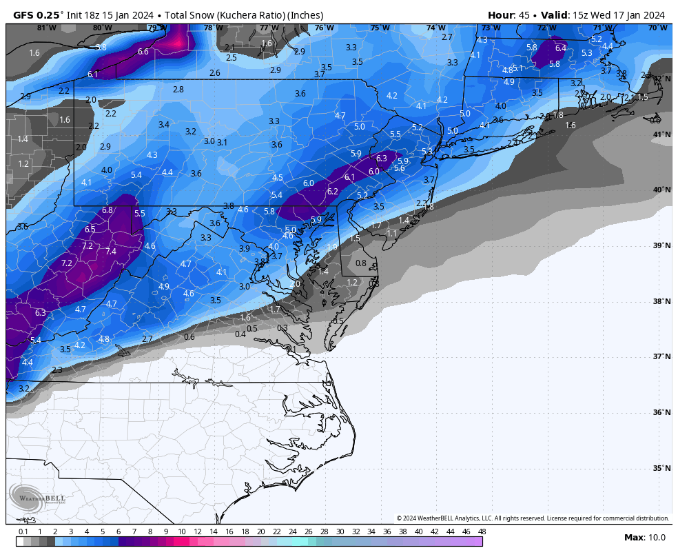
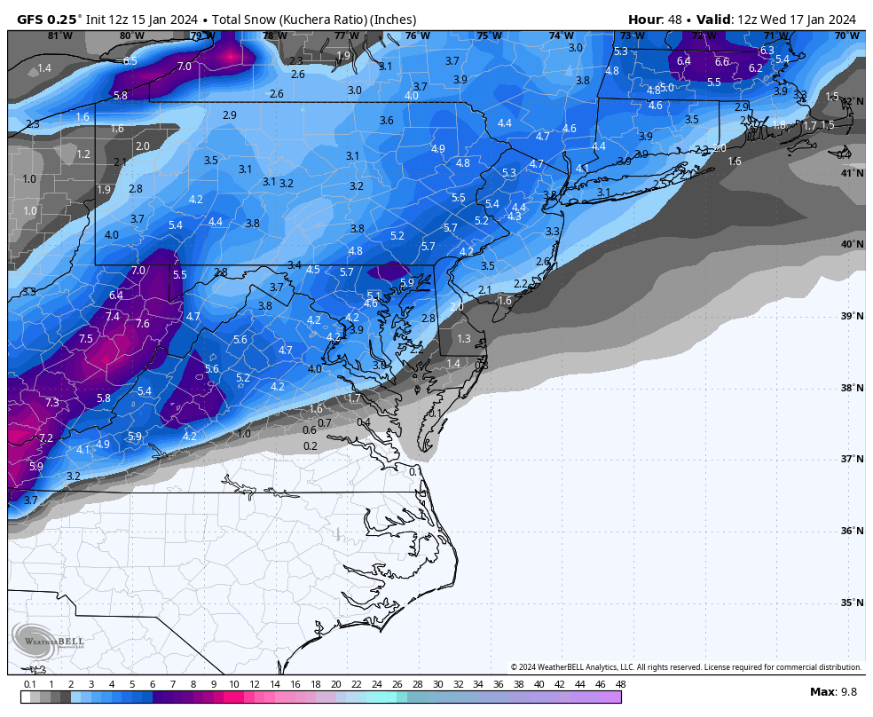
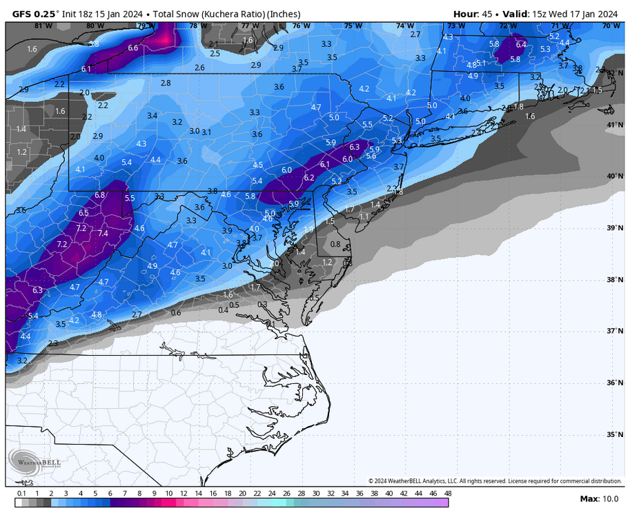
18z GFS kuchera snowmap also showing stripe of possibly 6” amounts in LSV area
-
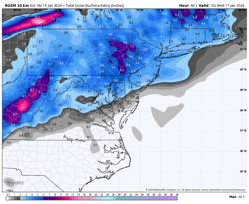
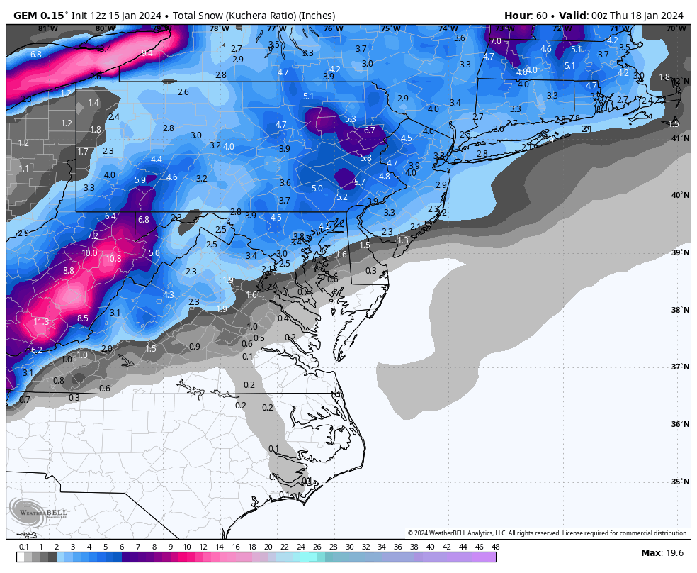
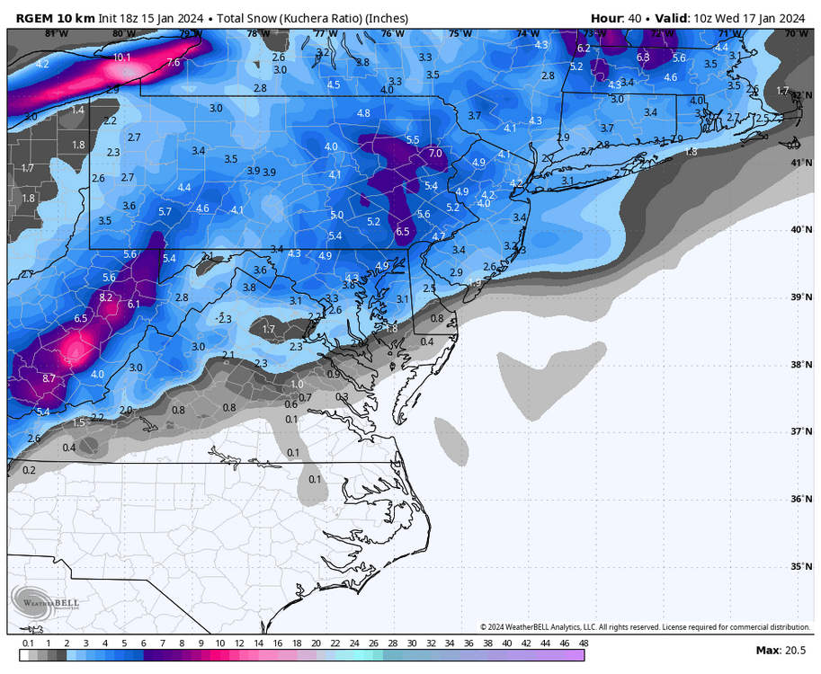
18z RGEM looks great too
-
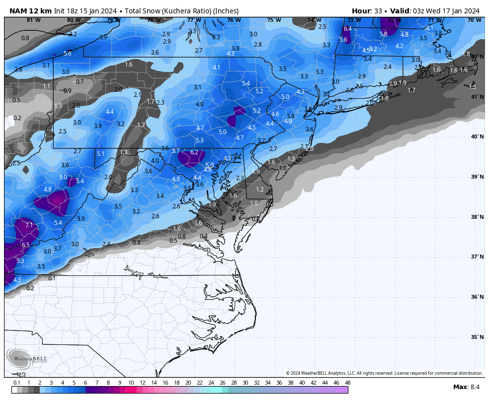
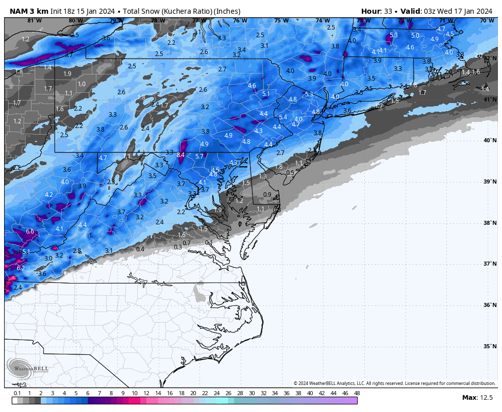
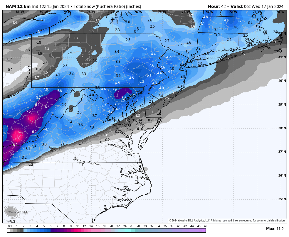
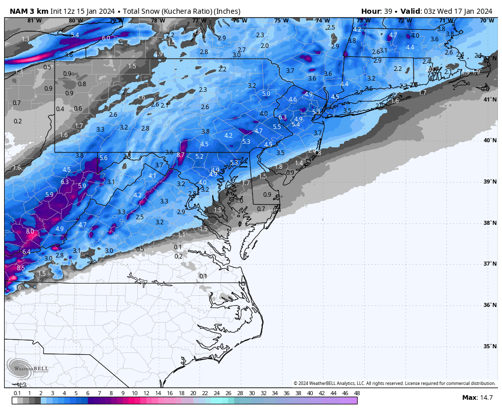
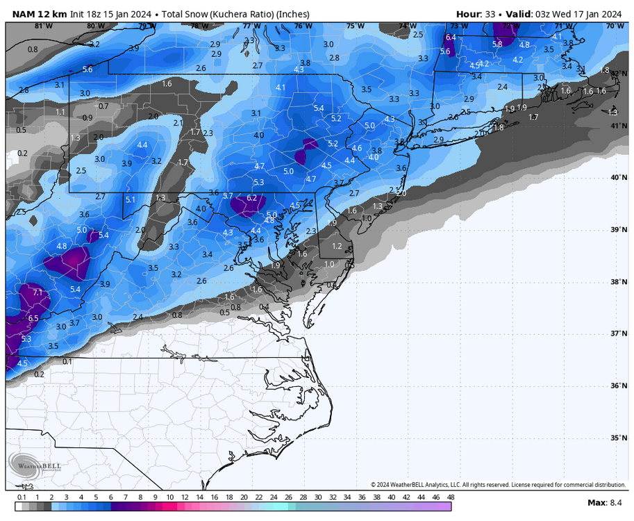
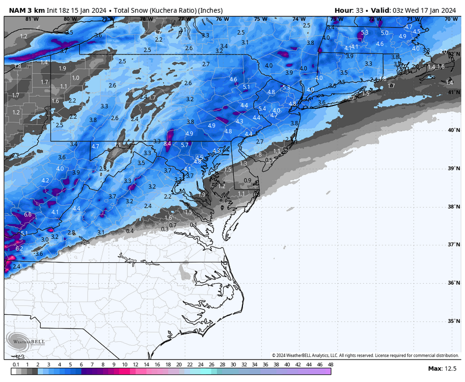
Latest 18z NAMs getting slightly more amped as well and very much in line with the latest long range HRRR showing a wide area of 4-6” in the LSV region
-
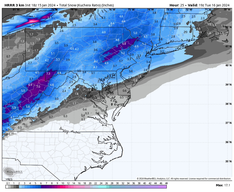
Latest long range HRRR getting slightly more juicy and hinting at close to 6” of snow in areas like Lebanon County. That pushes warning criteria as its 5” there
-
Light flurries in Lebanon right now
-
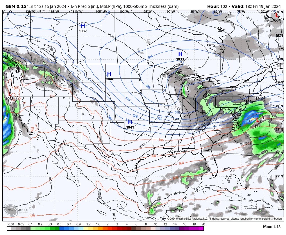
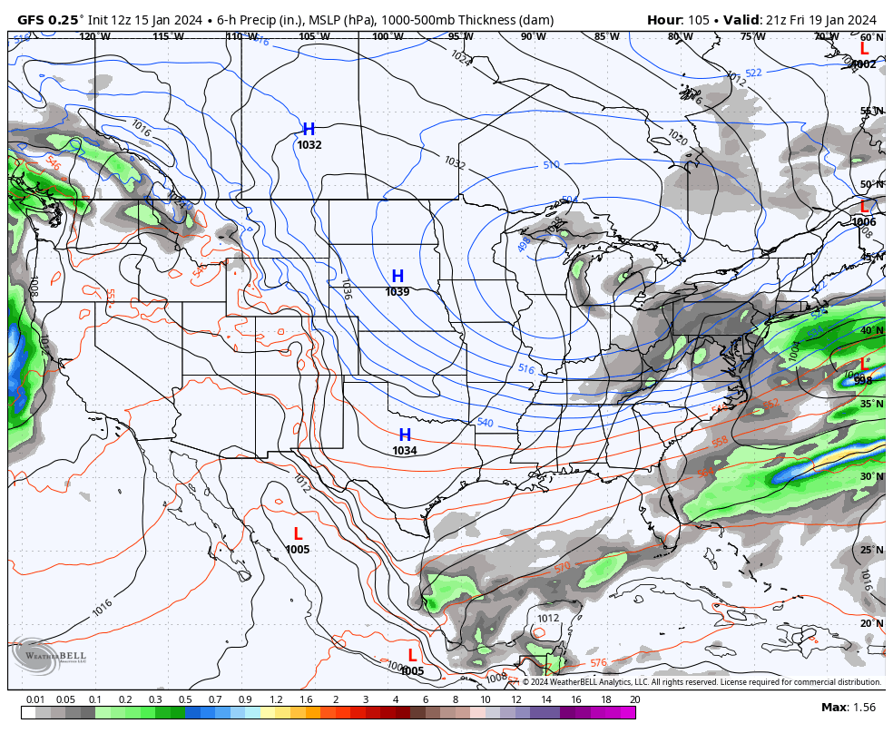
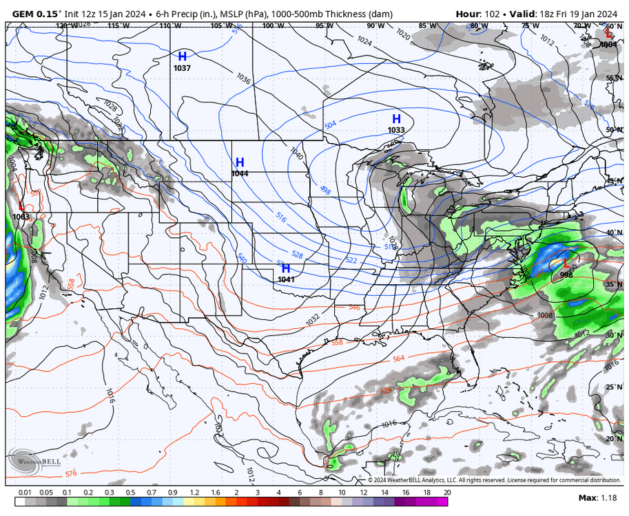
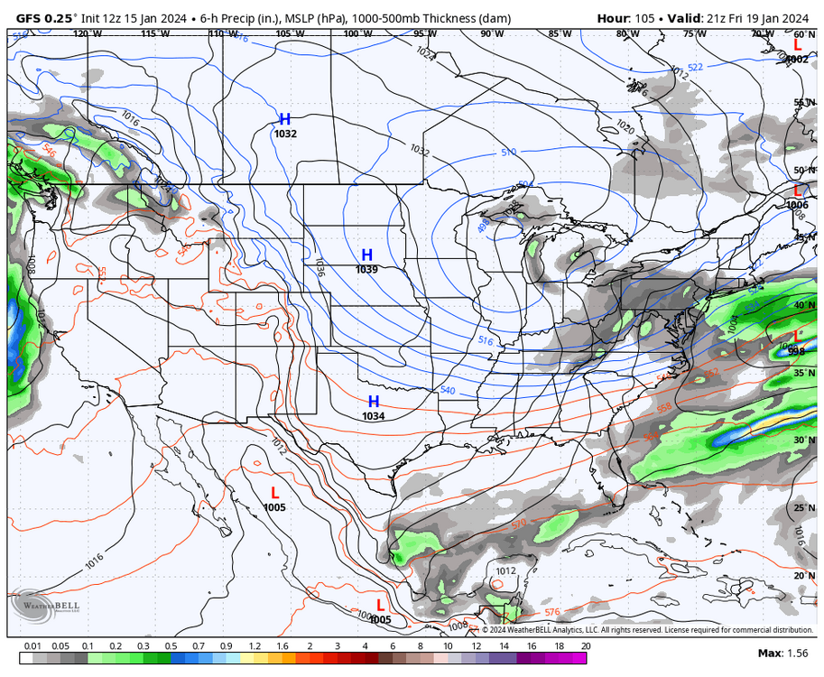
Canadian and to a lesser extent the GFS still trying to drum up trouble at the end of the week too
-
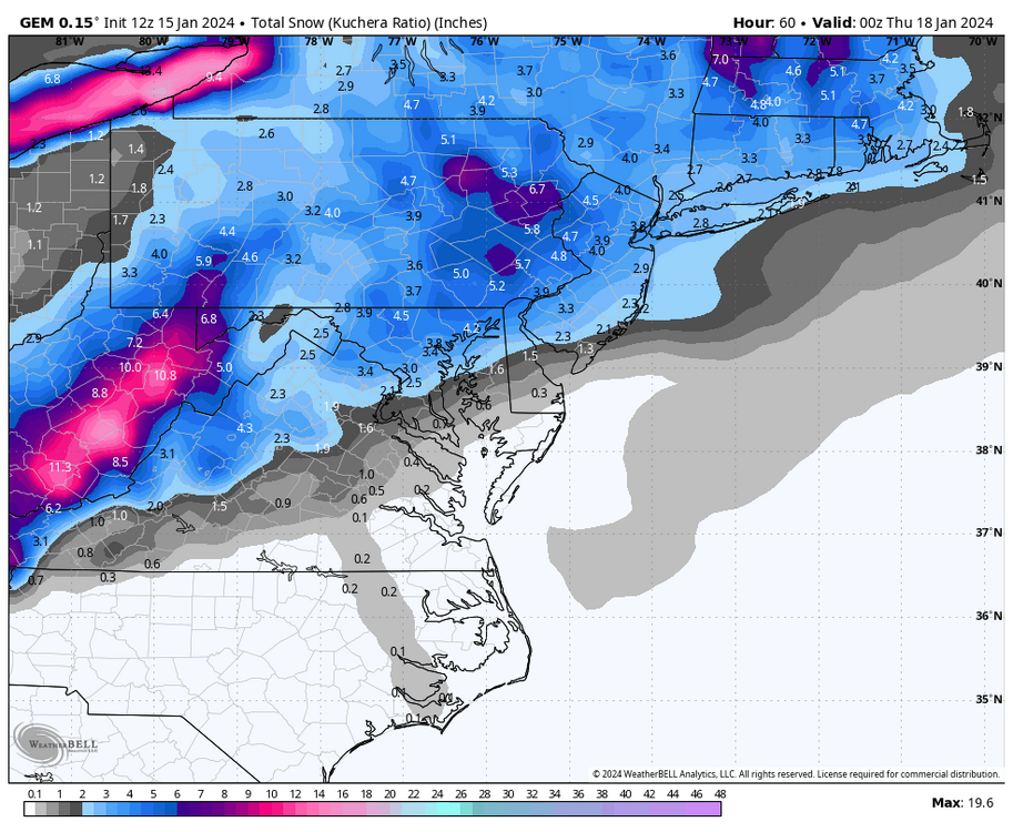
12z CMC looks great too
-
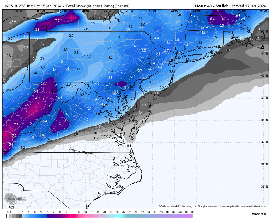
12z GFS Kuchera snowfall map
-
Last minute 12z NAMs’ kuchera snowmaps…all looks good
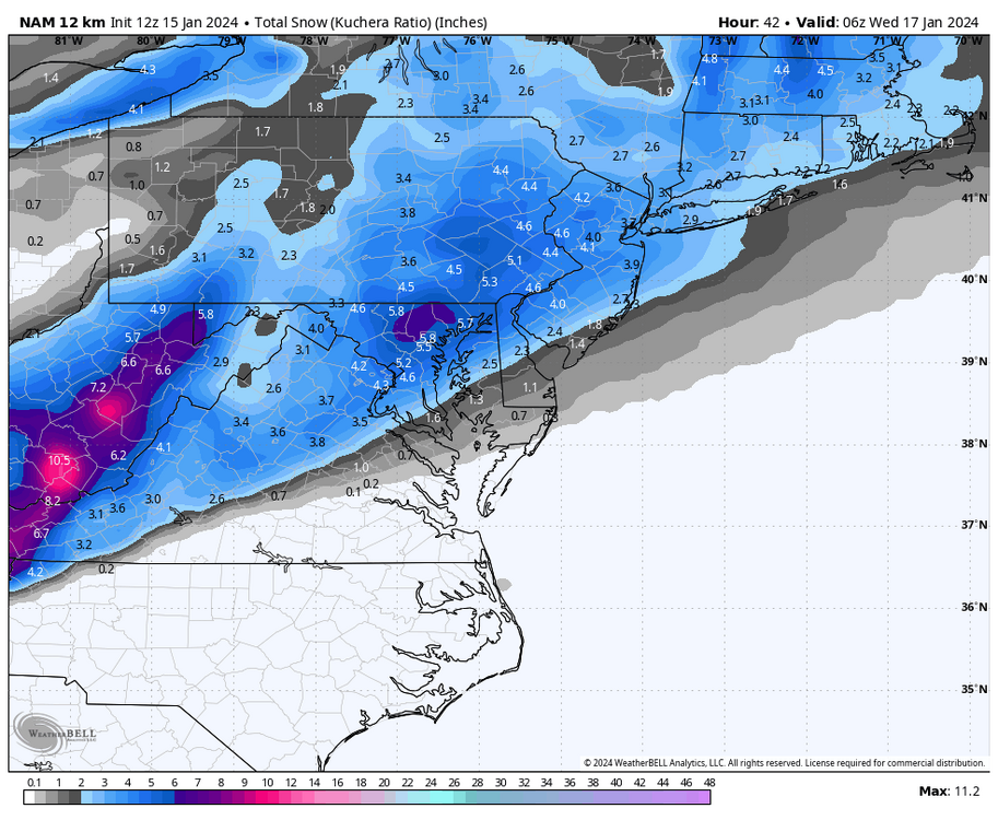
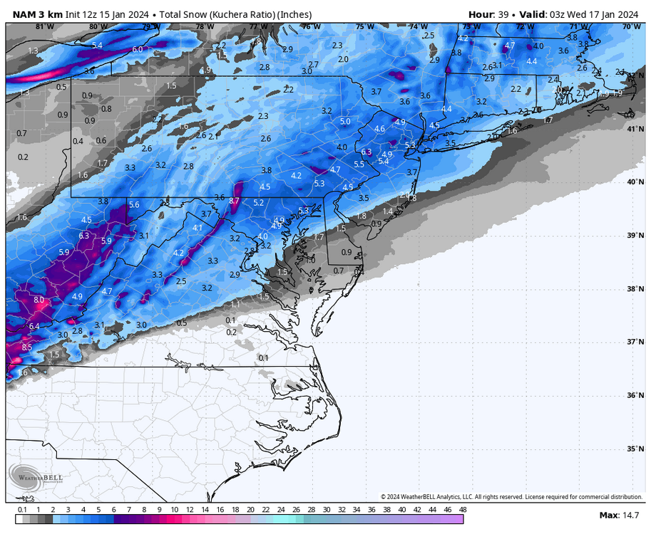
-
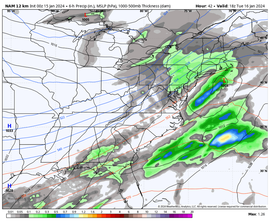
0z NAM trying to keep this juiced up over a large area
-
I was down at my alma-mater at the Millersville Meteo Dept about 6 weeks ago seeing some old friends and faces at the weather center and asked about the new radar etc. Long story short, its not even operational yet as some parts were missing/broken and have not been replaced/repaired yet to be even functional. Once it is, the radar will not be available for public viewing/use unless the NWS or other media outlets buy the license rights to broadcast it and use it. Its a private company so everyone who “wants to use it” needs to pay for the access. I would imagine the NWS would want it as they are the only entity who can issues warnings, etc. Hopefully we all will get the ability to see it once its up and running and a deal is worked out. Millersville University is only a location for the radar and for research and not the ones who give the rights/licenses out. Although Millersville did spend a ton of money via a grant to get the radar there and access to it for research. But again, its been 5 months installed now and not functional.
-
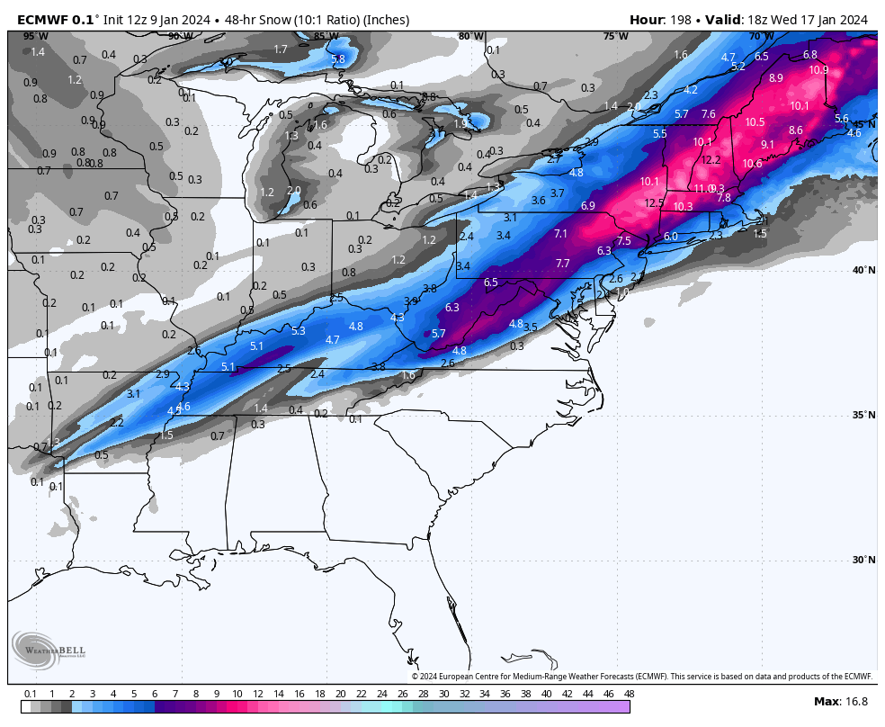
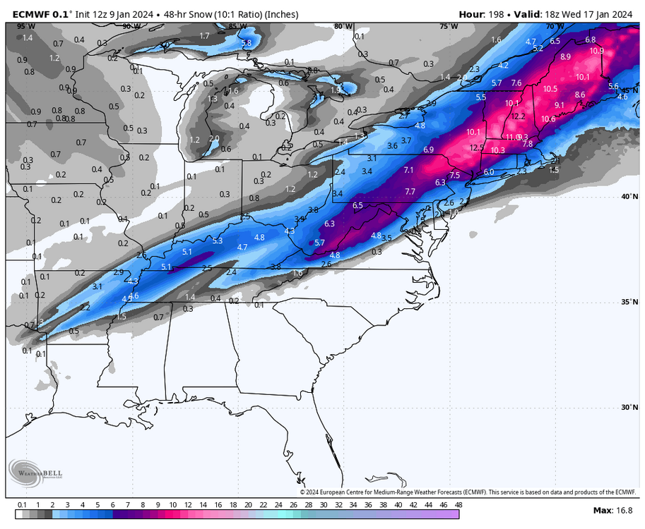
Here is the 12z European 2 day 10:1 snowfall map for next Tuesday
-
Just measured another inch on the snow board in Lebanon making it a storm total of 4” and now it went over to moderate freezing rain. Winds gusty out of the NE at 20MPH and temp 30°
-
Went back to heavy snow for a while in Lebanon and just measured new storm total of 3” now
-
Back to heavy snow in Lebanon now