AccuChris
-
Posts
772 -
Joined
-
Last visited
Content Type
Profiles
Blogs
Forums
American Weather
Media Demo
Store
Gallery
Everything posted by AccuChris
-
Yes, in Lebanon my weather station hovered around 30° throughout the event. Seems like Lebanon City just skirted the southern edge of the death band. Saw on social media someone posted close to 12” in Fredricksburg about 7 miles northeast of me that parallels Route 78 near the Berks County line…wild stuff
-
To illustrate the intensity of this narrow band that set up, I have a friend that lives 6 miles north of me near the 78/81 interchange in northern Lebanon County and they have about 8” and I have 5” closer to Lebanon City
-
This goes to show that rates are everything for the duration of a storm. Before the last storm it was almost 50° 12 hours prior to start time AND rain first. Went over to snow and boom snowed 1”/hr for 6 hours and I got 6” and every road and highway caved immediately. This storm comes 12 hours after a high of 40° and comes at night but rates not nearly as great, we had the fluff factor make up for lower rates and no pavement caved this time
-
Just measured 5” here in Lebanon with light snow presently. Like others, even with 5” on the snow board, roads and sidewalks just wet, even with a night storm
-
Light snow has commenced in Lebanon
-
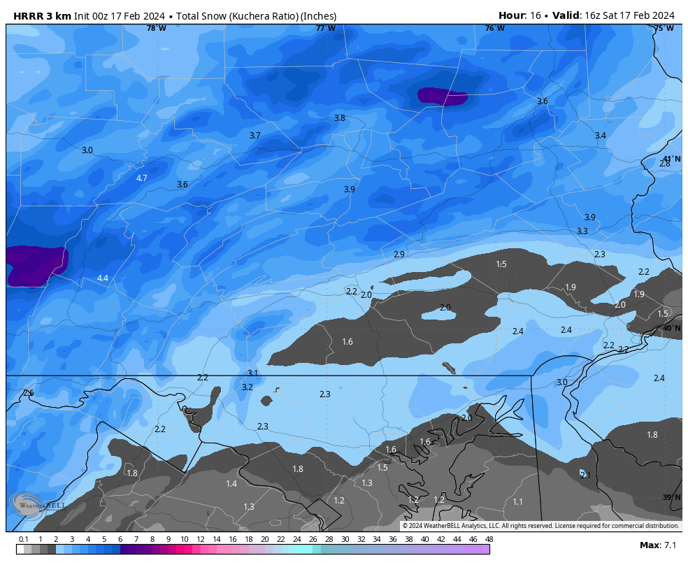
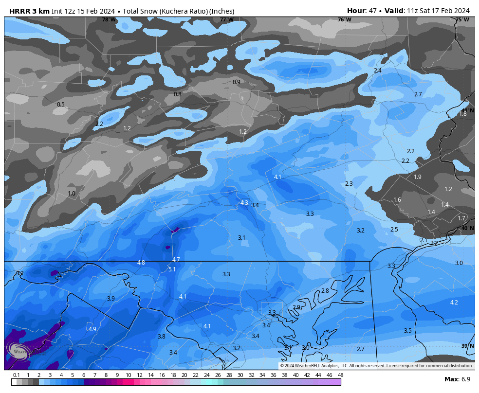
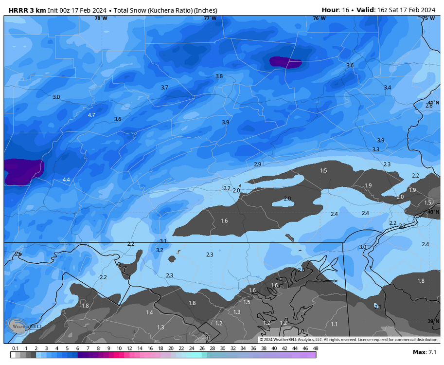
Latest HRRR looking quite paltry over LSV
-
Sitting in Lebanon at 38/19 right now
-
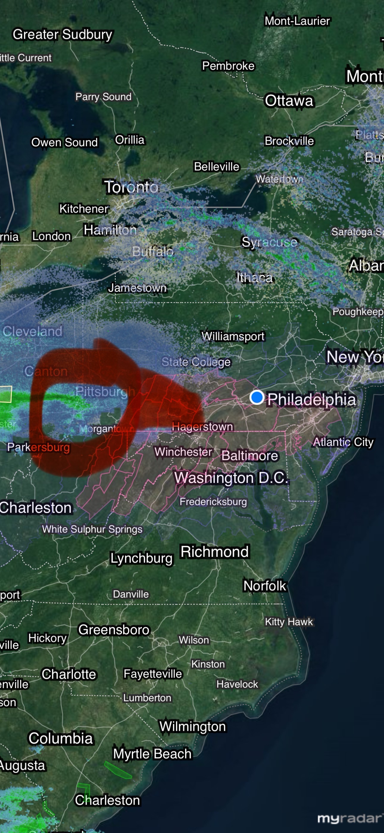
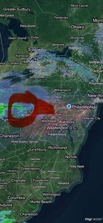
Follow the “finger” of snow and that generally will be where the best band will be. Looks to want to ride right across the Turnpike. So 5-10 miles either side of the turnpike ultimately may have the greatest snowfall amounts. We will see
-
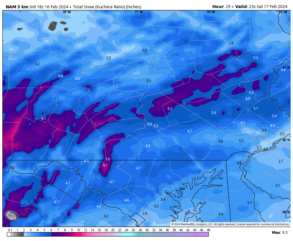
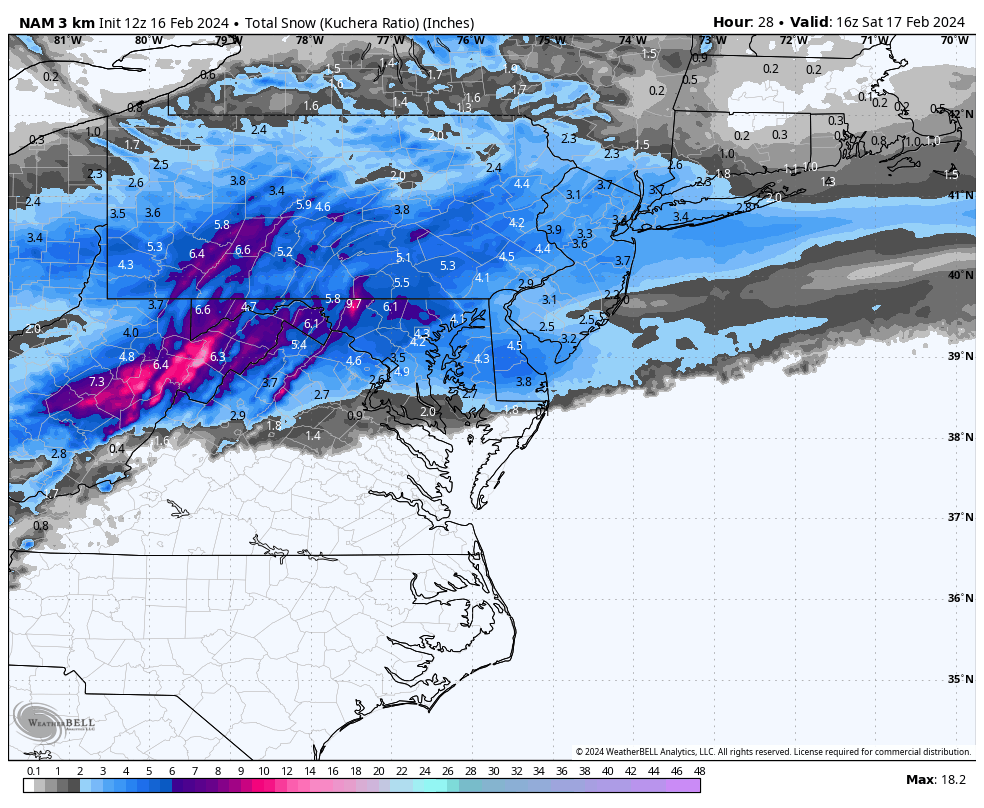
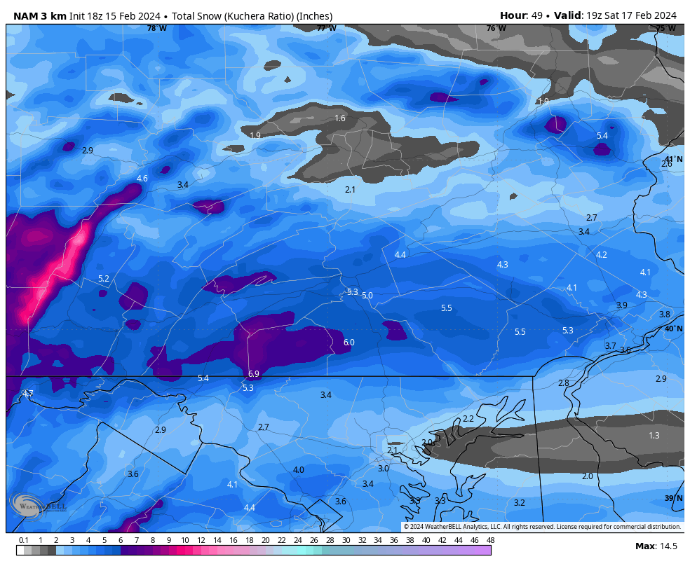
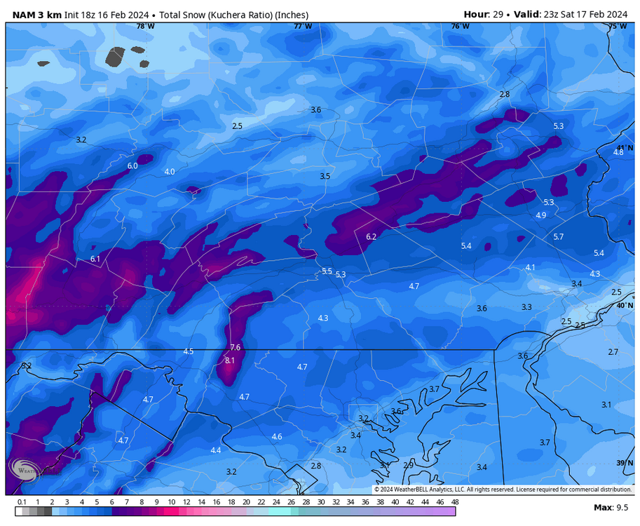
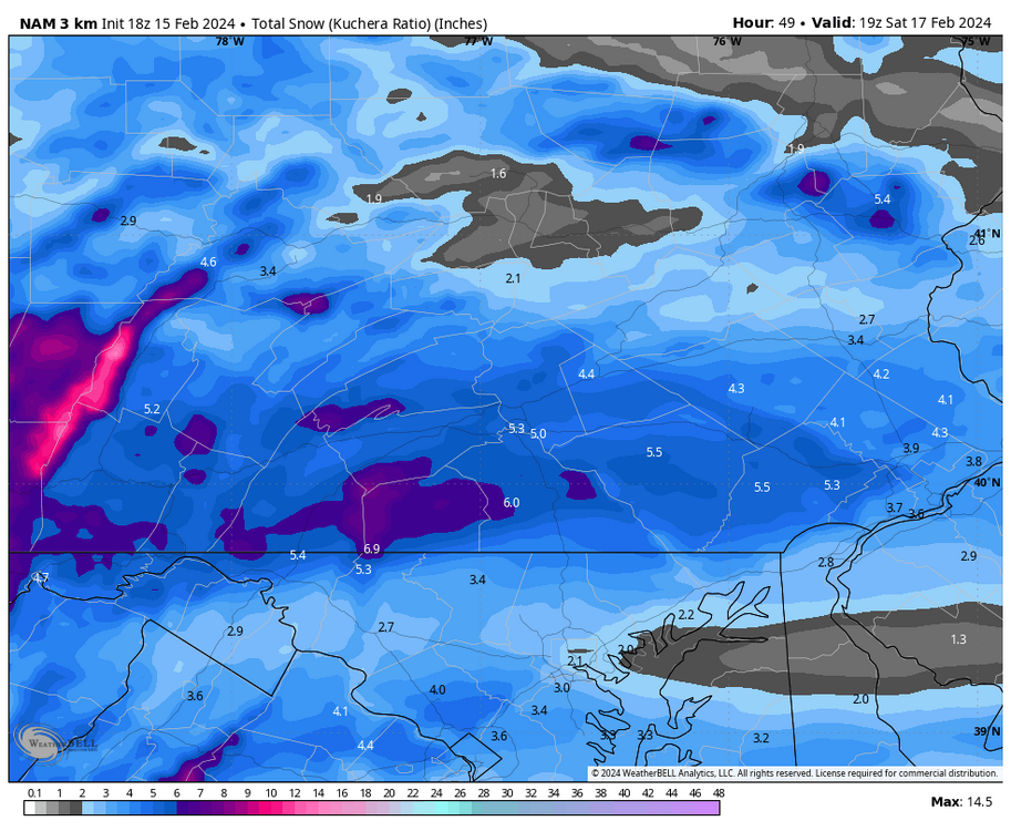
Here is another zoomed in 18z 3km NAM kuchera map
-
FWIW, at least at my location in Lebanon, I am 6.5” away from reaching a cumulative season snow total of 24”. Anything we get beyond tonight storm is gravy and this season has already been wayyy better than the last couple years in this area. I chalk this season up as a win for snow lovers regardless what the rest of this month and March bring
-
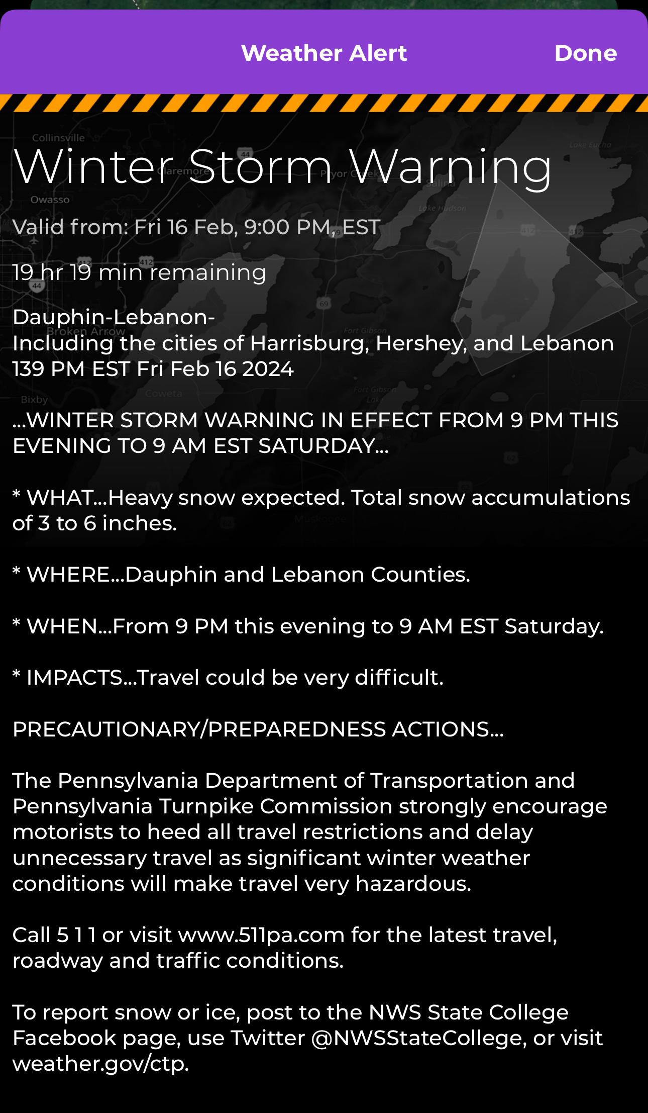
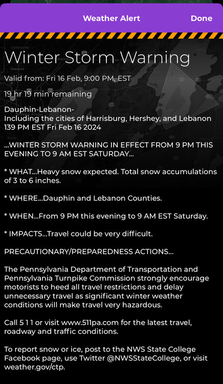
Hot off the press: Winter Storm Warnings
-
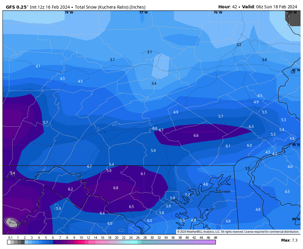
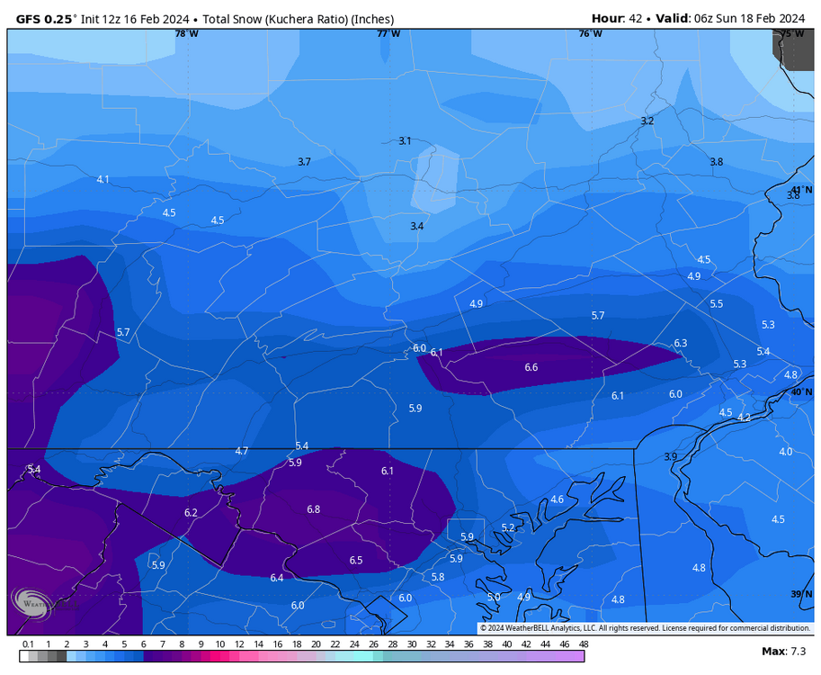
12z GFS kuchera shows widespread low-end warning snows
-
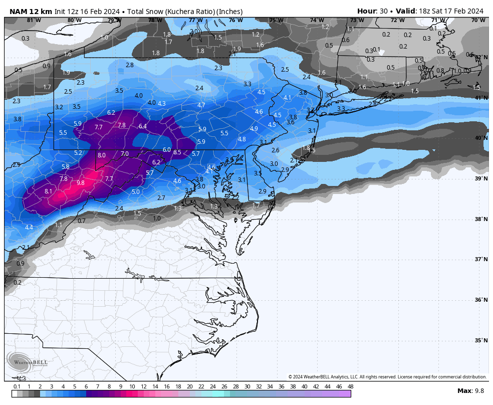
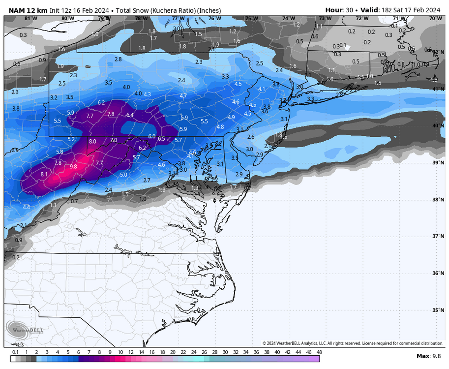
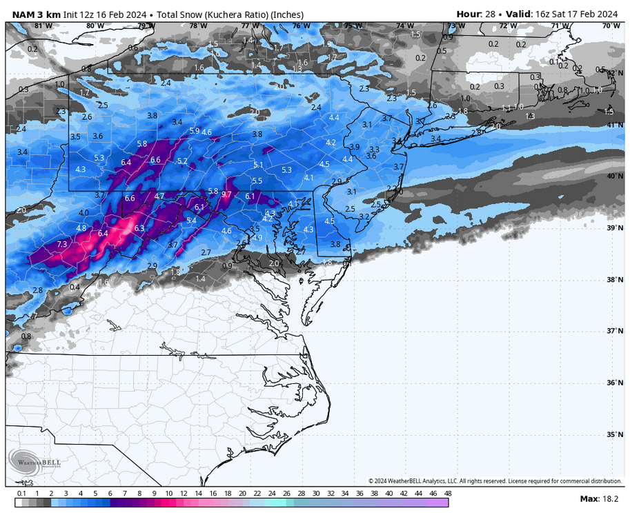
Another kuchera view of the 12z NAM and 3km NAM….very much in line with the latest HRRR
-
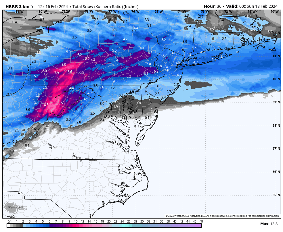
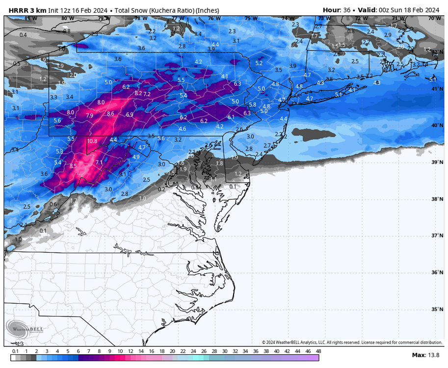
Another view of the HRRR looking amped up
-
Beautiful look on the 18z3km NAM
-
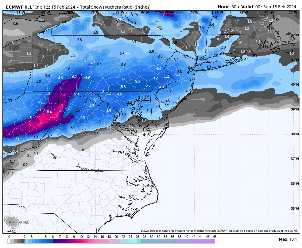
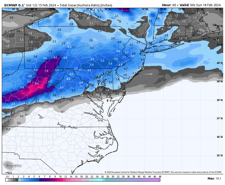
12z Euro Kuchera looks the most robust for Saturday
-
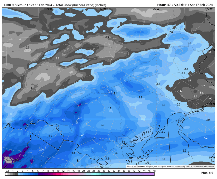
Zoomed in Kuchera map for 12z HRRR
-
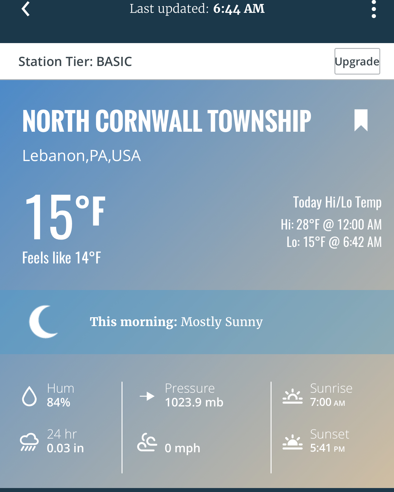
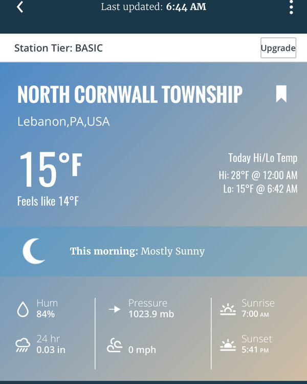
Dipped pretty chilly this morning in Lebanon
-
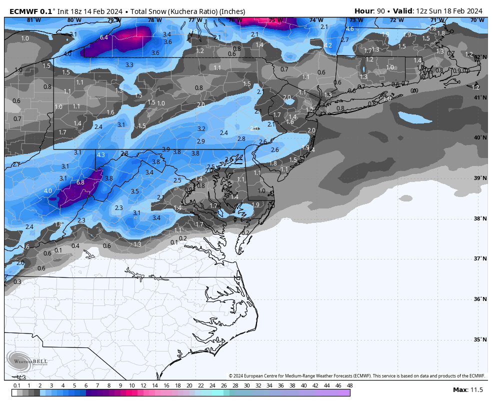
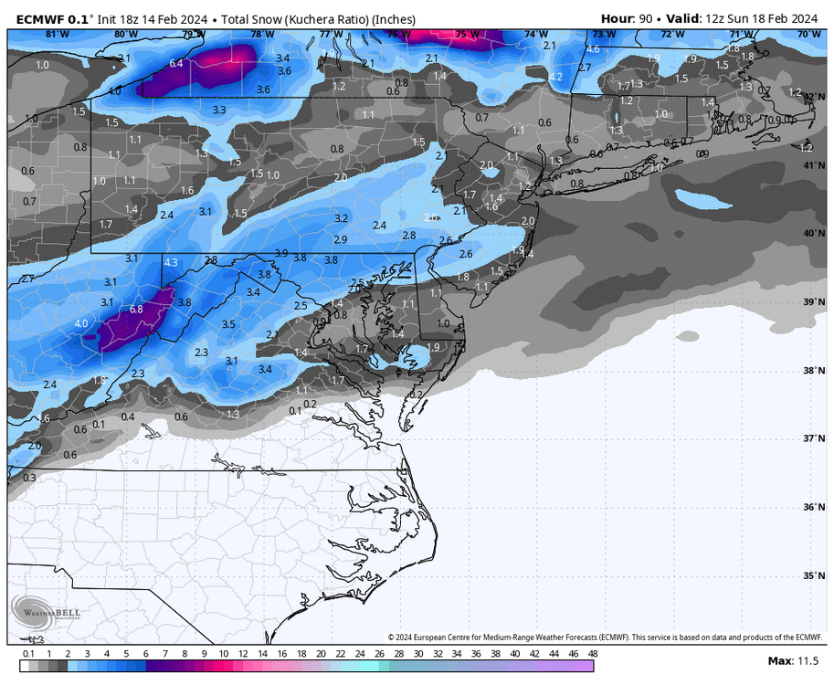
Here is 18z Euro kuchera map
-
Luckily for me the storm worked in easy numbers recorded by my Davis weather station. Recorded a total of 1.00” of LE. Of that, .40” was rain and .60” fell as snow. I measured 6” of snow so a perfect 10:1 ratio fell here. It also snowed for exactly 6 hours meaning it snowed a steady average if 1”/hr where I am located just west of Lebanon
-
Snow is ending in Lebanon. Storm total is 6” and season total is now 17.5”
-
I really like the CTP people and they do a bang up job but this storm was not their finest hour. Yesterday they had my area in 4-8” with WSW and then last night lowered it to 3-5” and still with a warning. Im at 5” now and still have an hour or so to go. Sometimes the NWS folks lean way too heavy on the National Blend Model solution but this storm was horribly predicted via the Canadian suite of products and only late yesterday did the Euro finally catch on
-
Now at 4” in Lebanon and total paste job ongoing
-
Saw Jim Thorpe in Carbon County reporting 10” so far
-
Now 3” in Lebanon with heavy snow. Picked up an inch in the last hour