AccuChris
-
Posts
772 -
Joined
-
Last visited
Content Type
Profiles
Blogs
Forums
American Weather
Media Demo
Store
Gallery
Everything posted by AccuChris
-
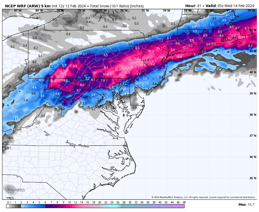
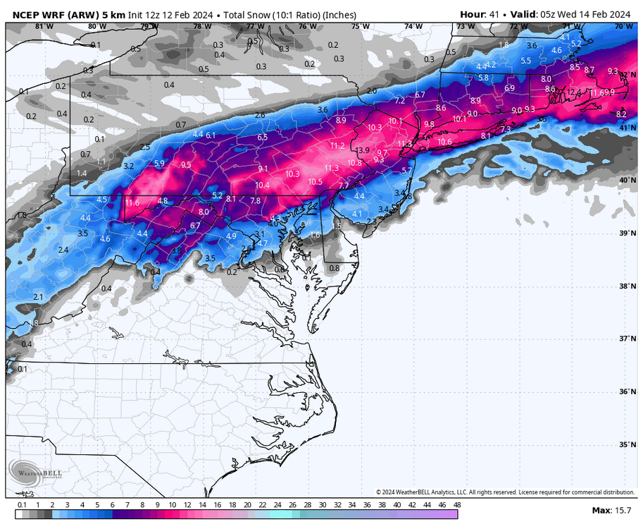
12z NCEP WRF-ARW 10:1 snow map
-
Id imagine come midday NWS CTP likely will do WWA for Adams, York, Lancaster for a broad 2-5” and Cumberland, Dauphin and Lebanon WSW for 4-7” or so
-
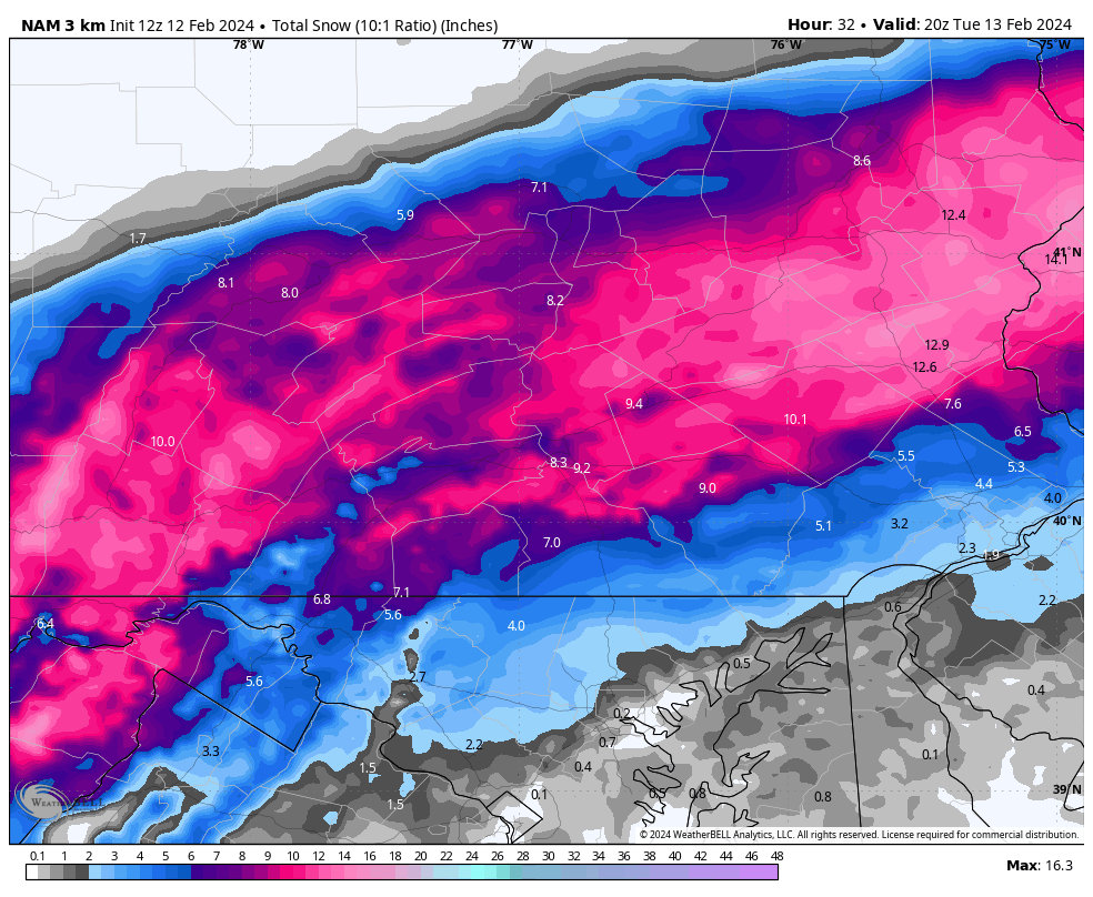
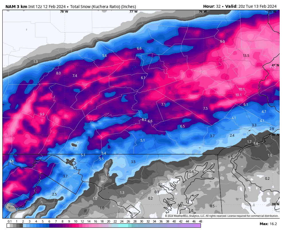
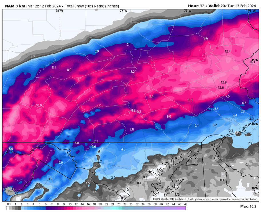
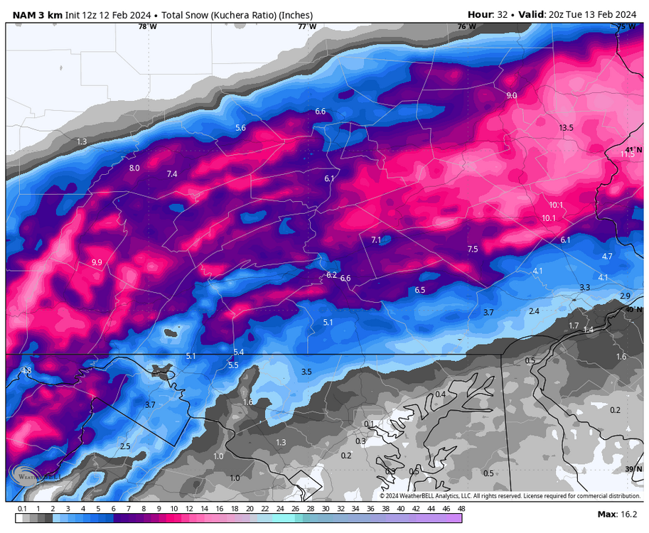
12z 3km NAM 10:1 and kuchera snow maps
-
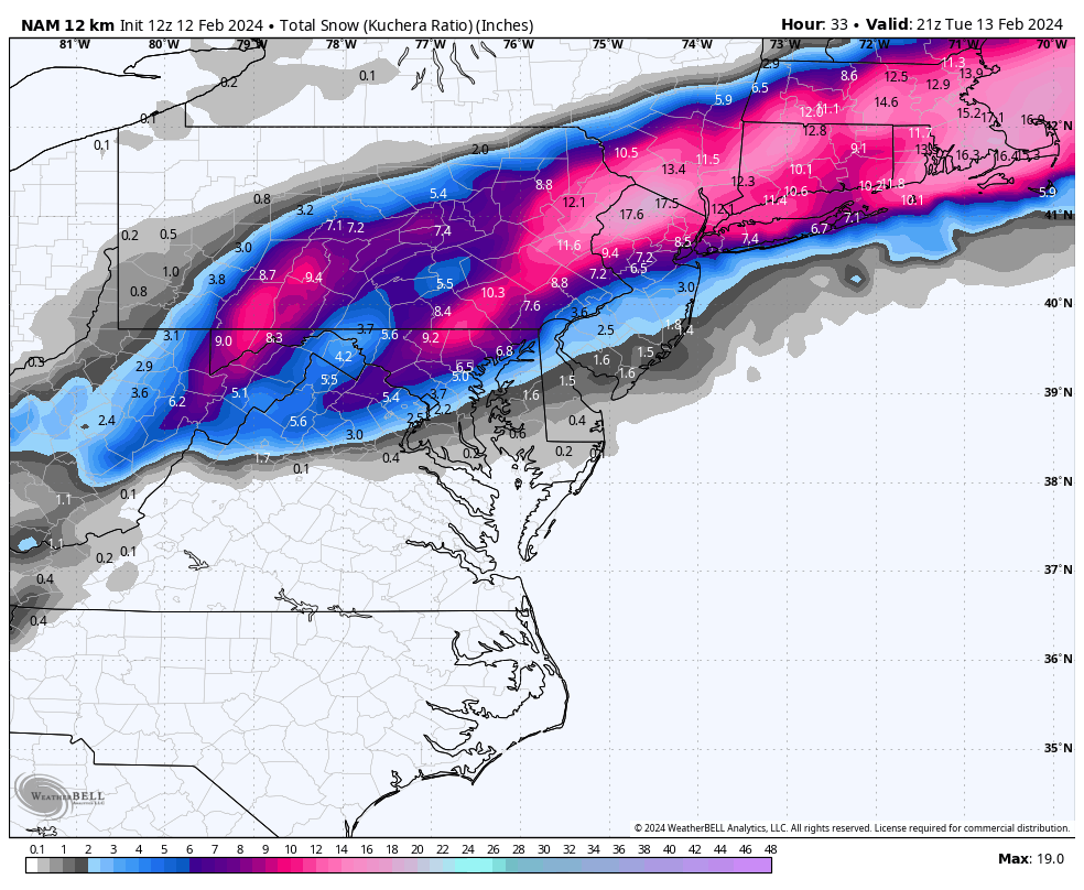
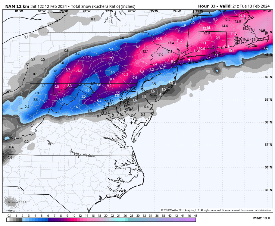
12z NAM kuchera
-
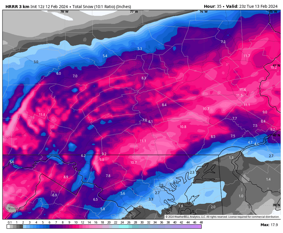
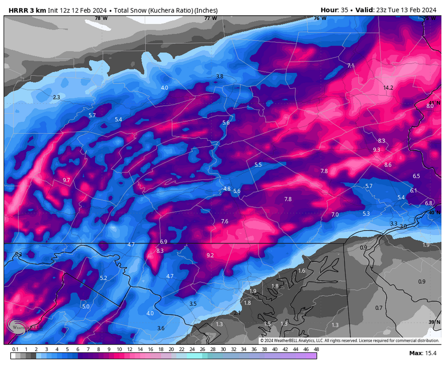
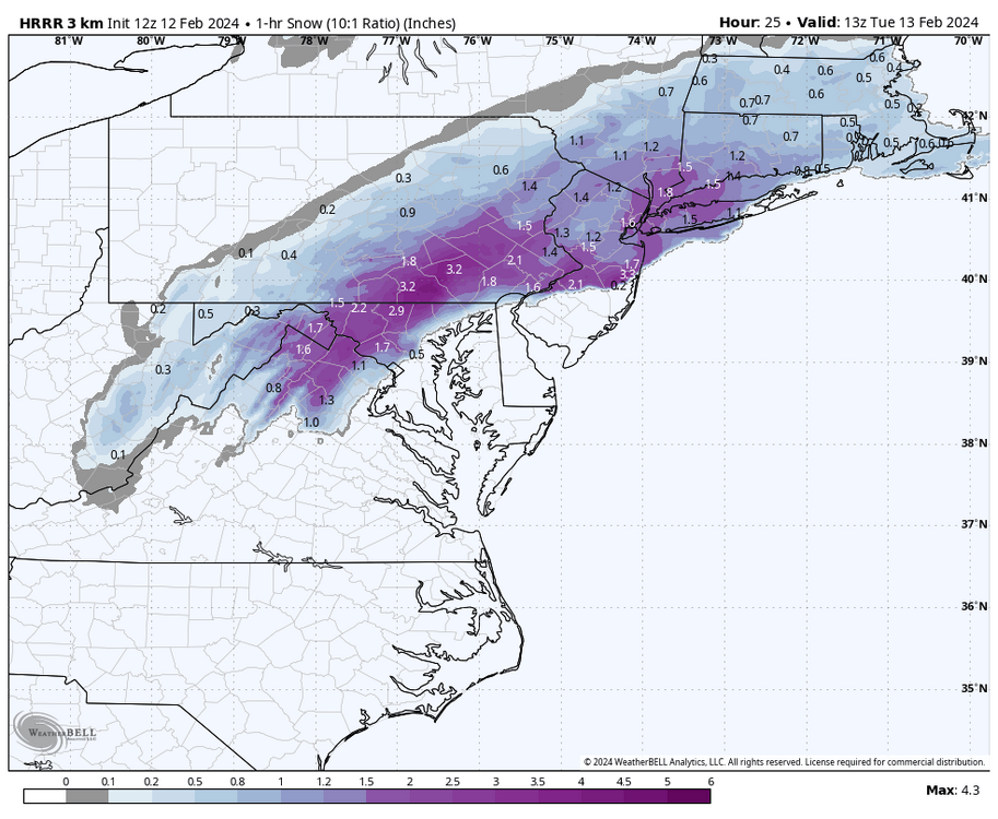
Zoomed in 10:1 and kuchera snow map from HRRR
-
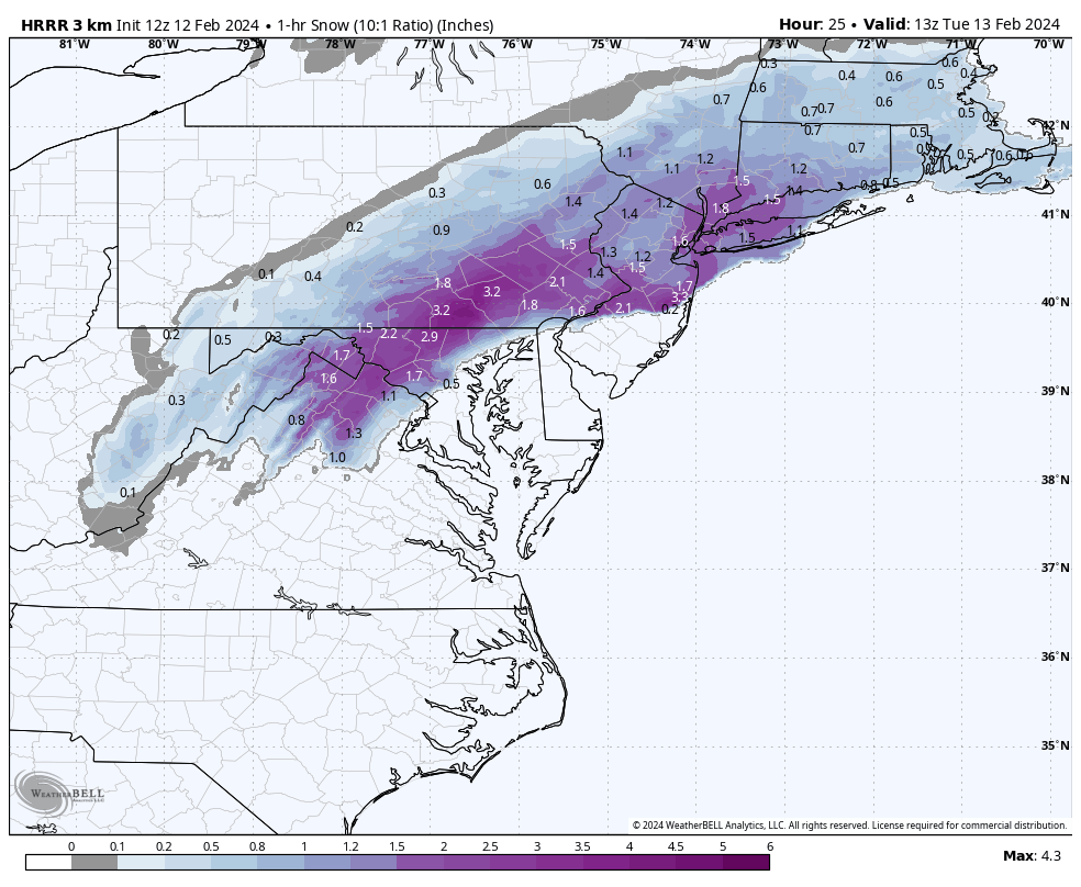
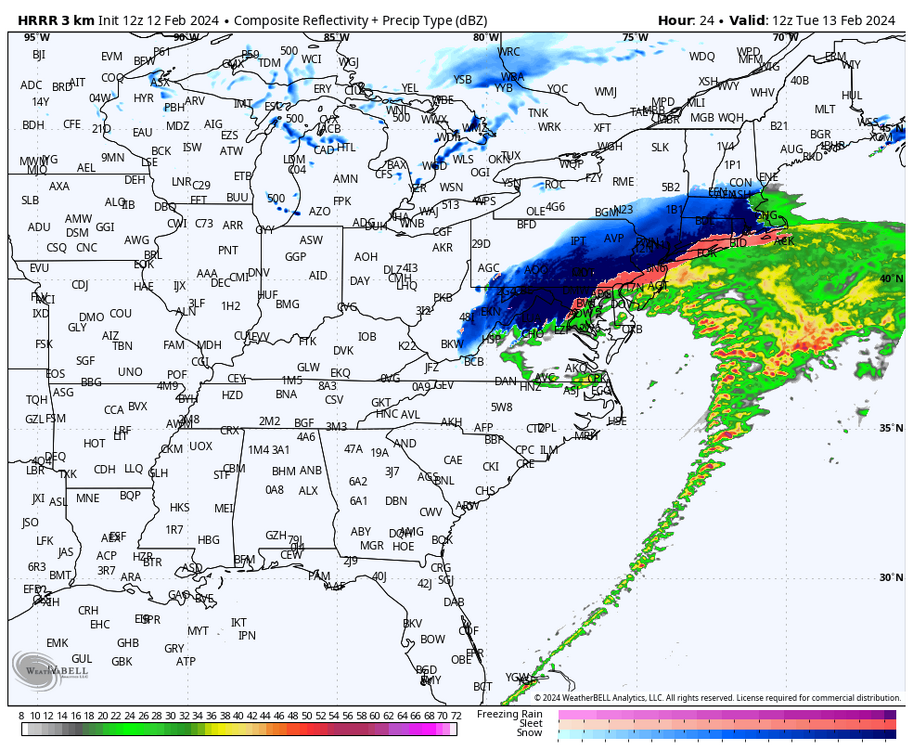
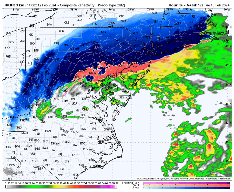
8AM tomorrow per HRRR is puking snow over the LSV
-
Yep, she is a beaut Clarke
-
If I was a betting man Id guess CTP will issue WSW during the early morning product updates and paint a broad-brushed 4-7” across at least Cumberland, Dauphin, and Lebanon Counties
-
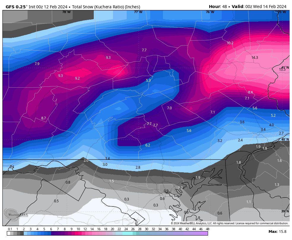
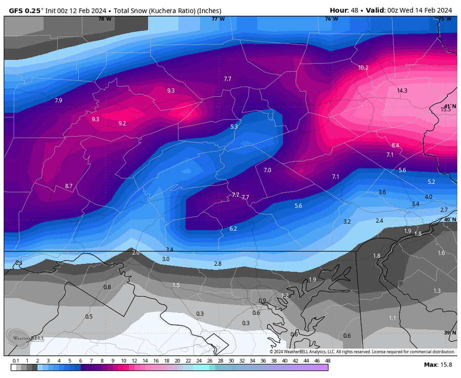
0z GFS kuchera
-
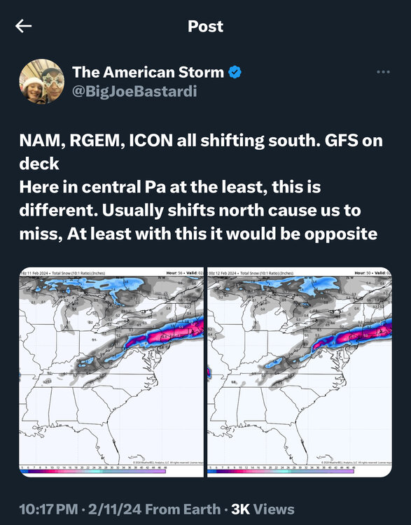
Latest tweet from crazy uncle JB
-
Typically, especially in February, a sub 980-ish storm near the Delmarva is a locked down major snowstorm for our area. Obviously, the lack of cold air and a strong high to the north make this tricky. BUT, a deepening storm with strong forcing and ascent can definitely manufacture its own cold as these models are now showing. Rates could be very impressive…maybe someone hears some thundersnow??
-
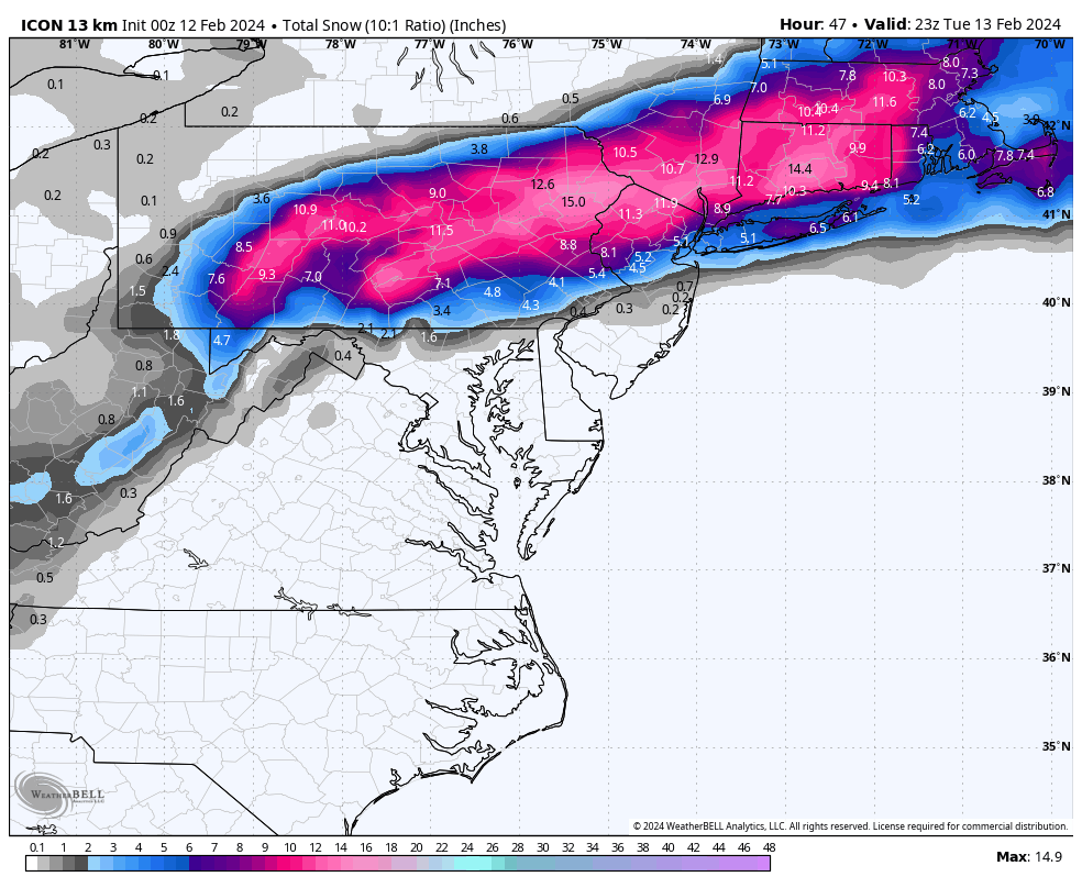
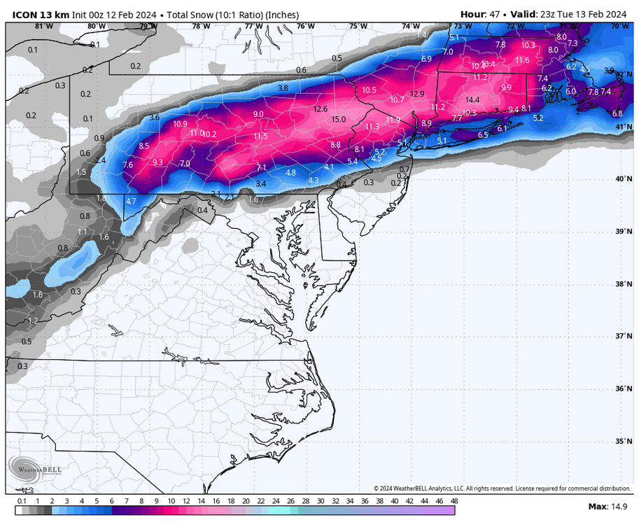
Another view of 0z Icon…ticked south about 25 miles compared to its 18z run
-
My temp now is 42° and DP is 34
-
NWS CTP updated their discussion at 9:07PM (before 0z NAM came in) and were already discussing significant snow may now make it down to the I-81 corridor and they will ride the watch still
-
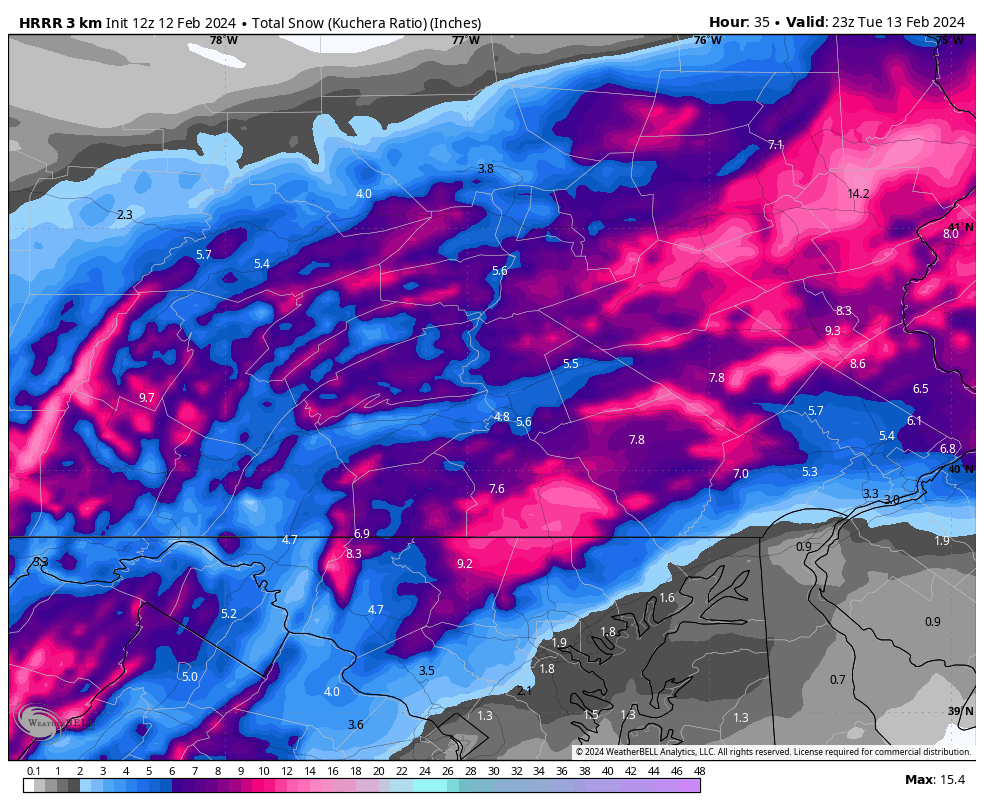
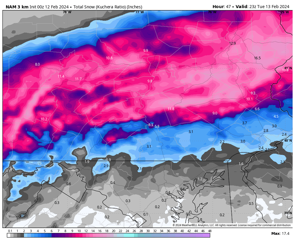
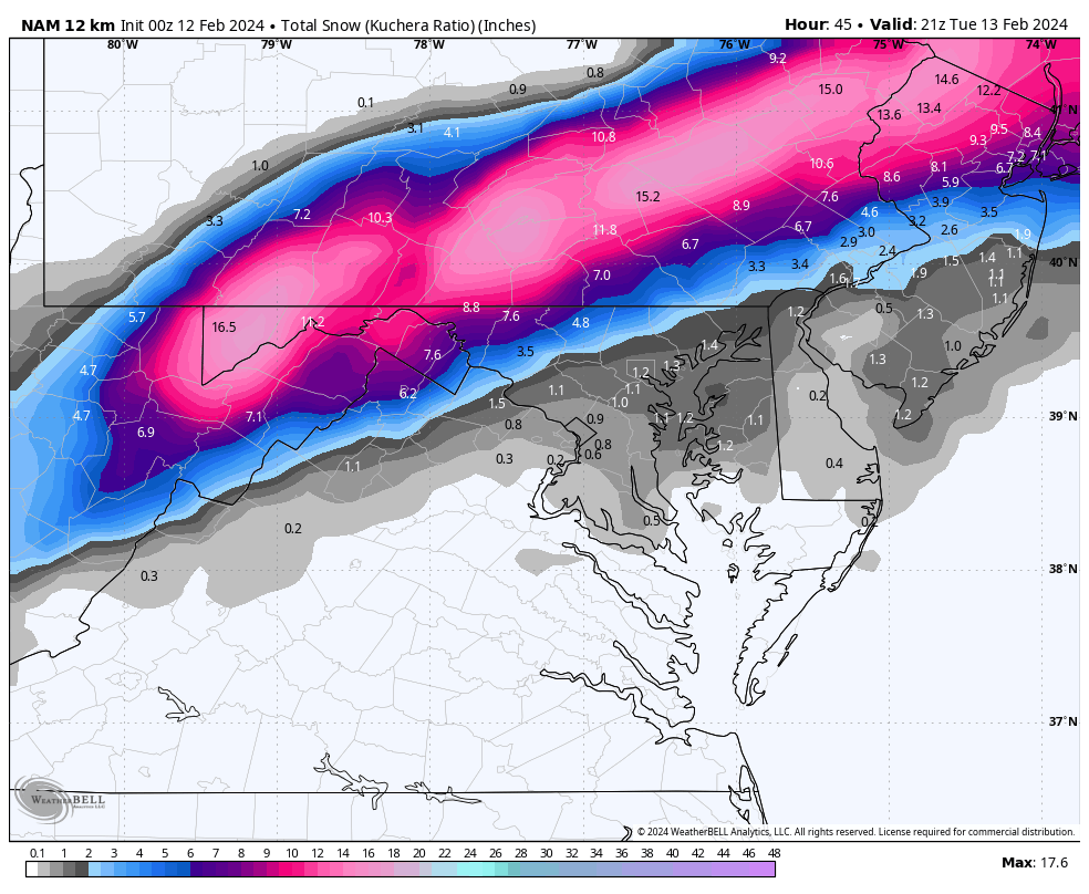
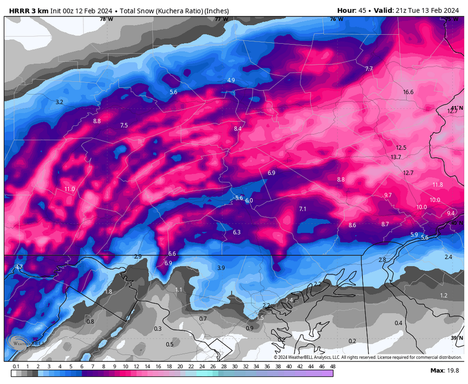
Average kuchera snowfall blended between 0z HRRR and 0z 3km NAM for Lebanon County blends to about 9-10” and 1.3” LE
-
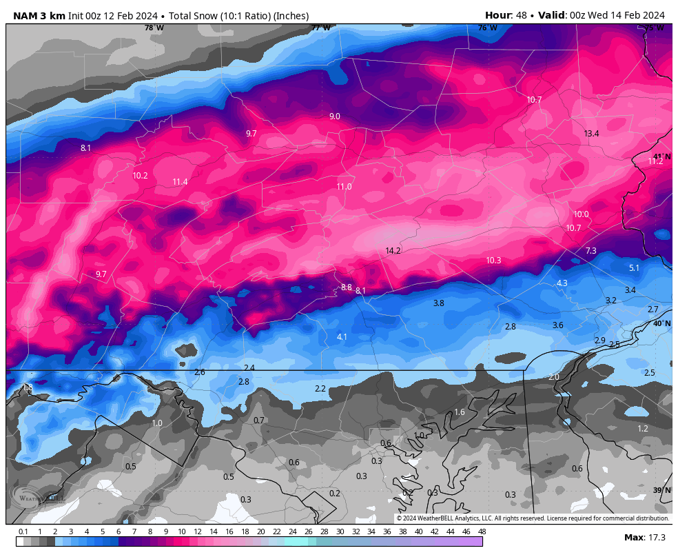
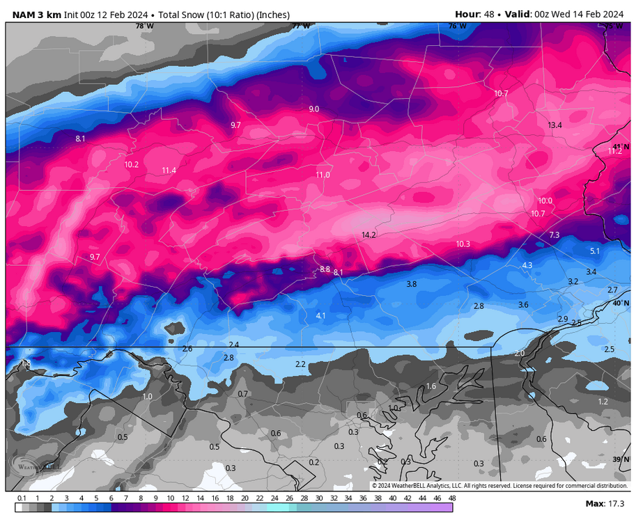
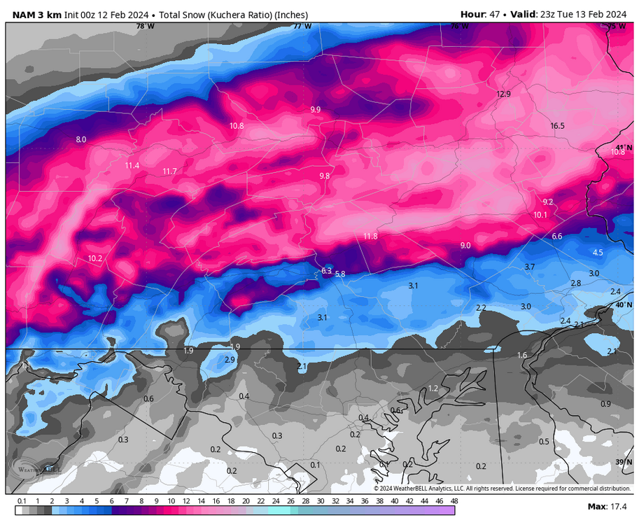
0z 3km NAM 10:1 and kuchera snow maps zoomed in from WB products
-
If the NAM is anywhere close to accurate NWS CTP would need to flip where they have the WSW up and put it much farther south
-
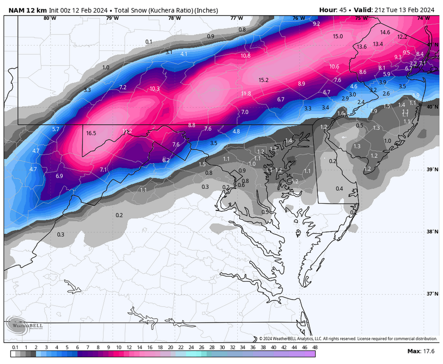
Another 0z NAM kuchera view
-
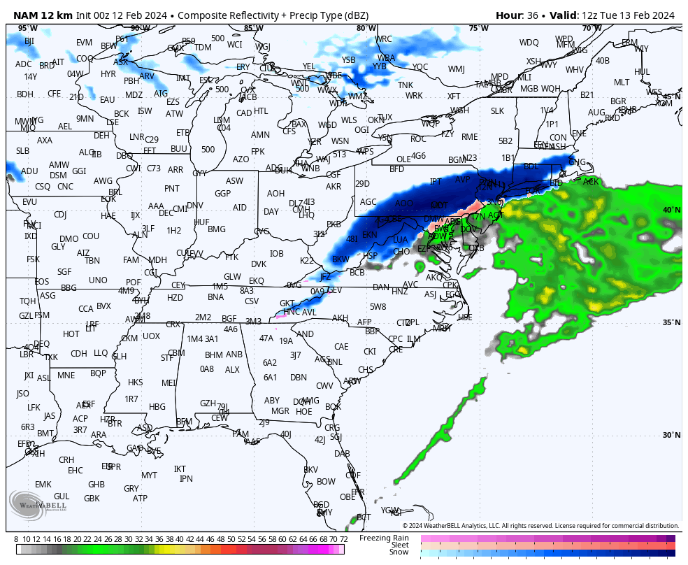
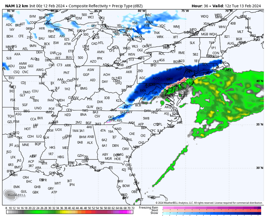
0z NAM crush job at hour 36
-
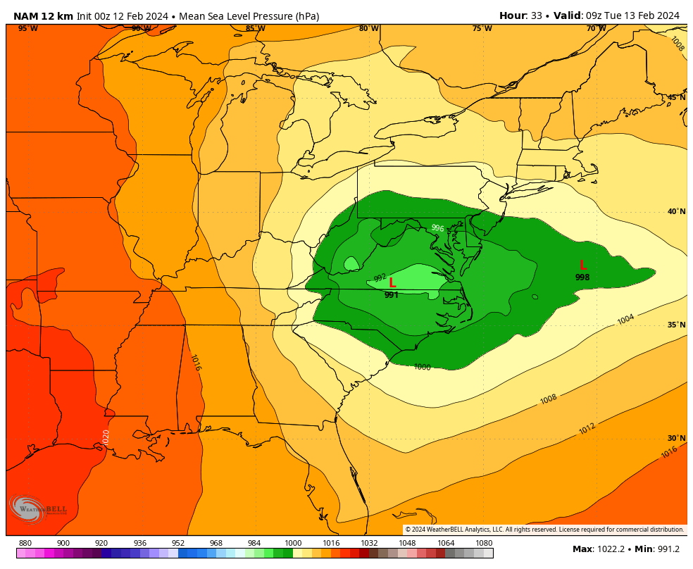
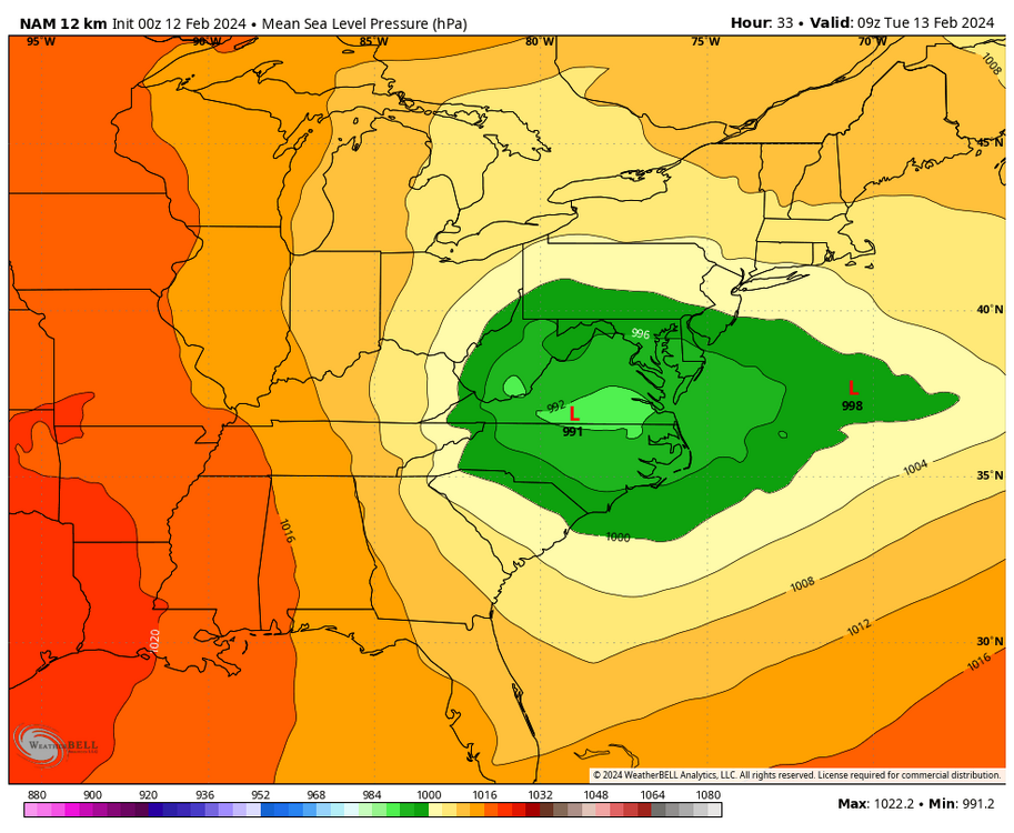
At hour 33 SLP is in souther VA and no primary up into WV…similar to HRRR
-
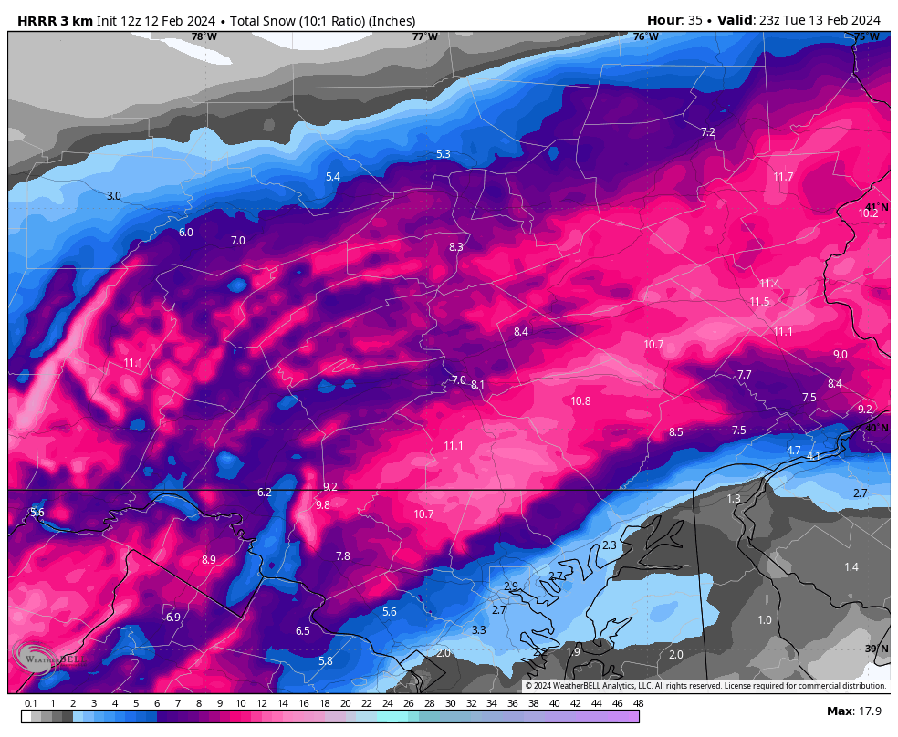
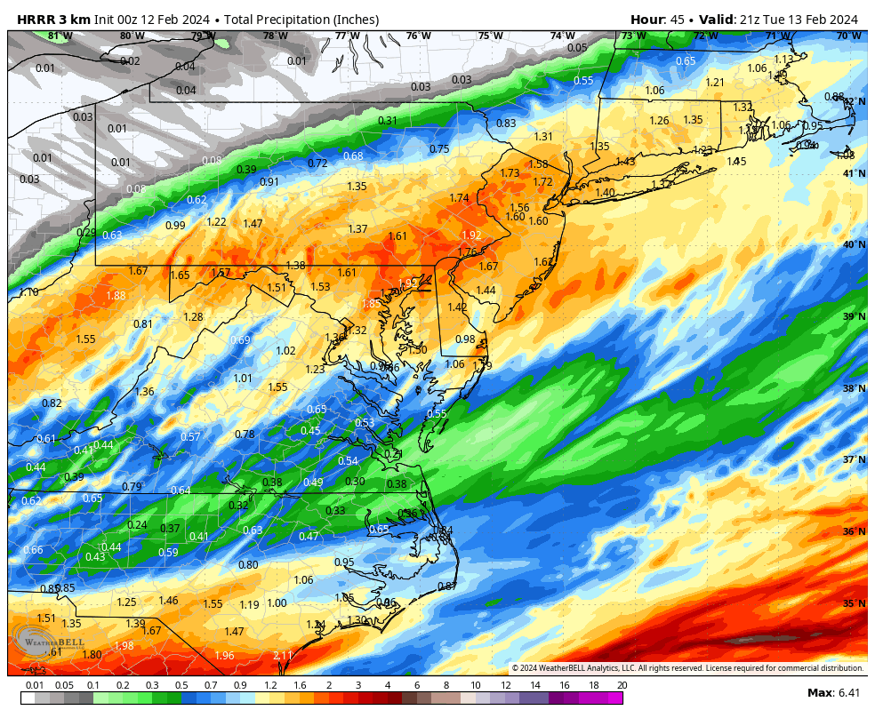
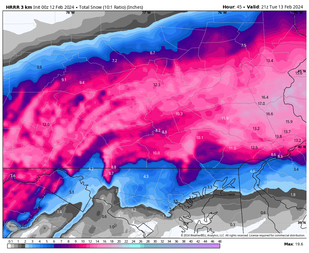
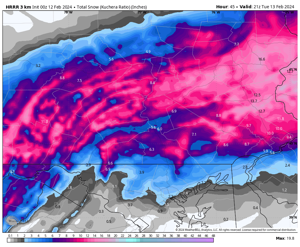
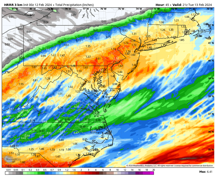
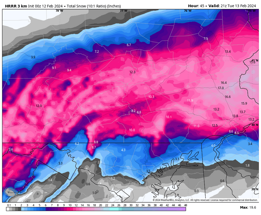
0z HRRR total QPF, 10:1 snow map and Kuchera snow map….
-
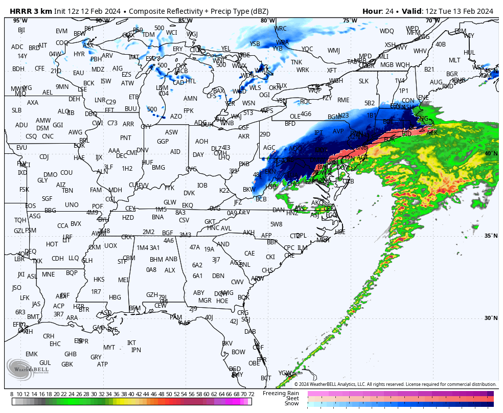
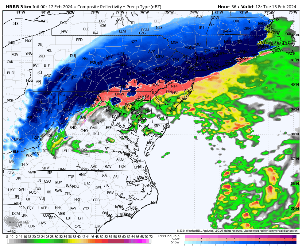
HRRR slightly colder and SLP cuts east across Virginia to the Delmarva. “Puking” snow come sunrise for many
-
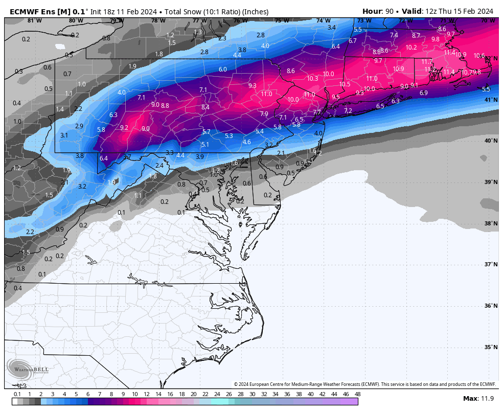
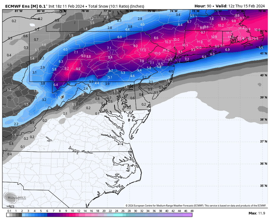
Another view of 18z Euro EPS mean snowfall 10:1
-
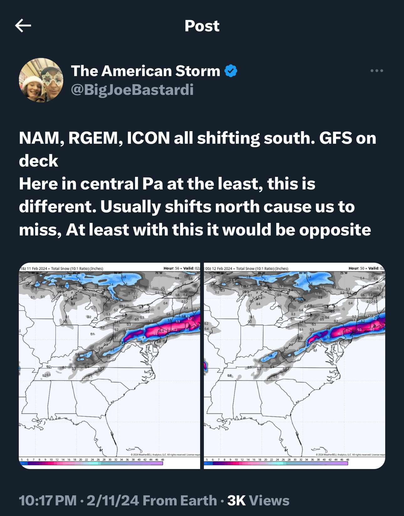
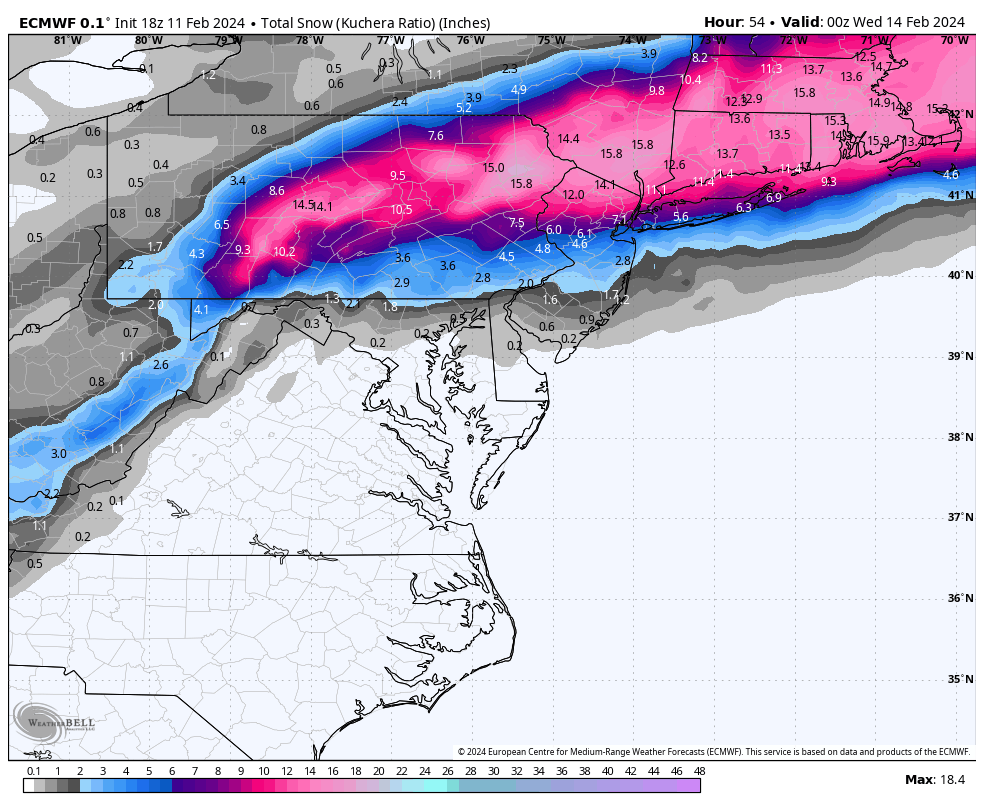
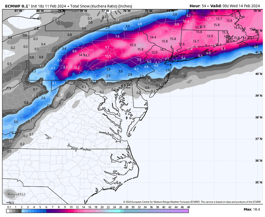
18z Euro was a tad slower and just a touch farther south…miles count for us in the LSV for sure
-
Definitely a subtle shift south on the 18z runs. Another 40 mile shift south would put many people in 6+” amounts