

Scott747
-
Posts
3,521 -
Joined
Content Type
Profiles
Blogs
Forums
American Weather
Media Demo
Store
Gallery
Posts posted by Scott747
-
-
Not going to lie. In all these years I've never been worried about Josh. A few when he has relocated to at the last minute to some spots that weren't previously scouted.
This one I'm on edge.
Little nervous about the elevation....
-
 8
8
-
 4
4
-
-
Josh is pretty much locked in.
Structure he's in looks to be sound and thick concrete reinforced.
Crazy to still be able to communicate with him....
-
11
-
-
Imminent reading coming up from the second recon mission.
Not surprising but the gradient is insane.
-
1
-
-
Second recon circled while the first one spent extra time in the eye.
Now looks to be heading in for a fix before landfall.
-
4 minutes ago, yoda said:
Well he did post pictures of where he was stationed already
There are a few alternatives if adjustments are needed.
")
This is a different animal though...
-
1 minute ago, eyewall said:
That is too far NW.
He won't reveal his final location until after the storm.
-
3
-
-
Second recon is booking it. Might get there before landfall.
First one spent extra time in the eye so it might be tight for it to make another pass.
-
1 hour ago, Scott747 said:
Recon is gonna find a sub 900 storm.
893 ish extrapolated
-
6
-
 1
1
-
 1
1
-
-
Should get a reading from recon shortly and then at least one more.
Second mission is on the way but could be tight in getting there before landfall.
-
Recon is gonna find a sub 900 storm.
-
1
-
 1
1
-
-
2 minutes ago, Radtechwxman said:
They going to do an intermediate advisory or wait till next main one at 5am?
Intermediate at 2 eastern 1 central
-
2
-
-
12 minutes ago, AStorms13 said:

Screenshot of new cone on Radar Omega. Not updating on other sites for some reason
.It isn't updating because there isn't a new cone....
-
1
-
-
6z HAFS-B isn't quite as ridiculous as the 0z but both hurricane models are still bottoming out at around 900.
Looks like the NW Caribbean is going to do its magic if it continues to get further enough W.
-
0z HAFS-B goes nuclear.
-
1
-
-
2 hours ago, WolfStock1 said:
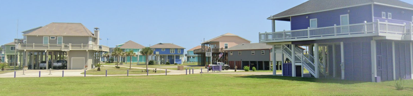
FWIW - lots of those houses are being built on quite-high stilts now, e.g. here's a neighborhood and a school in Port Bolivar:

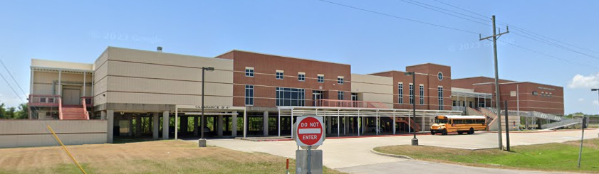
Everything has to be about 15' above ground level now - above BFE (Base Flood Elevation - 100-year flood plain). So these generally aren't your grandparents homes.
Fwiw -
That's houses and the rebuilt elementary and middle school (Crenshaw) in Crystal Beach after Ike.
All of that construction had nothing to do with Harvey and was done due to Ike.
-
1
-
1
-
-
Well then... Can't say I Google members names but that's pretty effed up.
I can't do anything but remove/hide his posts and will do so until he explains himself to someone with a higher pay grade.
In the meantime report his posts that get by until they make a decision.
-
3
-
5
-
1
-
1
-
-
7 minutes ago, BarryStantonGBP said:
I keep posting about a bloody WCAR thread as a bloody quote from S2k. Someone keeps removing it
Because this isn't S2K. So keep it over there.
You posted a bunch of S2k crap about a ridiculous low off of Florida earlier this week that had to be cleaned up.
Patience is wearing thin...
-
3
-
 1
1
-
1
-
1
-
-
6 minutes ago, GaWx said:
And that’s not surprisingly the area of formation where the EWs have been suggesting would probably be the greatest threat to the US 9/15+ though NC north has some threat from the open Atlantic, too:
My point is the idea that the Gulf or Caribbean is some sort of escalated threat because they haven't been 'touched' or active so far.
It's almost always supportive (when it comes to sst's/ohc) throughout the season regardless of activity.
-
3
-
1
-
-
4 hours ago, shaggy said:
Wouldn't be surprised to see a burst of storms in the Carribbean and GOM this year as those waters have remained undisturbed and ready to blow up if something can form there.
This could be the most overplayed and tiring argument year after year when it comes to ssts/ohc and the potential.
When it comes to the 'waters' the GoM and NW Caribbean are generally always supportive of not only tropical formation but intense storms throughout the season.
I
-
11 minutes ago, TampaMan said:
So it's growing increasingly likely this will likely hit Florida? I don't follow the tropics like I did winter weather in the Mid-Atlantic.
It will be another week before you should even begin to worry about what the models are showing...
-
1
-
-
It's in the middle of an erc so nailing the center is a little tricky and there can be wide variations on the pressure readings. Especially with the gradient that Milton has shown.
Another recon is already nearing the storm.
-
3
-
2
-
-
Damn. What a gradient. Looks like it might be below 910 this pass.
-
2
-
-
As the thread starts heating up again try not quoting any imagery with quick reactions. If your commenting and contributing to some meaningful type of analysis, then fine.
Otherwise it's going to disappear. There is already enough scrolling as it is.
-
15
-
2
-
 1
1
-
2
-
-
Major Hurricane Melissa - 892mb - 185mph Jamaica landfall
in Tropical Headquarters
Posted
This is total bs.
You won't find one video of any chaser standing directly in legit sustained major hurricane/typhoon winds.