

Chris12WX
-
Posts
319 -
Joined
-
Last visited
Content Type
Profiles
Blogs
Forums
American Weather
Media Demo
Store
Gallery
Posts posted by Chris12WX
-
-
6 minutes ago, brooklynwx99 said:
I mean, it's not uncommon for a weaker, more progressive wave to establish a baroclinic zone / confluence for a larger, more cohesive follow-up
that's pretty much what the EPS and CMC (and ENS) have trended towards
Will gladly sacrifice the weekend deal for next week.
-
 8
8
-
-
How much more does a Minnesota Squeeze cost than a Kraft?
-
 2
2
-
-
1 minute ago, wxeyeNH said:
30.8F Light snow vis 3/4 mile 10" 84" on the season
This storm brings me just over average for a season. We have a new metal roof and all season the snow slides off and keeps building up on the north and west sides. One of our barn windows in the back is completely covered.


That’s one way to feel like you live in Tahoe.
-
1
-
2
-
-
On 3/2/2023 at 9:14 PM, Chris12WX said:
over under 6” here?
56 minutes ago, STILL N OF PIKE said:6.2” final in Nashua (one clearing ) we are compacting faster now
Nailed it!
-
1 hour ago, wx2fish said:
Pretty saggy here. Had some good gusts around 7 that knocked some off, but since winds went north its been pretty calm and stacking up again.
Seems just enough wind to knock the snow bombs down.
-
Been ripping pretty good for last little while. Going to test structural integrity of pines again?
-
On 3/2/2023 at 9:14 PM, Chris12WX said:
over under 6” here?
18 hours ago, Chris12WX said:NWS had me for 10”. Put me firmly in the “I’ll believe it when I see it camp.”
not saying its wrong, just saying it based on this winter.
Thinking O/U 6” going to end up being a good number here. Books might push on this one.
-
1
-
-
Was sleeting around 4am when I was out. Been primarily snow since.
-
36 & overcast
-
1
-
-
NWS had me for 10”. Put me firmly in the “I’ll believe it when I see it camp.”
not saying its wrong, just saying it based on this winter.
-
1
-
-
1 minute ago, STILL N OF PIKE said:
Back to giving me and ray the initial thump
over under 6” here?
-
I was told the GFS was the best!
-
1
-
-
What type of snow are we expecting with the thump? Heavy wet or fluffy? Asking as someone who’s trees got the hell beat out them once already this year.
-
2 hours ago, MuddyWx said:
clowny

So can I lock in my 16-18”?
-
2
-
1
-
-
17 minutes ago, ORH_wxman said:
The entire ridge/trough couplet in March 1993 was considerably larger than what the Euro is showing...and that's not to poo-poo the OP Euro look...that's a powderkeg look there....but Mar '93 was so ridiculous in the magnitude of it relative to the hemispheric pattern that it makes the D10 Euro look kind of paltry in comparison. Like March '93 wasn't playing around with the blocky look we have here...it was just simply including the PV into the trough axis
Of course this is probably all a useless discussion as this will probably transition into a repeat of the Christmas bomb. Maybe we'll get severe out of it?
-
4 minutes ago, Typhoon Tip said:
Not even close to the same set up actually ...
I applaud the enthusiasm but Mar 1993 was a rare circumstance of the eastern Pacific being in such an overwhelming AA mode type amplitude, that the full latitude ridging went from eastern Alaska all the way to the subtropics, such that the entire local hemisphere wound up in one dominate jet with a powerful Rosby wave propagating through.
That's entirely different than what that chart above is indicating. just fwiw
You mean the 240 hr EPS mean doesn't show that amplitude of ridging? Op Euro is pretty close. Loop 250 mb winds from hr 186 on, it legit yanks the subtropical jet from the equator to New Orleans.
-
2 minutes ago, cleetussnow said:
The storm that shall not be named.
I was 2....any reason in particular?
-
Marh 1993 redux setting up 240 on Euro.
-
1 hour ago, CT Rain said:
North and pretty weak sauce. Meh.
#Persistance
-
1 minute ago, weatherwiz said:
Going to have to rely quite heavily on getting good upper level divergence to help with blossoming precipitation. There is a ton of dry air out ahead of the system and also a great deal of dry air that gets ingested into the system as a whole.
Don't you know that you aren't supposed to present meaningful negative analysis?
-
1
-
2
-
 1
1
-
 2
2
-
-
Holy fog
-
On 2/22/2023 at 8:35 PM, Chris12WX said:
Was just thinking the same thing. Congrats MVY. What a winter for them.
7 hours ago, Childude645 said:>4” wet coastal inches on MVY

Special winter for them.
-
On 2/23/2023 at 8:59 AM, Chris12WX said:
Well that was fun while it lasted. Guess I still won't be using my snowblower this winter.
Note: count me solidly in the skeptical camp. The 12z Euro & 18z GFS were great because of the 850mb firehose from the east-southeast. That has trended downhill since.
This aged fairly well. Modeling picked up on the 850mb firehose a couple more times after this, but in the end, it was wrong and everything trended southwest.
-
1
-
-
1" shoveled.

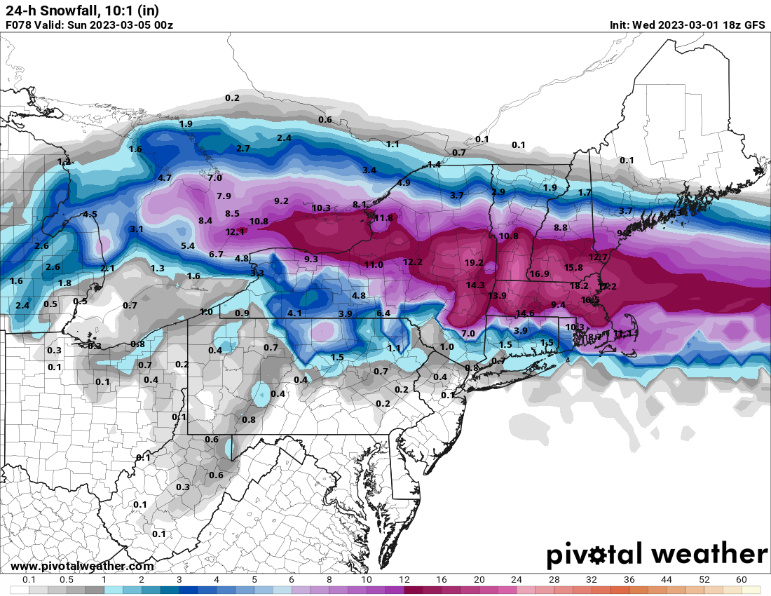
Impressive signal is just beginning emerge in actual guidance, Mar 10 -15th...
in New England
Posted
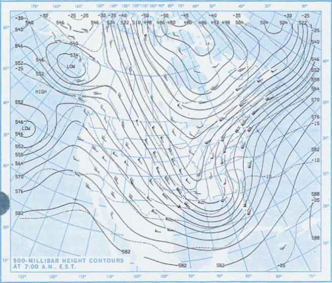
That’s an adorable little cyclone there.