

eurojosh
-
Posts
2,350 -
Joined
-
Last visited
Content Type
Profiles
Blogs
Forums
American Weather
Media Demo
Store
Gallery
Posts posted by eurojosh
-
-
Rain downtown DC, natch.
-
1 minute ago, high risk said:
really strange in that it looks like it's snowing pretty good according to the reflectivity, but there is no precip accumulated. Looking at the soundings, it's insanely dry in the low levels, so I guess it's virga, but it seems odd that it would snow decently for a few hours and never reach the ground. It's also surprising that the HRRR takes much of the area into the low 40s during the early afternoon.
Seems doubly odd because virga would bring down temps via mixing, no?
-
Fropa or Faux Pas amiright
-
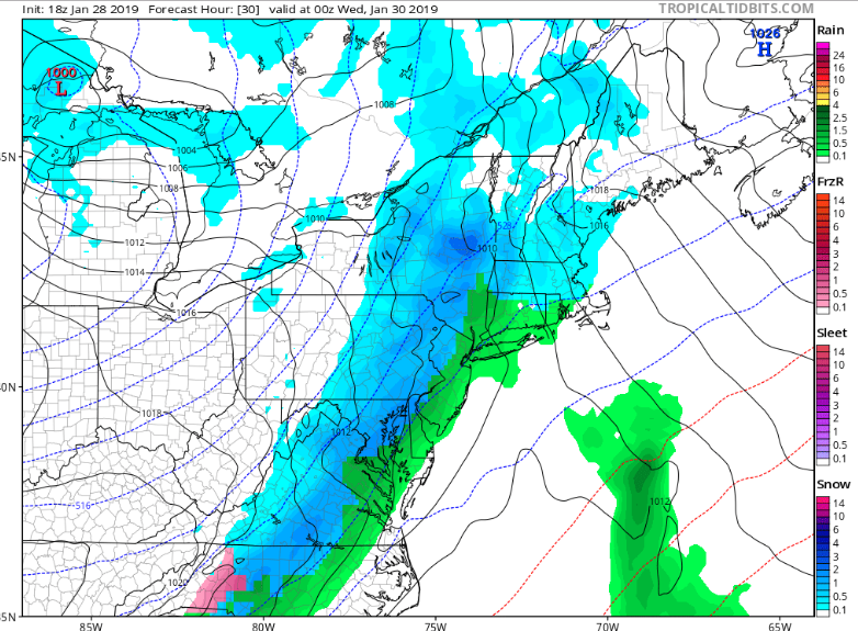
is nobody going to woof about the 18z GFS? NE of Balt in particular is in luck, though there's an embedded line of FRZ amidst the snow for DCA.
-
ICON remains relatively anemic for tomorrow, FWIW. Seems warmer and less dynamic than the NAMs.
-
Yes - NAM is a good hit, even after a little rain, plenty of frozen after 20z for the metro region.
-
That's an odd extratropical cyclone hitting northern California next weekend on the GFS...
-
1 minute ago, Bob Chill said:
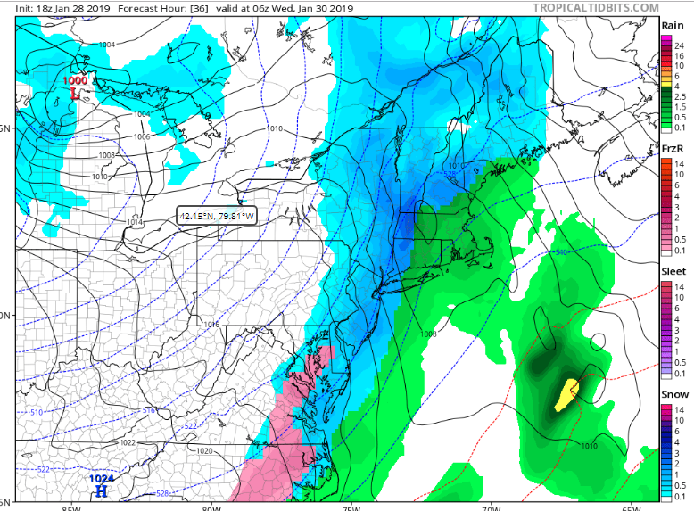
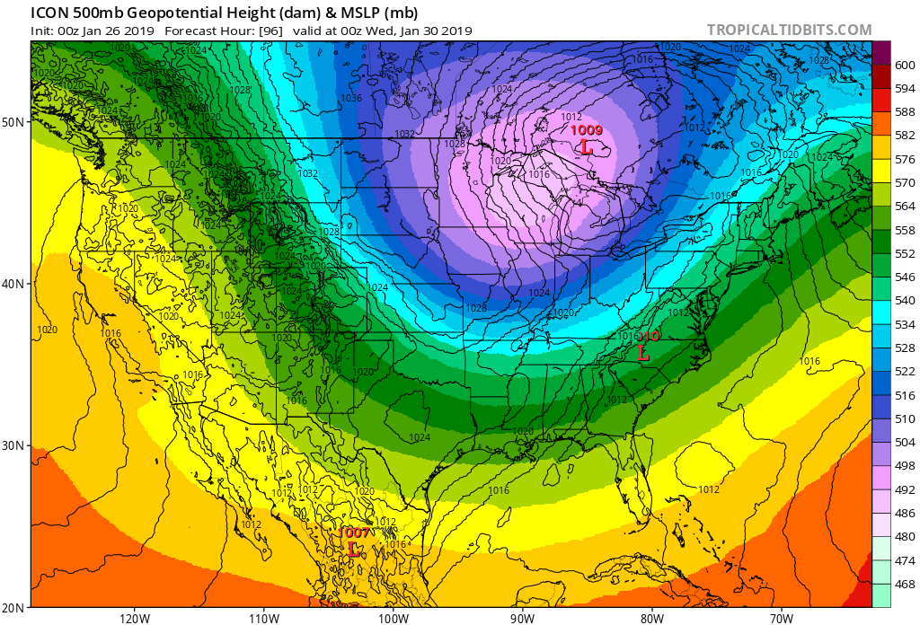
Icon illustrates how unusual this arctic front is. It crawls across our area as everything tilts around the tpv. Similar to the euro with a wave of low pressure.
I think the gfs is probably wrong and will likely be another boring fropa. Leads are getting short enough to trust the euro the most and now seeing the icon come around builds confidence. Wobbles and shifts are likely but the idea of a wave running along the front is becoming more likely.
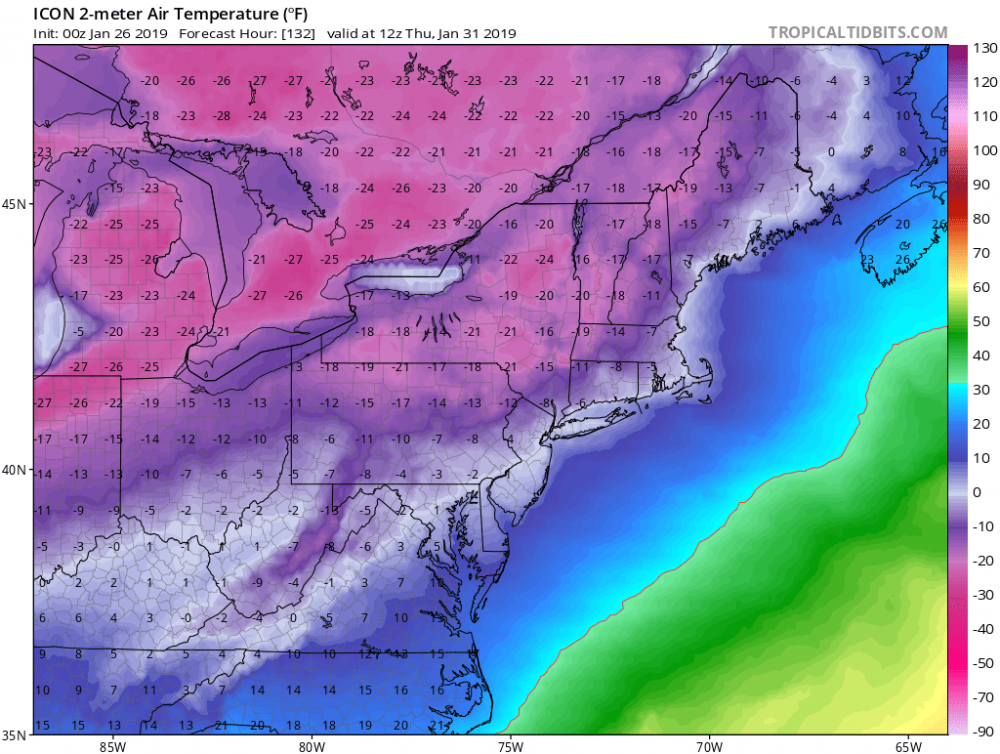
Speaking of which, check out the temps post-passage. Coldest I've seen it here in a long time.
-
 3
3
-
-
That's not not promising...
Edit: I'm not saying it's promising either. Just not unpromising.
2nd edit: Not a deep enough LP to do damage, but looks like a decent backside snowfall - am guessing around .1, maybe a little more.

-
I'd call the 6z suite a 'mitigated disaster'. Which is a two letter improvement from the last few runs.
-
 1
1
-
-
Canadian is so close at 120 to giving us a decent Miller B, and then hits the no-snow-dome* around our region, and the LP slips north.
*this is the technical term for the feature being described
-
Likewise the Fv3-GFS is very close with back to back snowstorms in that timeframe - it misses north on both occasions, but is enough to stay interested for now.
-
25 minutes ago, BornAgain13 said:
Fv3-GFS 18z looks good for next weekend... would like to see more consistency.
Lol - this is the first time it's shown that solution. But I'd take it in a heartbeat. That's the halfway solution between the 12Z Euro and GFS I was hoping for!
Edit - infact, the whole second half of the Fv3 would be acceptable.
-
1
-
-
There's a huge difference between the Euro and GFS 500mb charts at hr 192 - GFS has an LP in the GL, Euro has a much deeper system heading OTS off OBX. If means counted for anything we'd be in luck.
-
1
-
-
I can't be the only one lurking until someone with the Euro precip panels chimes in?
-
1 minute ago, Bob Chill said:
18z gefs agrees

I'll pray for E16 and put my money on E11.
-
2
-
-
GFS looks tasty af. That's my (non)professional analysis.
-
1
-
-
Healthy system down the line on the CMC... On a weird double-barreled front that has the leading LP in Canada (rain for us) and the trailing low in texas (snow, when it finally moves up the coast).
-
Just now, psuhoffman said:
Who gives a crap what Boston gets???
The amount I care about how much rain Boston gets is an inverse function of the amount of snow we get.
-
That is the best GFS run I have seen in days.
It literally gives SNE (particularly Boston) nothing but heavy rain.
-
1
-
-
Hmmm. Well it's certainly different to the Canadian. Would like to see that LP stay south of the VA-NC border until it hits the Atlantic.
-
Just got done with a jebdrive around Potomac and Bethesda (not yet enough on the ground for a jebwalk). Couldn't stop in time for my driveway and had to go around the block again. Good times.
-
1
-
-
8 minutes ago, Roger Smith said:
Some of those could take three winters to achieve.
They have.
-
1
-
-
e18 or bust!
-
1
-

January 29-30, 2019 Arctic FROPA
in Mid Atlantic
Posted
Technically doesn't it actually run through DC, with erosion accounting for the current position of Great Falls?