

Saguaro
-
Posts
154 -
Joined
-
Last visited
Content Type
Profiles
Blogs
Forums
American Weather
Media Demo
Store
Gallery
Posts posted by Saguaro
-
-
Indicative of this failure of a summer that we can't even manage getting a warm frontal passage in July. NYC metro and SW CT are where it's at today, true summer conditions there.
KEWR 021651Z 22009KT 10SM FEW028 BKN045 BKN140 BKN250 31/22 A2986 RMK AO2 SLP110 T03060217
KDXR 021653Z VRB04KT 8SM FEW015 BKN026 26/22 A2989 RMK AO2 SLP117 T02610217vs
KIZG 021714Z AUTO 00000KT 4SM -RA BR FEW006 SCT011 OVC014 18/18 A2996 RMK AO2 P0002 T01830178
-
 1
1
-
-
Managed upper 70s, then copious debris clouds from the Ontario and Quebec storms blowing up moved in along with the ever present smoke. Close the shades until Wednesday. May forego plans and go back to AZ early if this pattern keeps up.
-
Sun is finally showing up about four hours earlier than yesterday. Satellite trend has been better today for getting rid of the marine sludge faster. Any heating today will be limited by losing eight hours of insolation and the high clouds now filtering in from the west along with smoke. The forecast trends are pointing towards Wednesday for the next chance at sun. Awful summer so far, though unusually persistent high dewpoints have made it easier to generate storms, and make it more of a summer feel in the evenings, but that is offset by the abundance of biting insects that thrive in excessively rainy patterns.
-
 2
2
-
-
GYX discussion says the flow responsible for this stratus puke isn't going away anytime soon. Only had a couple hours of sun very late in the day and it quickly became overcast again by sunset. Tomorrow isn't looking any better given the trend. More rain arrives Sunday as the warm front stalls to the south.
-
4
-
-
58 minutes ago, Lava Rock said:
Heading to naples. Supposed to take boat out but starting to doubt the frcst that the sun is coming out
Yea it's looking like a stolen day at this point. The satellite isn't encouraging, and low level winds are even out of the NE/ENE reminiscent of a backdoor. Still stuck in the mid 60s while everywhere else outside this purgatory is in the 80s.
-
2 minutes ago, Typhoon Tip said:
Yeah that coastal region of Maine up there is getting bum packed by flow off the Gulf ..
It's actually regaining ground to the west. Reminds me of my years living in socal when the marine layer would stay in place all day. Today was supposed to be one of the few sunny days before the return to the gloom most of next week.
-
4 minutes ago, ineedsnow said:

I won't be going as far N as Quebec city, just Montreal but they're dealing with it too.
Lower 80s now under what I assume are "bahama blues" and puffy cu.
-
Brilliant sunshine and a spectacular day on Friday, mid 80s under cobalt blue skies. Last for a while it appears. Today we're getting more sun than I expected so that's a nice respite. Looking forward it looks terrible through the end of the workweek.
Yesterday was very muggy in the western ME area. I haven't felt this level of humidity around here since that mini tornado outbreak 5 or 6 summers ago. I've noticed in the past 15 years or so that it seems more exceedingly difficult to get this type of true tropical airmass up here during the summer, and even when they do manage to arrive they're shorter lived. Even now with this deep southerly flow at all levels, it seems a backdoor is finding a way to intrude for a few days beginning tomorrow.
1 hour ago, Typhoon Tip said:Can you imagine being N of the border up there in interior eastern QUE ?
One sees DPs around 53 or whatever and might think ahhh, but temp might not matter under that extraordinary smoke slab - jesus. I mean to completely obscure from seeing the surface of the Earth through that giant region on vis sat, whence the solstice sun cannot even penetrate, goes in both directions - which means they probably don't even have the dim orb looking up from the ground. The day light's probably dimmed down to apocalypse eeriness.
I am actually headed up to Quebec later today and will be there a few days. It's looking like I'll begin running into the smoke around the Newry area and points north. I think it might be pushing into the remainder of the state later tonight judging on the satellite trends. It seems the southern QC area will be avoiding most of the murk that's forecast for ME most of the coming week, but I don't see the smoke going anywhere.
-
1
-
-
IZG holding out at 61 dp
-
1
-
-
4 hours ago, dryslot said:
Cobalt blues in the lakes region.

Yea it's on tier with Arizona clear and cloudless skies. For once there was no smoke ruining it.
-
1
-
-
1 hour ago, dendrite said:
The trough went through mid morning for much of the region on 7/22 so we got a big dew drop to let the heat soar. 7/21 and that following night was oppressive though.
IZG had 101° on 7/22.
I remember that day well. If I recall correctly it came as a surprise since it was supposed to be HHH and ended up as H. Still impressive highs given triple digits are exceedingly rare in ME. The summer of 2011 had a bit of all the things which the vast majority of summers don't in NNE.
-
2 hours ago, tamarack said:
Added to the sadness is that, in early January, Cool Spruce wondered whether that stalled retro-bomb might wreck winter - he was spot on. Unfortunately, not long after that came the stroke that took him off the board and eventually (I assume) took his life. We were kindred spirits about trees and forests.
I also remember him specifically mentioning that event in the same way. He was a good friend of mine for many years. Taught me interesting things about forestry that I never would have found out otherwise. I tried to keep in touch with him after the stroke but didn't have much success.
-
1
-
-
Changed to rain shortly after I posted that last obs.
-
Gigantic flakes in Harrison, looks like the changeover is imminent. I'd say there's about 6-7" new accumulation, but that's a visual estimate only.
-
It's remarkable how persistent and reliable the grinch storm is every year in the Dec 20-25 timeframe. During my two decades living in Maine, I can only recall one or two years where we actually had a currier and ives tier white Christmas that was free of said grinch. It almost seems a given that if any significant snow events happen before the 25th, that incurs a debt which must be repaid in torchy rain between the 20 and 25th. If I recall correctly, this anomaly has even become visible in some long term climate records.
-
2
-
-
Finally some much needed sunshine after 5 days. This past week smacked of a classic warm season "cosmic dildo" event as Tip likes to say. Ridge trying to build in the east gets kneecapped by Atlantic crud which rots for days over the coastal plain before the ridge finally breaks down and the surface front clears it out. Meanwhile those locations to the west of the coastal plain divide torch with sunshine and unseasonable warmth. It did feel like a borderline tropical airmass with dewpoints in the 60s the last few days. Interestingly enough, the lows at IZG during this timeframe have been warmer than the lows back in the Phoenix area with the large trough that's taken over the western half of the country.
-
1
-
-
On 10/25/2022 at 11:51 AM, klw said:
Then came the Post 9/11 crackdown:
Things were far less stressful at the borders before 9/11. Didn't even need a passport back then for either Canada or Mexico. From what I hear, in the US/Canada border towns, during those times they didn't block off all the side streets that crossed the border and the residents of border towns regularly went across on them without hassle. The Escourt station debacle certainly didn't help existing tensions between Quebecois and US residents.
-
25 minutes ago, tamarack said:
Once one gets north of Rt 2, most of the "pines" are spruce and fir. (And maybe you knew that already.)
Just a rudimentary knowledge. I'm not well versed in the proper terminologies, but saw how they change once getting past Augusta or so on 95 as well as that drive on 26. In the past I had a friend who used to be in the forest service and pointed these things out to me.
3 hours ago, Hoth said:Really on the receiving end of the ol' cosmic dil today. Awful weather.
Yea it's pretty miserable looking out today.
-
20 hours ago, mreaves said:
Made the trip home from Augusta today. I always go over on Rt. 2 and then go home cutting across to 302 as I love the Naples/Bridgton area. Drove through the dirty Lew, somewhere in the vicinity of the Lava Rock and right through Alex and Nopoles land. It was like an AMWX NNE tour.
302 is about a 5 minute drive from Harrison. I'm always going on there for grocery runs in North Conway/Windham as well as to PWM for my flights to/from Phoenix.
4 hours ago, tamarack said:Only 2-3 miles from dryslot, too. About the same as from Lava Rock when a few mils to 302.
When my parents lived in Woodsville, NH, we would take the same route from Lewiston to North Conway on the way there, then drive the Kanc and Kinsman Notch. Less spectacular but nice rural Maine was Route 11 from Mechanics Falls to Rt 302. Our return trip usually took the northerly route, to Jefferson and then Rt 2 to Bethel, 26 to 219 thru the Sumner woods, another even more rural Maine country drive.26 from Bethel to Errol is interesting too. There's a mountain divide where the rain snow line often sets up in the winter, and which acts as a barrier to marine crud in the warm season. The pines there are also more of the kind upstate and downeast.
-
13 hours ago, TauntonBlizzard2013 said:
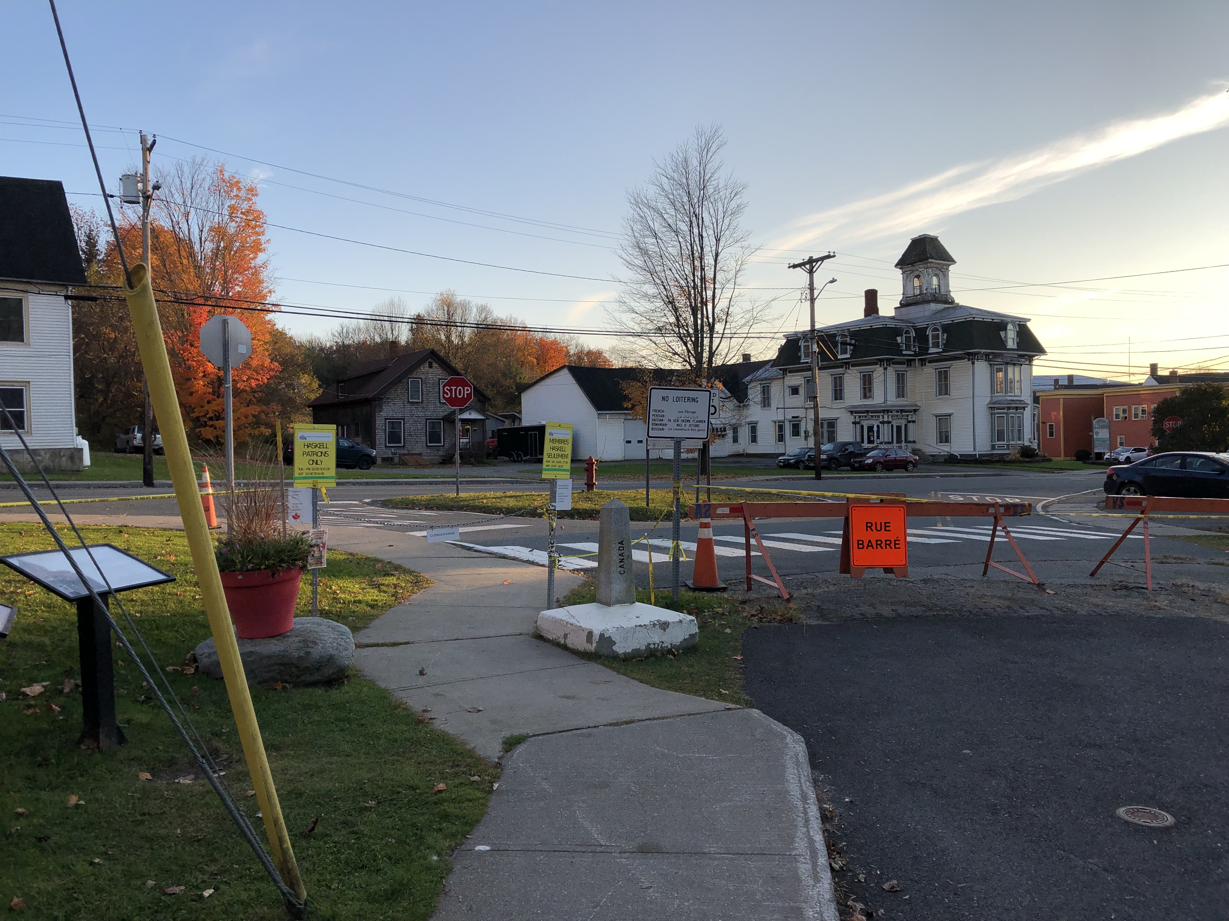
So is there actual border patrol up there? It looks like you can just drive right into Canada and not even know it lol
I saw cameras and the border patrol does have a presence. I imagine it's a pain for those living in the houses on the Vermont side of QC247 just to leave their driveways.
Here you can see a CBP suv at the hilltop watching who drives into Vermont to make sure they stop at the port of entry:
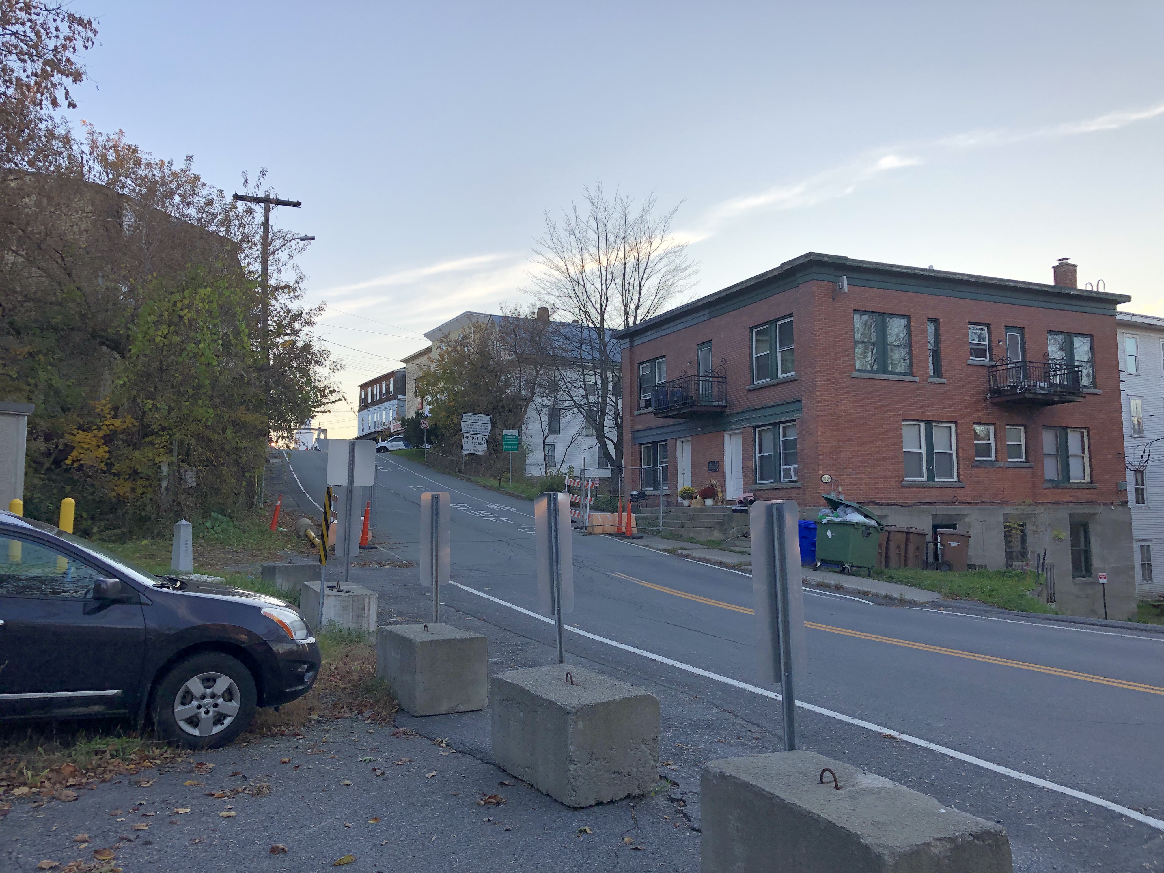
The red apartment building is split by the border as well.
5 hours ago, tamarack said:Quebecois from Estcourt and nearby villages cross into Estcourt Station (pop ~20) to get cheaper US gas, though up there even the US fuel is more costly than in more southerly parts of Maine.
There's an Irving station in Derby line that was filled with Quebecois getting gas. The price was about 10 cents higher than further down 91 at the next exit, but that's still lower than Quebec gas. The store employees inside were even fluent in French.
-
Yea that library is actually the building in the second picture. The border runs through the center of it. It was closed when I was there so I wasn't able to look inside.
Just down the way in western Stanstead the provincial Quebec route 247 is bisected down the centerline by the border as well. The houses on the right side are in Vermont and the left side Quebec:
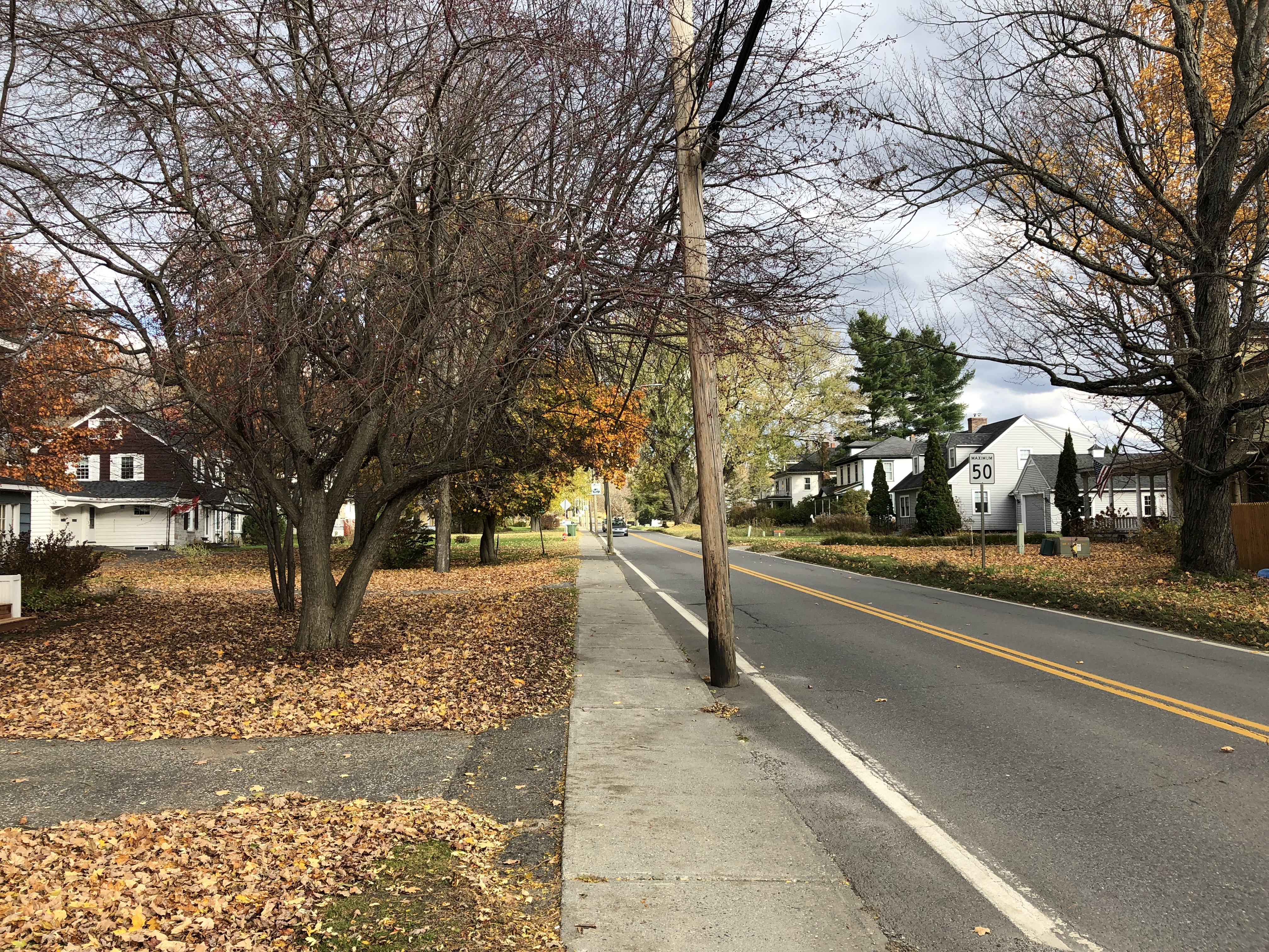
Facing the other direction, the white and gray house beyond the corner is also split by the border:
 35 minutes ago, powderfreak said:
Some of those border towns are wild. Like one sidewalk in Canada the other in the US. I think there are a couple buildings up there literally bisected by the international border.
A little different than the border environment down along Mexico/US.
Much different for sure. I have a picture when I went down to Nogales in southern AZ a while back, I'll have to see if I can find it.
-
1
-
-
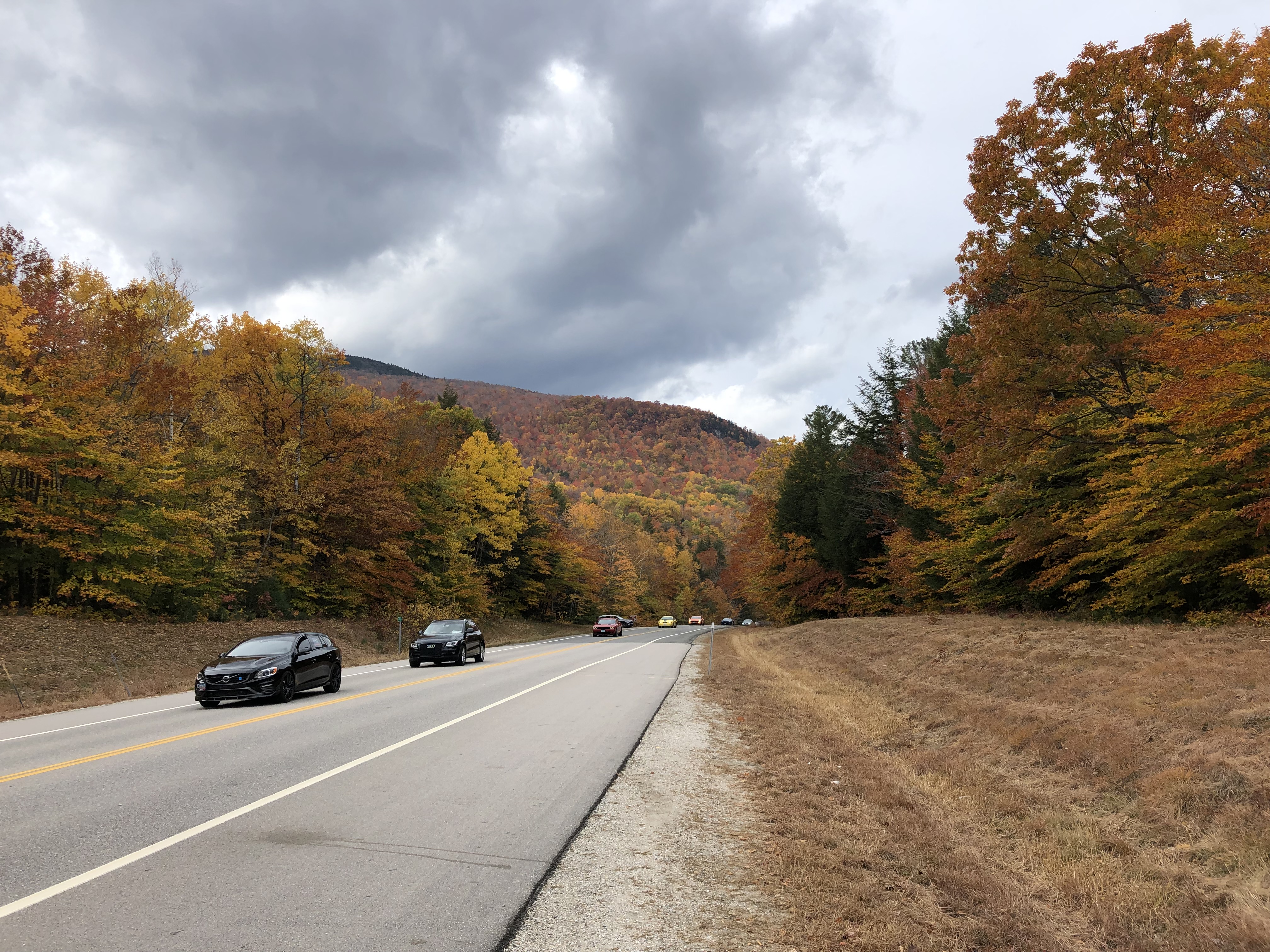
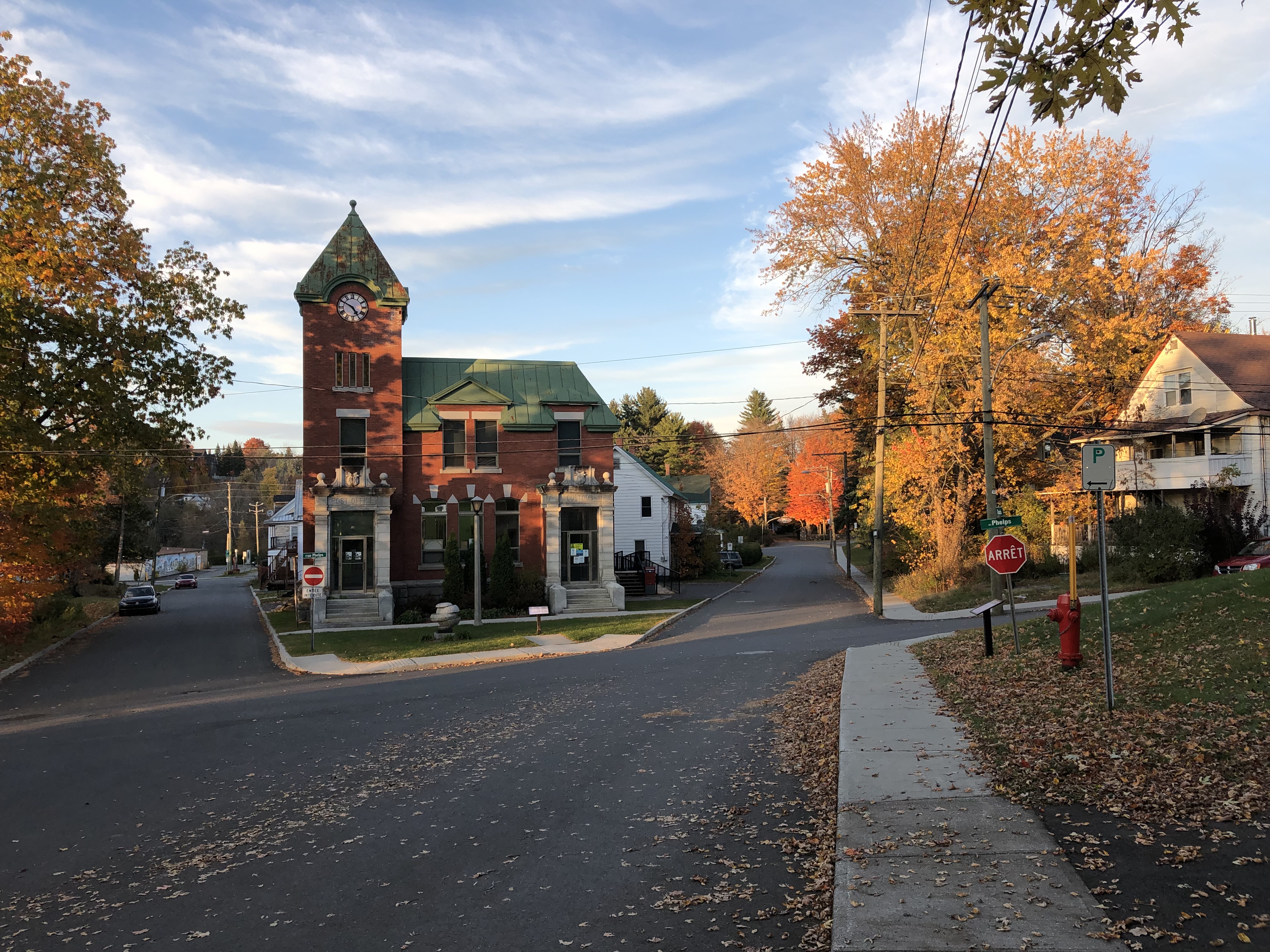
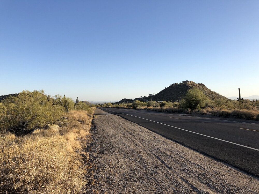
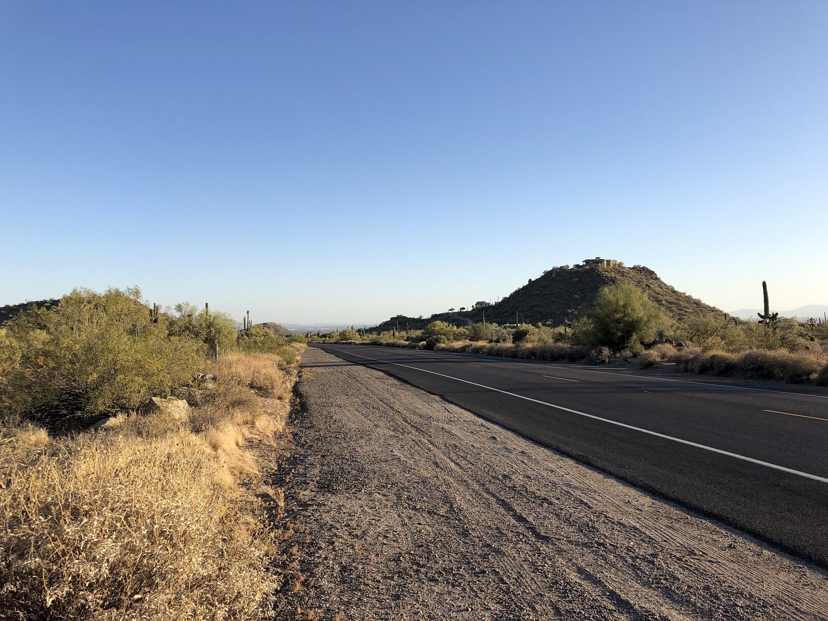
These past few weeks I've been back in Maine again. Last weekend I made the drive from western Maine up to Montreal to see a friend for a few days. The route went through the White Mountains and Vermont before reaching Quebec. Here's a few pictures from the journey.
Rt 302 in the White Mountains was packed with tourists looking at the colors:
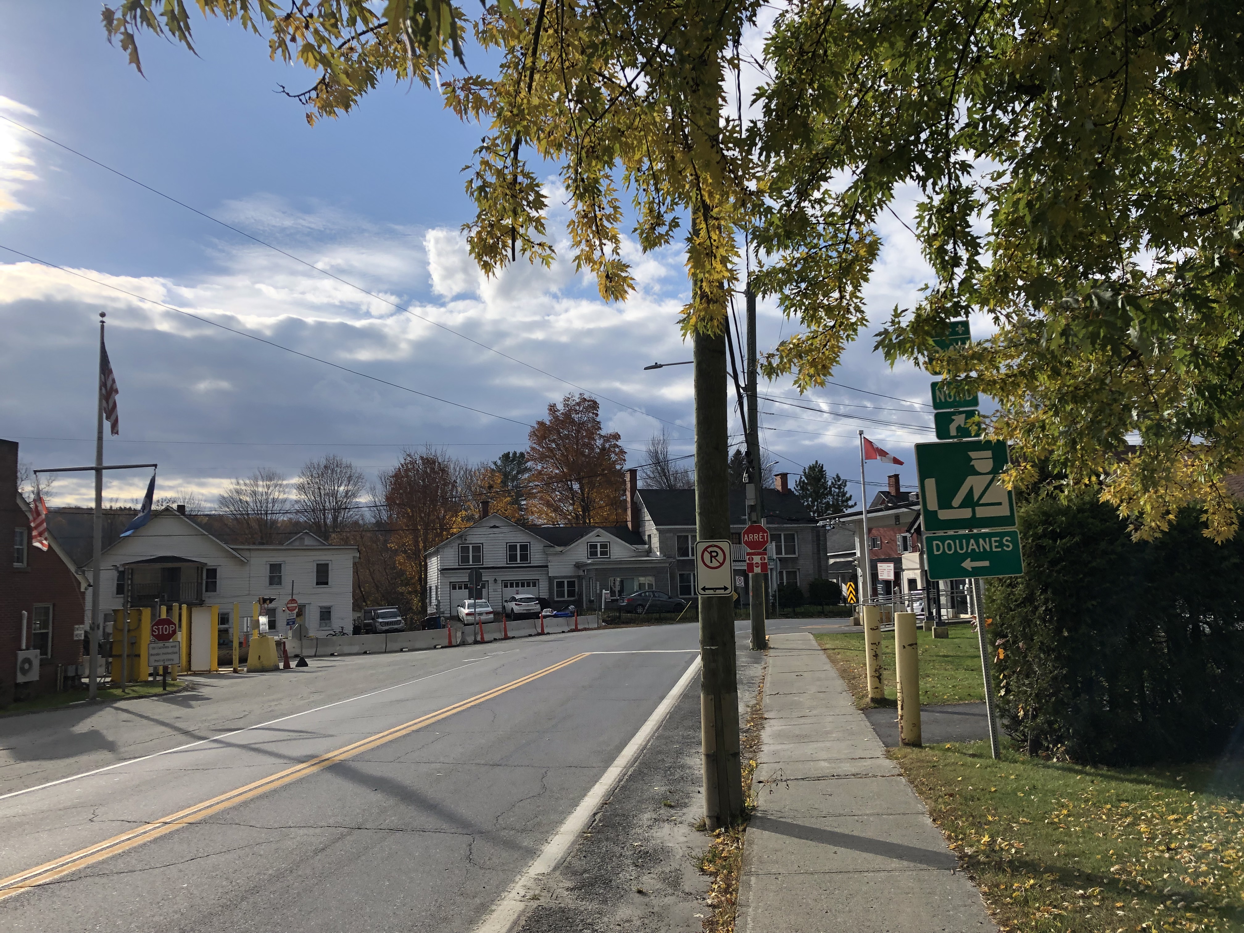
I crossed the border at a town called Derby Line in Vermont. Some of the foliage there was still vibrant. This one is just on the Quebec side:
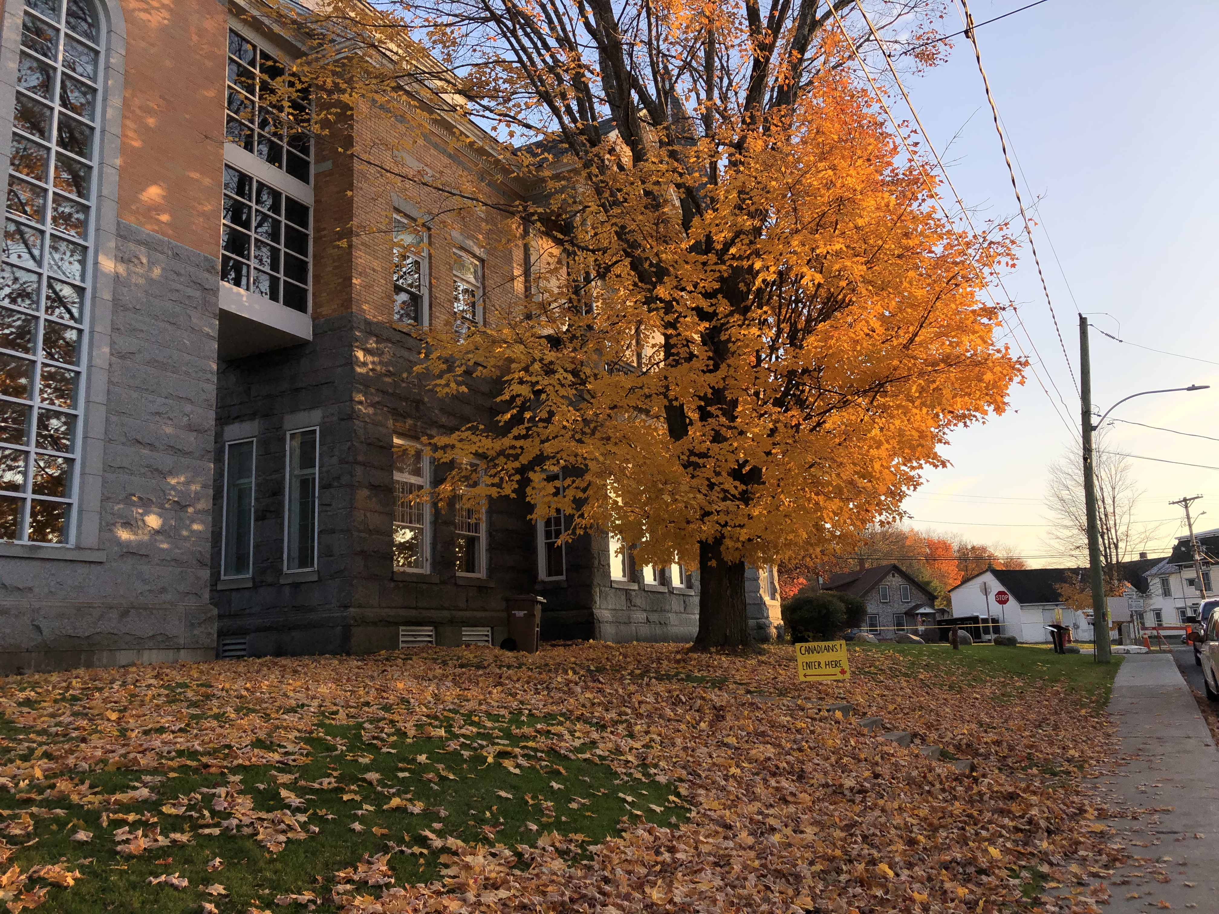
Facing the other direction, an old customs house and post office:
On the border looking into the top of Vermont:
-
7
-
-
4 hours ago, powderfreak said:
It is pretty impressive how tenacious that NE trough is… looping the 850mb temps out to day 16 is just a continual baking of the center of the nation and every time it attempts to slide a bit NE it gets beaten down hard.
GFS went full body trough over us out in mid-July on that 6z run. EPS continues to show big heat squeezed into PA and then just get crushed.
Yea it's become pretty clear that this just isn't the year in NE if one is looking for another 2011/2002 etc. Once that pattern change happened at the end of May it's just been lights out. The long range is just shutting any chance down past the middle of July. At that point, how much time is left? In NNE once you reach mid August it's pretty much done. At least the summer temps and storms are reliable out this way, currently at 100 looking to reach 104 this afternoon.
48 minutes ago, weatherwiz said:I'm sick and tired of opening up Radarscope and seeing these massive severe thunderstorm watch boxes in Canada. Not fair. I mean it seems like some of these areas have been under a watch for like 3 weeks straight...wtf.
It feels like Quebec gets far more reliable convection events than NE. I saw some videos of a tornado there a few years ago that did some pretty serious damage to an apartment complex and surrounding areas.
-
Monday ended up being a lot nicer than expected. Dark and gloomy in the morning with rain gave way to lots of sun in the afternoon. It seems SNE was stuck in the clouds and rain the whole day. Looking at the forecast, 80s are finally more attainable for the first time of the season. May even make a run for 90 again on Friday. After that, no real sign of any heat, as has been the case since May, and the GFS is continuing its usual parade of troughs drilling into NE.
Headed back to AZ today. Forecast changes accordingly from this:
Today: Mostly sunny, with a high near 81.
Tonight: Scattered showers between 9pm and 1am. Mostly cloudy, then gradually becoming mostly clear, with a low around 56.
Thursday: Sunny, with a high near 79.
Thursday Night: Partly cloudy, with a low around 56.
Friday: Mostly sunny and hot, with a high near 90.
Friday Night: A 40 percent chance of showers after 2am. Mostly cloudy, with a low around 64.
Saturday: Showers likely, mainly after 8am. Mostly cloudy, with a high near 84.
Saturday Night: Partly cloudy, with a low around 56.
Sunday: Sunny, with a high near 83.To this:
Today: Sunny, with a high near 105.
Tonight: A slight chance of showers and thunderstorms between 9pm and midnight. Partly cloudy, with a low around 87.
Wednesday: Sunny, with a high near 107.
Wednesday Night: A 40 percent chance of showers and thunderstorms. Mostly cloudy, with a low around 85.
Thursday: Mostly sunny, with a high near 104.
Thursday Night: Partly cloudy, with a low around 83.
Friday: Sunny, with a high near 104.
Friday Night: Mostly clear, with a low around 83.
Saturday: Sunny, with a high near 105.
Saturday Night: Partly cloudy, with a low around 84.
Sunday: Mostly sunny, with a high near 105.Most of the lows there will actually be close to the daytime highs in ME. Also of note is the differing criteria for "hot." For PSR, that means at least 110. GYX by comparison is a mere 90.
-
3
-


July has arrived ... the Meteorologically defined mid summer month
in New England
Posted
Keeps falling. Down to 62 now here and 62.6 at IZG.