

21chuck
-
Posts
27 -
Joined
-
Last visited
Content Type
Profiles
Blogs
Forums
American Weather
Media Demo
Store
Gallery
Posts posted by 21chuck
-
-
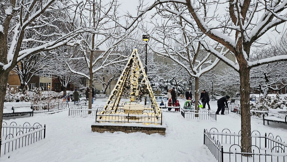
Seems like 4-5" in my back patio in the Italian Market area of South Philly. 6.5" when you add what already fell with the storm earlier this week. Feels like Mt Holly really nailed it - wonder if anyone could tell me what they saw that no one else could?
It was really a perfect snow day - snowed for all daylight hours, was mostly windless, stuck to everything, no dry slot, no threat of mixing. Beautiful day!
.thumb.jpg.1f6953cdb802e2c5421dca0b94457ffe.jpg)
-
 9
9
-
-
Steady moderate to heavy snow in south philly, I feel like rates are easily exceeding what radar would suggest.
-
Something beautiful happening right now. Coming down heavy in south philly
Wish I could upload the gif I have of this band strengthening right over head
-
6
-
-
Didn't snap any photos or take any measurements this time but I can confirm that in south philly this was basically just a white rain event despite ~12 hours of continuous light to moderate snowfall. The banding actually set up quite nicely for us overall. I woke up around sunrise to a coating of snow on the coldest surfaces like grass and cars. And then as the day went on it felt like the more the snow fell from the sky the less snow there was on the ground. Now there's just a spotty coating on select shaded surfaces. It was just too warm during the event and the ground was so warm to begin with.
-
1
-
-
16 minutes ago, RU848789 said:
Thanks! How much did you get during the day on Friday - looks like people are including that...
I wasn't home but got up to maybe an inch or half inch across the river in university city so somewhere in that ballpark.
-
10 hours ago, RU848789 said:
On another note, if any Philly folks are reading this, any reports from Center City/South Philly? A guy I know is claiming he only got 4" in South Philly and that the forecast for Philly was a bust, despite reports from the airport, Fairmount Park and Chestnut Hill showing 6"+. There had been a preliminary report of 4.5" from South Phillly before the storm was over, but no final report from there or Center City.
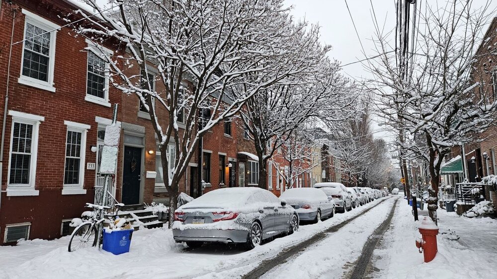
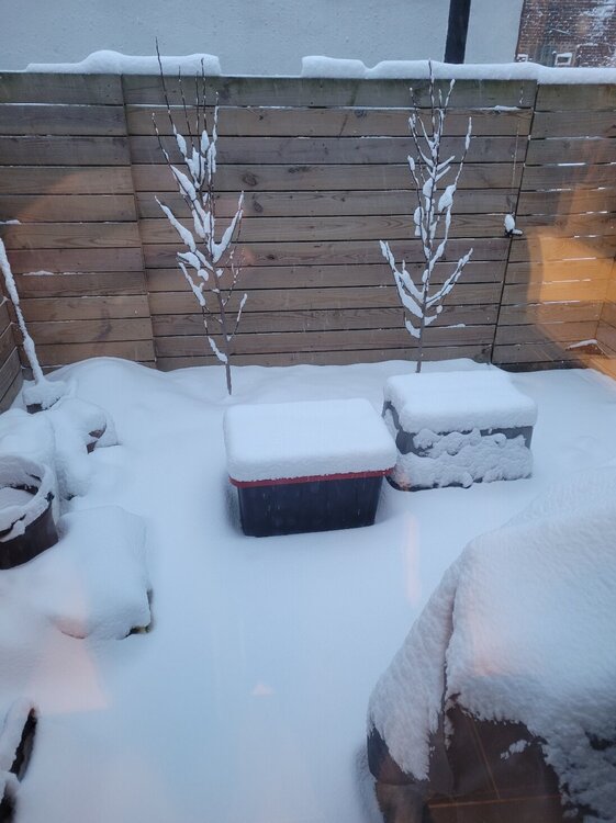
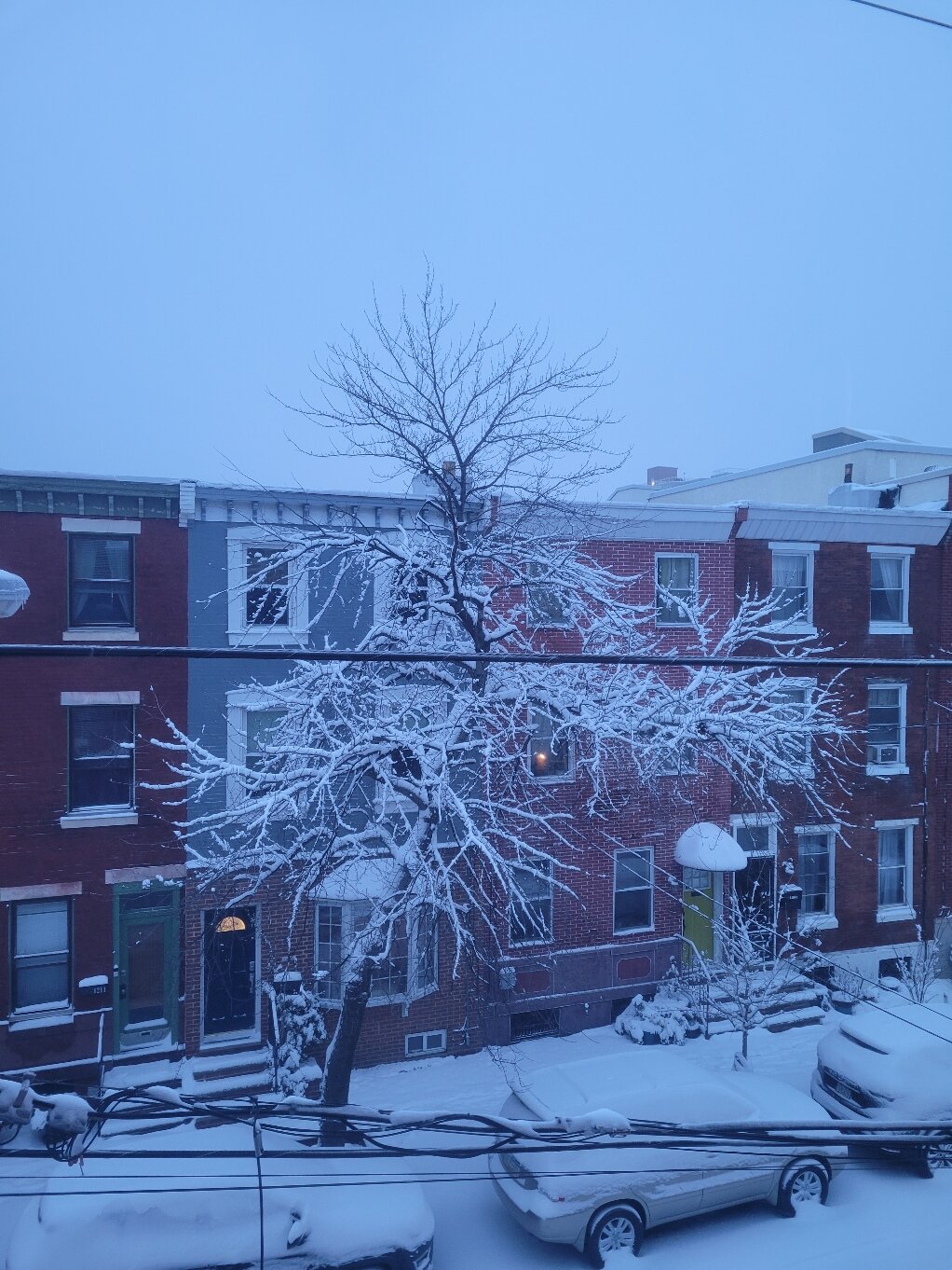
I live in south philly near the Italian market. I have a back patio that is pretty well wind protected (I know wind had a major impact on folks ability to measure elsewhere). My set up/technique is perhaps not the most sophisticated. I have a plastic bin that is maybe 20"x30" and I turned it upside down and I measured when the snow concluded noon Saturday and got 6 inches on the dot. I feel pretty good about that reading. It didnt include anything that fell Friday morning since that had all melted by sunset. Photo demonstrates the set up haha. Measured the bin on the right.
Edit: to be clear photo was taken a few hours before my measurement
-
3
-
-
55 minutes ago, The Iceman said:
8.5” storm total in Levittown. Mt Holly nailed this one, big kudos to them on a very difficult forecast! @MGorse
Was just having this exact same thought. Measured exactly 6" inches in my back patio plus had maybe a half inch from yesterday's snow. Right inside their 4-11 call for my area. They stood their ground in the face of some significant fluctuations in the last second modeling.
-
1
-
-
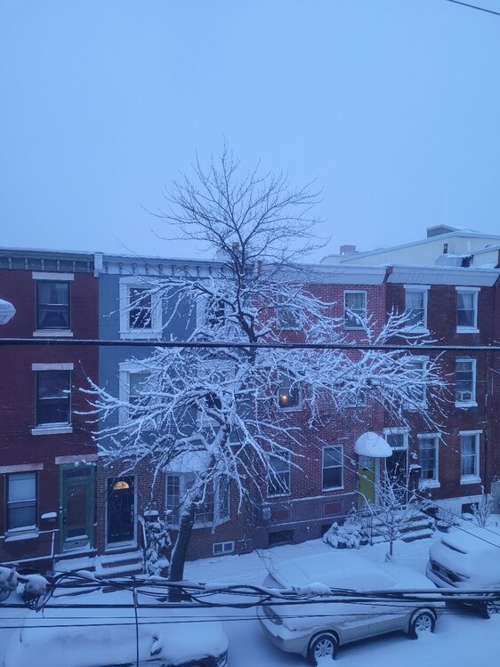
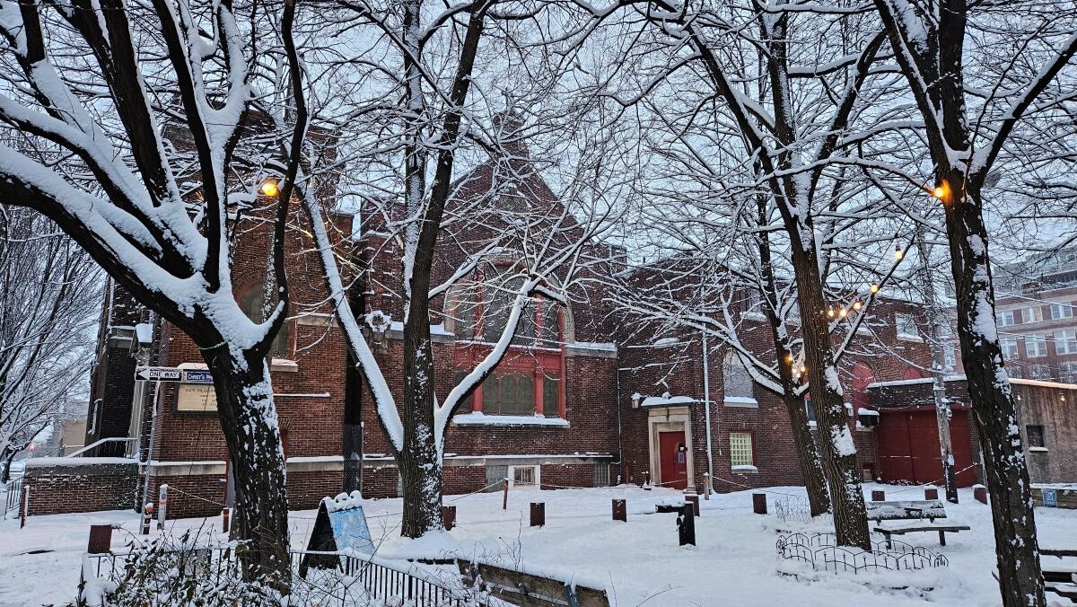
You can see the difference between areas that are wind exposed and not just looking at the top of this tree!
Light snow coming down in south philly. I measure 5 inches exactly in my very wind protected back patio. It's a very pretty snow!
-
3
-
-
13 minutes ago, Hurricane Agnes said:
Yeah I was thinking the pushing thing would be a bear although at least it wouldn't have a chute that gets clogged.

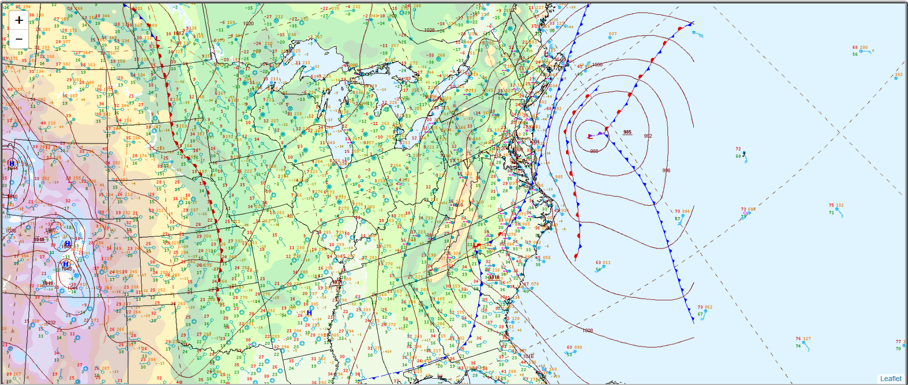
WPC did a surface map about 2 1/2 hours ago and that thing is way west - sortof where GFS had said it would be awhile ago.


So did the double barrel low not really happen or did it consolidate west?
-
3 minutes ago, mahk_webstah said:
accumulating? snowing hard? I'm flying in tomorrow afternoon because my flight to Boston was cancelled.
Sorry meant to include sticking to all surfaces. Maybe half inch or so so far. Snow is moderate.
Not sure how best to upload a photo taken from my phone. Seems it's always too large
-
1
-
-
Banding has set up nicely over Philly as radar appears to be filling in north of us.

-
Most of the local mets seem pretty bullish and after the very mixed 12Z runs (and meh 18Z NAM), NWS still slightly upped storm totals for my area to 5-11 in. I find it reassuring.
-
This thread is such a pleasant break from the NYC metro's thread for this event... all the same content without *most of the mayhem.
Has also been steady light snow for over 4 hours now in University City.
-
 1
1
-
-
2 hours ago, BBasile said:
Philly actually is average so far for this month.
I am looking at this chart and can't even remember these warmer days. Certainly felt like an anomolous number of days *with highs in the 30s and 20s to me. Average is skewed a bit by the extreme warmth in the start of the month.
-
1
-
-
3 minutes ago, Hurricane Agnes said:
Ya I understand it's been La Nina. I guess overall it's been an average La Nina January? Although the blocking in the West has been so strong even Washington has looked pretty dry
-
I am wondering who the current pattern has favored this January? The west has been completely dry. Family in Chicago report very little snow on the season. And we've been cold but without the ingredients necessary to reliably produce good storms. So who in north america has been doing well in terms of snow this winter? Maybe Alaska?
-
1
-
-
Just now, ChasingFlakes said:
Sun is poking through the clouds with some flurries still falling. Cars and grass are dusted. I wasn't paying attention on this one, but checked wunderground last night and saw the 3-5 inch call and was surprised. Not surprised we busted lol.
Yes wunderground gave me false hope. Should have known this set up was guaranteed to deliver almost nothing. Light flakes for about 50 minutes thus far (and obviously no accumulation) in south philly. Back end rapidly approaching.
-
1
-
-
1 hour ago, LVblizzard said:
Over a foot for most of us. Would feel a lot better about this if the Euro wasn’t totally on its own.

Really couldn't be a better track for all the folks DC -> Boston that got screwed with this last one. One can dream...
Btw some flakes in west philly right now with the wrap around showers
-
1
-
-
2 minutes ago, jm1220 said:
We need more than small ticks. State College/I-99/Rt 220/I-81 north of Harrisburg should be good spots for this event. And it’s desperately needed for them. Ski resorts have gotten essentially zippo this winter.
Agreed - that's always been the silver lining to this as a more coastal person
-
Props to all of you who stayed up through the night! I just rolled around restlessly in bed forcing myself to not check my phone or look outside for fear of not getting back to sleep. Maybe 3.5 inches in south philly
-
1
-
1
-
-
35 minutes ago, Hurricane Agnes said:
Mt. Holly reports what is submitted via CoCoRaHS here - https://www.wrh.noaa.gov/total_forecast/getprod.php?new&prod=XXXLCOPHI&wfo=phi
and any Local Storm Reports here (if/when people submit them) - https://www.wrh.noaa.gov/total_forecast/getprod.php?new&prod=XXXLSRPHI&wfo=phi
and Public Information Statements here (if/when people are submitting them) - https://www.wrh.noaa.gov/total_forecast/getprod.php?new&prod=XXXPNSPHI&wfo=phi
At the moment, the CoCoRaHS reports seem to be the most complete, although there are only a handful of Philly reports.
I recall last week the Phillies had rain delays on 2 consecutive evenings - 8/10 & 8/11 (one of my BIL's was at the first game). Sometimes you guys get the northern fringe of the storms that come through northern MD and Wilmington, DE. Whenever I have been running either of my doppler programs (GR2Analyst or GRLevel3), I don't recall seeing mpings or other spotter reports from down there though outside of the airport (KPHL), which is the official reading for down there too.
I attached a radar image (with 3 overlapping severe thunderstorm warnings) over S. Philly on 8/10 just after 8:30 pm & on the look on 8/11, about 7:50 pm.
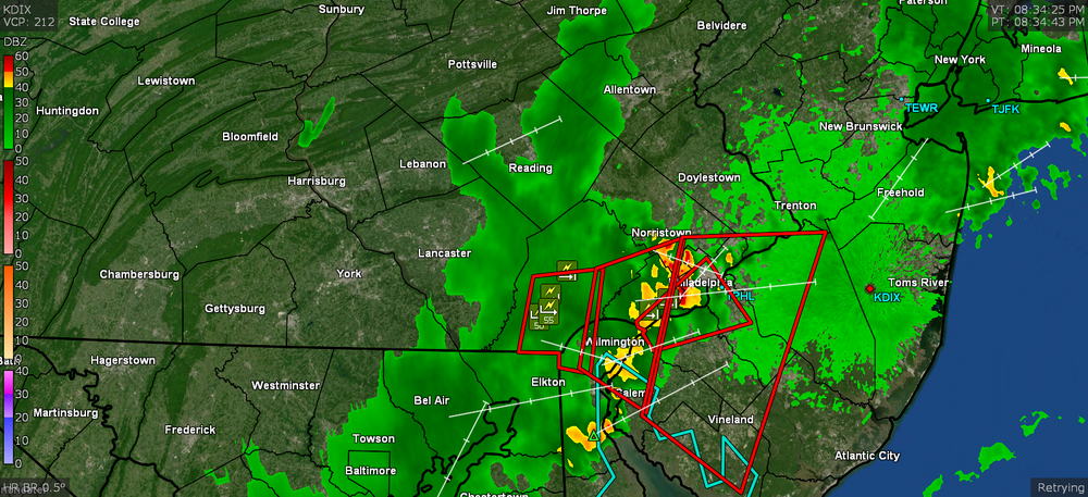
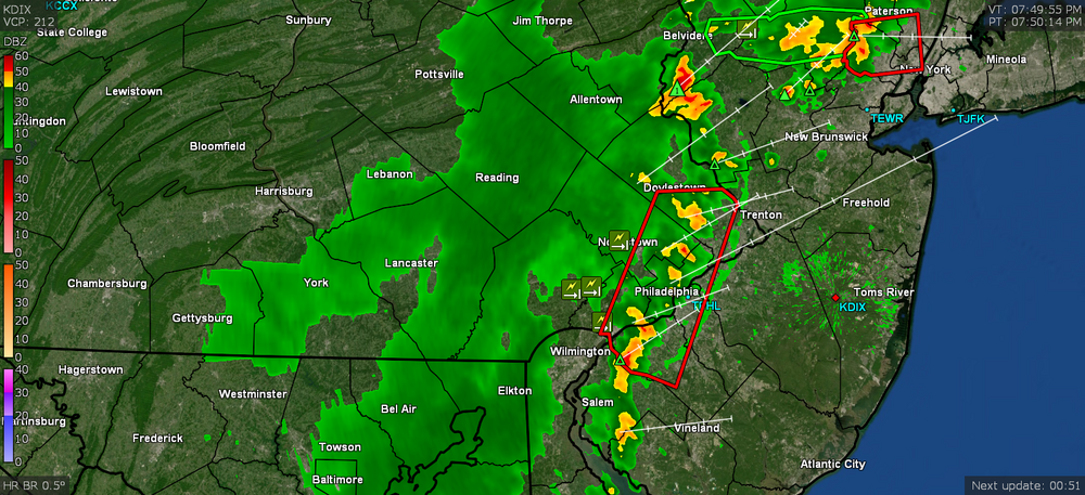
Thanks so much for the info! Maybe I am a bit of pessimist. Somehow I can't even really remember that rain from the 10th and 11th... I do recall watching cells split and reform in such a way that a mile or two seemed to make all the difference (I am closer to CC)
-
Anyone else in South Philly? I feel like the rest of the region is well above average the last 6 weeks while we are consistently getting screwed over and over again by these storms. Like North Philly is above average for the month and we are approaching abnormally dry conditions. My concern is we will exit this wet pattern but with none of the buffer our neighbors have. Anyone know where I could get official numbers on past 24 hrs of rain in my area e.g. a resource with measurements from spotters nearby? Is there anything similar that looks at a longer timespan like weeks? Thanks
-
1
-
-
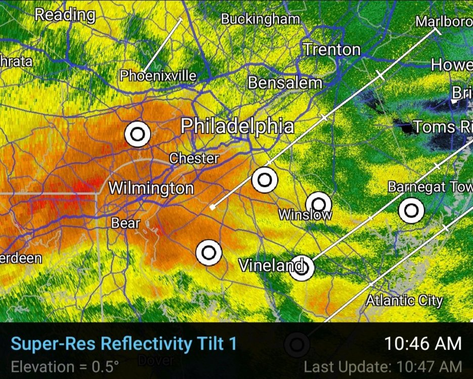
1 minute ago, BBasile said:
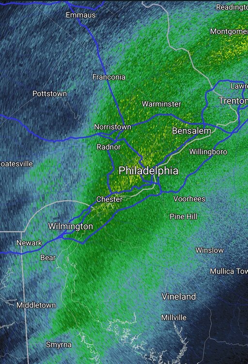
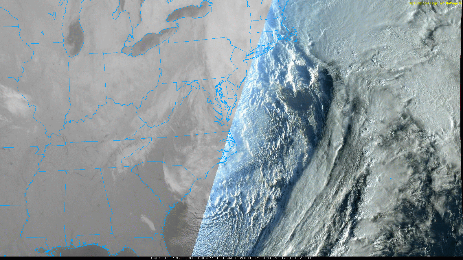
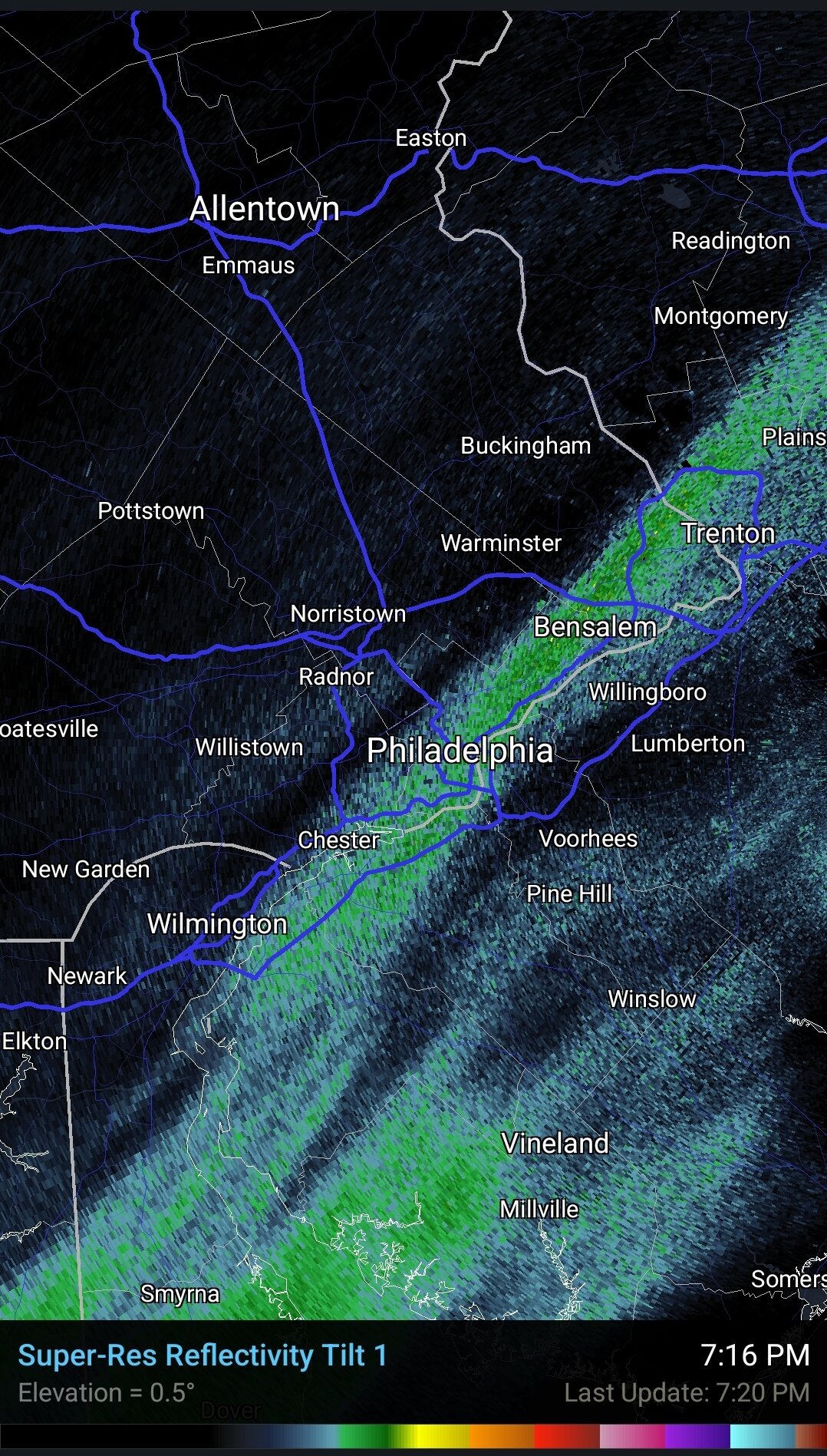
Is that a 60.5 dbz return in Philly? Yes, yes it is.

Is anyone under this thing right now? Snow or all sleet?
-
Have not seen radar like this all winter in south philly. Sleet trying to mix in but mostly heavy snow with big fat flakes
Edit: as I say that - moving more to heavy sleet
-
1
-
.jpg.a1afe605eebca7c83f58dd5d9d8d46cf.jpg)


Lake Tahoe Question
in Central/Western States
Posted
You might get a better answer to your question asking at weatherwest.com
Edit: or faster answer