Joshua D Wells
-
Posts
6 -
Joined
-
Last visited
Content Type
Profiles
Blogs
Forums
American Weather
Media Demo
Store
Gallery
Everything posted by Joshua D Wells
-
Severe Weather May 26th- 28th 2021
Joshua D Wells replied to weatherextreme's topic in Central/Western States
Looks really messy to me. Initial tornado threat was there, but I can't see anything but weak spin-ups happening now. Got called into work so I won't be chasing, but I'll have an unobstructed view to the west in Glenpool to watch whatever happens. -
Severe Weather April 27-28th 2021
Joshua D Wells replied to cheese007's topic in Central/Western States
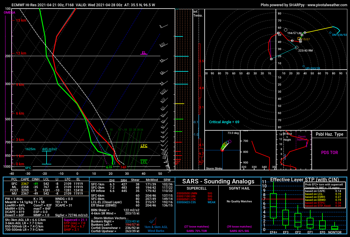
This year's storm season for Oklahoma has gotten off to a slow start, so it's difficult not to become excited. The ECMWF is hinting at something ominous. Forecast soundings across the warm sector are throwing out numerous PDS TORs. For the time being, however, the GFS is looking less than favorable for an upper end severe weather event. I'd like to see more consistency between the two models before I start taking this event seriously. That being said, a 15% threat area on day 7, with the potential for greater probabilities introduced in future outlooks is definitely something to raise an eyebrow at. No predictions at this point, but definitely worth keeping a very close eye on.
-
MO/KS/AR/OK 2020-2021 "Winter" Discussion
Joshua D Wells replied to JoMo's topic in Central/Western States
https://twitter.com/RobertTimsah/status/1361039897210028033?s=20 -
MO/KS/AR/OK 2020-2021 "Winter" Discussion
Joshua D Wells replied to JoMo's topic in Central/Western States
Seeing a stray flake or two making it to the ground in Sapulpa. Just enough to start to get excited for the real show in a few hours. Stocked up on red bull in preparation! -
MO/KS/AR/OK 2020-2021 "Winter" Discussion
Joshua D Wells replied to JoMo's topic in Central/Western States
We could meet all criteria for ending Oklahomas Blizzard Warning drought, with the exception of sustained 35mph winds. 30mph+ wind gusts are still possible. Think we could pull it off? -
MO/KS/AR/OK 2020-2021 "Winter" Discussion
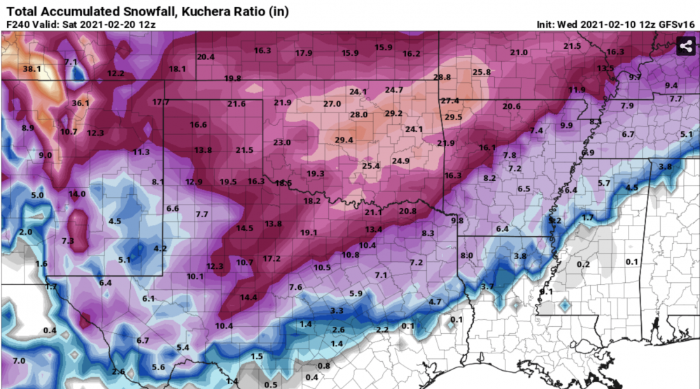
Joshua D Wells replied to JoMo's topic in Central/Western States
Howdy y'all! I've been a longtime lurker on this site for a few years now. Just thought I'd hop on and share this screenshot from the 12z GFSv16. It's unlikely this would verify, but the models have done poorly with Tulsa's recent ice accumulation. Seriously messed up my alignment hitting a curb hard in Sapulpa this morning. Easily .25" of ice on the side streets. Can't even make it out of the neighborhood.