

MDSnowyWxTracker
-
Posts
84 -
Joined
-
Last visited
Content Type
Profiles
Blogs
Forums
American Weather
Media Demo
Store
Gallery
Posts posted by MDSnowyWxTracker
-
-
Down to 32 here. Pretty heavy band coming thru now.
-
Snowing pretty good rates here in Urbana. Roads all covered.
-
 1
1
-
-
39/27 here in Urbana. Cloudy skies.
-
Coming down heavy flakes in Urbana. Close to 4 in here. 34/32
-
1 minute ago, peribonca said:
The storm pulls in a good amount of moisture from the gulf (and even further south) during it’s formation. Wouldn’t surprise me at all if qpf juiced up more as we get closer.
Agreed, I am a novice when it comes to fully understanding the upper levels and minutia of a storm. But looking at the low placement, while there has definitely been tics NW. One thing is for sure, on all the maps it is digging more grabbing up more gulf moisture making a more impressive western precip shield.
-
Definitely some of the best rates now coming down. Hoping those bands hold together.
-
Looks like went back to sleet here. Hearing some pingers outside.
-
Back to snow in Urbana now. 28/27
-
7 minutes ago, Imgoinhungry said:
Actually decent snow in Frederick and roads finally caved.
Agree(im in Urbana), just came from outside. Coming down at a good clip now, giving a good covering over everything that was exposed earlier today. Hoping the rates hold up for a few hours at least tonight. At least before the lull again(and maybe coastal bands).
-
1
-
-
Man super fine grain snow here in Urbana. Thought it was sleet at first coming down at a pretty good clip now.
-
The Icon and RGEM had me worried there but the GFS seems to support the tucked west feature still. Saturates the whole area with good qpf. Hugging this run until the next one.
-
Feels like the Euro is moving toward the other models. I dont know if I buy that jump out in the Atlantic of that low at the 70hour mark. I feel like this thing is likely to tuck more with the progression. But then again I am novice and will differ to better more informed on here.
-
Just now, Maestrobjwa said:
Making me nervous for 0z dude...It would be a fail of spectacular proportions (but one you warned was the main fail scenario: suppression). That's how some would get blanked, and others wouldn't get warning criteria. I hope it doesn't trend south again tonight.
You are saying what us northern crew and western crew are thinking and worried about. NAM, RGEM and 18Z Euro all have that low down in Outer Banks but moving mostly east ENE(maybe NAM is a little better with Low position) Sure capture part could happen but likely too late for us. Hoping a blip, we see more lows west on the EPS, so the capture can at least keep us from fringing.
-
Just now, JakkelWx said:
Based on the 84 HR NAM at z500 the confluence is about to push the low due NE instead of tucking it in.
Yeah that is what I am seeing too. Looks like a potential fringe some of the north and western crews.
-
1
-
 2
2
-
-
3 minutes ago, jayyy said:
Don’t think anyone in this sub is getting 2 feet my dude. That’s not realistic unless this coastal truly gets captured and bombs out. Those 20”+ totals will come in NW of NYC - not here.
No I agree there too but will say some of the runs were showing that tucked low close to the Delmarva stalling. That would of did it, likely for yours and PSU area. But that solution does not seem to be playing out at the moment.
-
1
-
-
3 minutes ago, Chris78 said:
Nothing to sweat at the point. Heavier amounts to the east and west of us.
Probably just an anomaly at this point.
No, I agree at this point it is still seems like a bounce here or there not changing the actually trajectory or event for that matter. So keep watching. I am still happy with at least 10in of snow just envious of those getting 2feet. But yet to be determined.
-
Also coastal seems to be a bit east messes cuts off Washington County and Frederick with the banding. Still gives us a healthy amount though, just not as good
-
3 minutes ago, EB89 said:
What’s with the hole over Frederick?
Yeah I was noticing that too. From trajectory of the WAA event kind of missing us a little and the coastal taking over, we miss some of the good stuff as it dryslots

-
Euro control looks amazing.
-
 1
1
-
-
Light but steady snow. Covering some pavements, grass and cars.
-
Switched over to all light snow now here in Urbana. Still 34/23
-
34/23 Looks like some rain but flurries in the mix here too
-
36/23 here in Urbana, looks like sleet at the moment.
-
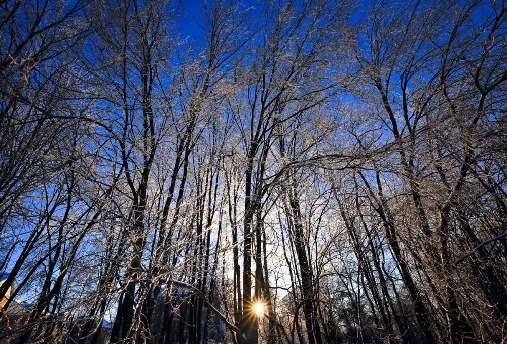
Wish I had the time today, would of taken more. Got out early in the morning to get this one while walking through the neighborhood.
")
-
3
-

February 10-12 event obs
in Mid Atlantic
Posted
This past storm photos. About 4in here Urbana.