
MRVexpat
-
Posts
278 -
Joined
-
Last visited
Content Type
Profiles
Blogs
Forums
American Weather
Media Demo
Store
Gallery
Posts posted by MRVexpat
-
-
6 minutes ago, powderfreak said:
Yeah we had that in both of those other seasons too. 2016-17 had a similar stretch over 6-8 weeks, including a 26-day stretch with 100” in it at 3,000ft. 2018-19 had a run early season Nov, Dec, into January I believe of just pow.
Its nice to get back to what folks seem to call “an old fashioned” winter compared to past 5 seasons at least.
Crazy to think the last several winters up here have had +8 type departure months. We knew once it flipped a bit it would feel ridiculously cold and snowy.
Totally. Would be nice to get a monster storm to cap things off! 16-17 had Stella, which at Sugarbush gave us 42" in about 48 hours on the heels of that huge late Feb thaw.
-
11 hours ago, powderfreak said:
269”… we’ll see if it makes a run at 2016-17’s 375” at that plot, or can get towards the more recent bigger year of 2018-19 max depth over 120”.
It’s not second place for late Feb.
I’m dammed if I do, dammed if don’t lol… rubbing it in or downplaying it depending on your viewpoint. Just let the stats fall where they are… it’s a solidly above normal snow winter, but not the best in even the last 8 years. A good winter.
What sets it apart is the lack of thaws and consistency in the snow surface. But yeah, no massive 30"+ synoptic + upslope type storms.
-
 1
1
-
-
2 minutes ago, PowderBeard said:
I don't know ow how much snow fell at home in Gray but I saw 3-4" per stuff at Black Mountain in Rumford with 3-4'+ drifts. Several kids had to be dug out of the glades/tree wells there today. At a couple points I was chest deep.
Had a friend ski there today and called it his best day of the year.
-
8 minutes ago, wxeyeNH said:
Finally the flip
20.7F Light snow
How much before the flip, Gene? Have some friends skiing Cardigan tomorrow so would love to give them a report.
-
3 minutes ago, powderfreak said:
Ha, yeah I saw a couple 15-30” forecasts from Josh at MRG and TK for Jay. I’m not sure how one looks at this storm’s guidance and calls for 15-30”… unless it’s just a blanket “it always snows big in the mountains” forecast.
Now, 15” over multiple measurement periods isn’t hard to envision… I like a dense 8-12” but if less sleet and this front end performs, along with the backside upslope, I could see a 12-18” outcome for the ski areas over 36 hours with this front end burst.
The mentions of 30” as an upper bound is wild though.
Yeah. Josh seems to be hitting backside snows hard. But yeah would need 12"+ to get anywhere near 30" lol. Western wind direction also not as ideal for down in the MRV. Need more NW so I'm a bit perplexed.
-
1
-
-
3 minutes ago, powderfreak said:
Nice little pre-game fronto band up here. A quick 2-3” just south of BTV to Waterbury and I-89 near MPV.

Bush cams showing almost 4" already. This is what's needed for Josh Fox's 15-30" range to verify

-
18 minutes ago, powderfreak said:
3.5” here. Nice synoptic density small flake but cold. Baking powder?
Looks like deep winter. Just keep adding another layer every couple days.
Crusty?
-
1 hour ago, borderwx said:
Cleared 4”, but the chimney is whistling so who knows for sure
Started the day with another sub zero dog walk, -8F
Some pingers on my way to check the mountain at 1:30. Skied through the break in the action, a wind loaded mess, but only a touch of sleet mixing
Curious what the morning brings
.Sweet! I'll be there this weekend. Excited for my annual big Jay lap. Hopefully the pow stayed fresh.
-
46 minutes ago, powderfreak said:
Lack of ice crystals and nuclei in the dry slot. So what often happens is we’ll get the deeper mix-level WAA lift being a several hour period of steady snow… but then the mid-level dry slot punches through. Snow growth temperatures are so high up because of the warm air advection (but not above freezing)… we end up with supercooled water droplets and low level orographics enhancing moisture slightly in the mountains.
Enter freezing drizzle and freezing mist. The type of stuff that coats your goggles and jackets but sometimes just seems suspended in the air, maybe not even weighing enough to fall to the ground. And if it is heavy enough to fall, it’s small droplet (drizzle) and low QPF.
We see this quite a bit in these set ups… as soon as the mid-level lift exits northeast, it goes freezing drizzle or snizzle. QPF may not even be measurable but it can candy coat the snow, lifts, trees.
And then if you do get a stronger shower or better lift it’ll go back to snow as the lift is usually higher up in that case. Those are the times when you get freezing drizzle and mist, then burst of snow then back to very light mist/drizzle… all at like 22F.
Super interesting and thnx for the explanation!
-
3 hours ago, dmconno said:
Any chance Northern Vermont avoids the freezing drizzle tomorrow tonight?
Ripping and reading the models shows a vast majority going thump to dry slot to upslope in northern VT with any zr staying Killington or south and temps in the mid to high 20s. Most forecasts however show at least a short period of zr all the way up to Jay. I'm no met so would love to understand what I'm missing here.
-
1
-
-
8 minutes ago, powderfreak said:
First time in like a month we had to kill snow guns due to marginal temps.
I think the mountain does another 4-6” tonight. A healthy 6 at High Road would not surprise me.
You have any thoughts on the Thursday deal? Would be really nice to avoid laying down a crust layer...
-
11 hours ago, snowgeek said:
Pico was amazing today. Since they’re closed on Tuesday and Wednesday’s Thursdays are the day to go. About 10” of fresh powder. I got 10 powder runs! Glad I brought my fatties so that I floated over any hard pack underneath. The bumps on summit glade were soft and delicious. The corduroy was so soft. Just stellar conditions. I did make one mistake and skied the old poma line just past Giant Killer. Never again! T

hat was terrifying haha. Side slid my way down most of it.


.Pico is so good! The terrain off of Outpost and little Pico is very underrated. And yeah that Poma line is spicy!
-
52 minutes ago, bwt3650 said:
anyone know why Castlerock at sugarbush is still hike only? Would think there would be enough snow up there. Was thinking of heading there next week for my once a season sugarbush stop, but I usually like to wait until Castlerock and Slide brook are going. I know Slide brook needs depth for the lift evac, but I would have thought there would be enough natural for both by now.
Huge staffing issues in lift maintenance and general lift issues are pushing slidebrook to the end of the priority queue unfortunately. There was a blog post on their website about it somewhat recently. Re: Castlerock, they usually keep it hike-to for a bit to preserve the conditions early season since those are super boney and narrow trails that get scraped down pretty quick. I agree though, there is definitely more than enough snow now to open it for MLK so if that doesn't happen, you'd have to think there is another maintenance issue we don't know about. Personally I hope they keep it hike-to only. It's a quick fun trek and the snow stays soooo nice even on busy weekends.
-
On 10/9/2024 at 4:00 PM, MRVexpat said:
Cheers to that! For this year, I wish for the upslope machine to return to above average levels of production. Seems like that's been somewhat absent in the central/northern greens the last few years.
I should start wishing for snow more often. You're welcome!
-
3
-
-
48 minutes ago, powderfreak said:
Ha. Looks like they had some wind issues at their plot. Makes the Lookout Snow cam look deep up here. I can appreciate the effort!

Yeah the fact that you can see that thing from a webcam mounted on the single chair mid station makes me think that it isn't super wind protected lol.
-
 1
1
-
-
MLK once again shaping up to be the winner of the ski holidays.
-
1
-
-
2 minutes ago, NotSureWeather said:
Hmmmm…
User name checks out.
-
1
-
 2
2
-
 1
1
-
 1
1
-
-
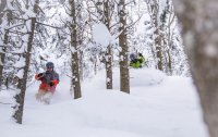
Mad River was a tale of two aspects today. The woods off of the double housed about a foot of blower while the single was wind hammered to hell, though still skied fairly well. Super fun day overall!
-
4
-
-
13 hours ago, bwt3650 said:
Anyone have thoughts on these?

.These are basically the new version of the Soul 7, which in the mid 2010s was probably the most popular ski out there and maybe Rossi's best selling model in North America ever? The sender series is slightly more robust from what I hear, while still retaining that approachability that made the original Soul so popular. 102 under foot is about where you want to be for a one ski quiver in northern VT.
-
1
-
-
Looking at radar returns and the flow still looks quite blocked. Will be at MRG tomorrow to sample whatever blew into the woods.
-
Also, how accurate are the NWS snowfall analyses? There's an image being passed around social media that seems to indicate another local jack of 24"+ in the Brandon Gap area. Hard to substantiate via cocorahs but there's a Randolph report of 15" in that timeframe so perhaps it's possible? Jw how they came to that conclusion...
-
1
-
-
1 hour ago, powderfreak said:
It’s interesting how different people perceive snowfall. A friend skinned next to Gilpin and said the number he’d pick was 18” for snowfall, no chance anything near 30”. Said he did find one pitch that was ridiculously deep but on the whole he was thinking 18”.
Skied Mansfield and then went to Domeys Dome next to Gilpin. Classic snowfall audit… but again, not Jay, just his estimates in the area.


I only share this not as a "ha, don't believe it" but because it was exactly what I always say... that area gets more snowfall but about 10-20% more on average than Smugglers Notch/Mansfield area (which gets 10-20% more than Sugarbush/MRG). It just fit my long-standing beliefs, that's all. And in America, we all like information that fits our own thoughts
 . I always find the different estimates interesting and sort of funny.
Haha Domeys Dome. Always loved that name. For what it's worth I have a friend who skied Little Jay today and reported that "No it was at least 24". Great skiing. Actually a somewhat reasonable report for Jay". Depending on the aspect both reports could be true? Domeys faces WNW and could have been a bit more subject to wind scouring too. Hard to say.
-
3
-
-
Honest to Cthulhu moderate snow at times is Cambridgeport. Nice to see! Now get it up to ski country where it belongs
")
-
And just like that, Sugarbush goes from severely lagging behind to the most open trails in the East. Mountain operations is a funny thing.
-
2
-
NNE Cold Season Thread 2024-2025
in New England
Posted
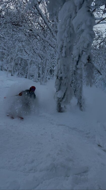
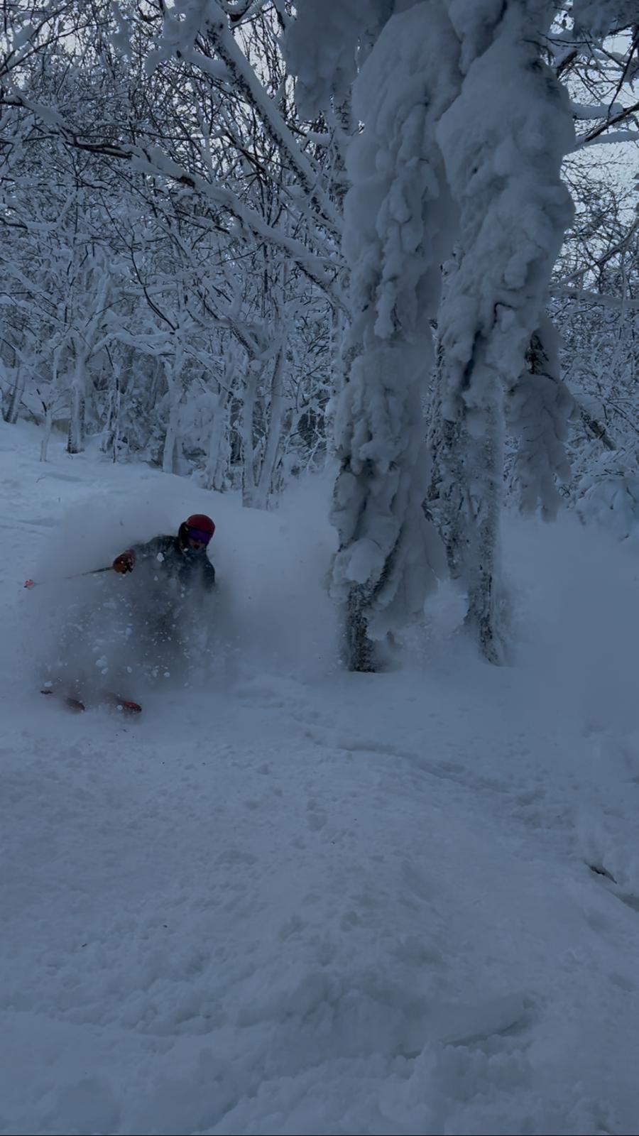
Slides are open!