twistingtornado
-
Posts
30 -
Joined
-
Last visited
About twistingtornado

-
Severe Event March 25th 2021
twistingtornado replied to Bob's Burgers's topic in Southeastern States
Looks like the tornado significantly weakened or lifted before hitting Wilsonville. -
March 17-18 Severe Weather Event
twistingtornado replied to DanLarsen34's topic in Southeastern States
A large concern with this setup is the potential for wedge tornadoes overnight in a region notorious for after-dark tornado outbreaks. As the evening wanes and the nocturnal LLJ ramps up, this setup is screaming danger in the 0-1 km layer over Alabama. Textbook long/looping hodographs, shear vectors with a large magnitude component normal to the front, and extremely low LCL heights. Not what you want to see at any time, let alone 12-4 am. These rain wrapped wedges may be hard to make out during the day, let alone at night. Nobody should attempt to confirm these. Was going to post this last night, I'll post it now that some skeptics have showed up before the nocturnal LLJ has fully ramped up. -
Severe Weather 3/12-3/15
twistingtornado replied to Tallis Rockwell's topic in Central/Western States
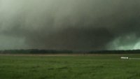
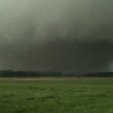
Impressive supercell cycling, going from one intense circulation to the next (which was really two circulations). Glad to hear it was in a rural area, hopefully nobody got hurt. 28969709-d90d-444c-98d3-5b01b0fc1226.mp4 -

-
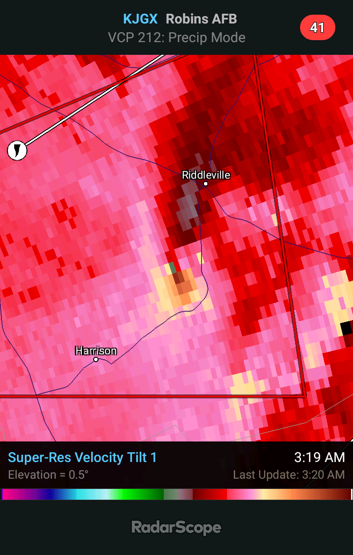
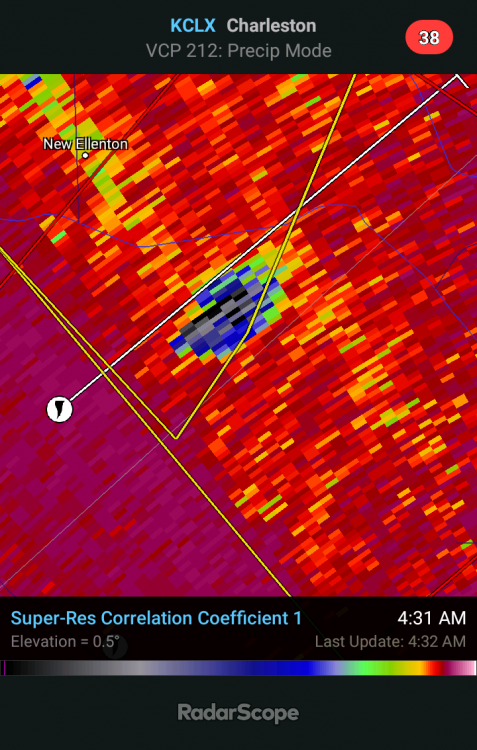
Circulation to the south now also has TDS.
-
-
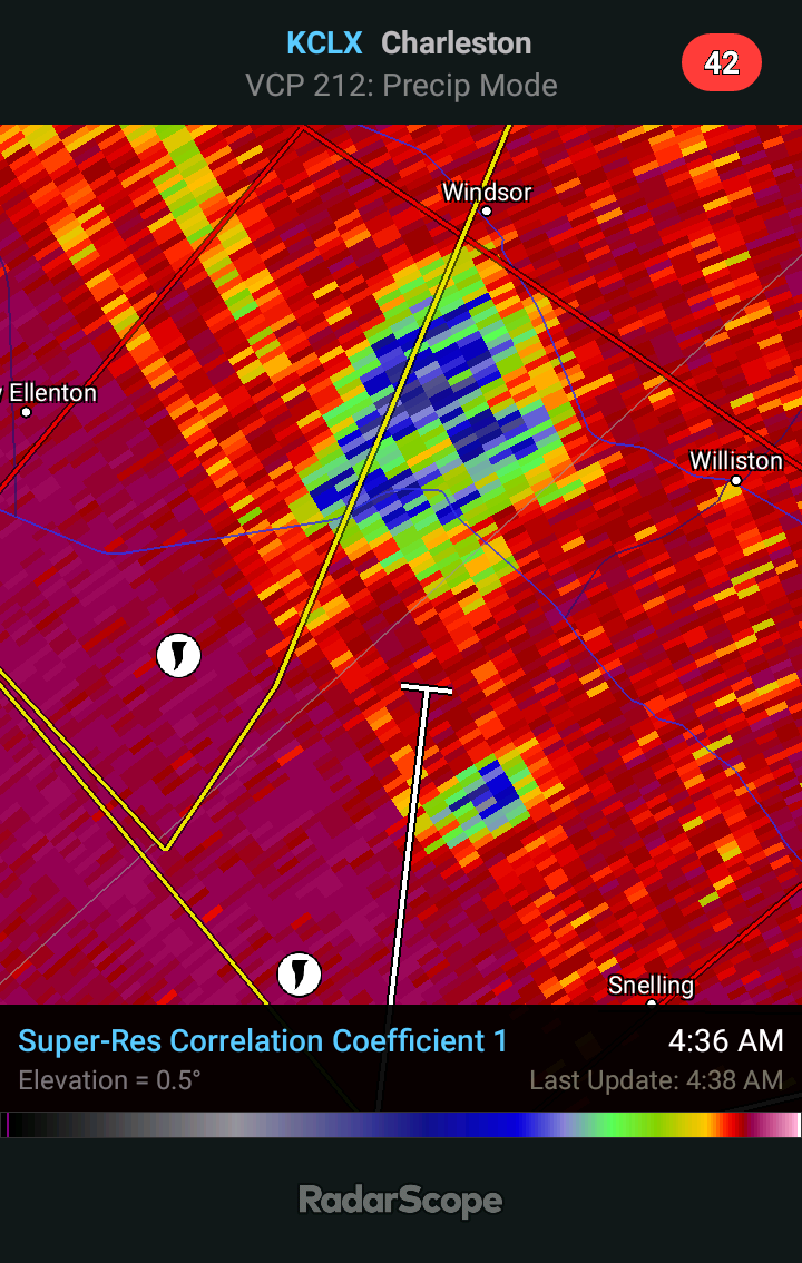
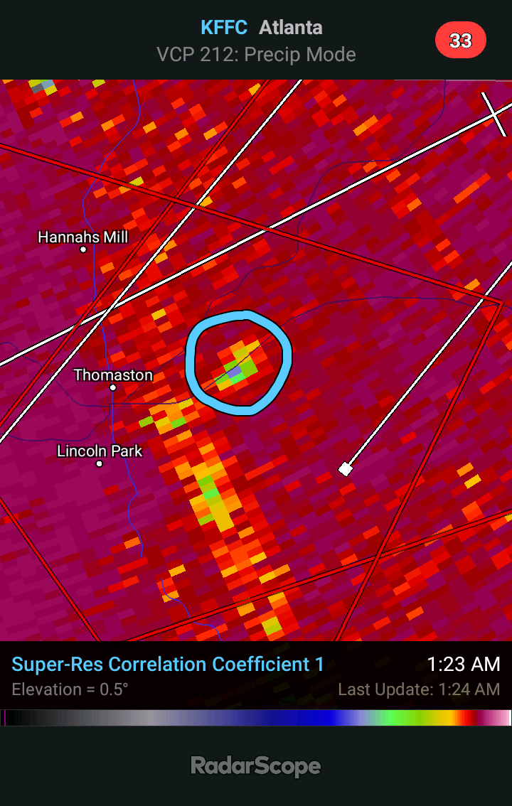
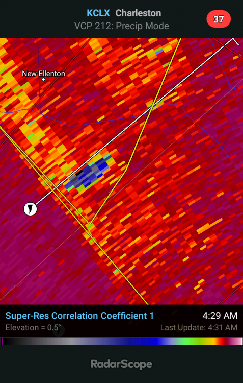
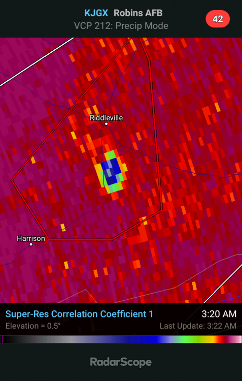
Confirmed TDS on couplet east of Jackson
-
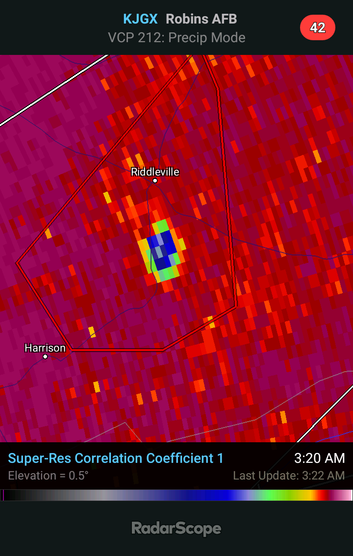
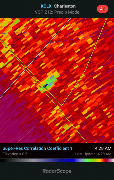
A little bit earlier south of Augusta, GA. Circulation has broadened since then.
-
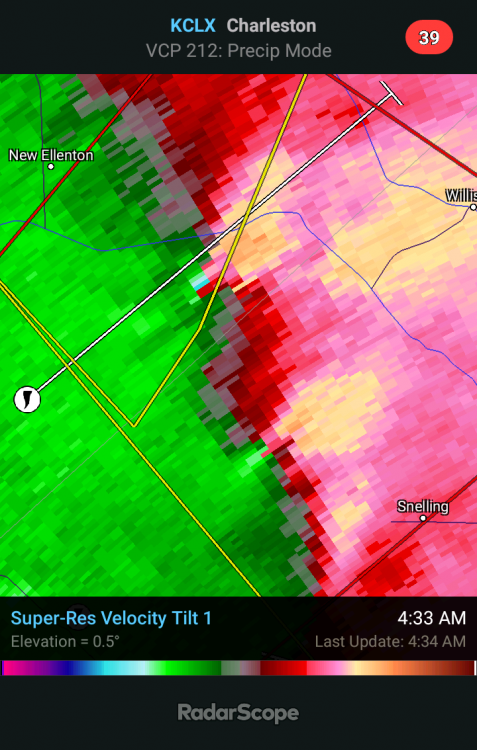
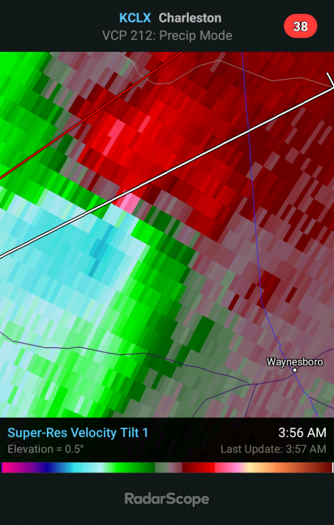
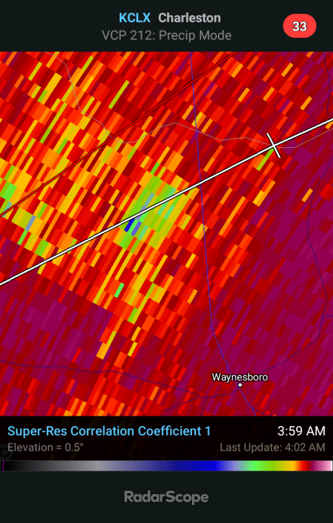
Rain-wrapped tornadoes at 4:30 am, not ideal.
-

-
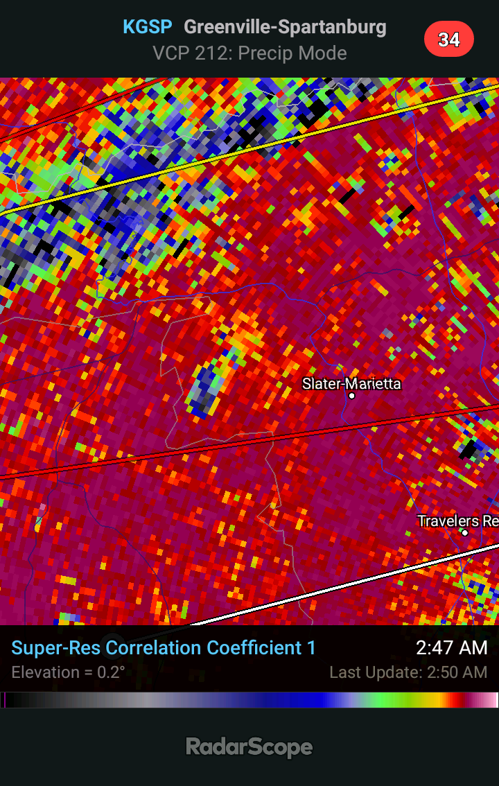
TDS near Slater-Marietta, SC

-
It can be quite tricky to get warnings out in time with all these brief spin up tornadoes in a QLCS. Not uncommon to put the wording for possible tornado into the severe thunderstorm warning, which is what I believe they did here.
-
They're right on the cold front, so no.
-
It would have to take the mother of all right turns to get to Macon, which isn't going to happen. It will stay well north of Macon. Looks like it's weakening anyway.
-